- ✓World-class recommendationGPS and field notes from veteran overlanders Dave vouches for. The source
- ✓ResearchedChecked and detailed by Dave — five decades in the field. Public data — no copyright on coordinates
- ★RecommendedMarked a standout on the list. Not the same as verified on the ground.
- 0Verified on the groundNo dated visit here yet. Stays Likely until Dave's stood on it — or the crowd confirms
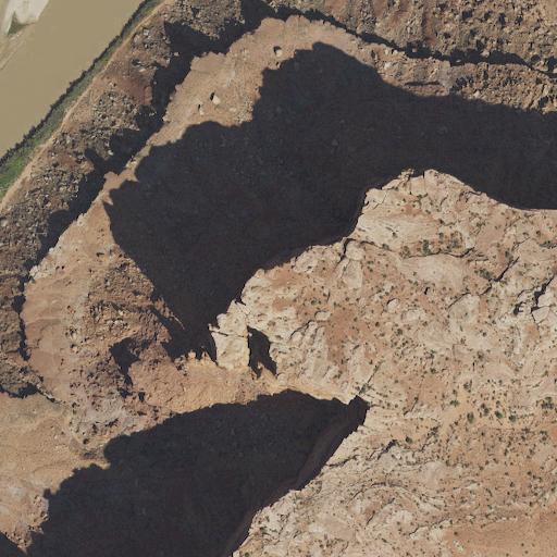
WOW! This is a phenomenal primitive campsite, north of Moab, with an amazing view of the Colorado River winding through the canyon below. Countless rock formations and outcroppings. Small fire ring and enough space for a few vehicles. 4x4 access required. No cell service. This is a treasure, so please do not spoil. Strongly recommended.
— field note from a world-class overlander Dave vouches for. Verdict: Highly recommended. Confidence stays Likely until Dave stands on it or the crowd confirms.
A dispersed site on public land, Grand County. The facts below are structured data from Dave's list; the write-up is being rebuilt from real field notes, so it's held at Likely until it's confirmed on the ground.
Stay limits vary by unit — many USFS/BLM areas cap dispersed camping around 14 days, but not all. Confirm the current rule and road status with the managing office before you commit.
- Road surface & last-mile access
- How many rigs fit
- Cell coverage by carrier
- Seasonal / winter access
- Current fire restrictions
- Water access from the pin
- Shade & wind exposure
- Noise / neighbors
- 1 Water11 mi
- 2 Dump14 mi
- 3 Fuel19 mi
- 4 Grocery19 mi
Straight-line miles from camp — real roads run longer; drive-time is the refinement coming. Nearest few per category, from OpenStreetMap (© OpenStreetMap contributors). Treat all natural water. Open in Google Maps ↗