Superior National Forest
Camp here — Superior National Forest
337 camps mapped in this forest, 311 of them free. Tap one for its topo and aerial, the weather, the water, and how far you will be from fuel and a shower.
- FreeWest Twin Lake Site 1
- FreeBurntside Lake Site 4
- FreeWhitefish Lake Site 3
- FreeTofte Lake Site 4
- FreeMoss Lake Campsite
- FreeLow Lake Site 1
- FreeFrear Lake Site 1
- FreeMyrtle Lake Site 10
Where dispersed camping is listed — Superior National Forest
The Forest Service lists dispersed camping as an activity at these 13 places. That is the agency saying it is allowed somewhere in the area — not a campsite we have mapped, and not a spot we can put a pin on. Read their page, then check the district for the rules that apply on the day.
- Boundary Waters Canoe Area Wilderness
window.dataLayer = window.dataLayer || []; function gtag(){dataLayer.push(arguments);} gtag('js', new Date()); gtag('config', 'G-NJK902HP6X'); Established in 1964 as Federally Designated Wilderness , the Boundary Waters Canoe…
the Forest Service page for it → - Butterball Lake
Butterball Lake offers a quiet atmosphere for canoeing, fishing and camping. The primary fish species are northern pike, perch and sucker. Downloadable information and map
the Forest Service page for it → - Divide Lake Campground & Backcountry Sites
The Divide Lake Campground provides a northwoods camping experience in a small (only 3 sites) secluded campground located near many recreational opportunities. A walk-down canoe launch provides access to Divide Lake and its…
the Forest Service page for it → - Echo Lake Campground & Backcountry Sites
This campground is on the south shore of Echo Lake and is surrounded by a mix of aspen, balsam, spruce, and pine trees. Echo Lake is popular for walleye and panfish fishing and is located on the west end of the Echo Trail, a…
the Forest Service page for it → - Franklin Lake
Franklin Lake is a small lake popular for fishing. Downloadable map .
the Forest Service page for it → - Gunflint Ranger District (Grand Marais MN)
Welcome to the Gunflint Ranger District! This area is the most Northeastern portion of the Forest, stretching from near Lake Superior all the way to the Canandian Border. The district office is located right in the town of Grand…
the Forest Service page for it → - Johnson Lake
Johnson Lake is popular for fishing and is connected to Johnson River and Little Johnson Lake. Fishing is considered good for small mouth bass, walleye, and northern pike. Downloadable map and information
the Forest Service page for it → - Kawishiwi Ranger District (Ely MN)
Welcome to the Kawishiwi Ranger District! Located in Ely, Minnesota, our LEED-certified office is designed to protect the environment we all cherish. LEED stands for Leadership in Energy and Environmental Design. Here's what that…
the Forest Service page for it → - LaCroix Ranger District (Cook MN)
Welcome to the LaCroix Ranger District. The landscape in this area is covered with dense forest and spotted with numerous lakes. Destination highlights include the Vermilion River and its falls and gorge, the Echo Trail, and the…
the Forest Service page for it → - Laurentian Ranger District (Aurora MN)
Welcome to the Laurentian Ranger District. This district is the southern portion of the Superior National Forest stretching from McCarthy State Park north of Hibbing, MN to near the north shore of Lake Superior. The district…
the Forest Service page for it → - Pfeiffer Lake Campground & Backcountry Sites
This campground is located on the north shore of Pfieffer Lake. It sites on sandy, rolling hills found north of the Laurentian Divide. Many sites offer scenic views of Pfeiffer Lake. The two backcountry sites on the lake are only…
the Forest Service page for it → - Tofte Ranger District (Tofte MN)
Welcome to the Tofte Ranger District. The geography of this area runs from the rocky shores of Lake Superior to the miniature mountains of the Sawtooth Range. There are plenty of lakes, lots of forest, and miles of wilderness.…
the Forest Service page for it → - Whiteface Reservoir Campground
This campground is on the northern shore of the Whiteface Reservoir and is surrounded by a mix of aspen, spruce, balsam, and pine trees. The Whiteface Reservoir is popular for walleye fishing. A campground host is on site during…
the Forest Service page for it →
Where the camps cluster
The place
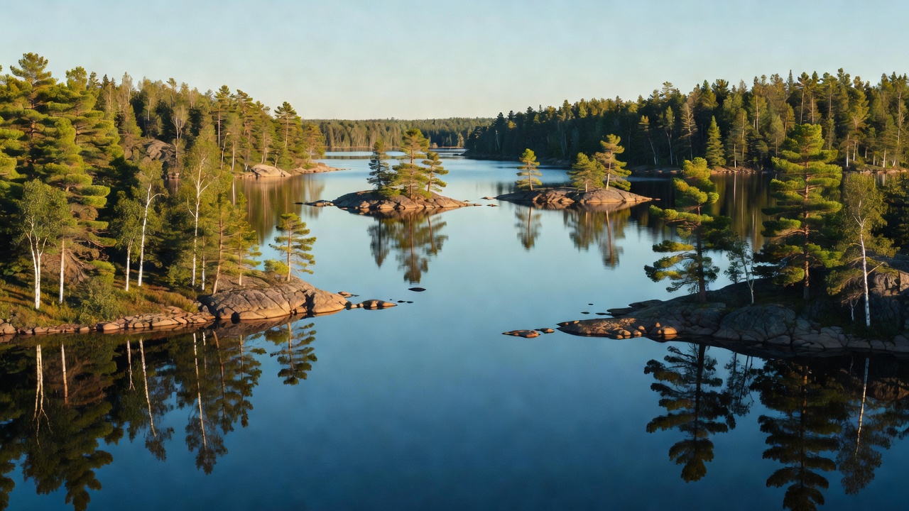
Superior National Forest covers the far northeastern corner of Minnesota -- the 'Arrowhead' that juts up between Lake Superior and the Canadian border. It's often called the largest national forest east of the Mississippi, and it doesn't feel like mountain country at all: this is North Woods of spruce, pine, and birch stitched together by an astonishing amount of water -- thousands of lakes, streams, and beaver ponds sitting on scoured Precambrian rock. If your idea of a good trip is a canoe, a paddle, and a week of loon calls, few places on the continent do it better.
History
The forest was proclaimed on February 13, 1909, under President Theodore Roosevelt, and it takes its name from nearby Lake Superior. It started much smaller than it is today and grew over the following decades. Long before that, this was the water highway of the fur trade -- French-Canadian voyageurs paddled and portaged birch-bark canoes loaded with furs and trade goods along these border lakes, following routes the Ojibwe (Anishinaabe) and earlier peoples had traveled for generations. That canoe-country heritage became something worth fighting for: after decades of battles over dams, roads, and logging, the wild lake district at the forest's core was set aside as the Boundary Waters Canoe Area Wilderness, protected under the 1964 Wilderness Act and a dedicated 1978 law.
Wildlife & plants
This is one of the wildest corners of the lower 48. Northern Minnesota holds the largest gray wolf population in the contiguous United States, and hundreds of wolves range across the forest -- though, as with most wolves, you're far likelier to hear a howl or cross a track than to see one. Moose are the iconic big animal here (their numbers in the region fell hard over the last couple of decades and remain well below earlier highs), alongside black bears, white-tailed deer, and beavers whose dams shape half the landscape. The elusive Canada lynx pads through the deep snow, scarce and rarely seen. On the water, the common loon -- Minnesota's state bird -- yodels across the lakes at dusk, bald eagles work the shorelines, and anglers cast for walleye, northern pike, smallmouth bass, and cold-water lake trout. The woods themselves are classic boreal forest -- spruce, balsam fir, jack and red pine, aspen, and paper birch -- near the southern edge of that great northern forest belt.
Notable features
The forest's crown jewel is the Boundary Waters Canoe Area Wilderness -- over a million acres and more than a thousand lakes of paddle-and-portage wilderness along the Canadian border, facing Ontario's Quetico Provincial Park across the line. It's mostly motor-free canoe country, with only a small number of designated lakes where limited motor use is allowed. Eagle Mountain, at 2,301 feet, is the highest point in all of Minnesota and sits right inside the forest -- remarkably, only a short distance from the shore of Lake Superior, which is close to the state's lowest ground. The Laurentian Divide crosses the forest too: the height of land where water decides whether it flows north toward Hudson Bay and the Arctic or south toward the Great Lakes and the Atlantic.
Camps are sourced from public U.S. Forest Service recreation data and have not been personally visited. Roads shown are Forest Service passenger-car routes (maintenance level 3–5) and may be seasonal or gated. Always confirm access, fees and fire rules with the ranger district before you go. Found a fee where we show free? Tell us on the contact page.