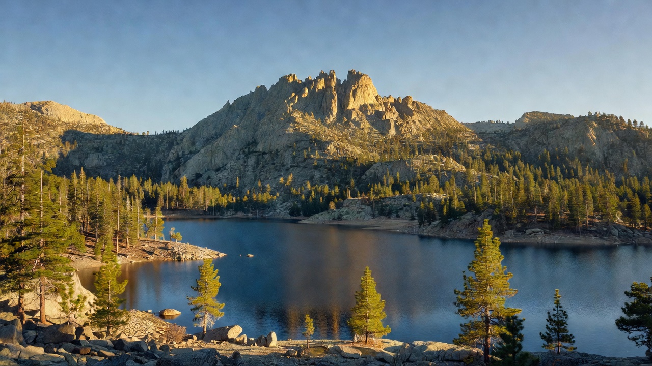
Tahoe National Forest
Camp here — Tahoe National Forest
171 camps mapped in this forest, 99 of them free. Tap one for its topo and aerial, the weather, the water, and how far you will be from fuel and a shower.
- FreeNevada County
- FreeRobinson Flat Campground
- FreeGiant Gap Ridge
- FreeBeyers Lakes
- FreeGold Valley
- FreeElliot Ranch
- FreeChapman
- FreeOak Valley
Where dispersed camping is listed — Tahoe National Forest
The Forest Service lists dispersed camping as an activity at these 1 places. That is the agency saying it is allowed somewhere in the area — not a campsite we have mapped, and not a spot we can put a pin on. Read their page, then check the district for the rules that apply on the day.
- Granite Chief Wilderness
In 1984, the Granite Chief Wilderness became a designated wilderness area under the Wilderness Act of 1964 because of its pristine nature, natural beauty, and primitive, non-motorized recreational opportunities. Located adjacent…
the Forest Service page for it →
Where the camps cluster
The place
Tahoe National Forest spreads across a roughly 1.2-million-acre swath of the northern Sierra Nevada in California -- climbing from the oak-and-pine foothills above the Sacramento Valley up over the granite crest to the Nevada line. Only about 850,000 acres of that is actually public forest; the rest is a checkerboard of private inholdings left over from the railroad and mining days. It's a landscape of high granite ridges, deep river canyons, and dozens of glittering reservoirs, and it's one of the busiest playgrounds in the whole Sierra: the Pacific Crest Trail runs its length, historic Donner Pass crosses its crest, and some of the deepest snow in the country piles up along the way. It's also Gold Rush ground -- some of the most torn-up, storied country in California.
History
The forest grew out of the Lake Tahoe Forest Reserve, set aside in 1899, and was reorganized and expanded into Tahoe National Forest under the young Forest Service around 1905-06 (a neighboring Yuba reserve was folded in about the same time). Long before that, this was home to the Washoe, the Nisenan (Southern Maidu), and neighboring Maidu and Miwok peoples. Then came 1848 and the Gold Rush, which hit this country about as hard as anywhere: miners rerouted whole rivers and blasted hillsides apart with water cannons chasing gold, and towns like Nevada City and Downieville boomed on the strike (Truckee, just east over the crest, came later as a railroad and logging town). This was also the great crossing of the Sierra -- the Donner Party wintered in the Truckee-Donner corridor on the forest's edge in 1846-47, and twenty years later the Transcontinental Railroad was punched over Donner Summit.
Wildlife & plants
Black bears are the forest's most famous residents -- the northern Sierra holds a healthy population, and they're a regular presence around campgrounds (hang your food) -- along with mule deer, coyotes, and mountain lions you're far more likely to read in tracks than to see. Overhead there are Steller's jays in the pines, and bald eagles and ospreys working the bigger reservoirs. The lakes and rivers are trout water -- rainbow, brown, and brook trout -- with kokanee salmon (a landlocked form of sockeye) in reservoirs like Stampede. The forest layers up by elevation through ponderosa and Jeffrey pine, sugar pine -- which grows the longest cones of any pine in the world -- incense cedar, and red and white fir up high.
Notable features
The forest's signature landmark is the Sierra Buttes -- a jagged, saw-toothed crest topping out around 8,590 feet, crowned by an old fire lookout you reach by climbing a set of open steel stairs bolted to the bare rock (the highest ground on the forest is actually Mount Lola, a bit over 9,100 feet). The western slope gives rise to the upper Yuba, Bear, and American rivers, while the east side drains into the Truckee; together they feed a chain of high reservoirs -- Bowman, Jackson Meadows, Stampede, Prosser, Boca, and more. Donner Summit crosses the crest on the east side of the forest, and the Pacific Crest Trail traverses that crest the whole length of the unit.
Camps are sourced from public U.S. Forest Service recreation data and have not been personally visited. Roads shown are Forest Service passenger-car routes (maintenance level 3–5) and may be seasonal or gated. Always confirm access, fees and fire rules with the ranger district before you go. Found a fee where we show free? Tell us on the contact page.