Agency-listedODWCFreeOpen today

4 mile Camp (Canton WMA)

Drive-up · Oklahoma Dept. of Wildlife · OK · 36.12834, -98.68842
Ask an AI about this campsiteOpens Grok already loaded with this site. It reads the same records this page is built from, and links whatever it tells you.
Ask about this camp →
Oklahoma Dept. of Wildlife lists this site. Someone from the agency inventoried it, so it is a real camp — not a spot we guessed at. What changes is conditions — roads, gates, closures, fire rules. Check those with the unit before you commit to the drive.

A designated primitive camping area on Canton WMA, mapped by the Oklahoma Department of Wildlife Conservation itself. There is no camping fee, but everyone 18 or older who enters ODWC land needs a Wildlife Conservation Passport ($26 for three days, $46 a year for residents) unless exempt. Camping is capped at 16 consecutive days and no more than 21 days in any 30. Expect nothing: bare ground. No drinking water is published here. Several Oklahoma WMAs close to all non-hunting use for part of the year and allow only hunter and angler camping in that window -- read the area rule in the audit note before you plan a trip. Nearest town is Canton, about 7.6 miles as the crow flies.
Can I go now? — 4 mile Camp (Canton WMA) · Oklahoma Dept. of Wildlife · OK
Open today The seasonal closure for non-hunters runs Oct 1 – Feb 15; not in effect today.
Oklahoma Dept. of Wildlife record: “Closed to all nonhunting activities, except hunter camping, from Oct. 1 - Feb. 15” Read against the calendar on 2026-09-17; with JavaScript your browser re-checks it against today.
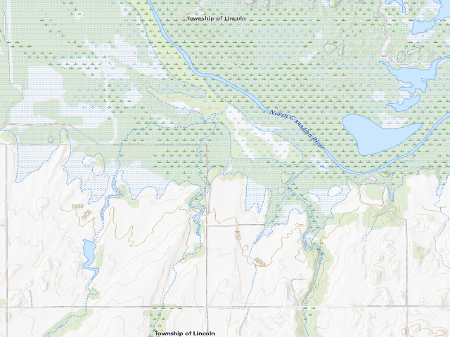
USGS topo — contours & terrain
USGS topographic map of 4 mile Camp (Canton WMA)
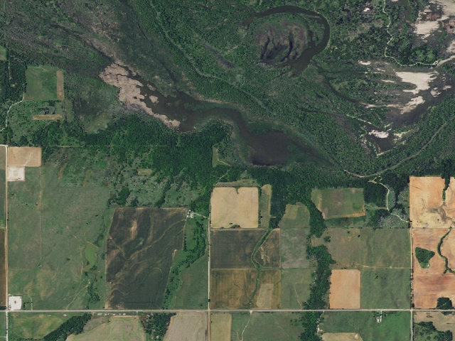
Aerial — USGS / NAIP
Aerial image of 4 mile Camp (Canton WMA)
XFacebookReddit
Weather outlook — at 4 mile Camp (Canton WMA)
Loading the latest forecast…
Live NWS area forecast (~2.5 km grid, not elevation-corrected). Camp sits at 1,635 ft.
Fire & smoke — around 4 mile Camp (Canton WMA)NIFC · AirNow
Checking active fires & air quality…
Active wildfires from NIFC (within ~50 mi); air quality from AirNow. Always confirm current fire restrictions with the managing office before you go.

Everything you need — measured from 4 mile Camp (Canton WMA) · Oklahoma Dept. of Wildlife · OK

15 MI30 MI60 MIYOUR CAMPN ↑Water · 53 miWDump · 4 miDFuel · 7 miFGrocery · 7 miGPharmacy · 15 miRxHardware · 7 miHMaximum Auto · Mechanic · 30 miMLaundry · 8 miLShower · 19 miShAir-up · 46 miAGreat Salt Plains Health Center - Canton · Urgent care · 8 mi+Overlook Cafe · Outfitter · 6 miOCanton Post Office · Mail · 8 mi@ASAP GENERAL 101 EV2 · EV fast charger · 41 miEV
Straight-line miles · bearings approx · roads run longer
Nearest of each
  • DDump4 mi
  • OOutfitter6 mi
  • HHardware7 mi
  • FFuel7 mi
  • GGrocery7 mi
  • LLaundry8 mi
  • @Mail8 mi
  • +Urgent care8 mi
  • RxPharmacy15 mi
  • ShShower19 mi
  • MMechanic30 mi
  • EVEV fast charger41 mi
  • AAir-up46 mi
  • WWater53 mi
≤30 mi30–4545+water

The read: water is a real 53-mi drive, fuel & food sit about 7 mi out, the nearest EV fast charger is a 41-mi run (and back).

Not within 60 mi: Propane. Plan those before you head up.

One dot per need — the nearest of each kind, straight-line from camp. Places from OpenStreetMap (© OpenStreetMap contributors); the EV fast charger from the US DOE station locator. Open in Google Maps ↗

The site — 4 mile Camp (Canton WMA)

Access
Drive-up
Land
Oklahoma Dept. of Wildlife
Elevation
1,635 ft
State
OK
Coordinates
36.12834, -98.68842
Cost
Free

Nearby & resupply — around 4 mile Camp (Canton WMA) · Oklahoma Dept. of Wildlife · OK (OpenStreetMap)

  • Drinking waternone within 10 mi
  • FuelFuel · ~7.4 mi
  • Propane / LPGnone within 31 mi
  • Dump station~4.0 mi
  • GroceriesGrocery · ~7.4 mi
  • PharmacyPharmacy · ~15.4 mi
  • Hospital / clinicGreat Salt Plains Health Center - Canton · ~7.7 mi
  • HardwareHardware · ~6.9 mi

EV charging — from 4 mile Camp (Canton WMA) · Oklahoma Dept. of Wildlife · OK — nearest public DC fast & Level 2 (US DOE station data)

Nearby restrooms — around 4 mile Camp (Canton WMA) · Oklahoma Dept. of Wildlife · OK — pit toilets, restrooms & rest areas (government data)

Open 4 mile Camp (Canton WMA) elsewhere

Other camps near 4 mile Camp (Canton WMA)

If this one is full, gated or washed out.

How we know this — 4 mile Camp (Canton WMA)

Seasonal closure
Closed to all nonhunting activities, except hunter camping, from Oct. 1 - Feb. 15
Fire rules
Fires shall be confined to those areas designated for camping and shall be contained in fireplaces, fire rings, grills, or other facilities designed for this purpose. Fires shall not be left unattended and must be completely extinguished prior to departure.
Stay limit
16 nights (limited to a maximum of 16 consecutive days)
Area rules
Hunter and angler camping is allowed in designated areas.
Source
public land records
Confidence
Likely — The record is good enough to put a pin on, but thin in places. Treat the details as a starting point, not gospel.
How it was placed
AREA RULE (https://www.wildlifedepartment.com/hunting/regs/public-hunting-areas-special-regulations, read 2026-08-16): ODWC Special Regulations heading "Canton WMA" (county: Blaine, Dewey) -- Additional Restrictions, verbatim: "The Prairie Dog Refuge is closed to prairie dog hunting. Closed to all nonhunting activities, except hunter camping, from Oct. 1 - Feb. 15. Hunter and angler camping is allowed in designated areas." LEGAL BASIS -- ODWC Department-Managed Area Rules, https://www.wildlifedepartment.com/hunting/regs/department-managed-area-rules, read 2026-08-16, verbatim: "Camping is limited to a maximum of 16 consecutive days, and for no more than 21 days total in any 30-day period on the same WMA. Camping on these areas is limited to two days longer than the period the camper (hunter) is authorized to hunt. Leaving a campsite unattended for a period longer than 48 hours is prohibited. Unattended camp items will be removed. Quiet hours are enforced from 11 p.m. to 7 a.m. All dogs or other pets must be kept on a leash or otherwise confined while in camping areas." FIRE -- same page, verbatim: "Fires shall be confined to those areas designated for camping and shall be contained in fireplaces, fire rings, grills, or other facilities designed for this purpose. Fires shall not be left unattended and must be completely extinguished prior to departure." ODWC does not publish a statewide seasonal fire ban on this page; Oklahoma county burn bans are issued separately and are not reflected here. Also verbatim from that page: "Public lands not specifically listed as open are closed." Read the area's own regulation before you go. THIS IS NOT A FEE-FREE PLACE TO ENTER -- fee=0 on this row means ODWC publishes NO per-night camping charge, not that access is free. ODWC's license fee table (https://www.wildlifedepartment.com/licensing/regs/license-fees, read 2026-08-16) states verbatim that an "Annual Wildlife Conservation Passport" is "Required of all persons 18 or older who enter Department owned lands, regardless of residency, unless exempt" at $46 for residents and $239 for nonresidents, and a "3-Day Wildlife Conservation Passport" at $26 / $51. A separate $100 / $200 "Land Access Permit" is "Required for residents ages 18 to 63, and nonresidents of any age, including lifetime license holders to access certain ODWC managed properties." ODWC's fee table says "unless exempt" but does not list the exemptions on that page, so we do not state who is exempt. Treat this as: budget for a permit, and check odwc before you drive. ODWC camp type: "Primitive". WATER: ODWC's layer carries no drinking-water field for camping areas and this row claims none. Do not treat any lake, creek or pond near these sites as potable. COORDINATE PROVENANCE: latitude and longitude are ODWC's own, from its public ArcGIS service https://www.wildlifedepartment.com/server/rest/services/PublicWILMA/WILMAFeatures/MapServer/4 (layer 4, 'Camping Areas'), queried 2026-08-16 with where=1=1 outSR=4326. Every ingested point carries OPENTOPUBL='Yes' in that layer. No geocoding was used. Nearest town: Canton ~7.6 mi. 'Nearest town' is STRAIGHT-LINE distance to the nearest OpenStreetMap place=city/town/village and is NOT a driving distance -- on a Corps lake shoreline or in the Ouachitas the road in is routinely two or three times longer. Ingest 2026-08-16. STATUS=pending: this is a lead for review, not published. --- NIGHT-SHIFT REVIEW 2026-08-18 (reviewer=nightshift-verified) --- RE-FETCHED THIS FIRE, all four sources this row cites: (1) https://www.wildlifedepartment.com/server/rest/services/PublicWILMA/WILMAFeatures/MapServer/4 queried live 2026-08-18 (where=1=1, outSR=4326): 299 features returned. OBJECTID 179 is STILL PRESENT, SITENAME "4 mile Camp", WMANAME "Canton Wildlife Management Area", CAMPTYPE "Primitive", OPENTOPUBL="Yes". Its geometry is 0.0000 mi from the latitude/longitude stored on this row -- unchanged. Across all 278 Oklahoma odwc_camp rows in the DB, zero had vanished from the layer, zero had moved more than 0.02 mi, and zero had flipped OPENTOPUBL away from 'Yes'. (2) https://www.wildlifedepartment.com/hunting/regs/public-hunting-areas-special-regulations re-read live 2026-08-18. NOTE FOR FUTURE FIRES: this page is PAGINATED (13 pages, ?page=0..12); a single fetch of the bare URL returns only ~9 of the 111 areas. All 13 pages were pulled. Heading "Canton WMA" is still present; its Additional Restrictions read verbatim: "The Prairie Dog Refuge is closed to prairie dog hunting. Closed to all nonhunting activities, except hunter camping, from Oct. 1 - Feb. 15. Hunter and angler camping is allowed in designated areas." (3) https://www.wildlifedepartment.com/hunting/regs/department-managed-area-rules re-read live 2026-08-18: the 16-day rule is UNCHANGED, verbatim -- "Camping is limited to a maximum of 16 consecutive days, and for no more than 21 days total in any 30-day period on the same WMA." The fire rule and "Public lands not specifically listed as open are closed." are also unchanged. (4) https://www.wildlifedepartment.com/licensing/regs/license-fees re-read live 2026-08-18: Annual Wildlife Conservation Passport still $46 ($239 nonresident), 3-Day still $26 ($51), Land Access Permit still $100 ($200) -- all UNCHANGED, and the passport is still described verbatim as "Required of all persons 18 or older who enter Department owned lands, regardless of residency, unless exempt". NEW SECOND SOURCE read this fire (it was NOT cited on this row before): the area's own ODWC page, https://www.wildlifedepartment.com/hunting/wma/northwest/canton-wma, read 2026-08-18. Its "Camping/Facilities" section reads verbatim: "Fifteen primitive camping areas are available at designated areas along most access roads on the area. Additionally developed campgrounds with RV hookups are available around Canton lake. Contact the U.S. Army Corps of Engineers for more information on the developed campground sites ( 580/886-2989 ). Lodging and restaurants are available around Canton WMA at Canton, Seiling, Fairview, and Longdale. The Canton chamber of commerce can be reached at ( 580/886-2216 )" DUPLICATE CHECK (coordinates, not names): compared against all 36 currently-published Oklahoma camps. Nearest published Oklahoma camp is "American Horse Lake", 35.84 mi away -- far outside any plausible same-site radius, so this is NOT a duplicate of anything we already show. VERDICT: APPROVED. The row still says exactly what ODWC's own live data says. This is ODWC's own point, in ODWC's own 'Camping Areas' layer, flagged open to the public, on an area whose published rule permits camping in designated areas, and the area's own ODWC page independently confirms primitive camping is offered. Nothing on this row was found to overstate the sources. Not visited; no field check was made. COUNT CROSS-CHECK PASSES EXACTLY: the Canton WMA page says "Fifteen primitive camping areas are available at designated areas along most access roads on the area", and the live GIS layer carries exactly 15 Canton WMA points. The agency's prose and the agency's own map agree, which is the strongest corroboration available without a site visit. SEASONAL CAVEAT that must survive onto the published page: Canton is "Closed to all nonhunting activities, except hunter camping, from Oct. 1 - Feb. 15" -- for four and a half months this is a hunter-camping-only area, not a general campsite.
Season
Read from the agency's own season / closure text in this record (data/conditions.py) and checked against the calendar. The words we read are printed under the verdict at the top of the page.
EV chargers
US DOE Alternative Fuels Data Center station locator, snapshot 2026-09-16. Straight-line miles to the nearest public, open, unrestricted station; restricted and planned units are shown but never counted.
Field check
On the agency's books. The land manager inventoried this site, so its existence is not in question — current conditions are. Nobody from here has camped it recently.

What we don’t know about 4 mile Camp (Canton WMA)

A land record can put you within a few meters of a spot. It cannot tell you any of this — so check it yourself, and treat anything below as the open question it is.

Before you go — 4 mile Camp (Canton WMA)

Been here? Tell us what changed. This page is built from public records, so the fastest way it gets better is somebody who has actually pulled in. Road washed out, site gone, gate locked, or it is exactly as described — all of it useful. Send a report →