Bayard City RV Sites (Swimming Pool Park)
Bayard sits in the North Platte valley in western Nebraska, and Chimney Rock -- the landmark that told Oregon Trail emigrants they were a third of the way to Oregon -- is a few miles southwest and visible from town. The city maintains three gravel RV sites at the Swimming Pool Park with both 30- and 50-amp electric and water hookups (no sewer), first-come first-serve with no reservations. The city's own page is refreshingly blunt about the deal: the first two nights of any stay cost nothing, the next eight are $25 a night, and there is a 10-day maximum -- and no, moving to a different site does not reset the clock. So this is a genuinely free two-night stop and a fairly expensive one after that. Pay at the city office, 445 Main Street. Across the narrow street is the main city park with mature shade, a covered pavilion and picnic tables, a playground, and a seasonal pool and tennis courts. Scotts Bluff National Monument is a short drive west. Honest caveats: watch the fee cliff -- several camping websites still say $10 a night after the free nights, but the city's current page says $25, so budget for the city's number. Our map pin is the park next to the municipal pool, which is where the city says the sites are, but the RV pads themselves are not mapped, so expect to look around a block or so when you arrive. The deal these towns offer is simple: camp free, and they hope you buy fuel, groceries or dinner in town. Be a good guest and it stays free for the next traveler. Town rules change often and we have not visited -- confirm current rules with the town before you go.
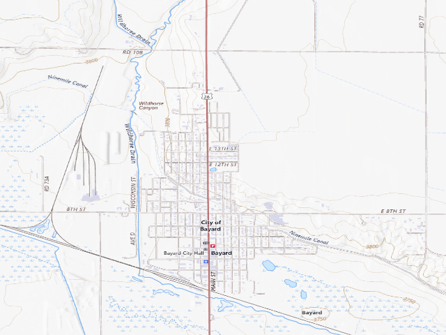
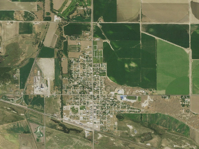
Everything you need — measured from Bayard City RV Sites (Swimming Pool Park) · public land · NE
- @Mail0 mi
- GGrocery1 mi
- FFuel1 mi
- MMechanic17 mi
- HHardware17 mi
- LLaundry18 mi
- RxPharmacy18 mi
- +Urgent care18 mi
- WWater18 mi
- EVEV fast charger19 mi
- DDump40 mi
- OOutfitter49 mi
The read: water's a short hop out, fuel & food sit about 1 mi out.
Not within 60 mi: Propane. Plan those before you head up.
One dot per need — the nearest of each kind, straight-line from camp. Places from OpenStreetMap (© OpenStreetMap contributors); the EV fast charger from the US DOE station locator. Open in Google Maps ↗
The site — Bayard City RV Sites (Swimming Pool Park)
Nearby & resupply — around Bayard City RV Sites (Swimming Pool Park) · public land · NE (OpenStreetMap)
- Drinking waternone within 10 mi
- FuelFuel · ~0.7 mi
- Propane / LPGnone within 31 mi
- GroceriesBayard Grocery · ~0.6 mi
- PharmacyU-Save Pharmacy · ~17.9 mi
- Hospital / clinicSweet Dreams Sleep Services · ~18.2 mi
- HardwareMenards · ~17.4 mi
EV charging — from Bayard City RV Sites (Swimming Pool Park) · public land · NE — nearest public DC fast & Level 2 (US DOE station data)
- Nearest public DC fast charger19.2 mi straight-line W — NPPD EV STATION SB SINCLAIR DCS, Scottsbluff, NE · ChargePoint Network · CHAdeMO, CCS · 1 fast port listed · listed open, last confirmed by AFDC 2026-09-16 · hours: 24 hours daily · directions
- Public DC fast stations within reach2 within 25 mi · 4 within 50 · 23 within 100 · 100 within 150
- Nearest listing NACS (Tesla)48.7 mi — Sidney, NE - Tesla Supercharger, Sidney
- Nearest public Level 2 (J1772)18.3 mi — WNCC MAIN CAMPUS, Scottsbluff, NE · ChargePoint Network · J1772 · 2 Level 2 ports listed · listed open, last confirmed by AFDC 2026-09-16 · hours: 24 hours daily
- Pricing at the fast chargernot listed
- Power (kW)not listed by AFDC — “DC fast” spans roughly 24 to 350 kW, so ask the network.
- Read this honestlyStraight-line miles, like every distance on this site. Roads run longer than this, and you have to get back. We know where a charger is listed. We don’t know if it works today, how fast it is, or the road miles. Check the network before you commit.
Snapshot 2026-09-16 · AFDC record 359949 · US DOE Alternative Fuels Data Center
Nearby restrooms — around Bayard City RV Sites (Swimming Pool Park) · public land · NE — pit toilets, restrooms & rest areas (government data)
- RestroomSunrise Beach Restroom Building · ~13.7 mi NW · BoR
- RestroomLake Minatare Vaulted Restroom - Primitive Campground Building · ~14.2 mi NW · BoR
- RestroomButte View South Restroom Building · ~14.3 mi NW · BoR
- RestroomButte View Restroom Building · ~14.6 mi NW · BoR
Open Bayard City RV Sites (Swimming Pool Park) elsewhere
Other camps near Bayard City RV Sites (Swimming Pool Park)
If this one is full, gated or washed out.
- Arnold Trupp WMA~5.5 mi
- Chet and Jane Fliesbach WMA~5.8 mi
- Williams Gap WMA~10.2 mi
- Nine Mile Creek WMA~10.9 mi
How we know this — Bayard City RV Sites (Swimming Pool Park)
What we don’t know about Bayard City RV Sites (Swimming Pool Park)
A land record can put you within a few meters of a spot. It cannot tell you any of this — so check it yourself, and treat anything below as the open question it is.
- Road surface & last-mile access
- How many rigs actually fit
- Cell coverage by carrier
- Seasonal & winter access
- Current fire restrictions
- Whether any water here is drinkable
- Shade & wind exposure
- Noise and who else shows up
- Whether a listed EV charger works today, or the road miles to it