Bowbells City Park Campground (Bowbells)
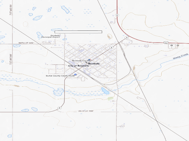
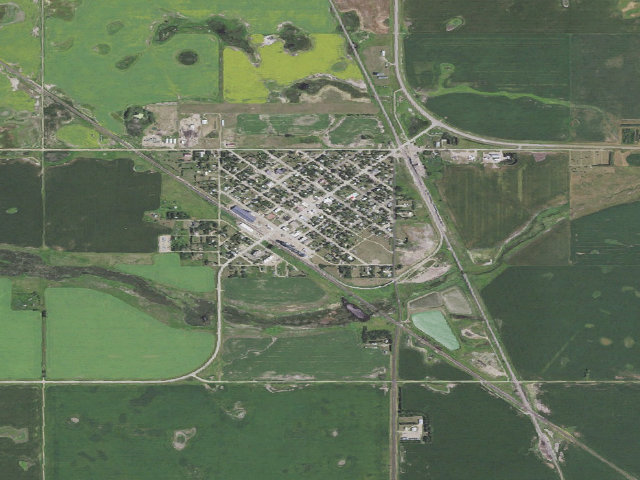
Bowbells is the Burke County seat up near the Canadian line, and the state tourism office lists its city park campground as free-will donation for overnight stays, with three RV hook-ups for water and sewer, an RV dump station, and outside bathrooms with showers at the town pool. It is described as an overnight stop rather than a place to settle in. One honest caveat you should weigh: this 'free-will donation' wording comes from the state tourism listing, not from the City of Bowbells itself, and we have seen a state tourism office in a neighbouring state describe a $20-a-night city park as free. Call (701) 377-2608 and confirm before you count on it being free. The mapped location is an unnamed campsite polygon in OpenStreetMap right by the town centre on Main Street, which matches the listed address, but it is not signed as such in the map data. The deal these towns offer is simple: camp free, and they hope you buy fuel, groceries or dinner in town. Town rules change often and we have not visited -- confirm with the city first.
Everything you need — measured from Bowbells City Park Campground (Bowbells) · public land · ND
- FFuel12 mi
- LLaundry34 mi
- GGrocery43 mi
- +Urgent care51 mi
- MMechanic52 mi
- EVEV fast charger56 mi
- RxPharmacy56 mi
- @Mail56 mi
- HHardware58 mi
- WWater58 mi
- AAir-up59 mi
The read: water is a real 58-mi drive, fuel & food sit about 12 mi out, the nearest EV fast charger is a 56-mi run (and back).
Not within 60 mi: Dump, Propane. Plan those before you head up.
One dot per need — the nearest of each kind, straight-line from camp. Places from OpenStreetMap (© OpenStreetMap contributors); the EV fast charger from the US DOE station locator. Open in Google Maps ↗
The site — Bowbells City Park Campground (Bowbells)
Nearby & resupply — around Bowbells City Park Campground (Bowbells) · public land · ND (OpenStreetMap)
- Water featureWater · nearby
- Nearest townBowbells · ~0.1 mi
- Drinking waternone within 10 mi
- Fuelnone within 30 mi
- Propane / LPGnone within 31 mi
- GroceriesCo-op · ~29.6 mi
- Hospital / clinicTrinity Kenmare Community Hospital · ~11.4 mi
- Mapping is thin out hereAn empty row means nothing is mapped within that radius — not that nothing exists. Small stores, seasonal resorts and single fuel pumps out here often never make it onto the map. Treat these as unconfirmed and ask locally.
EV charging — from Bowbells City Park Campground (Bowbells) · public land · ND — nearest public DC fast & Level 2 (US DOE station data)
- Nearest public DC fast charger56.2 mi straight-line SE — ENERBASE VEC, Minot, ND · ChargePoint Network · CHAdeMO, CCS · 1 fast port listed · listed open, last confirmed by AFDC 2026-09-16 · hours: 24 hours daily · directions
- Public DC fast stations within reachnone within 25 mi · none within 50 · 5 within 100 · 7 within 150
- Nearest listing NACS (Tesla)59.2 mi — Minot, ND - Tesla Supercharger, Minot
- Nearest public Level 2 (J1772)59.2 mi — Ryan Buick GMC, Minot, ND (at a car dealership) · Non-Networked · J1772, CCS · 1 Level 2 port listed · listed open, last confirmed by AFDC 2025-06-06 · hours: 24 hours daily
- Pricing at the fast chargernot listed
- Power (kW)not listed by AFDC — “DC fast” spans roughly 24 to 350 kW, so ask the network.
- Read this honestlyStraight-line miles, like every distance on this site. Roads run longer than this, and you have to get back. We know where a charger is listed. We don’t know if it works today, how fast it is, or the road miles. Check the network before you commit.
Snapshot 2026-09-16 · AFDC record 164078 · US DOE Alternative Fuels Data Center
Nearby restrooms — around Bowbells City Park Campground (Bowbells) · public land · ND — pit toilets, restrooms & rest areas (government data)
- RestroomFederal restroom · ~6.8 mi SE · FWS
- RestroomFederal restroom · ~12.9 mi SE · FWS
- RestroomFederal restroom · ~26.9 mi E · FWS
Open Bowbells City Park Campground (Bowbells) elsewhere
How we know this — Bowbells City Park Campground (Bowbells)
What we don’t know about Bowbells City Park Campground (Bowbells)
A land record can put you within a few meters of a spot. It cannot tell you any of this — so check it yourself, and treat anything below as the open question it is.
- Road surface & last-mile access
- How many rigs actually fit
- Cell coverage by carrier
- Seasonal & winter access
- Current fire restrictions
- Whether any water here is drinkable
- Shade & wind exposure
- Noise and who else shows up
- Whether a listed EV charger works today, or the road miles to it