Bridge Creek Wildlife Area - primitive camping along the public access road
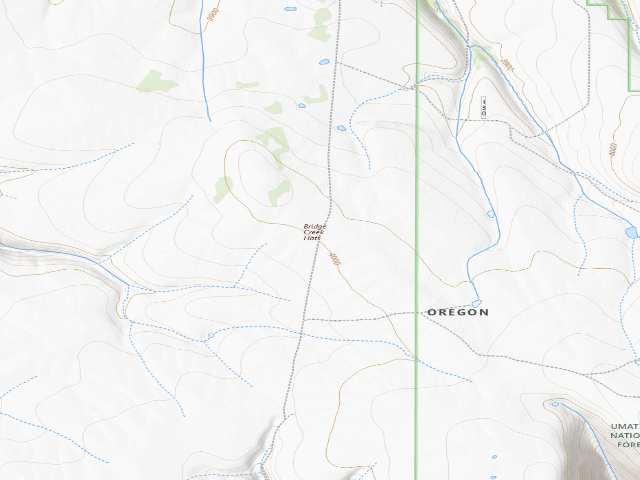
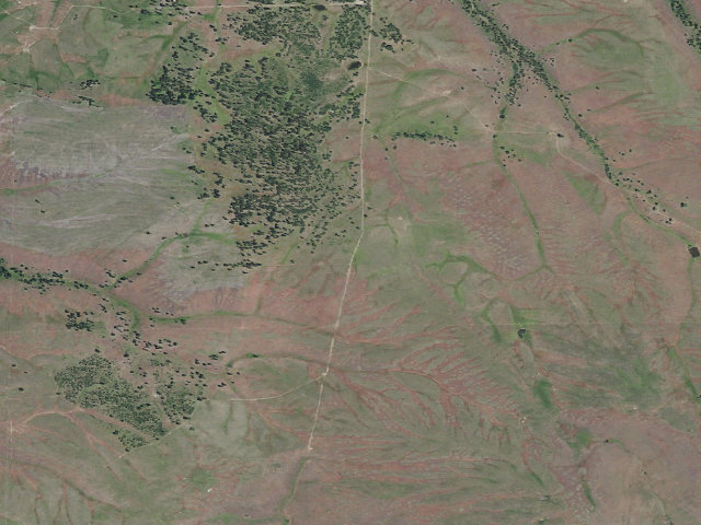
Free primitive camping on an Oregon state wildlife area in the Blue Mountains, about three miles south of Ukiah off Forest Road 52. No fee and no permit to camp here in season -- ODFW's own visitors' guide states plainly that no parking permit is required, and Bridge Creek is not one of the fifteen ODFW wildlife areas that charge the $8/day (or $28/year) parking permit. WHERE YOU MAY ACTUALLY CAMP -- READ THIS, IT IS NARROWER THAN IT LOOKS. The wildlife area is about 15,000 acres, but you may NOT camp anywhere in it. ODFW's 2021 management plan says primitive camping is allowed within 300 feet of the area's public access road, and that the area's other (administrative) roads are closed to public motor vehicles year-round. In practice that means one unimproved road -- old County Road 1479, which ODFW calls its single public access road and describes as about five miles long. Stay within 300 feet of it. THE RULES, PLAINLY: the area is only open April 15 through November 30 -- it closes December 1 through April 14 for wintering elk, and in that period you may only enter by permit from ODFW. Camping is allowed in the open season but no more than 14 days total in any 30-day period. Drive only on open roads and parking areas, and only up to 300 feet off an open road to reach a campsite. Campfires only at campsites, and no open fires at all during designated fire closures -- this is dry country in late summer, so expect restrictions. Note also that ODFW gates the southern part of the area after second rifle elk season each fall (the gate at Kennedy Springs), so late-season motor access can be shorter than the map suggests. WHAT IS ACTUALLY HERE: essentially nothing built. ODFW's facility list for the whole wildlife area is two administrative cabins, a survey shed, one interpretive trail with a picnic table, the unimproved access road, fencing, and stock ponds. There is no campground, no toilet, no drinking water and no hookups. Bring all your own water -- the ponds are stock and wildlife ponds, not a supply. ODFW warns the access road is unimproved and cautions passenger vehicles; high clearance is the sensible choice, and it will be worse when wet. HONEST CAVEATS: this pin is a point ON the public access road roughly midway through the wildlife area -- it is NOT a developed campsite and not a known pull-off, because no such site is mapped or described anywhere. Treat it as a starting point for finding your own legal spot within 300 feet of the road. We have not visited. Rules on wildlife areas change, and ODFW's own plan floats the idea of a self-service permit system some day, so confirm current rules and fire restrictions with ODFW before you go. This is remote country with no services; the nearest town is Ukiah.
Everything you need — measured from Bridge Creek Wildlife Area - primitive camping along the public access road · Oregon Dept. of Fish & Wildlife · OR
- GGrocery3 mi
- @Mail3 mi
- FFuel24 mi
- MMechanic24 mi
- WWater36 mi
- RxPharmacy38 mi
- ShShower41 mi
- EVEV fast charger42 mi
- HHardware42 mi
- LLaundry42 mi
- +Urgent care43 mi
- DDump43 mi
The read: water is a real 36-mi drive, fuel & food sit about 3 mi out, the nearest EV fast charger is a 42-mi run (and back).
Not within 60 mi: Propane. Plan those before you head up.
One dot per need — the nearest of each kind, straight-line from camp. Places from OpenStreetMap (© OpenStreetMap contributors); the EV fast charger from the US DOE station locator. Open in Google Maps ↗
The site — Bridge Creek Wildlife Area - primitive camping along the public access road
Nearby & resupply — around Bridge Creek Wildlife Area - primitive camping along the public access road · Oregon Dept. of Fish & Wildlife · OR (OpenStreetMap)
- Water featureChilson Creek (stream) · nearby
- Nearest townDale · ~3.1 mi
- Drinking waternone within 10 mi
- FuelFuel · ~23.6 mi
- Propane / LPGnone within 31 mi
- GroceriesDale Store · ~3.1 mi
EV charging — from Bridge Creek Wildlife Area - primitive camping along the public access road · Oregon Dept. of Fish & Wildlife · OR — nearest public DC fast & Level 2 (US DOE station data)
- Nearest public DC fast charger42.1 mi straight-line S — OTEC OTEC OFFICE JD, John Day, OR · ChargePoint Network · CHAdeMO, CCS · 1 fast port listed · listed open, last confirmed by AFDC 2026-09-16 · hours: 24 hours daily · directions
- Public DC fast stations within reachnone within 25 mi · 11 within 50 · 52 within 100 · 143 within 150
- Nearest listing NACS (Tesla)44.0 mi — Arrowhead Travel Plaza, Pendleton
- Nearest public Level 2 (J1772)38.0 mi — COLUMBIA BASIN HEPPNER · ChargePoint Network · J1772 · 2 Level 2 ports listed · listed open, last confirmed by AFDC 2026-09-16 · hours: 24 hours daily
- Pricing at the fast chargernot listed
- Power (kW)not listed by AFDC — “DC fast” spans roughly 24 to 350 kW, so ask the network.
- Read this honestlyStraight-line miles, like every distance on this site. Roads run longer than this, and you have to get back. We know where a charger is listed. We don’t know if it works today, how fast it is, or the road miles. Check the network before you commit.
Snapshot 2026-09-16 · AFDC record 312972 · US DOE Alternative Fuels Data Center
Nearby restrooms — around Bridge Creek Wildlife Area - primitive camping along the public access road · Oregon Dept. of Fish & Wildlife · OR — pit toilets, restrooms & rest areas (government data)
- Vault / pit toiletTollbridge · ~2.3 mi S · USFS
- Vault / pit toiletDriftwood · ~3.4 mi E · USFS
- Vault / pit toiletDrift Fence · ~3.8 mi NE · USFS
- Vault / pit toiletGold Dredge · ~5.6 mi E · USFS
Open Bridge Creek Wildlife Area - primitive camping along the public access road elsewhere
Other camps near Bridge Creek Wildlife Area - primitive camping along the public access road
If this one is full, gated or washed out.
- Tollbridge Campground~2.3 mi
- Driftwood~3.4 mi · fee
- Drift Fence~3.8 mi
- Gold Dredge~5.6 mi · fee
How we know this — Bridge Creek Wildlife Area - primitive camping along the public access road
What we don’t know about Bridge Creek Wildlife Area - primitive camping along the public access road
A land record can put you within a few meters of a spot. It cannot tell you any of this — so check it yourself, and treat anything below as the open question it is.
- Road surface & last-mile access
- How many rigs actually fit
- Cell coverage by carrier
- Current fire restrictions
- Whether any water here is drinkable
- Shade & wind exposure
- Noise and who else shows up
- Whether a listed EV charger works today, or the road miles to it