Campbell Park (Box Canyon Dam)
Free camping, ten nights, no reservations -- from the utility that owns it. Campbell Park sits on the Pend Oreille River at the Box Canyon Dam Visitor's Center, about two miles north of the town of Ione on WA-31 in the far northeast corner of the state. It is run by the Pend Oreille County PUD, the public utility district, and the PUD says it plainly: 'There are 8 camp sites with BBQ pits. There is no fee and no reservations.' Pick a site -- they are all numbered -- then register; the PUD is explicit that 'camping is still free, registration is for notification and park usage data purposes only.' The maximum stay is ten consecutive nights, which is generous for this category. Through Labor Day there is a camp host on site Thursday, Friday and Saturday from 11:30 am to 8 pm, and if he is not in the guard shack he is out making his rounds; outside those hours the Box Canyon Visitor's Center (509-447-6703) is the number, and the camp host direct is 509-442-4125. Eight sites means it can simply be full, so have a backup. Be honest with yourself about the season: the park 'typically stays open through the summer and into late fall until the weather turns and snow begins to accumulate' -- there is no posted closing date, so in October or April you should call first. We are not claiming drinking water here; the PUD's page lists BBQ pits and nothing about potable water, so haul your own. This is not a park on the town square -- it is a dam-side utility park -- but Ione is two miles down the road with fuel and a store, and the whole Selkirk Loop is worth the drive. Confirm the current rules with the PUD before you go, pack out what you bring, and leave the site better than you found it.
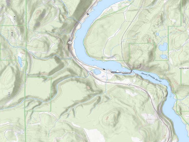
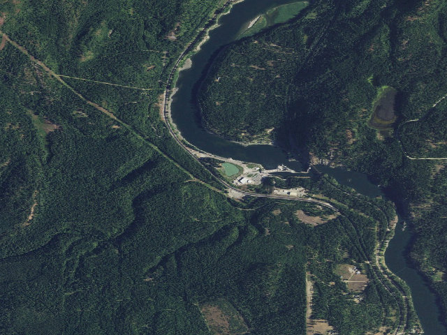
Everything you need — measured from Campbell Park (Box Canyon Dam) · public land · WA
- FFuel3 mi
- GGrocery3 mi
- @Mail3 mi
- EVEV fast charger7 mi
- HHardware19 mi
- +Urgent care27 mi
- MMechanic28 mi
- LLaundry28 mi
- OOutfitter28 mi
- DDump29 mi
- ShShower33 mi
- WWater45 mi
- RxPharmacy45 mi
The read: water is a real 45-mi drive, fuel & food sit about 3 mi out.
Not within 60 mi: Propane. Plan those before you head up.
One dot per need — the nearest of each kind, straight-line from camp. Places from OpenStreetMap (© OpenStreetMap contributors); the EV fast charger from the US DOE station locator. Open in Google Maps ↗
The site — Campbell Park (Box Canyon Dam)
Nearby & resupply — around Campbell Park (Box Canyon Dam) · public land · WA (OpenStreetMap)
- Water featurePend Oreille River (river) · nearby
- Nearest townIone · ~2.7 mi
- Drinking waternone within 10 mi
- FuelFuel · ~2.7 mi
- Propane / LPGnone within 31 mi
- Dump station~29.2 mi
- GroceriesStore · ~2.7 mi
- PharmacyWalmart Pharmacy · ~22.9 mi
- Hospital / clinicKootenay Boundary Regional Hospital · ~25.7 mi
- HardwareNorthport Hardware · ~18.9 mi
EV charging — from Campbell Park (Box Canyon Dam) · public land · WA — nearest public DC fast & Level 2 (US DOE station data)
- Nearest public DC fast charger6.6 mi straight-line S — Tiger Historical Museum, Cusick, WA (at a public site) · RED_E · CHAdeMO, J1772, CCS · 4 fast ports listed · listed open, last confirmed by AFDC 2026-09-16 · hours: not listed · directions
- Public DC fast stations within reach1 within 25 mi · 6 within 50 · 48 within 100 · 83 within 150
- Nearest listing NACS (Tesla)77.7 mi — The Hive, Spokane
- Nearest public Level 2 (J1772)6.0 mi — Metaline Falls Visitor Center · Blink Network · J1772 · 2 Level 2 ports listed · listed open, last confirmed by AFDC 2026-09-16 · hours: 24 hours daily
- Pricing at the fast chargernot listed
- Power (kW)not listed by AFDC — “DC fast” spans roughly 24 to 350 kW, so ask the network.
- Read this honestlyStraight-line miles, like every distance on this site. Roads run longer than this, and you have to get back. We know where a charger is listed. We don’t know if it works today, how fast it is, or the road miles. Check the network before you commit.
Snapshot 2026-09-16 · AFDC record 456457 · US DOE Alternative Fuels Data Center
Nearby restrooms — around Campbell Park (Box Canyon Dam) · public land · WA — pit toilets, restrooms & rest areas (government data)
- Vault / pit toiletEdgewater · ~1.8 mi S · USFS
- Vault / pit toiletEdgewater Day Use · ~1.9 mi S · USFS
- Vault / pit toiletHanks Butte · ~4.9 mi S · USFS
- Vault / pit toiletNoisy Creek · ~6.2 mi E · USFS
Open Campbell Park (Box Canyon Dam) elsewhere
Other camps near Campbell Park (Box Canyon Dam)
If this one is full, gated or washed out.
- Edgewater~1.8 mi · fee
- Noisy Creek~6.3 mi · fee
- Moon Flats~6.9 mi
- West Sullivan~7.2 mi · fee
How we know this — Campbell Park (Box Canyon Dam)
What we don’t know about Campbell Park (Box Canyon Dam)
A land record can put you within a few meters of a spot. It cannot tell you any of this — so check it yourself, and treat anything below as the open question it is.
- Road surface & last-mile access
- How many rigs actually fit
- Cell coverage by carrier
- Seasonal & winter access
- Current fire restrictions
- Whether any water here is drinkable
- Shade & wind exposure
- Noise and who else shows up
- Whether a listed EV charger works today, or the road miles to it