Chester City Park
Free overnight camping in the Town of Chester's city park, right in town on the US-2 Hi-Line -- the single verified free overnight stop across 23 Hi-Line towns checked, and a genuinely useful one on a long, thin stretch of northern Montana. The town's own site says it plainly: "While there is no electric, water or sewer services for overnight campers, travelers may stay for up to 3 nights at no charge. A donation box is located on site and donations are very much appreciated." So: 3 nights, no charge, and there IS a donation box -- if the stop saves you a motel night, feed the box, that is the whole spirit of this. The park covers an entire city block and has a bathroom facility, playground equipment, plenty of picnic areas, and a large covered three-sided pavilion built in 2010. NO hookups of any kind -- no electric, no water, no sewer -- so arrive self-sufficient. Chester is also the jumping-off point for Lake Elwell (Tiber Reservoir) about 18 miles southwest, where Reclamation has more free primitive camping. Do not confuse this in-town park with the town's Recreation page listings for Sandford Park and VFW Park -- those are federal Bureau of Reclamation sites out at the reservoir, not the city block. Confirm current rules with the town at (406) 759-5635 before you go. We have not visited this site.
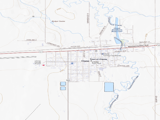
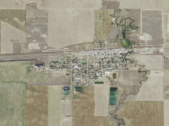
Everything you need — measured from Chester City Park · public land · MT
- FFuel0 mi
- @Mail0 mi
- GGrocery0 mi
- RxPharmacy0 mi
- HHardware0 mi
- +Urgent care46 mi
- MMechanic49 mi
- WWater50 mi
- ShShower50 mi
- LLaundry50 mi
- DDump50 mi
- EVEV fast charger56 mi
The read: water is a real 50-mi drive, fuel & food sit about 0 mi out, the nearest EV fast charger is a 56-mi run (and back).
Not within 60 mi: Propane. Plan those before you head up.
One dot per need — the nearest of each kind, straight-line from camp. Places from OpenStreetMap (© OpenStreetMap contributors); the EV fast charger from the US DOE station locator. Open in Google Maps ↗
The site — Chester City Park
Nearby & resupply — around Chester City Park · public land · MT (OpenStreetMap)
- Water featureCottonwood Creek (stream) · nearby
- Nearest townChester · ~0.1 mi
- Drinking waternone within 10 mi
- FuelConoco · ~0.2 mi
- Propane / LPGnone within 31 mi
- GroceriesLiberty Quick Stop · ~0.3 mi
- PharmacyLiberty Drugs · ~0.3 mi
- Hospital / clinicLogan Health - Chester · ~0.1 mi
EV charging — from Chester City Park · public land · MT — nearest public DC fast & Level 2 (US DOE station data)
- Nearest public DC fast charger55.8 mi straight-line E — Tilleman Motors, Havre, MT · EVGATEWAY · CCS · 1 fast port listed · listed open, last confirmed by AFDC 2026-09-16 · hours: 24 hours daily · directions
- Public DC fast stations within reachnone within 25 mi · none within 50 · 3 within 100 · 7 within 150
- Nearest listing NACS (Tesla)73.1 mi — Great Falls, MT - Tesla Supercharger, Great Falls
- Nearest listing CHAdeMO71.1 mi — Great Falls Subaru, Great Falls
- Nearest public Level 2 (J1772)49.1 mi — Wolfe of Fort Benton · FLO · J1772 · 2 Level 2 ports listed · listed open, last confirmed by AFDC 2026-09-16 · hours: 24 hours daily
- Pricing at the fast chargernot listed
- Power (kW)not listed by AFDC — “DC fast” spans roughly 24 to 350 kW, so ask the network.
- Read this honestlyStraight-line miles, like every distance on this site. Roads run longer than this, and you have to get back. We know where a charger is listed. We don’t know if it works today, how fast it is, or the road miles. Check the network before you commit.
Snapshot 2026-09-16 · AFDC record 349557 · US DOE Alternative Fuels Data Center
Nearby restrooms — around Chester City Park · public land · MT — pit toilets, restrooms & rest areas (government data)
- RestroomTiber Reservoir Recreation Management Area-Precast Restroom 2 Building · ~13.8 mi S · BoR
- RestroomTiber Reservoir Recreation Management Area-Block Restroom 1 Building · ~14.1 mi SW · BoR
- RestroomWillow Creek Boat Ramp Day Use Area-Block Restroom Building · ~14.1 mi SW · BoR
- Vault / pit toiletTiber Marina Campground-Outhouse Building · ~14.2 mi SW · BoR
Open Chester City Park elsewhere
How we know this — Chester City Park
What we don’t know about Chester City Park
A land record can put you within a few meters of a spot. It cannot tell you any of this — so check it yourself, and treat anything below as the open question it is.
- Road surface & last-mile access
- How many rigs actually fit
- Cell coverage by carrier
- Seasonal & winter access
- Current fire restrictions
- Whether any water here is drinkable
- Shade & wind exposure
- Noise and who else shows up
- Whether a listed EV charger works today, or the road miles to it