Deshler Crossroads Park
FIRST, THE DONATION: this is a free-to-stay spot run by local railfan volunteers, but there's a donation slot at the signal bungalow -- the suggested donation is about $20 for tents and $30 for RVs (older write-ups mention $5 for electric), so please drop it in; it keeps the park open. Deshler Crossroads Park sits in the southwest corner of the famous Deshler 'diamond' in Deshler, a small village in Henry County, northwest Ohio, where two busy CSX lines cross -- 50 to 70 trains a day, a 24-hour webcam, and a scanner speaker calling out approaching trains. It's a railfan paradise and a genuinely welcoming free overnight stop: camping is first-come, first-served on the grass west of the pavilion, both tents and RVs, no designated sites. There's a covered pavilion with tables and a fire pit, a porta-john, a pop machine, and an electric pole (30-amp and standard RV plugs) -- but NO water or sewer hookups, so come self-contained with your own water. It's right at an active rail crossing, so expect train noise all night (that's the point). This is the honest camp-free, shop-and-eat-in-town spirit -- Deshler hopes you'll spend a little locally. HEADS UP, this is a MEDIUM-confidence lead: the free/donation policy comes from long-standing railfan community sources rather than an official village page (the park's old website has lapsed), so please CONFIRM the current rules and donation via the 'Deshler Crossroads Park' Facebook page before you rely on it, pay the donation, and leave it better than you found it so the town keeps welcoming travelers.
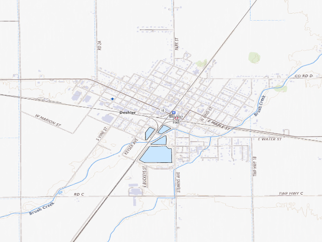
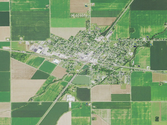
Everything you need — measured from Deshler Crossroads Park · public land · OH
- @Mail0 mi
- FFuel9 mi
- GGrocery11 mi
- MMechanic11 mi
- AAir-up12 mi
- WWater12 mi
- EVEV fast charger14 mi
- LLaundry14 mi
- HHardware15 mi
- +Urgent care15 mi
- OOutfitter15 mi
- RxPharmacy15 mi
- PPropane26 mi
- DDump30 mi
- ShShower30 mi
The read: water's a short hop out, fuel & food sit about 9 mi out.
One dot per need — the nearest of each kind, straight-line from camp. Places from OpenStreetMap (© OpenStreetMap contributors); the EV fast charger from the US DOE station locator. Open in Google Maps ↗
The site — Deshler Crossroads Park
Nearby & resupply — around Deshler Crossroads Park · public land · OH (OpenStreetMap)
- Drinking waternone within 10 mi
- FuelFuel · ~8.7 mi
- Propane / LPGSpeedway Cafe · ~25.9 mi
- Dump station~29.8 mi
- GroceriesMain Street Station · ~11.0 mi
- PharmacyRite Aid · ~15.1 mi
- Hospital / clinicBlanchard Valley Health System Wellness Park · ~14.9 mi
- HardwareMaag's Paint Center · ~14.9 mi
EV charging — from Deshler Crossroads Park · public land · OH — nearest public DC fast & Level 2 (US DOE station data)
- Nearest public DC fast charger13.5 mi straight-line E — Pilot Travel Center 360, Findlay, OH · eVgo Network · CCS · 4 fast ports listed · listed open, last confirmed by AFDC 2026-09-15 · hours: 24 hours daily · directions
- Public DC fast stations within reach11 within 25 mi · 60 within 50 · 383 within 100 · 820 within 150
- Nearest listing NACS (Tesla)15.7 mi — Findlay, OH - Tesla Supercharger, Findlay
- Nearest listing CHAdeMO17.1 mi — SNYDER CHEV CPE250, Napoleon
- Nearest public Level 2 (J1772)15.7 mi — City Express Findlay OH · EV Connect · J1772 · 2 Level 2 ports listed · listed open, last confirmed by AFDC 2026-09-16 · hours: 24 hours daily
- Pricing at the fast chargernot listed
- Power (kW)not listed by AFDC — “DC fast” spans roughly 24 to 350 kW, so ask the network.
- Read this honestlyStraight-line miles, like every distance on this site. Roads run longer than this, and you have to get back. We know where a charger is listed. We don’t know if it works today, how fast it is, or the road miles. Check the network before you commit.
Snapshot 2026-09-16 · AFDC record 371375 · US DOE Alternative Fuels Data Center
Nearby restrooms — around Deshler Crossroads Park · public land · OH — pit toilets, restrooms & rest areas (government data)
- Highway rest areaWood I75 SB · ~16.9 mi NE
- Highway rest areaWood I75 NB · ~17.2 mi NE
- Highway rest areaHancock I75 SB · ~18.1 mi SE
- Highway rest areaHancock I75 NB · ~18.2 mi SE
Open Deshler Crossroads Park elsewhere
How we know this — Deshler Crossroads Park
What we don’t know about Deshler Crossroads Park
A land record can put you within a few meters of a spot. It cannot tell you any of this — so check it yourself, and treat anything below as the open question it is.
- Road surface & last-mile access
- How many rigs actually fit
- Cell coverage by carrier
- Seasonal & winter access
- Current fire restrictions
- Whether any water here is drinkable
- Shade & wind exposure
- Noise and who else shows up
- Whether a listed EV charger works today, or the road miles to it