Agency-listedMaine BPLFree
Fairy Head 3 (Cutler Coast Public Land)
Hike-in · public land · ME · 44.66304, -67.17131
Ask an AI about this campsiteOpens Grok already loaded with this site. It reads the same records this page is built from, and links whatever it tells you.
Ask about this camp →The land manager lists this site. Someone from the agency inventoried it, so it is a real camp — not a spot we guessed at. What changes is conditions — roads, gates, closures, fire rules. Check those with the unit before you commit to the drive.
🔥 Fire ban recorded in the agency listing when it was last read (“Campfires are prohibited”). That is a snapshot, not a live feed — check current restrictions before you light anything.
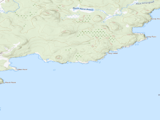
USGS topo — contours & terrain
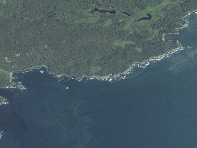
Aerial — USGS / NAIP
Weather outlook — at Fairy Head 3 (Cutler Coast Public Land)
Loading the latest forecast…
Live NWS area forecast (~2.5 km grid, not elevation-corrected). Camp sits at 61 ft.
Fire & smoke — around Fairy Head 3 (Cutler Coast Public Land)NIFC · AirNow
Checking active fires & air quality…
Active wildfires from NIFC (within ~50 mi); air quality from AirNow. Always confirm current fire restrictions with the managing office before you go.
Everything you need — measured from Fairy Head 3 (Cutler Coast Public Land) · public land · ME
Straight-line miles · bearings approx · roads run longer
Nearest of each
- @Mail2 mi
- FFuel9 mi
- MMechanic12 mi
- ShShower13 mi
- HHardware14 mi
- GGrocery14 mi
- RxPharmacy15 mi
- +Urgent care15 mi
- OOutfitter21 mi
- EVEV fast charger33 mi
- WWater48 mi
- DDump48 mi
- LLaundry48 mi
≤30 mi30–4545+water
The read: water is a real 48-mi drive, fuel & food sit about 9 mi out, the nearest EV fast charger is a 33-mi run (and back).
Not within 60 mi: Propane. Plan those before you head up.
One dot per need — the nearest of each kind, straight-line from camp. Places from OpenStreetMap (© OpenStreetMap contributors); the EV fast charger from the US DOE station locator. Open in Google Maps ↗
The site — Fairy Head 3 (Cutler Coast Public Land)
Access
Hike-in
Land
public land
Elevation
61 ft
State
ME
Coordinates
44.66304, -67.17131
Cost
Free
Nearby & resupply — around Fairy Head 3 (Cutler Coast Public Land) · public land · ME (OpenStreetMap)
- Nearest townMachias · ~15.3 mi
- Drinking waternone within 10 mi
- FuelGulf · ~8.9 mi
- Propane / LPGnone within 31 mi
- GroceriesGrocery · ~14.3 mi
- PharmacyWalgreens · ~14.6 mi
- Hospital / clinicRegional Medical Center at Lubec · ~15.2 mi
- HardwarePineo's True Value · ~13.6 mi
EV charging — from Fairy Head 3 (Cutler Coast Public Land) · public land · ME — nearest public DC fast & Level 2 (US DOE station data)
- Nearest public DC fast charger33.0 mi straight-line N — Baileyville, ME - Tesla Supercharger (at a gas station) · Tesla · NACS (Tesla) · 8 fast ports listed · listed open, last confirmed by AFDC 2026-06-18 · hours: 24 hours daily. Open to Teslas only. · directions
- Public DC fast stations within reachnone within 25 mi · 2 within 50 · 34 within 100 · 66 within 150
- Nearest listing CCS35.3 mi — Pratt Chevrolet GMC, CALAIS
- Nearest listing CHAdeMO60.3 mi — AGC FC AGC FC 05, Trenton
- Nearest public Level 2 (J1772)9.5 mi — Cobscook Institute, Trescott, ME · CHARGELAB · J1772 · 2 Level 2 ports listed · listed open, last confirmed by AFDC 2026-09-16 · hours: not listed
- Pricing at the fast chargernot listed
- Power (kW)not listed by AFDC — “DC fast” spans roughly 24 to 350 kW, so ask the network.
- Read this honestlyStraight-line miles, like every distance on this site. Roads run longer than this, and you have to get back. We know where a charger is listed. We don’t know if it works today, how fast it is, or the road miles. Check the network before you commit.
Snapshot 2026-09-16 · AFDC record 149293 · US DOE Alternative Fuels Data Center
Nearby restrooms — around Fairy Head 3 (Cutler Coast Public Land) · public land · ME — pit toilets, restrooms & rest areas (government data)
- No mapped restroom within 30 miles — plan to pack it out.
Open Fairy Head 3 (Cutler Coast Public Land) elsewhere
Other camps near Fairy Head 3 (Cutler Coast Public Land)
If this one is full, gated or washed out.
- Fairy Head 2 (Cutler Coast Public Land)~0.2 mi
- Fairy Head 1 (Cutler Coast Public Land)~0.3 mi
- Long Point (Cutler Coast Public Land)~0.8 mi
- Black Point Cove (Cutler Coast Public Land)~1.4 mi
How we know this — Fairy Head 3 (Cutler Coast Public Land)
Fire ban
Campfires are prohibited
Stay limit
14 nights (fourteen days in any 45 day period)
Source
public land records
Confidence
Researched — The record is detailed and internally consistent, and the coordinates land where the managing agency says this site is.
How it was placed
Cutler Coast Public Land, on the Bold Coast in Washington County. The guide states: "5 primitive campsites with pit toilets: 3 at Fairy Head and one each at Black Point Cove and Long Point Cove. Camping is only allowed at these five sites which are first-come, first-served with no reservations. A log-in book is at the trailhead." Also: campsites "Are 3-5 miles from the parking lot within the Coastal Section", "No more than 6 people per campsite", "CAMPFIRES ARE PROHIBITED" (the guide's words: "Campfires are prohibited"), "Carry in food, water and camp stoves", "Each campsite has a privy style toilet." This is a designated Ecological Reserve -- stay on trail and inside the marked sites. Backpack in; there is no vehicle access to the sites. MAINE PUBLIC RESERVED LANDS -- THE RULES THAT APPLY HERE. Fees: maine.gov/dacf/parks/about/public_reserved_lands.shtml (read 2026-08-14) says fees are "Generally not charged; In a few instances such as inside the North Maine Woods, Public Lands are managed in cooperation with neighboring landowners and fees are collected." Reservations: maine.gov/dacf/parks/camping/backcountry_camping.shtml says "Remote campsites are almost exclusively first-come, first-serve; reservations are not generally possible." STAY LIMIT, from the Bureau's own rules page maine.gov/dacf/parks/about/lands_rules.shtml: "No person shall camp, stay overnight or maintain any tent, camper, shelter, trailer or other camping unit on any public lands for more than fourteen days in any 45 day period, without the prior written permission of the Bureau." FIRE: open fires only in authorized campsites with fire rings, or under a Maine Forest Service permit; "Dead and down wood only may be used for campfires. No living trees shall be cut without the Bureau's prior written permission." Untreated firewood from outside Maine is BANNED -- buy it where you burn it. ABANDONED PROPERTY: BPL staff may take custody of personal property left unattended more than 3 days. Hunting and trapping are permitted on these lands in season -- wear blaze orange in the fall. Pets must be leashed and attended in campsites. WATER: BPL does not list drinking water at this site and none is claimed here. These are primitive sites on lakes, ponds and rivers; surface water is NOT represented as potable. Carry water in or treat it. COORDINATE PROVENANCE: latitude and longitude are copied from the "Campsite Latitude / Longitudes" table printed by the Maine Bureau of Parks and Lands in Cutler Coast Public Land guide/map (https://www.maine.gov/dacf/parksearch/PropertyGuides/PDF_GUIDE/cutlercoastguide.pdf), downloaded and text-extracted 2026-08-14. This is the agency's own published coordinate for the named site -- it is NOT a geocode, NOT OpenStreetMap and NOT a field visit. No accuracy figure is published with the table. GIS CROSS-CHECK: the point falls INSIDE the state's mapped "Cutler Coast" parcel (Maine GeoLibrary, Maine_Conserved_Lands_BPL_Interests, queried 2026-08-14). Nearest town: Cutler ~1.6 mi -- STRAIGHT-LINE distance to the nearest OpenStreetMap place=city/town/village, NOT a driving distance. In the North Woods the road in is routinely two to four times that on gravel. SEASON: BPL publishes no open/close date for these primitive sites on the guides read this fire. Access is over gravel logging roads that are generally passable June-October (the Machias River guide's words for comparable roads); mud season and snow close them. Confirm with the regional BPL office before a shoulder-season trip. Ingest 2026-08-14. || REVIEW 2026-08-18 (nightshift-verified): re-fetched the agency source and re-checked this row. The coordinate in this row matches the campsite coordinate the Bureau prints in the "Campsite Latitude/Longitudes" table in the Cutler Coast Public Land guide (https://www.maine.gov/dacf/parksearch/PropertyGuides/PDF_GUIDE/cutlercoastguide.pdf) (re-downloaded 2026-08-18, HTTP 200) to the last digit. The three shared BPL rules pages were re-read 2026-08-18 and still carry the exact sentences quoted above: fees "Generally not charged; In a few instances such as inside the North Maine Woods, Public Lands are managed in cooperation with neighboring landowners and fees are collected" (maine.gov/dacf/parks/about/public_reserved_lands.shtml); "Remote campsites are almost exclusively first-come, first-serve; reservations are not generally possible" (maine.gov/dacf/parks/camping/backcountry_camping.shtml); the fourteen-days-in-45 stay limit and "Dead and down wood only may be used for campfires" (maine.gov/dacf/parks/about/lands_rules.shtml). DUPLICATE CHECK: no published or approved camp anywhere in the DB sits within 1 mile of this coordinate (matched on coordinates, not name). NOT re-verified this fire, and still resting on the ingest fire's word: the Maine GeoLibrary parcel cross-check, and the straight-line nearest-town distance. No site was visited. PROPERTY RE-CHECK: the guide read today says, verbatim, "5 primitive campsites with pit toilets: 3 at Fairy Head and one each at Black Point Cove and Long Point Cove. Camping is only allowed at these five sites which are first-come, first-" served; "Campfires are prohibited."; "Fires Open fires are prohibited; cook only on self-contained stoves. Cut no live vegetation."; "Each campsite has a privy style toilet."; "Carry in food, water and camp stoves"; "No more than 6 people per campsite."; "Campsites Are 3-5 miles from the parking lot within the Coastal Section of Cutler Coast."; "Check the logbook at the trailhead to see if sites are full." DATA FIX THIS FIRE: the row had been given the generic Maine-BPL tag blanket, which included fire-ring and picnic-table. BOTH ARE WRONG HERE -- the guide prohibits campfires outright and claims only a privy, never a table. This fire removed the fire-ring and picnic-table tags and added no-fires and hike-in. Nothing else in the row was altered. hike_mi left NULL on purpose: the guide gives 3-5 miles as a range for the group of five sites, not a distance per site, and the trailhead coordinate is not published in the guide.
EV chargers
US DOE Alternative Fuels Data Center station locator, snapshot 2026-09-16. Straight-line miles to the nearest public, open, unrestricted station; restricted and planned units are shown but never counted.
Field check
On the agency's books. The land manager inventoried this site, so its existence is not in question — current conditions are. Nobody from here has camped it recently.
What we don’t know about Fairy Head 3 (Cutler Coast Public Land)
A land record can put you within a few meters of a spot. It cannot tell you any of this — so check it yourself, and treat anything below as the open question it is.
- Road surface & last-mile access
- How many rigs actually fit
- Cell coverage by carrier
- Seasonal & winter access
- Current fire restrictions
- Whether any water here is drinkable
- Shade & wind exposure
- Noise and who else shows up
- Whether a listed EV charger works today, or the road miles to it
Before you go — Fairy Head 3 (Cutler Coast Public Land)
Been here? Tell us what changed. This page is built from public records, so the fastest way it gets better is somebody who has actually pulled in. Road washed out, site gone, gate locked, or it is exactly as described — all of it useful. Send a report →