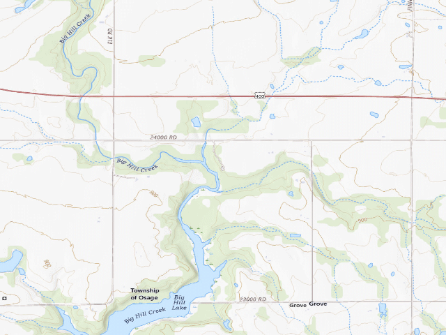
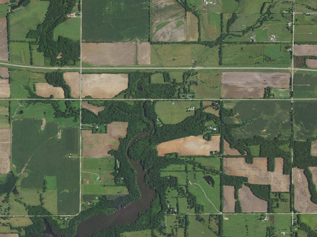
Drive-up · U.S. Army Corps of Engineers · KS · 37.33715, -95.43843
Ask an AI about this campsiteOpens Grok already loaded with this site. It reads the same records this page is built from, and links whatever it tells you.
U.S. Army Corps of Engineers lists this site. Someone from the agency inventoried it, so it is a real camp — not a spot we guessed at. What changes is conditions — roads, gates, closures, fire rules. Check those with the unit before you commit to the drive.
The only free camping the Corps of Engineers appears to offer in Kansas. Big Hill Lake's 17-mile horse trail has three parking areas that the Corps says may be used for overnight camping by trail riders. It is an equestrian-oriented gravel lot, not a campground -- no hookups, no fee booth, limited facilities.
The site — Hwy 160 Horse Trail North Camp (Big Hill Lake)
Access
Drive-up
Land
U.S. Army Corps of Engineers · dispersed
Elevation
883 ft
State
KS
Coordinates
37.33715, -95.43843
Cost
Free
Nearby & resupply — around Hwy 160 Horse Trail North Camp (Big Hill Lake) · U.S. Army Corps of Engineers · KS(OpenStreetMap)
Drinking waternone within 10 mi
FuelPump 'N Pete's · ~8.4 mi
Propane / LPGnone within 31 mi
Dump station~4.9 mi
GroceriesG & W · ~7.9 mi
PharmacyPharmacy · ~8.9 mi
Hospital / clinicHospital · ~8.6 mi
HardwareHardware · ~9.4 mi
EV charging — from Hwy 160 Horse Trail North Camp (Big Hill Lake) · U.S. Army Corps of Engineers · KS— nearest public DC fast & Level 2 (US DOE station data)
Nearest public DC fast charger9.8 mi straight-line E — EVERGY @PRSONCITY-437A, Parsons, KS · ChargePoint Network · CHAdeMO, CCS · 1 fast port listed · listed open, last confirmed by AFDC 2026-09-16 · hours: 24 hours daily · directions
Public DC fast stations within reach2 within 25 mi · 3 within 50 · 76 within 100 · 211 within 150
Nearest public Level 2 (J1772)9.8 mi — EVERGY @PRSONCITY-436A, Parsons, KS · ChargePoint Network · J1772 · 2 Level 2 ports listed · listed open, last confirmed by AFDC 2026-09-16 · hours: 24 hours daily
Pricing at the fast chargernot listed
Power (kW)not listed by AFDC — “DC fast” spans roughly 24 to 350 kW, so ask the network.
Read this honestlyStraight-line miles, like every distance on this site. Roads run longer than this, and you have to get back. We know where a charger is listed. We don’t know if it works today, how fast it is, or the road miles. Check the network before you commit. Snapshot 2026-09-16 · AFDC record 333502 · US DOE Alternative Fuels Data Center
Nearby restrooms — around Hwy 160 Horse Trail North Camp (Big Hill Lake) · U.S. Army Corps of Engineers · KS— pit toilets, restrooms & rest areas (government data)
How we know this — Hwy 160 Horse Trail North Camp (Big Hill Lake)
Stay limit
None published
Source
public land records
Confidence
Likely — The record is good enough to put a pin on, but thin in places. Treat the details as a starting point, not gospel.
How it was placed
AREA RULE: US Army Corps of Engineers, Corps Lakes Gateway project page for Big Hill Lake, https://corpslakes.erdc.dren.mil/visitors/projects.cfm?ID=M501450 , read 2026-08-16. Quoted: 'Other features of the lake include the Big Hill Lake Horse Trail. This trail is 17 miles long ... It also offers tethering areas and three parking area which are equipped with limited facilities and may be used for overnight camping by trail riders.' The same page's area table marks Cherryvale Park, Down Stream Point, Mound Valley, Overlook and Timber Hill Park with a fee symbol and Hwy 160 Horse Trail without one. FEE CORROBORATION: USACE Tulsa District Recreation (SWT) feature service, https://services8.arcgis.com/GvI5dZtQIoT0Fznq/arcgis/rest/services/District_Recreation_Features_SWT/FeatureServer/42 , queried 2026-08-16 -- the recreation feature at 37.33715, -95.43843 carries feeIndicator='no'. COORDINATE: the same service's Trailheads layer (0) puts 'HWY 160 HORSE TRAIL NORTH CAMP TO WEST RAE BRIDGE SIGN' at 37.33736, -95.43856 and the east sign at 37.33629, -95.43847, i.e. the no-fee feature sits between the two signs; the layer's own name for this spot contains 'NORTH CAMP'. CAVEAT 1: the Corps wording restricts overnight use to 'trail riders' -- a reviewer should decide whether we present this to non-equestrian campers. CAVEAT 2: the Corps names three horse-trail parking areas but publishes a no-fee point for only this one, so only one row is created. CAVEAT 3: nwk.usace.army.mil and swt.usace.army.mil both return HTTP 403 to this network, so the lake's own USACE district page could not be read to confirm a stay limit. No stay limit is recorded. NEAREST TOWN: Cherryvale, 7.9 mi (straight line), from the Census TIGER incorporated-places layer KDWP hosts at https://services1.arcgis.com/q2CglofYX6ACNEeu/arcgis/rest/services/IncorporatedPlaces/FeatureServer/0 , queried 2026-08-16. | auto:agency-trust 2026-08-18: state agency GIS record with a source URL and coordinates, confidence not low. Fee value is the agency's own, not field-checked. Not field-verified -- confirm access, road conditions and fire rules before you go.
EV chargers
US DOE Alternative Fuels Data Center station locator, snapshot 2026-09-16. Straight-line miles to the nearest public, open, unrestricted station; restricted and planned units are shown but never counted.
Field check
On the agency's books. The land manager inventoried this site, so its existence is not in question — current conditions are. Nobody from here has camped it recently.
What we don’t know about Hwy 160 Horse Trail North Camp (Big Hill Lake)
A land record can put you within a few meters of a spot. It cannot tell you any of this — so check it yourself, and treat anything below as the open question it is.
Road surface & last-mile access
How many rigs actually fit
Cell coverage by carrier
Seasonal & winter access
Current fire restrictions
Whether any water here is drinkable
Shade & wind exposure
Noise and who else shows up
Whether a listed EV charger works today, or the road miles to it
Before you go — Hwy 160 Horse Trail North Camp (Big Hill Lake)
Been here? Tell us what changed. This page is built from public records, so the fastest way it gets better is somebody who has actually pulled in. Road washed out, site gone, gate locked, or it is exactly as described — all of it useful. Send a report →