Drive-up · public land · WA · 48.05579, -119.89571
Ask an AI about this campsiteOpens Grok already loaded with this site. It reads the same records this page is built from, and links whatever it tells you.
The land manager lists this site. Someone from the agency inventoried it, so it is a real camp — not a spot we guessed at. What changes is conditions — roads, gates, closures, fire rules. Check those with the unit before you commit to the drive.
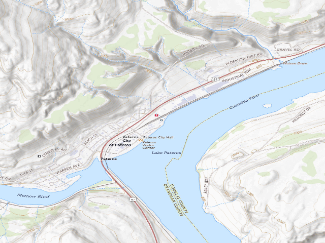
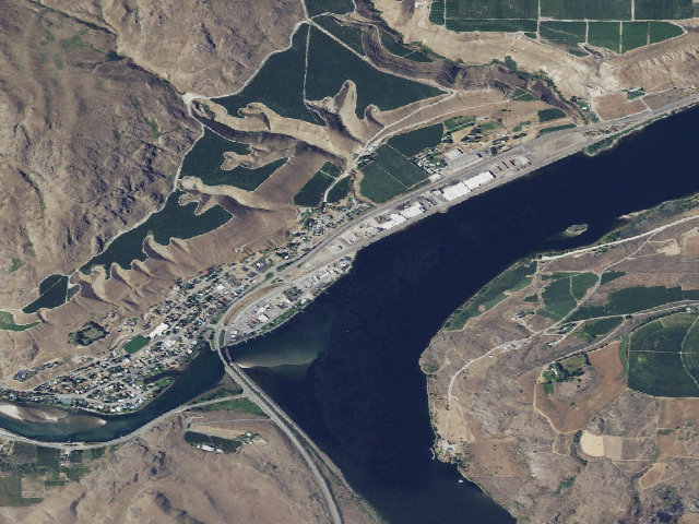
Read this one carefully, because the free part is narrow: at Ives Landing Park the City of Pateros gives FREE TENT CAMPING, ONE NIGHT, TO 'PEDDLERS & PADDLERS' -- that is, to people arriving under their own power, on a bicycle or in a kayak, canoe or driftboat. If you roll in with a van or an RV, this is a PAID city campground and you owe the posted rate at the self-serve kiosk or at City Hall; do not treat it as a free overnight. For the cyclists and paddlers it is aimed at, it is one of the best small stops on the Columbia: a city park right on the water where the Methow meets the Columbia at Lake Pateros, with restrooms, a free hot shower room, a boat launch and a dump station, and the town's small business district within an easy walk. The rest of the park is RV and tent sites with water and electric hookups, reservable in advance or paid at the kiosk. Note the near-name trap: Pateros' OTHER waterfront park, MEMORIAL PARK a quarter-mile up the shore, is the $15-a-night curbside RV parking -- it is not this, and it is not free. Because the city publishes the free offer but not its fine print (how many nights beyond the first, what counts as a paddler, what everyone else pays), call Pateros City Hall at 509-923-2571 before you count on it, and be ready to pay if the answer has changed. This is a town doing something genuinely kind for people travelling the hard way -- if you take the free night, spend money in Pateros, and leave the site better than you found it.
EV charging — from Ives Landing Park · public land · WA— nearest public DC fast & Level 2 (US DOE station data)
Nearest public DC fast charger0.4 mi straight-line SW — WCEH City of Pateros · EVCS · CHAdeMO, J1772, CCS · 3 fast ports listed · listed open, last confirmed by AFDC 2026-09-16 · hours: not listed · directions
Public DC fast stations within reach4 within 25 mi · 21 within 50 · 61 within 100 · 416 within 150
Nearest public Level 2 (J1772)0.4 mi — WCEH City of Pateros · EVCS · CHAdeMO, J1772, CCS · 1 Level 2 port listed · listed open, last confirmed by AFDC 2026-09-16 · hours: not listed
Pricing at the fast chargernot listed
Power (kW)not listed by AFDC — “DC fast” spans roughly 24 to 350 kW, so ask the network.
Read this honestlyStraight-line miles, like every distance on this site. Roads run longer than this, and you have to get back. We know where a charger is listed. We don’t know if it works today, how fast it is, or the road miles. Check the network before you commit. Snapshot 2026-09-16 · AFDC record 333271 · US DOE Alternative Fuels Data Center
Nearby restrooms — around Ives Landing Park · public land · WA— pit toilets, restrooms & rest areas (government data)
Likely — The record is good enough to put a pin on, but thin in places. Treat the details as a starting point, not gospel.
How it was placed
Source (FREE TIER stated by the OPERATOR): City of Pateros' own site, pateros.com Ives Landing Park page (read 2026-07-28), verbatim: 'Free Tent Camping to "Peddlers & Paddlers"' and 'Tent camping sites - free one night to "paddlers & pedalers"'. The same park's other sites (tent and RV with water + electric, dump station, free hot shower room) are paid, booked via a self-serve kiosk at the park or City Hall 509-923-2571; the city's OTHER waterfront park, Memorial Park, is $15/night curbside RV parking. Banked fee=0 under Dave's FREE-TIER rule, with the restriction LEADING the field_note. CONFIDENCE 'med' NOT 'high': the city's page states the free tier but never prints the paid rate, the stay rules, or how the qualification is checked -- the OFFER is operator-confirmed, its EDGES are not. COORDINATE: OSM way/1458523500 'Ives Landing Park' (leisure=park), area-weighted polygon centroid from Overpass 'out geom' full geometry -> 48.055785,-119.895707, with 10 mapped tourism=camp_pitch nodes (13376297612-621) inside the same polygon at 48.0553-48.0563 confirming the pin is on the campsites, not the parking lot. TRAP LOGGED: relation/19961004 'Ives Landing Park Campground' covering this same park is tagged fee=yes (true of the majority product, false of the free tier), and PAID Memorial Park (way/260224003, 48.052543,-119.899584) is only 0.28 mi away -- INSIDE the 0.5 mi dedup radius -- so ingesting the paid sibling first would have silently blocked this lead. GUARDRAILS: camping expressly allowed by the city; no entry fee or pass to be in the park. land_manager='City of Pateros'; dispersed=0; camp_type NULL; water='potable at the park (city park with restrooms, showers and RV water hookups)'. Nearest existing WA lead 13+ mi. Ingest 2026-07-28.
--- NIGHTSHIFT REVIEW 2026-08-21 (fire 1220, leftover backlog) --- HOLDS UP, AND THE OPERATOR'S OWN PAGE IS STILL THE SOURCE -- BUT THE URL MOVED. The pateros.com URL recorded at ingest is dead; the live City of Pateros page for this park is https://pateros.com/business_detail_T2_R32.php (read this fire). Both free-tier sentences are still published by the city, verbatim: 'Free Tent Camping to "Peddlers & Paddlers"' in the amenities list, and 'Tent camping sites - free one night to "paddlers & pedalers"' in the park's rules block. Also still confirmed by the city: 'Free Hot Shower Room', 'Self-serve camping kiosk', 'Water & electric hookups - sewer dump station included in reservation', year-round boat launch, and the address 190 Lakeshore Drive, Pateros WA 98846, phone (509) 923-2571. The narrow-free-tier framing banked at ingest is exactly right and must keep leading the field_note: free is ONE NIGHT, TENT ONLY, for people arriving by bike or paddle; everyone else pays. The city still does not print the paid rate or the qualification test, so this correctly stays MEDIUM -- the offer is operator-confirmed, its edges are not. The near-name trap with paid Memorial Park 0.28 mi away is unchanged and still worth the field_note warning. APPROVED.
EV chargers
US DOE Alternative Fuels Data Center station locator, snapshot 2026-09-16. Straight-line miles to the nearest public, open, unrestricted station; restricted and planned units are shown but never counted.
Field check
On the agency's books. The land manager inventoried this site, so its existence is not in question — current conditions are. Nobody from here has camped it recently.
What we don’t know about Ives Landing Park
A land record can put you within a few meters of a spot. It cannot tell you any of this — so check it yourself, and treat anything below as the open question it is.
Road surface & last-mile access
How many rigs actually fit
Cell coverage by carrier
Seasonal & winter access
Current fire restrictions
Whether any water here is drinkable
Shade & wind exposure
Noise and who else shows up
Whether a listed EV charger works today, or the road miles to it
Been here? Tell us what changed. This page is built from public records, so the fastest way it gets better is somebody who has actually pulled in. Road washed out, site gone, gate locked, or it is exactly as described — all of it useful. Send a report →