Jacks Creek
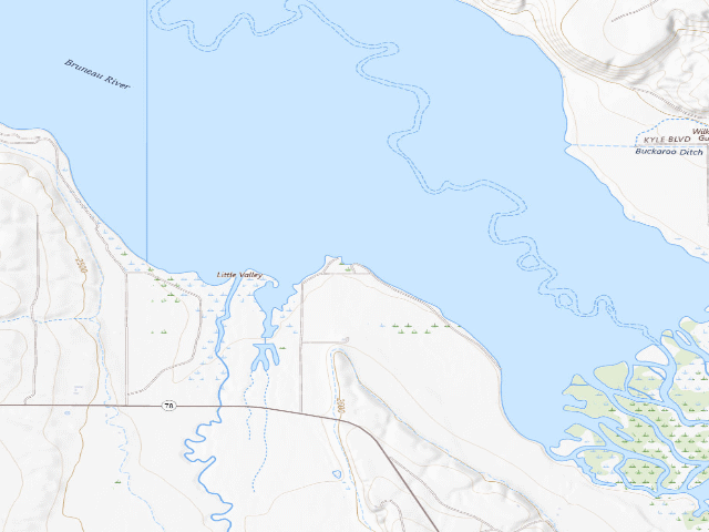
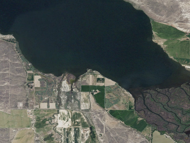
A small free camp on the Snake River arm of C.J. Strike Reservoir, run by the power company that owns the dam. Idaho Power's own page prices it in two words -- 'Free. No usage fees.' -- and lists it as 'Day use and overnight camping'. Do not expect a campground: what is here is a limited number of sites with fire rings, a vault toilet and some interpretive signs, off Idaho Highway 78 near milepost 74 in the sagebrush country of Owyhee County. There are no water or electric hookups and no drinking water is claimed, so come fully self-contained -- this is high desert and it is hot and exposed in midsummer. The stay limit is 14 days. 'Limited sites' means exactly that, so have a backup in mind on a holiday weekend; Idaho Power's paid C.J. Strike campgrounds (North, Scout, Cottonwood, Locust) are the nearby fallback and they do charge. Watch the near-name trap: JACKS CREEK WEST, a mile down the road, is also free but is day-use only -- no overnight camping there. The fishing is the point for most people who come here. Confirm current conditions with Idaho Power (1-800-488-6151) before you go, pack out what you bring, and leave the site better than you found it.
Everything you need — measured from Jacks Creek · public land · ID
- +Urgent care4 mi
- @Mail4 mi
- FFuel4 mi
- GGrocery4 mi
- LLaundry13 mi
- HHardware18 mi
- RxPharmacy18 mi
- MMechanic18 mi
- EVEV fast charger19 mi
- DDump40 mi
- ShShower40 mi
- WWater47 mi
- OOutfitter50 mi
- AAir-up59 mi
The read: water is a real 47-mi drive, fuel & food sit about 4 mi out.
Not within 60 mi: Propane. Plan those before you head up.
One dot per need — the nearest of each kind, straight-line from camp. Places from OpenStreetMap (© OpenStreetMap contributors); the EV fast charger from the US DOE station locator. Open in Google Maps ↗
The site — Jacks Creek
Nearby & resupply — around Jacks Creek · public land · ID (OpenStreetMap)
- Water featureBruneau River (stream) · nearby
- Nearest townBruneau · ~3.6 mi
- Drinking waternone within 10 mi
- FuelSinclair · ~3.7 mi
- Propane / LPGnone within 31 mi
- GroceriesStore · ~3.7 mi
- PharmacyWalmart Pharmacy · ~18.9 mi
- Hospital / clinic366th Medical Group - Mountain Home Airforce Base Medical Facility · ~11.2 mi
- HardwareCarr’s Home Center Tru Value · ~18.0 mi
EV charging — from Jacks Creek · public land · ID — nearest public DC fast & Level 2 (US DOE station data)
- Nearest public DC fast charger18.9 mi straight-line NE — Walmart 2782 (Mountain Home, ID) · Electrify America · CHAdeMO, CCS · 4 fast ports listed · listed open, last confirmed by AFDC 2026-09-16 · hours: 24 hours daily · directions
- Public DC fast stations within reach2 within 25 mi · 2 within 50 · 38 within 100 · 54 within 150
- Nearest listing NACS (Tesla)19.4 mi — Mountain Home, ID - Tesla Supercharger, Mountain Home
- Nearest public Level 2 (J1772)33.9 mi — STAGE STOP BOISE · ChargePoint Network · J1772 · 2 Level 2 ports listed · listed open, last confirmed by AFDC 2026-09-16 · hours: 24 hours daily
- Pricing at the fast chargernot listed
- Power (kW)not listed by AFDC — “DC fast” spans roughly 24 to 350 kW, so ask the network.
- Read this honestlyStraight-line miles, like every distance on this site. Roads run longer than this, and you have to get back. We know where a charger is listed. We don’t know if it works today, how fast it is, or the road miles. Check the network before you commit.
Snapshot 2026-09-16 · AFDC record 121718 · US DOE Alternative Fuels Data Center
Nearby restrooms — around Jacks Creek · public land · ID — pit toilets, restrooms & rest areas (government data)
- RestroomCove Rec Site Toilet 2 - Cove Point · ~4.8 mi NW · BLM
- RestroomCove Rec Site Toilet 1 - Cove Inlet Road · ~4.8 mi NW · BLM
- RestroomCove Rec Site Toilet 3 - Cove Loop Road Ridgeline · ~4.9 mi NW · BLM
- Vault / pit toiletCove Rec Site Vault Toilet 6 - Inland Lower Group · ~4.9 mi NW · BLM
Open Jacks Creek elsewhere
Other camps near Jacks Creek
If this one is full, gated or washed out.
- Crane Falls East~4.9 mi
- Little Jacks Creek Wild And Scenic River~17.1 mi
- Big Jacks Creek Wild And Scenic River~22.4 mi
- Poison Creek Picnic Site~24.1 mi
How we know this — Jacks Creek
What we don’t know about Jacks Creek
A land record can put you within a few meters of a spot. It cannot tell you any of this — so check it yourself, and treat anything below as the open question it is.
- Road surface & last-mile access
- How many rigs actually fit
- Cell coverage by carrier
- Seasonal & winter access
- Current fire restrictions
- Whether any water here is drinkable
- Shade & wind exposure
- Noise and who else shows up
- Whether a listed EV charger works today, or the road miles to it