Jesse Owens State Park - Sand Hollow Campground (no fee)
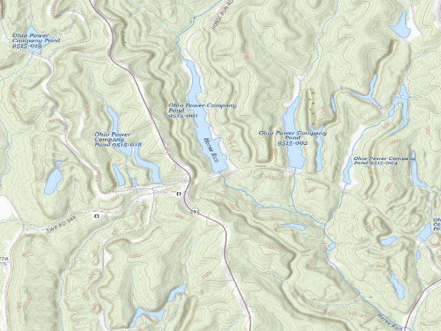
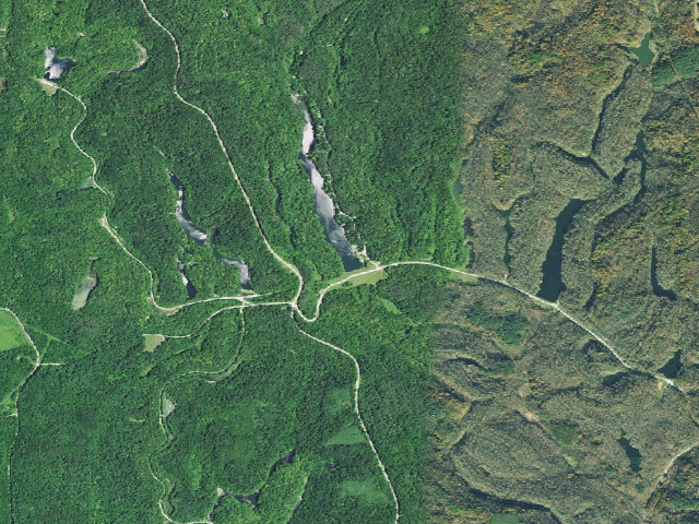
FREE camping -- ODNR labels Sand Hollow '(no fee)'. It is the lakeside one: the campground borders Horse Run Lake with boat-ramp access and several sites sit right on the water, at the north end of Jesse Owens State Park off State Route 284 north of McConnelsville (Morgan County). There is a shelter house and several latrines. Old maps and listings call it 'Camp C' -- the letter it carried as AEP ReCreation Land. ODNR's own page says Jesse Owens 'offers four no-fee campgrounds' and that 'campers should follow the self-registration process' -- free, first-come first-served, with a TWO-WEEK maximum stay. Sites are primitive: no water, no electric, no pad; each has a picnic table and a fire ring. Open seasonally, generally April 1 to mid-December; from November 1 to April 1 the park is walk-in only with latrines available. BRING YOUR OWN DRINKING WATER. Careful: the same park also runs TWO FEE campgrounds -- Big Muskie (50 full-hookup sites, reservations required) and Sawmill Road (fee-based, reservable) -- so 'Jesse Owens' is not free across the board; this free-camping listing is for the named campground only. This is reclaimed strip-mine country, the former AEP ReCreation Land, now Ohio state park and wildlife-area land; the surrounding wildlife area is open to hunting, so wear orange in season. Confirm current rules and the season with the park office (740) 558-6040 before you go -- we have not visited.
Everything you need — measured from Jesse Owens State Park - Sand Hollow Campground (no fee) · public land · OH
- @Mail5 mi
- GGrocery9 mi
- FFuel9 mi
- ShShower11 mi
- EVEV fast charger11 mi
- DDump11 mi
- MMechanic11 mi
- HHardware14 mi
- +Urgent care18 mi
- PPropane18 mi
- AAir-up18 mi
- RxPharmacy19 mi
- LLaundry19 mi
- OOutfitter20 mi
- WWater22 mi
The read: water is a real 22-mi drive, fuel & food sit about 9 mi out.
One dot per need — the nearest of each kind, straight-line from camp. Places from OpenStreetMap (© OpenStreetMap contributors); the EV fast charger from the US DOE station locator. Open in Google Maps ↗
The site — Jesse Owens State Park - Sand Hollow Campground (no fee)
Nearby & resupply — around Jesse Owens State Park - Sand Hollow Campground (no fee) · public land · OH (OpenStreetMap)
- Water featureHorse Run (stream) · nearby
- Nearest townBristol · ~2.5 mi
- Drinking waternone within 10 mi
- FuelFuel · ~8.9 mi
- Propane / LPGnone within 31 mi
- Dump station~11.0 mi
- GroceriesSunoco · ~8.7 mi
- PharmacyRiesbeck's Pharmacy · ~19.2 mi
- Hospital / clinicFamily HealthCare Partners · ~19.7 mi
- HardwareHardware · ~19.6 mi
EV charging — from Jesse Owens State Park - Sand Hollow Campground (no fee) · public land · OH — nearest public DC fast & Level 2 (US DOE station data)
- Nearest public DC fast charger10.9 mi straight-line E — Pilot Travel Center 309, Caldwell, OH · eVgo Network · CCS · 4 fast ports listed · listed open, last confirmed by AFDC 2026-09-16 · hours: 24 hours daily · directions
- Public DC fast stations within reach9 within 25 mi · 38 within 50 · 252 within 100 · 534 within 150
- Nearest listing NACS (Tesla)19.9 mi — Cambridge, OH Rechargery Relay - Southgate Rd, Cambridge
- Nearest listing CHAdeMO19.5 mi — Walmart 3262 (Cambridge, OH), Cambridge
- Nearest public Level 2 (J1772)17.2 mi — GARLAND HOTEL GARLAND 2, New concord, OH · ChargePoint Network · J1772 · 2 Level 2 ports listed · listed open, last confirmed by AFDC 2026-09-16 · hours: 24 hours daily
- Pricing at the fast chargernot listed
- Power (kW)not listed by AFDC — “DC fast” spans roughly 24 to 350 kW, so ask the network.
- Read this honestlyStraight-line miles, like every distance on this site. Roads run longer than this, and you have to get back. We know where a charger is listed. We don’t know if it works today, how fast it is, or the road miles. Check the network before you commit.
Snapshot 2026-09-16 · AFDC record 372119 · US DOE Alternative Fuels Data Center
Nearby restrooms — around Jesse Owens State Park - Sand Hollow Campground (no fee) · public land · OH — pit toilets, restrooms & rest areas (government data)
- Highway rest areaGuernsey I77 SB · ~16.0 mi NE
- Highway rest areaGuernsey I77 NB · ~17.8 mi NE
- Highway rest areaMuskingum I70 WB · ~17.9 mi N
- Vault / pit toiletWildcat Hollow Trailhead · ~19.5 mi SW · USFS
Open Jesse Owens State Park - Sand Hollow Campground (no fee) elsewhere
Other camps near Jesse Owens State Park - Sand Hollow Campground (no fee)
If this one is full, gated or washed out.
- Jesse Owens State Park - Hook Lake Campground (no fee)~1.5 mi
- Jesse Owens State Park - Maple Grove Campground (no fee)~2.0 mi
- Burr Oak Cove Campground~21.4 mi · fee
How we know this — Jesse Owens State Park - Sand Hollow Campground (no fee)
What we don’t know about Jesse Owens State Park - Sand Hollow Campground (no fee)
A land record can put you within a few meters of a spot. It cannot tell you any of this — so check it yourself, and treat anything below as the open question it is.
- Road surface & last-mile access
- How many rigs actually fit
- Cell coverage by carrier
- Seasonal & winter access
- Current fire restrictions
- Whether any water here is drinkable
- Shade & wind exposure
- Noise and who else shows up
- Whether a listed EV charger works today, or the road miles to it