Judith River WMA
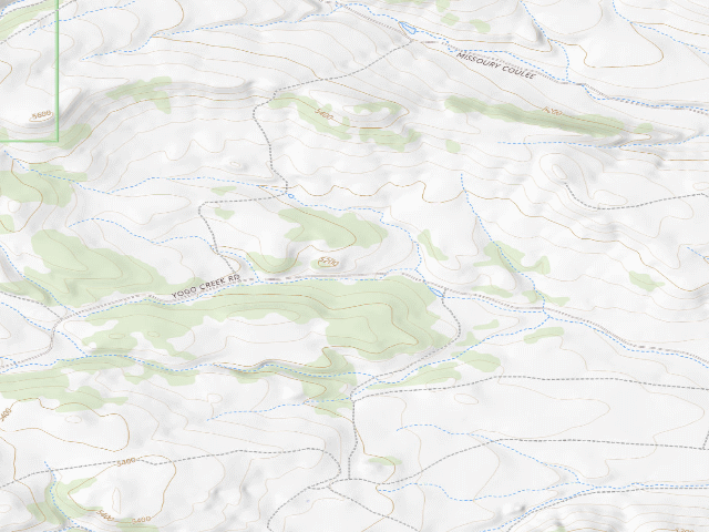
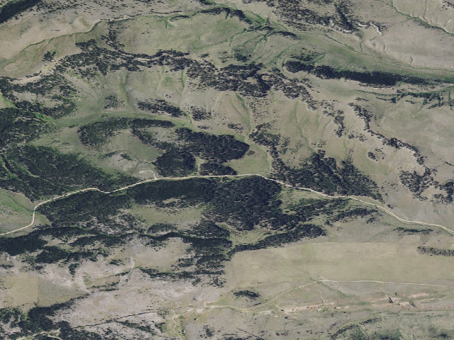
SEASONAL -- this WMA is open only May 15 to Dec 1; it is CLOSED the rest of the year to protect big-game winter range. Do not plan a winter or early-spring night here. Judith River Wildlife Management Area, managed by Montana Fish, Wildlife & Parks, FWP Region 4. FWP's own site record lists a designated primitive campsite here and its fee table shows no camping fee. IMPORTANT -- THIS IS NOT FREE LAND, even though the camping itself costs nothing: Montana requires a Conservation License of every person aged 12 and older to use an FWP wildlife management area FOR ANY REASON, not just to hunt or fish. It is $8/year for residents, $10/year for nonresidents ($4 for resident youth 12-17 and seniors 62+). Buy it before you arrive. There is no separate per-night camping fee. Camping is allowed only in areas FWP has designated or marked for it (ARM 12.12.107), for no more than 7 nights in any 30-day period statewide. Primitive: pack in / pack out, no hookups and no drinking water; no toilet is listed. Quiet hours are 10 p.m.-7 a.m. and certified weed-free feed is required for stock. We have not visited this site. Confirm the current season dates, the travel plan map and whether camping is still allowed with FWP Region 4 at (406)594-1464 before you go.
Everything you need — measured from Judith River WMA · Montana Fish, Wildlife & Parks · MT
- FFuel18 mi
- GGrocery19 mi
- MMechanic19 mi
- @Mail19 mi
- WWater23 mi
- OOutfitter29 mi
- RxPharmacy37 mi
- LLaundry37 mi
- ShShower37 mi
- +Urgent care38 mi
- HHardware43 mi
- EVEV fast charger63 mi
The read: water is a real 23-mi drive, fuel & food sit about 18 mi out, the nearest EV fast charger is a 63-mi run (and back).
Not within 60 mi: Dump, Propane. Plan those before you head up.
One dot per need — the nearest of each kind, straight-line from camp. Places from OpenStreetMap (© OpenStreetMap contributors); the EV fast charger from the US DOE station locator. Open in Google Maps ↗
The site — Judith River WMA
Nearby & resupply — around Judith River WMA · Montana Fish, Wildlife & Parks · MT (OpenStreetMap)
- Nearest townYogo Crossing · ~2.3 mi
- Drinking waternone within 10 mi
- FuelFuel · ~20.5 mi
- Propane / LPGnone within 31 mi
- GroceriesBig Sky Grocery · ~27.1 mi
EV charging — from Judith River WMA · Montana Fish, Wildlife & Parks · MT — nearest public DC fast & Level 2 (US DOE station data)
- Nearest public DC fast charger62.9 mi straight-line NW — Great Falls Subaru · EV Connect · CHAdeMO, CCS · 2 fast ports listed · listed open, last confirmed by AFDC 2026-09-16 · hours: 24 hours daily · directions
- Public DC fast stations within reachnone within 25 mi · none within 50 · 15 within 100 · 29 within 150
- Nearest listing NACS (Tesla)63.5 mi — Great Falls, MT - Tesla Supercharger, Great Falls
- Nearest public Level 2 (J1772)60.5 mi — CITY MOTOR CO CITY TOYOTA 1, Great Falls, MT · ChargePoint Network · J1772 · 2 Level 2 ports listed · listed open, last confirmed by AFDC 2026-09-16 · hours: 24 hours daily
- Pricing at the fast chargernot listed
- Power (kW)not listed by AFDC — “DC fast” spans roughly 24 to 350 kW, so ask the network.
- Read this honestlyStraight-line miles, like every distance on this site. Roads run longer than this, and you have to get back. We know where a charger is listed. We don’t know if it works today, how fast it is, or the road miles. Check the network before you commit.
Snapshot 2026-09-16 · AFDC record 449926 · US DOE Alternative Fuels Data Center
Nearby restrooms — around Judith River WMA · Montana Fish, Wildlife & Parks · MT — pit toilets, restrooms & rest areas (government data)
- Vault / pit toiletHay Canyon Cg · ~6.2 mi S · USFS
- Vault / pit toiletDry Wolf Campground · ~11.8 mi NW · USFS
- RestroomDry Wolf Cabin · ~12.6 mi NW · USFS
- Vault / pit toiletHunters Cabin · ~16.8 mi SW · USFS
Open Judith River WMA elsewhere
Other camps near Judith River WMA
If this one is full, gated or washed out.
- Mid Fork Jd Th Rd 6537-1~2.5 mi
- Mid Fork Jd 825-2~2.6 mi
- Mid Fork Jd Rd 825-1~2.7 mi
- For Rd 266-Yogo Ck~2.8 mi
Snow, and when this opens
The nearest automatic snow station is Daisy Peak at 7,590 ft, about 15 miles away. It sits about 2,427 ft higher than this camp, so treat it as a guide rather than a reading for this spot. We do not repeat a depth here, because any number we stored would be stale by the time you read it — the station publishes today's.
How we know this — Judith River WMA
What we don’t know about Judith River WMA
A land record can put you within a few meters of a spot. It cannot tell you any of this — so check it yourself, and treat anything below as the open question it is.
- Road surface & last-mile access
- How many rigs actually fit
- Cell coverage by carrier
- Seasonal & winter access
- Current fire restrictions
- Whether any water here is drinkable
- Shade & wind exposure
- Noise and who else shows up
- Whether a listed EV charger works today, or the road miles to it