Agency-listedADCNRFee
Jug Lake floating camping platform (Bartram Canoe Trail, Upper Mobile-Tensaw Delta)
Dispersed · public land · AL · 31.01191, -87.90814
Ask an AI about this campsiteOpens Grok already loaded with this site. It reads the same records this page is built from, and links whatever it tells you.
Ask about this camp →The land manager lists this site. Someone from the agency inventoried it, so it is a real camp — not a spot we guessed at. What changes is conditions — roads, gates, closures, fire rules. Check those with the unit before you commit to the drive.
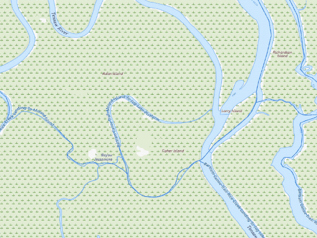
USGS topo — contours & terrain
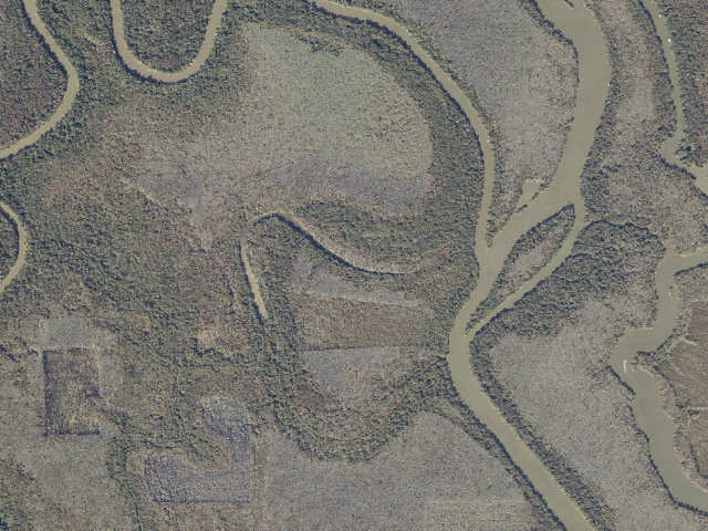
Aerial — USGS / NAIP
Weather outlook — at Jug Lake floating camping platform (Bartram Canoe Trail, Upper Mobile-Tensaw Delta)
Loading the latest forecast…
Live NWS area forecast (~2.5 km grid, not elevation-corrected). Camp sits at the elevation shown above.
Fire & smoke — around Jug Lake floating camping platform (Bartram Canoe Trail, Upper Mobile-Tensaw Delta)NIFC · AirNow
Checking active fires & air quality…
Active wildfires from NIFC (within ~50 mi); air quality from AirNow. Always confirm current fire restrictions with the managing office before you go.
Everything you need — measured from Jug Lake floating camping platform (Bartram Canoe Trail, Upper Mobile-Tensaw Delta) · public land · AL
Straight-line miles · bearings approx · roads run longer
Nearest of each
- @Mail3 mi
- FFuel3 mi
- GGrocery3 mi
- HHardware3 mi
- RxPharmacy11 mi
- EVEV fast charger13 mi
- +Urgent care18 mi
- MMechanic19 mi
- LLaundry22 mi
- OOutfitter24 mi
- WWater28 mi
- ShShower37 mi
- DDump47 mi
- AAir-up58 mi
≤30 mi30–4545+water
The read: water is a real 28-mi drive, fuel & food sit about 3 mi out.
Not within 60 mi: Propane. Plan those before you head up.
One dot per need — the nearest of each kind, straight-line from camp. Places from OpenStreetMap (© OpenStreetMap contributors); the EV fast charger from the US DOE station locator. Open in Google Maps ↗
The site — Jug Lake floating camping platform (Bartram Canoe Trail, Upper Mobile-Tensaw Delta)
Access
Dispersed
Land
public land
State
AL
Coordinates
31.01191, -87.90814
Cost
Fee
Nearby & resupply — around Jug Lake floating camping platform (Bartram Canoe Trail, Upper Mobile-Tensaw Delta) · public land · AL (OpenStreetMap)
- Drinking waternone within 10 mi
- FuelPure · ~3.2 mi
- Propane / LPGnone within 31 mi
- GroceriesPowell's Grocery · ~3.2 mi
- PharmacyWalmart Pharmacy · ~11.2 mi
- Hospital / clinicInfirmary Medical Plaza · ~18.3 mi
- HardwareStockton Equipment Company · ~3.2 mi
EV charging — from Jug Lake floating camping platform (Bartram Canoe Trail, Upper Mobile-Tensaw Delta) · public land · AL — nearest public DC fast & Level 2 (US DOE station data)
- Nearest public DC fast charger12.7 mi straight-line SW — Pilot Travel Center 75, Satsuma, AL · eVgo Network · CCS · 4 fast ports listed · listed open, last confirmed by AFDC 2026-09-15 · hours: 24 hours daily · directions
- Public DC fast stations within reach11 within 25 mi · 29 within 50 · 72 within 100 · 152 within 150
- Nearest listing NACS (Tesla)22.5 mi — OPTIMUS ENERGY CREEKS TRAVEL 1, Atmore
- Nearest listing CHAdeMO18.4 mi — Walmart 1212 (Saraland, AL), Saraland
- Nearest public Level 2 (J1772)23.3 mi — MOBILE ST LOUIS ST EV1 · ChargePoint Network · J1772 · 2 Level 2 ports listed · listed open, last confirmed by AFDC 2026-09-16 · hours: 24 hours daily
- Pricing at the fast chargernot listed
- Power (kW)not listed by AFDC — “DC fast” spans roughly 24 to 350 kW, so ask the network.
- Read this honestlyStraight-line miles, like every distance on this site. Roads run longer than this, and you have to get back. We know where a charger is listed. We don’t know if it works today, how fast it is, or the road miles. Check the network before you commit.
Snapshot 2026-09-16 · AFDC record 458494 · US DOE Alternative Fuels Data Center
Nearby restrooms — around Jug Lake floating camping platform (Bartram Canoe Trail, Upper Mobile-Tensaw Delta) · public land · AL — pit toilets, restrooms & rest areas (government data)
- No mapped restroom within 30 miles — plan to pack it out.
Open Jug Lake floating camping platform (Bartram Canoe Trail, Upper Mobile-Tensaw Delta) elsewhere
Other camps near Jug Lake floating camping platform (Bartram Canoe Trail, Upper Mobile-Tensaw Delta)
If this one is full, gated or washed out.
- Dead Lake Island floating camping platform (Bartram Canoe Trail, Upper Mobile-Tensaw Delta)~2.3 mi · fee
- Two Rivers Point Campsite (Bartram Canoe Trail, Upper Mobile-Tensaw Delta)~2.3 mi
- Canal Island floating camping platform (Bartram Canoe Trail, Upper Mobile-Tensaw Delta)~5.5 mi · fee
- Spoonbill Sandbar Campsite (Bartram Canoe Trail, Upper Mobile-Tensaw Delta)~10.8 mi
How we know this — Jug Lake floating camping platform (Bartram Canoe Trail, Upper Mobile-Tensaw Delta)
Area rules
Primitive camping is allowed only in designated areas and is available on a first come, first served basis.
Source
public land records
Confidence
Researched — The record is detailed and internally consistent, and the coordinates land where the managing agency says this site is.
How it was placed
NOT FREE -- $26.75 PER NIGHT. Alabama State Lands Division floating camping platform on the Bartram Canoe Trail, Mobile-Tensaw Delta. PRICE SOURCE: the State Lands reservation page at alabamainteractive.org/campsite, read 2026-08-16, which prints 'State Lands Campsite Reservation Fee 25.0 / Total Reservation Fee through Alabama.gov 26.75' and states 'Rental of camping platforms and shelters is 26.75 per night.' Jug Lake is on that page's Upper Delta list. Reservation is REQUIRED and is limited to canoeists and kayakers; one night only per reservation, noon to noon; you must carry the confirmation number. Group size capped at 8. alabamaforeverwild.com/mobile-tensaw-delta, read the same day, confirms: "The Jug Lake Platform can be reserved for camping. It is a stop on the Bartram Canoe Trail." State Lands publishes an overnight route 'Jug Lake: 2 Days / 1 Night'. PLATFORM RULES: no pets. NO OPEN FIRE on the platform -- a camp stove is required and must sit on the metal sheet provided. Each party must carry a compass, map, flashlight and a portable toilet with disposable bags; leave no trace. No alcohol. Cancellations inside 24 hours are not allowed; earlier cancellations forfeit half the fee plus $1.50. Damage is billed to the user. Phone 251-625-0814. COORDINATE: ADCNR's own GIS, 'Camping' layer of conservationgis.alabama.gov/adcnrweb/rest/services/Activities/MapServer/0, Name attribute 'Jug Lake Platform'. ALABAMA STATE LANDS CANOE TRAILS RULES, alabamacanoetrails.com/rules-for-use read 2026-08-16: "Because hunting is allowed on the WMA properties, camping is permitted in designated camping locations only. Floating platforms and camping shelters must be reserved through this website. Primitive camping is allowed only in designated areas and is available on a first come, first served basis." Fires are allowed in designated areas only; cutting trees or brush for firewood is prohibited. No alcohol at any campsite, platform or shelter. "Each party is required to have a compass, map, flashlight, and portable toilet with disposable bags" -- State Lands runs a leave-no-trace policy and you pack your waste out. Swimming "is discouraged in the Delta due to local alligator populations." Access is by canoe or kayak; this is not a drive-up site. Nearest town: Movico ~7.8 mi -- STRAIGHT-LINE distance to the nearest OpenStreetMap place=city/town/village, NOT a driving distance; in the Mobile-Tensaw Delta and on the Cumberland Plateau the way in is far longer. Ingest 2026-08-16.
--- REVIEW 2026-08-20 (nightshift-verified) --- BOTH SOURCES RE-FETCHED TODAY. https://www.alabamacanoetrails.com/bartram still reads, word for word, "Currently, the State Lands Division maintains six day-use trails and six overnight trails. There are two land-based campsites and four floating platform campsites available for the overnight routes. The land based camping areas are open to anyone on a first-come first-served basis. The floating platform campsites are limited to groups no larger than eight and are available by reservation only." https://www.alabamacanoetrails.com/rules-for-use still carries every rule this row quotes, unchanged: camping in designated locations only because hunting is allowed on the WMA properties; platforms and shelters by reservation; primitive camping first-come in designated areas only; fires in designated areas only and no cutting of trees or brush for firewood; no alcohol at any campsite, platform or shelter; "Each party is required to have a compass, map, flashlight, and portable toilet with disposable bags"; and "Swimming is allowed at the visitor's own risk, and is discouraged in the Delta due to local alligator populations." https://www.alabamainteractive.org/campsite/ still prints "State Lands Campsite Reservation Fee $25.00 / Total Reservation Fee through Alabama.gov $26.75" and "Rental of camping platforms and shelters is $26.75 per night.", and its selectable list is still exactly: Upper Delta -- Canal Island, Dead Lake Island #1, Dead Lake Island #2, Jug Lake; Lower Delta -- Yancey Branch, Mudhole Creek, Justin's Bay Sunset, Justin's Bay Sunrise; Perdido Trail -- Nelson Ditch #1 and #2, Peaden Lake, Loggerhead Creek #1 and #2, Swamp Field. PRIMARY SOURCE RE-FETCHED TODAY: ADCNR's public ArcGIS 'Camping' layer, https://conservationgis.alabama.gov/adcnrweb/rest/services/Activities/MapServer/0 -- still live, still returns exactly 13 points statewide, with the same five named Bartram points and the same eight unnamed ones recorded at discovery. This row is NOT FREE and the price was re-confirmed today: $26.75 per night, reservation required, and 'Jug Lake' is still on the Upper Delta list above. Its coordinate is still ADCNR GIS OBJECTID 9, Name attribute 'Jug Lake Platform', at 31.011907 / -87.908138 -- identical to the stored value. https://alabamaforeverwild.com/mobile-tensaw-delta was also re-fetched today and still resolves. Platform rules re-confirmed on the reservation page: group size 8, no pets, no open fire on the platform, camp stove on the supplied metal sheet, one night per reservation, noon to noon, confirmation number on your person. VERDICT: HOLDS UP -> approved as a FEE site.
EV chargers
US DOE Alternative Fuels Data Center station locator, snapshot 2026-09-16. Straight-line miles to the nearest public, open, unrestricted station; restricted and planned units are shown but never counted.
Field check
On the agency's books. The land manager inventoried this site, so its existence is not in question — current conditions are. Nobody from here has camped it recently.
What we don’t know about Jug Lake floating camping platform (Bartram Canoe Trail, Upper Mobile-Tensaw Delta)
A land record can put you within a few meters of a spot. It cannot tell you any of this — so check it yourself, and treat anything below as the open question it is.
- Road surface & last-mile access
- How many rigs actually fit
- Cell coverage by carrier
- Seasonal & winter access
- Current fire restrictions
- Whether any water here is drinkable
- Shade & wind exposure
- Noise and who else shows up
- Whether a listed EV charger works today, or the road miles to it
Before you go — Jug Lake floating camping platform (Bartram Canoe Trail, Upper Mobile-Tensaw Delta)
Camping near a reservoir →Water on public land →Dumping grey & black →Dispersed camping tips →All field notes →
Been here? Tell us what changed. This page is built from public records, so the fastest way it gets better is somebody who has actually pulled in. Road washed out, site gone, gate locked, or it is exactly as described — all of it useful. Send a report →