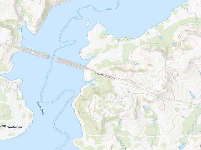
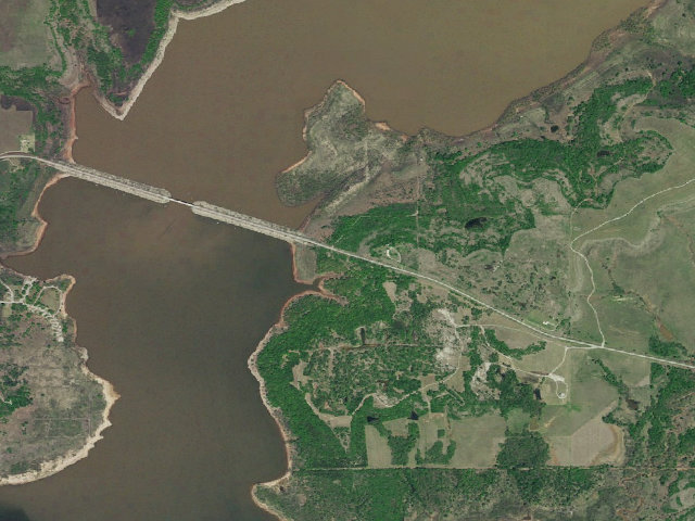
How it was placed
AREA RULE (https://www.wildlifedepartment.com/hunting/regs/public-hunting-areas-special-regulations, read 2026-08-16): ODWC Special Regulations heading "Kaw WMA" (county: Kay, Osage) -- Additional Restrictions, verbatim: "Hunter and angler camping is allowed in designated areas." LEGAL BASIS -- ODWC Department-Managed Area Rules, https://www.wildlifedepartment.com/hunting/regs/department-managed-area-rules, read 2026-08-16, verbatim: "Camping is limited to a maximum of 16 consecutive days, and for no more than 21 days total in any 30-day period on the same WMA. Camping on these areas is limited to two days longer than the period the camper (hunter) is authorized to hunt. Leaving a campsite unattended for a period longer than 48 hours is prohibited. Unattended camp items will be removed. Quiet hours are enforced from 11 p.m. to 7 a.m. All dogs or other pets must be kept on a leash or otherwise confined while in camping areas." FIRE -- same page, verbatim: "Fires shall be confined to those areas designated for camping and shall be contained in fireplaces, fire rings, grills, or other facilities designed for this purpose. Fires shall not be left unattended and must be completely extinguished prior to departure." ODWC does not publish a statewide seasonal fire ban on this page; Oklahoma county burn bans are issued separately and are not reflected here. Also verbatim from that page: "Public lands not specifically listed as open are closed." Read the area's own regulation before you go. THIS IS NOT A FEE-FREE PLACE TO ENTER -- fee=0 on this row means ODWC publishes NO per-night camping charge, not that access is free. ODWC's license fee table (https://www.wildlifedepartment.com/licensing/regs/license-fees, read 2026-08-16) states verbatim that an "Annual Wildlife Conservation Passport" is "Required of all persons 18 or older who enter Department owned lands, regardless of residency, unless exempt" at $46 for residents and $239 for nonresidents, and a "3-Day Wildlife Conservation Passport" at $26 / $51. A separate $100 / $200 "Land Access Permit" is "Required for residents ages 18 to 63, and nonresidents of any age, including lifetime license holders to access certain ODWC managed properties." ODWC's fee table says "unless exempt" but does not list the exemptions on that page, so we do not state who is exempt. Treat this as: budget for a permit, and check odwc before you drive. ODWC publishes NO site name for this point -- the '#' number in our name is ours, assigned north-to-south within the area for stable identification. It is not an ODWC site number and it is not signed on the ground. WATER: ODWC's layer carries no drinking-water field for camping areas and this row claims none. Do not treat any lake, creek or pond near these sites as potable. COORDINATE PROVENANCE: latitude and longitude are ODWC's own, from its public ArcGIS service https://www.wildlifedepartment.com/server/rest/services/PublicWILMA/WILMAFeatures/MapServer/4 (layer 4, 'Camping Areas'), queried 2026-08-16 with where=1=1 outSR=4326. Every ingested point carries OPENTOPUBL='Yes' in that layer. No geocoding was used. Nearest town: Kaw City ~3.1 mi. 'Nearest town' is STRAIGHT-LINE distance to the nearest OpenStreetMap place=city/town/village and is NOT a driving distance -- on a Corps lake shoreline or in the Ouachitas the road in is routinely two or three times longer. Ingest 2026-08-16. STATUS=pending: this is a lead for review, not published. REVIEW PASS 6 (night shift, 2026-08-20, reviewer=nightshift-verified). VERDICT: APPROVED. Every source named in this block was re-fetched and re-read live on 2026-08-20 by the fire that wrote it. (1) THE RULE IS UNCHANGED. ODWC Public Hunting Areas Special Regulations, https://www.wildlifedepartment.com/hunting/regs/public-hunting-areas-special-regulations?page=6 -- heading 'Kaw WMA', counties 'Kay, Osage', Additional Restrictions verbatim: 'Hunter and angler camping is allowed in designated areas.' Identical to what this row already recorded. TRAP FOR THE NEXT FIRE: that page is paginated into 13 pages (?page=0 .. ?page=12) and Kaw sits on page 6; a bare fetch of the URL returns only the first nine areas and will make you think Kaw has no published rule. (2) THE GEOMETRY IS UNCHANGED. ODWC layer 4 'Camping Areas' re-queried live (https://www.wildlifedepartment.com/server/rest/services/PublicWILMA/WILMAFeatures/MapServer/4/query, where=WMANAME LIKE '%Kaw%', outSR=4326): 40 Kaw features, every one OPENTOPUBL='Yes', WMANAME 'Kaw Wildlife Management Area'. This row's OBJECTID is still in the layer and its published coordinate has moved by less than 0.06 m since ingest on 2026-08-16. 38 of the 40 are in our database; OBJECTID 4023 and 4814 were never ingested, and 4814 sits 3 m from 4817, an internal duplicate inside ODWC's own layer that our ingest deduplicated correctly. (3) NEW EVIDENCE THIS FIRE -- THE COUNT CHECK PASSES, ON ODWC'S OWN PRINTED MAP. Pass 4 (2026-08-20) held all 38 Kaw rows because ODWC's prose gives no number: the area page says only 'Several primitive camping sites are available free of charge on the WMA for hunters and anglers (those possessing hunting and/or fishing licenses).. These sites are mowed in the early fall.' and the FAQ says 'Kaw WMA has numerous primitive campgrounds that are available for hunter and angler camping. For locations and more information check out ODWC's WMA maps.' Both verbatim from https://www.wildlifedepartment.com/hunting/wma/northeast/kaw-wma, re-read 2026-08-20. Note the region: ODWC's GIS files Kaw under REGION 'Central' but the website files it under /northeast/, and /central/kaw-wma is a 404. Pass 4 asked the next fire to count the camping symbols on ODWC's own Kaw atlas. That was done this fire. METHOD, so it can be re-run or refuted: the atlas PDF (https://www.wildlifedepartment.com/sites/default/files/wma-maps/Kaw%20WMA%20Atlast_2018%20QC.pdf) holds one flattened 2606x3400 JPEG and zero extractable text, so the symbols were counted by image template matching (OpenCV TM_CCOEFF_NORMED) using a 16x16 px camping marker cropped from the atlas itself and cross-checked against the tent glyph in ODWC's WMA Legend PDF (https://www.wildlifedepartment.com/sites/default/files/wma-maps/WMA%20Legend.pdf). RESULT: 37 camping symbols, with a clean separation in match score -- the 37th scores 0.879 and the next best candidate scores 0.719 -- and all 37 were eyeballed on a contact sheet and are genuine tent markers. 37 RECONCILES WITH 40: at the atlas scale of 15.6 m per pixel the 3 m pair (OBJECTID 4814/4817) is 0.2 px apart and the 146 m pair (4022/4023) is 9 px apart against a 16 px marker, so each pair can only be drawn as a single symbol, giving 40 - 2 - 1 = 37 drawable positions. ODWC's printed map and ODWC's GIS layer therefore agree on how many designated camping sites Kaw has, and 'several'/'numerous' means high thirties. That is the corroboration this cluster was waiting for, and it is the same standard -- agency prose against agency geometry -- used to approve Canton, Pushmataha, McGee Creek and Texoma-Washita in passes 4 and 5. (4) WHAT THE ATLAS DOES NOT PROVE -- READ THIS BEFORE TRUSTING THE PRINTED MAP. The atlas was georeferenced by fitting a north-up similarity transform and then cross-checking it against ODWC's own WMA Roads layer 9, whose 36 Kaw polylines overlay the roads drawn on the atlas correctly; scale 15.60 m/px, rotation 0.17 deg. Under that transform the camping SYMBOLS do NOT sit on the GIS POINTS: only 11 of the 40 points fall within 190 m of a symbol, the median offset is about 700 m, and a brute-force search over +/- 250 px found no translation that improves the match, so this is not a georeferencing error. The likely reason is vintage plus cartographic generalisation -- the atlas layout is dated 2018 and its markers are visibly stacked into E/P/tent columns near access points for legibility, while layer 4 was last edited 2024-12-16/17 and three of its Kaw points are late additions with incomplete attributes. CONSEQUENCE: the atlas corroborates HOW MANY sites Kaw has. It does not verify WHERE any individual site is, and this row's coordinate is not derived from it. The coordinate is ODWC's own current GIS position, unchanged since ingest. Expect the printed atlas to show the tent symbol somewhere else. (5) NOT A DUPLICATE. Checked on COORDINATES, not on name, against all 19,094 published-or-approved rows in the database on 2026-08-20. The nearest published or approved camp to ANY of the 38 Kaw rows is 9.98 mi away (Cowley State Fishing Lake, in Kansas); the nearest Oklahoma one is John Dahl WMA primitive camp #1 at 10.74 mi. Within the Kaw cluster itself the closest two rows are 0.133 mi apart and the median nearest-neighbour spacing is 0.615 mi, so these are 38 distinguishable places, not one place recorded 38 times. (6) NOT A MIS-FILED CORPS FEE CAMPGROUND. Every Kaw Lake facility on recreation.gov was pulled keyless (https://www.recreation.gov/api/search, 13 entries with coordinates, all US Army Corps of Engineers). The nearest Corps campground to any of the 38 is BEAR CREEK COVE at 1.008 mi. The Cedar Lake trap from pass 1 -- a paid Corps campground filed as free primitive camping -- does not repeat here. (7) CORRECTION -- THE PERMIT PARAGRAPH EARLIER IN THIS NOTE IS WRONG FOR KAW, AND THE ROW HAS BEEN FIXED. The paragraph above says an Annual or 3-Day Wildlife Conservation Passport is required of everyone 18 or older, and mentions a $100/$200 Land Access Permit. For Kaw both statements overstate the requirement. ODWC's own Kaw FAQ, verbatim: 'A hunting license and appropriate game licenses (tags) are required to hunt on Kaw WMA. There is not a use permit required unless using US Army Corps of Engineers (USACE) boat ramps or campgrounds.' ODWC's specialty-licences page (https://www.wildlifedepartment.com/licensing/regs/specialty-licenses, read 2026-08-20) gives the passport rule in full, verbatim: 'People who use Department owned areas for non-hunting or non-fishing activities, such as birdwatching or photography, are required to have either a Wildlife Conservation Passport or any current hunting or fishing license issued by the Wildlife Department. Persons 17 years of age or younger at the start of the calendar year, and students and instructors participating in bona fide educational tours or activities sponsored or organized by an education institution or any other organized event sanctioned by and approved in advance by the Wildlife Department are exempt.' -- so a hunting or fishing licence is an ALTERNATIVE to the passport, not an addition to it, and that is exactly the licence Kaw's camping paragraph already assumes you hold. The same page narrows the Land Access Permit, verbatim: 'Required for residents to hunt, fish or otherwise use Honobia Creek, Three Rivers and Herron Family WMAs, and OLAP properties.' KAW IS NOT ONE OF THOSE, so the Land Access Permit does not apply here at all. The fee figures quoted earlier were re-checked live against https://www.wildlifedepartment.com/licensing/regs/license-fees and are still correct as figures ($46/$239 annual, $26/$51 three-day, $100/$200 Land Access Permit); it is their applicability to Kaw that was wrong. The reader-facing field_note on this row has been rewritten accordingly. CARRIED FORWARD: the tags on this row still include 'permit-required', which now reads as an overstatement -- what Kaw actually requires is a hunting or fishing licence. Tags were deliberately not edited by this review (no pass has edited tags, and they feed the build); an editor should decide. (8) THE DAY LIMIT AND FIRE RULE ARE UNCHANGED, re-read at https://www.wildlifedepartment.com/hunting/regs/department-managed-area-rules on 2026-08-20: 'Camping is limited to a maximum of 16 consecutive days, and for no more than 21 days total in any 30-day period on the same WMA.', 'Quiet hours are enforced from 11 p.m. to 7 a.m.', 'Fires shall be confined to those areas designated for camping and shall be contained in fireplaces, fire rings, grills, or other facilities designed for this purpose.' and 'Public lands not specifically listed as open are closed.' (9) WATER. ODWC's layer carries no drinking-water field for camping areas and publishes nothing about water at Kaw. This row claims no potable water and that claim is unchanged. Kaw Lake and its creeks are not potable. (10) ROAD ACCESS, MEASURED THIS FIRE FOR THIS ROW. Distance to the nearest road ODWC itself maps (layer 9 'WMA Roads', 36 Kaw polylines, 479 vertices, queried live 2026-08-20): 52 m. Distance to the nearest road OpenStreetMap maps (Overpass, highways excluding footway/path/cycleway, bbox 36.76/-97.02 to 37.02/-96.72, queried live 2026-08-20): 115 m, tagged highway=residential. NEAREST OF THE TWO IS 52 m. This matters because pass 4 flagged nine Kaw rows as far from any ODWC-mapped road and proposed holding them; adding OSM this fire resolves that, because ODWC maps only 36 roads across a 17,450-acre WMA and every one of the nine is in fact within 267 m of a road OSM maps. ACROSS ALL 38 ROWS the worst nearest-road distance is 267 m (camp #6) and the median is 34 m. HONEST LIMITS: neither source proves the road is open, passable in a two-wheel-drive vehicle, or that it reaches this exact spot, and OSM is not an agency source -- it is used here only to show that a road exists where ODWC did not map one. (11) ATLAS CROSS-REFERENCE FOR THIS ROW: the nearest camping symbol on ODWC's printed atlas is 1057 m from this coordinate. See item (4) for why that number is not a verification either way. (12) CORRECTION -- AN ATTRIBUTE CLAIM EARLIER IN THIS NOTE IS NOT SUPPORTED BY ODWC AND HAS BEEN WITHDRAWN. This note says ODWC camp type: 'Primitive'. Restroom per ODWC: No. Showers per ODWC: No. Re-reading ODWC layer 4 live on 2026-08-20 for OBJECTID 21221 shows CAMPTYPE, RESTROOMS and SHOWERS are all null -- ODWC publishes no camp type and says nothing either way about restrooms or showers at this point. The ingest on 2026-08-16 appears to have defaulted these blank fields; the same three Kaw points (OBJECTID 4817, 21220 and 21221) were already blank in the layer snapshot pass 4 took on 2026-08-20, so this is our error and not an agency change. The site itself is unaffected -- OBJECTID 21221 is still a feature of ODWC's 'Camping Areas' layer with OPENTOPUBL='Yes' -- but the row must not tell a reader that ODWC published a facility level it did not publish. The reader-facing field_note has been corrected.