Kerns WHMA — Broderick camping zone
FIRE BAN: WGFD flags this area as 'Fire Ban is in Effect for this Area' -- check before you plan on any open flame. SEASONAL CLOSURE -- READ THIS FIRST: Nov. 16 - May 31 Wyoming closes many of these areas in winter and spring to protect wintering big game, and a closure is not advisory. Confirm the current dates with Game and Fish before you drive out. This is a designated campground on the Kerns Wildlife Habitat Management Area in Sheridan County, land acquired or administered by the Wyoming Game and Fish Commission. The area runs about 4,943 acres. Camping here is genuinely free and first come, first served -- and unlike neighbouring states, Wyoming does NOT make you buy a license or a habitat/entrance pass simply to be on the land or to camp. (If you intend to hunt or fish while you are there, that is a different matter: you need the appropriate Wyoming license and a conservation stamp for that activity.) The rules that bind: you may only camp in the designated spots, no more than 14 consecutive days, and you cannot leave a camp unattended more than 48 hours. After you hit the limit you have to be off that same Game and Fish land for at least 72 hours before returning. Some areas post a limit shorter than 14 days on the sign at the entrance -- if the sign says less, the sign wins. WATCH THIS ONE CAREFULLY -- Game and Fish carves out a spot on this area where camping is NOT allowed: 'No camping or parking on TR Bench between gravel pit and 2'. Camping is permitted on the area, but not there. Note in particular that Wyoming STATE TRUST LAND parcels are often mixed in with wildlife areas, and camping on state trust land is prohibited statewide by the Board of Land Commissioners -- so a boundary you cannot see on the ground can matter. Read the sign and the map at the entrance. Area-specific regulations from Game and Fish: 14 day camping limit. No camping or parking on TR Bench between gravel pit and 2.5 miles up access road.Weed free certified hay only. Exceptions noted for this area: Closed to vehicles Nov. 1 - May 31 Amenities listed by Game and Fish for the area: Parking, Comfort Station, Horse Corrals These are working wildlife areas first and campgrounds second -- they exist for habitat, so expect gravel, expect stock, and leave it cleaner than you found it. We have not visited; confirm current conditions and closures with the Wyoming Game and Fish Sheridan regional office before you go.
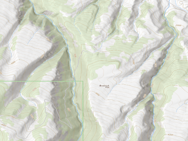
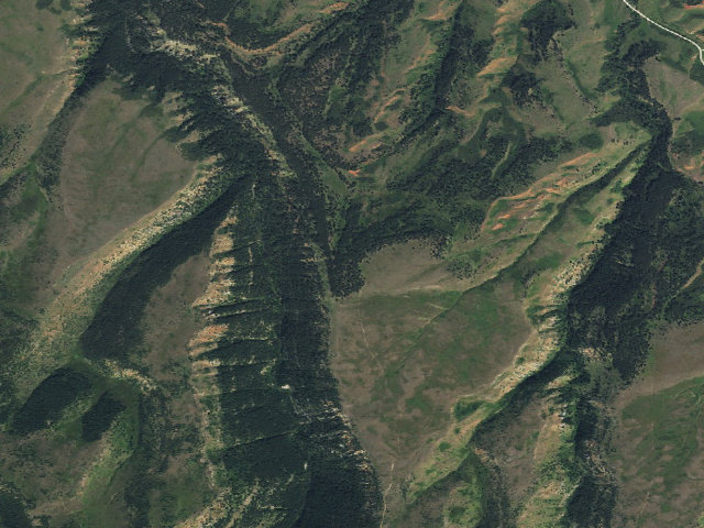
Everything you need — measured from Kerns WHMA — Broderick camping zone · Wyoming Game & Fish · WY
- @Mail15 mi
- FFuel18 mi
- GGrocery18 mi
- LLaundry22 mi
- EVEV fast charger32 mi
- DDump32 mi
- RxPharmacy34 mi
- HHardware34 mi
- +Urgent care35 mi
- OOutfitter35 mi
- MMechanic35 mi
The read: fuel & food sit about 18 mi out, the nearest EV fast charger is a 32-mi run (and back).
Not within 60 mi: Water, Propane. Plan those before you head up.
One dot per need — the nearest of each kind, straight-line from camp. Places from OpenStreetMap (© OpenStreetMap contributors); the EV fast charger from the US DOE station locator. Open in Google Maps ↗
The site — Kerns WHMA — Broderick camping zone
Nearby & resupply — around Kerns WHMA — Broderick camping zone · Wyoming Game & Fish · WY (OpenStreetMap)
- Nearest townParkman · ~13.2 mi
- Drinking waternone within 10 mi
- FuelCenex gas station · ~21.5 mi
- Propane / LPGnone within 31 mi
- GroceriesIGA · ~26.6 mi
EV charging — from Kerns WHMA — Broderick camping zone · Wyoming Game & Fish · WY — nearest public DC fast & Level 2 (US DOE station data)
- Nearest public DC fast charger32.3 mi straight-line E — SHERIDAN MOTORS CPE250 · ChargePoint Network · CHAdeMO, CCS · 1 fast port listed · listed open, last confirmed by AFDC 2026-09-16 · hours: 24 hours daily · directions
- Public DC fast stations within reachnone within 25 mi · 2 within 50 · 10 within 100 · 18 within 150
- Nearest listing NACS (Tesla)33.5 mi — Sheridan, WY - Tesla Supercharger, Sheridan
- Nearest public Level 2 (J1772)32.4 mi — SHERIDAN MOTORS CT4000 · ChargePoint Network · J1772 · 2 Level 2 ports listed · listed open, last confirmed by AFDC 2026-09-16 · hours: 24 hours daily
- Also listed, not counted aboveNACS-only Level 2 — Shell WY Tesla Chargers - Tesla Destination, Shell, 31.0 mi · NACS (Tesla) · hours: 24 hours daily. Open to Teslas only. · AFDC lists it “Free”
- Pricing at the fast chargernot listed
- Power (kW)not listed by AFDC — “DC fast” spans roughly 24 to 350 kW, so ask the network.
- Read this honestlyStraight-line miles, like every distance on this site. Roads run longer than this, and you have to get back. We know where a charger is listed. We don’t know if it works today, how fast it is, or the road miles. Check the network before you commit.
Snapshot 2026-09-16 · AFDC record 255681 · US DOE Alternative Fuels Data Center
Nearby restrooms — around Kerns WHMA — Broderick camping zone · Wyoming Game & Fish · WY — pit toilets, restrooms & rest areas (government data)
- Vault / pit toiletBurgess · ~13.2 mi S · USFS
- Vault / pit toiletNorth Tongue · ~13.3 mi S · USFS
- Flush restroomBurgess Junction Visitor Center · ~13.4 mi SE · USFS
- Vault / pit toiletPine Island · ~14.4 mi SE · USFS
Open Kerns WHMA — Broderick camping zone elsewhere
Other camps near Kerns WHMA — Broderick camping zone
If this one is full, gated or washed out.
- Kerns WHMA — camping zone~2.3 mi
- Kerns WHMA — Gay Creek Campsite~3.5 mi
- Kerns WHMA — Kerns Lower Trail Bench Site~4.1 mi
- North Tongue~13.3 mi · fee
Snow, and when this opens
The nearest automatic snow station is Burgess Junction at 7,910 ft, about 13 miles away. It sits about 2,001 ft higher than this camp, so treat it as a guide rather than a reading for this spot. We do not repeat a depth here, because any number we stored would be stale by the time you read it — the station publishes today's.
How we know this — Kerns WHMA — Broderick camping zone
What we don’t know about Kerns WHMA — Broderick camping zone
A land record can put you within a few meters of a spot. It cannot tell you any of this — so check it yourself, and treat anything below as the open question it is.
- Road surface & last-mile access
- How many rigs actually fit
- Cell coverage by carrier
- Current fire restrictions
- Whether any water here is drinkable
- Shade & wind exposure
- Noise and who else shows up
- Whether a listed EV charger works today, or the road miles to it