Ask an AI about this campsiteOpens Grok already loaded with this site. It reads the same records this page is built from, and links whatever it tells you.
The land manager lists this site. Someone from the agency inventoried it, so it is a real camp — not a spot we guessed at. What changes is conditions — roads, gates, closures, fire rules. Check those with the unit before you commit to the drive.
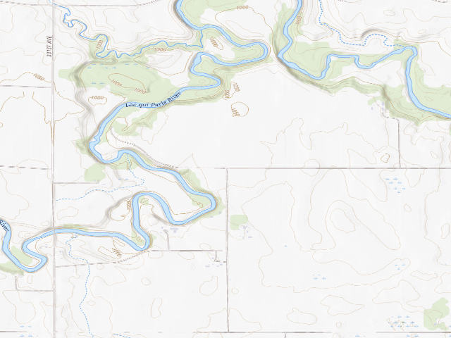
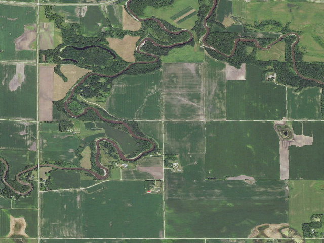
PAY THE DONATION: overnight camping here is free of charge, but Lac qui Parle County requests a $20/night donation dropped in the payment boxes (located at each entrance and by the bathroom) -- leave it so it stays free for the next traveler. Lac qui Parle County Park is a quiet county park on the bluffs near Dawson in far-western Minnesota (physical address 2299 337th Avenue, Dawson, MN 56232). Camping is first-come, first-served, with a 9-day maximum stay, and unusually for the region the county says the park is OPEN EVERY DAY OF THE YEAR (quiet hours 10 p.m.-7 a.m.). It is PRIMITIVE camping -- a bathroom and fire rings, no electric or water hookups, so come self-contained; good for a tent or a self-contained RV. Note the county's rules: recreational fires only in the provided rings, and NO HUNTING / no firearms allowed in the park. HEADS UP ON THE PIN: this county park is not mapped as a boundary or campsite in our data (and it shares its name with the separate, DNR-run Lac qui Parle STATE Park about 5 miles northeast -- do not confuse the two), so the marker sits on the park's own access road, 337th Avenue, rather than on an exact campsite; watch for the county park signs off 337th Avenue northeast of Dawson. Rules change and we have not visited -- confirm the current rules before you go (countypark@lqpco.com or 320-598-7261).
Can I go now? — Lac qui Parle County Park (Dawson) · public land · MN
Season: check firstSeason stated, but not plainly enough to read as a date.
public land record: “Unless otherwise noted, or to prevent damage to the roads/trails, the Park will be open each day of the year.” Read against the calendar on 2026-09-17; with JavaScript your browser re-checks it against today.
Nearby & resupply — around Lac qui Parle County Park (Dawson) · public land · MN(OpenStreetMap)
Water featureLac qui Parle River (river) · nearby
Nearest townLac qui Parle · ~3.0 mi
Drinking waternone within 10 mi
FuelFuel · ~8.1 mi
Propane / LPGnone within 31 mi
GroceriesStore · ~12.3 mi
PharmacyCanby Drug & Gifts · ~24.8 mi
Hospital / clinicJohnson Memorial Health Services · ~6.5 mi
HardwareHardware Hank · ~12.3 mi
EV charging — from Lac qui Parle County Park (Dawson) · public land · MN— nearest public DC fast & Level 2 (US DOE station data)
Nearest public DC fast charger5.8 mi straight-line SW — Dawson · CHARGELAB · CHAdeMO, J1772, CCS · 2 fast ports listed · listed open, last confirmed by AFDC 2026-09-16 · hours: not listed · directions
Public DC fast stations within reach1 within 25 mi · 6 within 50 · 47 within 100 · 232 within 150
Nearest public Level 2 (J1772)5.5 mi — Lee Motor Company, Dawson, MN (at a public site) · RED_E · J1772 · 2 Level 2 ports listed · listed open, last confirmed by AFDC 2026-09-16 · hours: not listed
Pricing at the fast chargernot listed
Power (kW)not listed by AFDC — “DC fast” spans roughly 24 to 350 kW, so ask the network.
Read this honestlyStraight-line miles, like every distance on this site. Roads run longer than this, and you have to get back. We know where a charger is listed. We don’t know if it works today, how fast it is, or the road miles. Check the network before you commit. Snapshot 2026-09-16 · AFDC record 455679 · US DOE Alternative Fuels Data Center
Nearby restrooms — around Lac qui Parle County Park (Dawson) · public land · MN— pit toilets, restrooms & rest areas (government data)
How we know this — Lac qui Parle County Park (Dawson)
Fire rules
Recreational fires are permitted only in fireplaces or fire rings provided for that purpose.
Open season
Unless otherwise noted, or to prevent damage to the roads/trails, the Park will be open each day of the year.
Stay limit
9 nights (No campers or tents will be allowed to stay in the park for more than nine (9) days)
Source
public land records
Confidence
Likely — The record is good enough to put a pin on, but thin in places. Treat the details as a starting point, not gospel.
How it was placed
FREE STATUS IS OFFICIAL (donation-based) and HIGH confidence via the COUNTY'S OWN board-adopted rules. "Lac qui Parle County Park Rules and Regulations, ADOPTED BY COUNTY BOARD 11/1/2022", the PDF linked from the county park page https://www.lqpcomn.gov/263/County-Park at https://www.lqpcomn.gov/DocumentCenter/View/166/County-Park-Rules-and-Regulations (both fetched 2026-07-22), states verbatim: "Short term recreational camping is allowed in the Park on a first come first serve basis. No campers or tents will be allowed to stay in the park for more than nine (9) days"; "A $20.00 donation is requested for each night you stay in the Park. Payment boxes are located at each entrance and by the bathroom"; "the Park will be open each day of the year. Quiet time in the Park will be from 10:00 p.m. to 7:00 a.m." (year-round); recreational fires only in provided rings; NO HUNTING/no firearms in the park. A REQUESTED DONATION (not a mandatory fee) => fee=0 under the free-only policy. County park physical address 2299 337th Avenue, Dawson, MN 56232; office 600 6th St, Madison; contact countypark@lqpco.com / 320-598-7261. COORDINATE CAVEAT (why confidence='med'): OpenStreetMap maps NO camp_site/park/boundary object for Lac qui Parle COUNTY Park. NAME-COLLISION TRAP AVOIDED -- Nominatim resolves the string "Lac qui Parle County Park" to LAC QUI PARLE STATE PARK (a different, DNR-run place ~5 mi NE at ~45.02,-95.89); that pin was NOT used. The only authoritative OSM object at the park is its named access road "337th Avenue" (OSM way 18129188, residential, lon ~-95.9659, lat 44.9787-44.9932), which MATCHES the street in the county's official address (2299 337th Avenue). The US Census geocoder could not match the rural address; a crowd coordinate (The Dyrt, 44.99655,-95.97576) independently places the park ~0.5 mi NW of that road's north end. The pin 44.993157,-95.965958 is placed ON the mapped 337th Avenue access road (its north node, the authoritative point nearest the independent crowd fix) -- the park's own named road, NOT a mapped campsite point. Free-status HIGH, pin-precision MED. Overpass via maps.mail.ru mirror (overpass-api.de/kumi 504'd). Not visited. Verified 2026-07-22. | auto:agency-trust 2026-08-18: state agency GIS record with a source URL and coordinates, confidence not low. Fee value is the agency's own, not field-checked. Not field-verified -- confirm access, road conditions and fire rules before you go.
Season
Read from the agency's own season / closure text in this record (data/conditions.py) and checked against the calendar. The words we read are printed under the verdict at the top of the page.
EV chargers
US DOE Alternative Fuels Data Center station locator, snapshot 2026-09-16. Straight-line miles to the nearest public, open, unrestricted station; restricted and planned units are shown but never counted.
Field check
On the agency's books. The land manager inventoried this site, so its existence is not in question — current conditions are. Nobody from here has camped it recently.
What we don’t know about Lac qui Parle County Park (Dawson)
A land record can put you within a few meters of a spot. It cannot tell you any of this — so check it yourself, and treat anything below as the open question it is.
Road surface & last-mile access
How many rigs actually fit
Cell coverage by carrier
Current fire restrictions
Whether any water here is drinkable
Shade & wind exposure
Noise and who else shows up
Whether a listed EV charger works today, or the road miles to it
Before you go — Lac qui Parle County Park (Dawson)
Been here? Tell us what changed. This page is built from public records, so the fastest way it gets better is somebody who has actually pulled in. Road washed out, site gone, gate locked, or it is exactly as described — all of it useful. Send a report →