Lewis Park Campground (Wheatland)
Wheatland is the Platte County seat on I-25 between Cheyenne and Casper, and the town lets you camp overnight at Lewis Park, in the 200 block of 8th Street, with no set fee -- everything, including the dump station, runs on donations. Three nights is the requested maximum and there are no reservations; you just turn up. Be clear on what is NOT here, because the camping apps get this wrong: several of them advertise free electric hookups at Lewis Park, and the Town of Wheatland's own page says plainly that there are no electrical or water hookups at the campground. Come self-contained. There IS a dump station, and like everything else it is donation-based, so put money in the box -- a town that asks for nothing is trusting you to keep it worth doing. This is a genuinely convenient I-25 overnight: you are a couple of blocks off the main drag in a real town with groceries, fuel and food. The deal these towns offer is simple: camp free, and they hope you spend a little locally. Town rules change often and we have not visited -- confirm with Town Hall at (307) 322-2962 before you count on it.
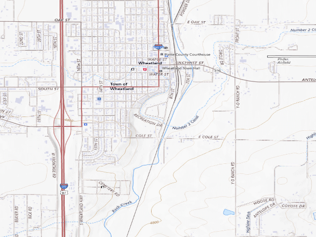
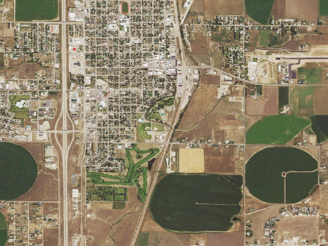
Everything you need — measured from Lewis Park Campground (Wheatland) · public land · WY
- FFuel0 mi
- GGrocery0 mi
- @Mail1 mi
- HHardware1 mi
- EVEV fast charger2 mi
- DDump13 mi
- RxPharmacy19 mi
- LLaundry19 mi
- +Urgent care19 mi
- MMechanic19 mi
- WWater31 mi
- OOutfitter60 mi
The read: water is a real 31-mi drive, fuel & food sit about 0 mi out.
Not within 60 mi: Propane. Plan those before you head up.
One dot per need — the nearest of each kind, straight-line from camp. Places from OpenStreetMap (© OpenStreetMap contributors); the EV fast charger from the US DOE station locator. Open in Google Maps ↗
The site — Lewis Park Campground (Wheatland)
Nearby & resupply — around Lewis Park Campground (Wheatland) · public land · WY (OpenStreetMap)
- Water featureStream · nearby
- Nearest townWheatland · ~0.5 mi
- Drinking waternone within 10 mi
- FuelFuel · ~0.6 mi
- Propane / LPGnone within 31 mi
- Dump station~13.4 mi
- GroceriesSafeway · ~1.1 mi
- Hospital / clinicPlatte County Hospital · ~0.4 mi
- HardwareDo it Best · ~18.8 mi
EV charging — from Lewis Park Campground (Wheatland) · public land · WY — nearest public DC fast & Level 2 (US DOE station data)
- Nearest public DC fast charger1.8 mi straight-line N — Wheatland, WY - Tesla Supercharger (at a hotel) · Tesla · NACS (Tesla) · 8 fast ports listed · listed open, last confirmed by AFDC 2026-06-18 · hours: 24 hours daily. Open to Teslas only. · directions
- Public DC fast stations within reach1 within 25 mi · 1 within 50 · 24 within 100 · 145 within 150
- Nearest listing CCS59.7 mi — LARAMIE AUTO CENTER, LARAMIE
- Nearest listing CHAdeMO67.0 mi — NPPD EV STATION SB SINCLAIR DCN, Scottsbluff
- Nearest public Level 2 (J1772)59.7 mi — Laramie Range · Blink Network · J1772 · 1 Level 2 port listed · listed open, last confirmed by AFDC 2026-09-16 · hours: 24 hours daily
- Also listed, not counted aboveNACS-only Level 2 — Heartland Inn & Suites - Tesla Destination, Wheatland, 1.8 mi · NACS (Tesla) · hours: 24 hours daily. Open to Teslas only. · AFDC lists it “Free”
- Pricing at the fast chargernot listed
- Power (kW)not listed by AFDC — “DC fast” spans roughly 24 to 350 kW, so ask the network.
- Read this honestlyStraight-line miles, like every distance on this site. Roads run longer than this, and you have to get back. We know where a charger is listed. We don’t know if it works today, how fast it is, or the road miles. Check the network before you commit.
Snapshot 2026-09-16 · AFDC record 102521 · US DOE Alternative Fuels Data Center
Nearby restrooms — around Lewis Park Campground (Wheatland) · public land · WY — pit toilets, restrooms & rest areas (government data)
- Highway rest areaI-25 MM 65 Turnout westbound · ~12.5 mi S
- Highway rest areaI-25 MM 65 Turnout eastbound · ~12.5 mi S
- Highway rest areaDwyer Junction Rest Area · ~13.3 mi N
- RestroomSkyline Campground Restroom 2 Building · ~19.0 mi NE · BoR
Open Lewis Park Campground (Wheatland) elsewhere
Other camps near Lewis Park Campground (Wheatland)
If this one is full, gated or washed out.
- Cottonwood Draw WHMA Campground~12.5 mi
- Grayrocks Reservoir PAA Campground #4~13.2 mi
- Grayrocks Reservoir PAA Campground #7~13.7 mi
How we know this — Lewis Park Campground (Wheatland)
What we don’t know about Lewis Park Campground (Wheatland)
A land record can put you within a few meters of a spot. It cannot tell you any of this — so check it yourself, and treat anything below as the open question it is.
- Road surface & last-mile access
- How many rigs actually fit
- Cell coverage by carrier
- Seasonal & winter access
- Current fire restrictions
- Whether any water here is drinkable
- Shade & wind exposure
- Noise and who else shows up
- Whether a listed EV charger works today, or the road miles to it