Ask an AI about this campsiteOpens Grok already loaded with this site. It reads the same records this page is built from, and links whatever it tells you.
The land manager lists this site. Someone from the agency inventoried it, so it is a real camp — not a spot we guessed at. What changes is conditions — roads, gates, closures, fire rules. Check those with the unit before you commit to the drive.
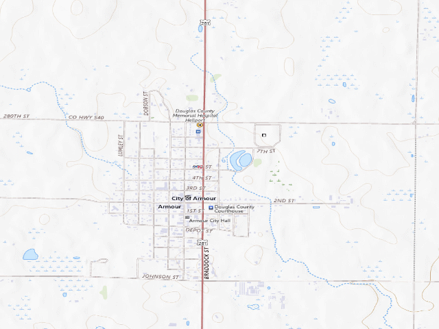
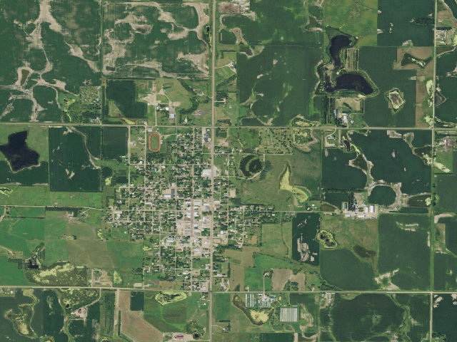
Donation-based camping in Armour's Lions Park, right on US-281 in Douglas County -- and unusually well equipped for a free stop: there is a bathhouse with toilets AND showers, and a dump station. The city is refreshingly direct about money: "There is no set fee for short camping stays at the park. Visitors who camp or use the facilities are asked to leave a donation in the drop box located near the bathhouse." So it is free in the sense that nothing is charged -- but there IS a drop box by the bathhouse and you should use it. Showers and a dump station cost the town real money to run. STAYING FIVE DAYS OR LONGER IS NOT FREE: "For stays of five days or longer, campers are asked to call 605-724-2459, for a daily rate." Plan on a short stop, or ring first. The park has two picnic shelters, 10 camping pads, plenty of green space, a sand volleyball court and playground facilities. There are also two cabins, which ARE priced -- "$40 per couple and $20 for each additional adult over age 18", kids free, two queen beds and two twin beds, heat and air conditioning, bring your own bedding, booked through Krull's Market at 605-724-2459. The cabins are a separate thing from the camping pads; do not turn up expecting a free cabin. The city page does not say whether potable water is available to campers, so we are not claiming it either way -- there is a bathhouse, but that is not the same statement. We have not visited this site.
Nearby & resupply — around Lions Park (Armour) · public land · SD(OpenStreetMap)
Drinking waternone within 10 mi
FuelClark · ~0.3 mi
Propane / LPGnone within 31 mi
Dump station~19.6 mi
GroceriesGrocery · ~0.3 mi
PharmacyParkston Drug · ~18.6 mi
Hospital / clinicAvera St. Benedict CRH Clinic - Lake Andes · ~15.1 mi
HardwareTrue Value · ~0.3 mi
EV charging — from Lions Park (Armour) · public land · SD— nearest public DC fast & Level 2 (US DOE station data)
Nearest public DC fast charger30.2 mi straight-line NE — Mitchell, SD - Tesla Supercharger (at a shopping center) · Tesla · NACS (Tesla) · 6 fast ports listed · listed open, last confirmed by AFDC 2026-06-18 · hours: 24 hours daily. Open to Teslas only. · directions
Public DC fast stations within reachnone within 25 mi · 3 within 50 · 22 within 100 · 56 within 150
Nearest public Level 2 (J1772)31.2 mi — Vern Eide Chevrolet Buick GMC Mitchell · EV Connect · J1772, CCS · 1 Level 2 port listed · listed open, last confirmed by AFDC 2026-09-16 · hours: 24 hours daily
Pricing at the fast chargernot listed
Power (kW)not listed by AFDC — “DC fast” spans roughly 24 to 350 kW, so ask the network.
Read this honestlyStraight-line miles, like every distance on this site. Roads run longer than this, and you have to get back. We know where a charger is listed. We don’t know if it works today, how fast it is, or the road miles. Check the network before you commit. Snapshot 2026-09-16 · AFDC record 102407 · US DOE Alternative Fuels Data Center
Nearby restrooms — around Lions Park (Armour) · public land · SD— pit toilets, restrooms & rest areas (government data)
Researched — The record is detailed and internally consistent, and the coordinates land where the managing agency says this site is.
How it was placed
SOURCE: City of Armour official website, https://armoursd.com/recreation/ -- fetched this fire and string-matched in the RAW page body via data/fetch_town_page.py. Quotes verbatim: "There is no set fee for short camping stays at the park. Visitors who camp or use the facilities are asked to leave a donation in the drop box located near the bathhouse. For stays of five days or longer, campers are asked to call 605-724-2459, for a daily rate."; "The park has two picnic shelters, 10 camping pads, two cabins and a bathhouse."; "The park's restroom and shower facilities also include a dump station for campers and RVs."; "Located along U.S. Highway 281". Cabin rates quoted from the same page. The page shows no date; the site footer identifies it as the City of Armour (cityhall at armour.sdcity.gov). FEE IS RECORDED AS 0 BECAUSE THE CITY SAYS THERE IS NO SET FEE FOR SHORT STAYS. This is donation-based, not silent-on-price, which is the distinction that matters -- same call the Montana fire made on Chester. The five-day threshold is carried in field_note as a first-class warning rather than buried, because a traveller who overstays WILL be charged. COORDINATE: OpenStreetMap via Overpass API. The pin is the CAMP_SITE polygon centre (way, tourism=camp_site) at 43.3223317,-98.3433576 -- i.e. the actual camping area, not just the park. It sits inside/beside an unnamed leisure=park polygon at 43.3226872,-98.3424154 whose OSM tags carry operator='Armour Lions Club', operator:type='private_non_profit', which is what identifies it as LIONS Park rather than the separate City of Armour park at 43.3283916,-98.3480067 (operator='City of Armour') that holds the pool, tennis courts and ball fields. CORROBORATION of the identification: Overpass also returns, within that Lions Club polygon, a leisure=pitch sport=beachvolleyball surface=sand at 43.3233436,-98.3435539 and a leisure=playground at 43.3235207,-98.3429974 -- matching the city's own "sand volleyball court and playground facilities". And the pin's longitude -98.3434 puts it on US-281 through Armour, matching "Located along U.S. Highway 281". GNIS has no park feature in Douglas County; Armour town centre per GNIS is 43.3186012,-98.3467455, about 0.3 mi southwest of the pin. Nominatim returned no result for either park name. Dedupe: nothing in the database within 5 km. Verified 2026-08-17 01:05:16. | auto:agency-trust 2026-08-18: state agency GIS record with a source URL and coordinates, confidence not low. Fee value is the agency's own, not field-checked. Not field-verified -- confirm access, road conditions and fire rules before you go.
EV chargers
US DOE Alternative Fuels Data Center station locator, snapshot 2026-09-16. Straight-line miles to the nearest public, open, unrestricted station; restricted and planned units are shown but never counted.
Field check
On the agency's books. The land manager inventoried this site, so its existence is not in question — current conditions are. Nobody from here has camped it recently.
What we don’t know about Lions Park (Armour)
A land record can put you within a few meters of a spot. It cannot tell you any of this — so check it yourself, and treat anything below as the open question it is.
Road surface & last-mile access
How many rigs actually fit
Cell coverage by carrier
Seasonal & winter access
Current fire restrictions
Whether any water here is drinkable
Shade & wind exposure
Noise and who else shows up
Whether a listed EV charger works today, or the road miles to it
Been here? Tell us what changed. This page is built from public records, so the fastest way it gets better is somebody who has actually pulled in. Road washed out, site gone, gate locked, or it is exactly as described — all of it useful. Send a report →