Louisville SRA
Nebraska State Recreation Area (NGPC), Cass County. The park's own page says: "Louisville State Recreation Area offers campers Full Hookup, Electric Plus, Electric and Basic campsites and is very popular with campers with over 200 camping pads with 20-, 30- and 50-amp electrical hookups, as well as Basic campsites without electricity. Other amenities include shower facility and modern restrooms. Campers also have access to drinking water and a dump and fill station and a playground for children. Camping reservations are available for half of the electrical campsites. All other camping is first-come, first-served. All campers should check in at the park office upon arrival. For those camping without reservations, please go to park office upon arrival to check availability and register to camp." The park's own page lists drinking water in the campground. That is the agency's claim about a developed tap, not a field check, and not a claim about any lake or river here -- treat all natural water as NOT potable. NOTE FOR REVIEW: our map already carries 'Louisville Boat Access WMA' about 0.98 mi away (published) -- check these are genuinely different places to camp.
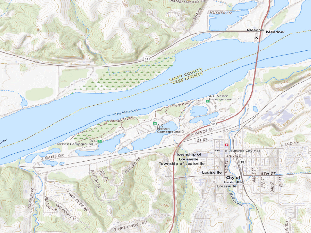
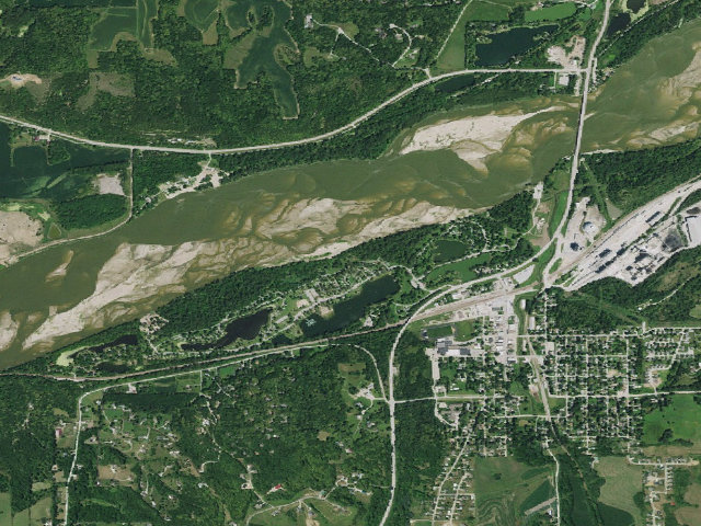
Everything you need — measured from Louisville SRA · Nebraska Game & Parks · NE
- ShShower0 mi
- DDump0 mi
- FFuel0 mi
- @Mail0 mi
- WWater3 mi
- GGrocery6 mi
- HHardware6 mi
- LLaundry7 mi
- OOutfitter8 mi
- EVEV fast charger8 mi
- +Urgent care10 mi
- AAir-up10 mi
- MMechanic10 mi
- RxPharmacy10 mi
- PPropane22 mi
The read: water is basically at camp, fuel & food sit about 0 mi out.
One dot per need — the nearest of each kind, straight-line from camp. Places from OpenStreetMap (© OpenStreetMap contributors); the EV fast charger from the US DOE station locator. Open in Google Maps ↗
The site — Louisville SRA
Nearby & resupply — around Louisville SRA · Nebraska Game & Parks · NE (OpenStreetMap)
- Drinking waterWater · ~2.9 mi
- FuelShell · ~0.5 mi
- Propane / LPGLakeside Country Store · ~22.3 mi
- Dump station~0.4 mi
- GroceriesCasey's General Store · ~5.5 mi
- PharmacyU Save Pharmacy · ~10.2 mi
- Hospital / clinicMethodist Physicians Clinic - Gretna · ~9.6 mi
- HardwareAce Hardware · ~5.9 mi
EV charging — from Louisville SRA · Nebraska Game & Parks · NE — nearest public DC fast & Level 2 (US DOE station data)
- Nearest public DC fast charger7.6 mi straight-line NW — CITY OF GRETNA3 GRETNA DC FAST · ChargePoint Network · CHAdeMO, CCS · 1 fast port listed · listed open, last confirmed by AFDC 2026-09-16 · hours: 24 hours daily · directions
- Public DC fast stations within reach30 within 25 mi · 52 within 50 · 78 within 100 · 176 within 150
- Nearest listing NACS (Tesla)14.8 mi — Walmart EV Charging, Omaha
- Nearest public Level 2 (J1772)7.1 mi — META_SNB METASNB5_1, Springfield, NE · ChargePoint Network · J1772 · 2 Level 2 ports listed · listed open, last confirmed by AFDC 2026-09-16 · hours: 24 hours daily
- Pricing at the fast chargernot listed
- Power (kW)not listed by AFDC — “DC fast” spans roughly 24 to 350 kW, so ask the network.
- Read this honestlyStraight-line miles, like every distance on this site. Roads run longer than this, and you have to get back. We know where a charger is listed. We don’t know if it works today, how fast it is, or the road miles. Check the network before you commit.
Snapshot 2026-09-16 · AFDC record 76731 · US DOE Alternative Fuels Data Center
Nearby restrooms — around Louisville SRA · Nebraska Game & Parks · NE — pit toilets, restrooms & rest areas (government data)
- Highway rest areaPlatte River Rest Area Eastbound · ~7.7 mi W
Open Louisville SRA elsewhere
Other camps near Louisville SRA
If this one is full, gated or washed out.
- Louisville Boat Access WMA~1.0 mi
- Eugene T. Mahoney SP~7.6 mi · fee
- Catfish Run WMA~9.3 mi
- Randall W. Schilling WMA~15.5 mi
How we know this — Louisville SRA
What we don’t know about Louisville SRA
A land record can put you within a few meters of a spot. It cannot tell you any of this — so check it yourself, and treat anything below as the open question it is.
- Road surface & last-mile access
- How many rigs actually fit
- Cell coverage by carrier
- Seasonal & winter access
- Current fire restrictions
- Whether any water here is drinkable
- Shade & wind exposure
- Noise and who else shows up
- Whether a listed EV charger works today, or the road miles to it