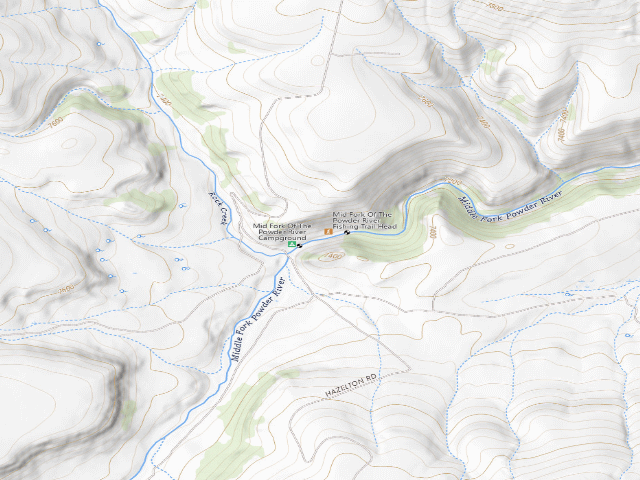
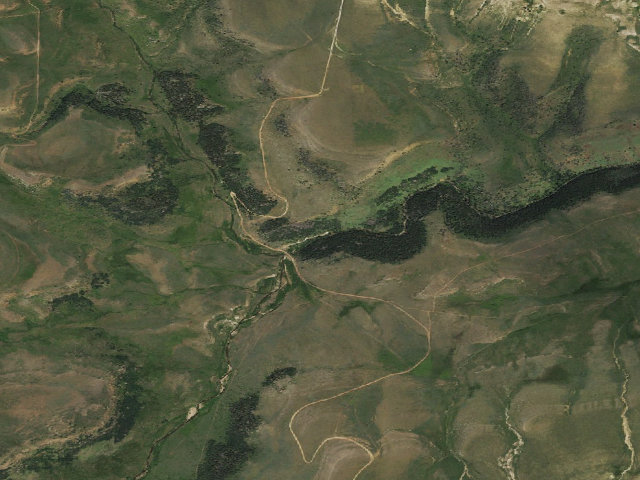
Drive-up · Bureau of Land Management · WY · 43.57728, -107.14010
Ask an AI about this campsiteOpens Grok already loaded with this site. It reads the same records this page is built from, and links whatever it tells you.
Bureau of Land Management lists this site. On most of their ground you can camp away from developed sites pretty much anywhere — so treat this as a known-good spot, not the only one allowed. The unit sets stay limits and how far off road and water you must be. What changes is conditions — roads, gates, closures, fire rules. Check those with the unit before you commit to the drive.
The site — Middle Fork of the Powder River Campground
Access
Drive-up
Land
Bureau of Land Management
Elevation
7,235 ft
State
WY
Coordinates
43.57728, -107.14010
Cost
Free
Nearby & resupply — around Middle Fork of the Powder River Campground · Bureau of Land Management · WY(OpenStreetMap)
Resupply lookup unavailable — try the map links below.
EV charging — from Middle Fork of the Powder River Campground · Bureau of Land Management · WY— nearest public DC fast & Level 2 (US DOE station data)
Nearest public DC fast charger53.9 mi straight-line W — Wind River Canyon Whitewater & Fly Fishing, Thermopolis, WY · EV Connect · CCS · 2 fast ports listed · listed open, last confirmed by AFDC 2026-09-16 · hours: 24 hours daily · directions
Public DC fast stations within reachnone within 25 mi · none within 50 · 12 within 100 · 20 within 150
Nearest public Level 2 (J1772)50.1 mi — Washakie Museum, Worland - Tesla Destination · Tesla Destination · J1772, NACS (Tesla) · 1 Level 2 port listed · listed open, last confirmed by AFDC 2026-08-27 · hours: 24 hours daily. Open to all vehicles.
Pricing at the fast chargernot listed
Power (kW)not listed by AFDC — “DC fast” spans roughly 24 to 350 kW, so ask the network.
Read this honestlyStraight-line miles, like every distance on this site. Roads run longer than this, and you have to get back. We know where a charger is listed. We don’t know if it works today, how fast it is, or the road miles. Check the network before you commit. Snapshot 2026-09-16 · AFDC record 462372 · US DOE Alternative Fuels Data Center
Nearby restrooms — around Middle Fork of the Powder River Campground · Bureau of Land Management · WY— pit toilets, restrooms & rest areas (government data)
The nearest automatic snow station is Middle Powder at 7,760 ft, about 4 miles away. It sits about 525 ft higher than this camp, so treat it as a guide rather than a reading for this spot. We do not repeat a depth here, because any number we stored would be stale by the time you read it — the station publishes today's.
How we know this — Middle Fork of the Powder River Campground
Stay limit
14 nights (14-day limit)
Source
Bureau of Land Management recreation data
Confidence
Likely — The record is good enough to put a pin on, but thin in places. Treat the details as a starting point, not gospel.
How it was placed
FREE BLM campground on a blue-ribbon trout stream in the Big Horns. FEE, BLM's own Fees section: "No Fees." STAY LIMIT: BLM's own field, "14 Days", and the description says "Use of the area is free with a 14-day limit on camping (as on all public lands)." SITES: "this remote and picturesque campground features five camping sites with fire rings, restroom and drinking water." SEASONAL: "located at an elevation of 7,500 feet, is open from May through September." ROAD -- READ THIS BEFORE YOU GO: BLM's own directions are "From Ten Sleep ... 20 miles south on State Highway 434 to Big Trails. From there turn left on the graveled Dry Farm Road and drive about 13 miles to the Hazelton Road. Turn right and drive about 17 miles on two-track dirt road to the campground." Seventeen miles of two-track. BLM itself adds: "For other routes to the campground, check with the BLM offices in Worland, Buffalo, or Casper." Coordinate is BLM's own published facility point from gis.blm.gov/arcgis/rest/services/recreation/BLM_Natl_Recreation_Sites_Facilities (read 2026-08-17), cross-checked against the Geographic Coordinates printed on the site's own blm.gov page. It is a facility pin, not a surveyed campsite. SOURCE: https://www.blm.gov/visit/search-details/14723/1
--- NIGHT-SHIFT REVIEW 2026-08-19 (nightshift-verified) -- APPROVED.
Re-fetched https://www.blm.gov/visit/search-details/14723/1 this fire. The page is live and still titled "Middle Fork of the Powder River Campground | Wyoming". The Fees section still reads "No Fees.", the Stay Limit field still reads "14 Days", and the description still says "five camping sites with fire rings, restroom and drinking water. Use of the area is free with a 14-day limit on camping (as on all public lands)... open from May through September." BLM's printed Geographic Coordinates are still 43.577279, -107.140095, matching this row to the digit. Cross-checked the same day against gis.blm.gov/arcgis/rest/services/recreation/BLM_Natl_Recreation_Sites_Facilities (layer 8, BLM Natl RIDB Facilities Camping). Checked and cleared as not a duplicate: the two nearest published rows are WGFD Ellis WHMA pins 2.8-3.0 km away, on different land under a different manager, one of which shares part of this name. Different sites. Nothing this row claims has changed since it was written.
EV chargers
US DOE Alternative Fuels Data Center station locator, snapshot 2026-09-16. Straight-line miles to the nearest public, open, unrestricted station; restricted and planned units are shown but never counted.
Field check
On the agency's books. The land manager inventoried this site, so its existence is not in question — current conditions are. Nobody from here has camped it recently.
What we don’t know about Middle Fork of the Powder River Campground
A land record can put you within a few metres of a spot. It cannot tell you any of this — so check it yourself, and treat anything below as the open question it is.
Road surface & last-mile access
How many rigs actually fit
Cell coverage by carrier
Seasonal & winter access
Current fire restrictions
Whether any water here is drinkable
Shade & wind exposure
Noise and who else shows up
Whether a listed EV charger works today, or the road miles to it
Before you go — Middle Fork of the Powder River Campground
Been here? Tell us what changed. This page is built from public records, so the fastest way it gets better is somebody who has actually pulled in. Road washed out, site gone, gate locked, or it is exactly as described — all of it useful. Send a report →