Ask an AI about this campsiteOpens Grok already loaded with this site. It reads the same records this page is built from, and links whatever it tells you.
The land manager lists this site. Someone from the agency inventoried it, so it is a real camp — not a spot we guessed at. What changes is conditions — roads, gates, closures, fire rules. Check those with the unit before you commit to the drive.
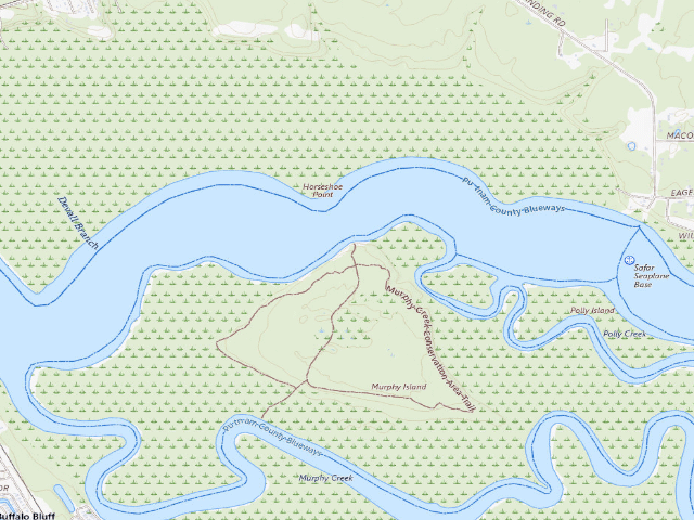
Murphy Creek Conservation Area group campsite is a designated primitive campsite on St. Johns River Water Management District land in Putnam County, and it costs nothing. That is the District's own word for it: "Campsites are available to individuals or groups and are free of charge." The legal basis is Rule 40C-9.300 of the Florida Administrative Code, which authorises primitive camping on District Lands in designated sites and sets the only hard limit - seven continuous days, and 30 days a year on any one property. You must book it first, and you must do it at least 48 hours ahead - before 1 p.m. two days before you arrive - through the District's online reservation system. There is no walk-up. Drive-in sites also need a vehicle permit on the dashboard of every car, with plate numbers given when you book, and you are responsible for shutting and locking the gate behind you. Now the honest part. Tents only. RVs, trailers and truck campers are prohibited outright, and so is dispersed camping - you camp on the numbered site or not at all. Assume no drinking water: the District mentions only a non-potable pitcher pump at some drive-in sites, and this campsite layer records no water at all, so carry every drop. Pack your rubbish out, there are no bins. Fires go in the existing ring and nowhere else, you may collect deadfall off the ground but may not cut a standing tree dead or alive, and local burn bans override all of that. The one thing most likely to spoil your trip is a prescribed burn or a timber operation - the District says plainly that land management takes precedence over camping - so check its recreation announcements page before you commit to the drive. The nearest town is Palatka, roughly 3.7 miles away in a straight line - the drive is longer, and on some of these approaches a good deal longer. Questions go to the Bureau of Land Resources on (386) 329-4401.
The site — Murphy Creek Conservation Area group campsite
Access
Drive-up
Land
public land
Elevation
12 ft
State
FL
Coordinates
29.59476, -81.65529
Cost
Free
Nearby & resupply — around Murphy Creek Conservation Area group campsite · public land · FL(OpenStreetMap)
Nearest townPalatka · ~3.7 mi
Drinking waternone within 10 mi
FuelCitgo · ~2.7 mi
Propane / LPGnone within 31 mi
Dump station~17.0 mi
GroceriesWinn-Dixie · ~3.3 mi
PharmacyCVS Pharmacy · ~25.2 mi
Hospital / clinicHastings Medical Clinic · ~12.1 mi
HardwareHarbor Freight Tools · ~4.0 mi
EV charging — from Murphy Creek Conservation Area group campsite · public land · FL— nearest public DC fast & Level 2 (US DOE station data)
Nearest public DC fast charger4.4 mi straight-line N — Krystals, Palatka, FL (at a restaurant) · FPLEV · CCS, NACS (Tesla) · 4 fast ports listed · listed open, last confirmed by AFDC 2025-09-12 · hours: 24 hours daily · directions
Public DC fast stations within reach2 within 25 mi · 88 within 50 · 302 within 100 · 502 within 150
Nearest public Level 2 (J1772)4.0 mi — Quality Inn & Suites Palatka Riverfront - Tesla Destination · Tesla Destination · J1772, NACS (Tesla) · 2 Level 2 ports listed · listed open, last confirmed by AFDC 2026-08-27 · hours: 24 hours daily. Open to all vehicles.
Also listed, not counted aboveLevel 2, restricted access — Quality Inn - Palatka, Palatka, 4.1 mi · J1772 · hours: 24 hours daily; hotel guests only
Pricing at the fast charger$0.30 per kWh (as listed by AFDC)
Power (kW)not listed by AFDC — “DC fast” spans roughly 24 to 350 kW, so ask the network.
Read this honestlyStraight-line miles, like every distance on this site. Roads run longer than this, and you have to get back. We know where a charger is listed. We don’t know if it works today, how fast it is, or the road miles. Check the network before you commit. Snapshot 2026-09-16 · AFDC record 420588 · US DOE Alternative Fuels Data Center
Nearby restrooms — around Murphy Creek Conservation Area group campsite · public land · FL— pit toilets, restrooms & rest areas (government data)
How we know this — Murphy Creek Conservation Area group campsite
Fire rules
Always use designated campfire rings for fires and obey local burn bans.
Stay limit
7 nights (no greater than seven continuous days)
Permit
Campsite reservations may be made up to 90 days in advance and must be made at least 48 hours in advance (before 1 p.m. two days prior to the desired arrival date) through the online reservation system. Campsites are available to individuals or groups and are free of charge. Vehicle permits must be displayed on the dashboards of all vehicles in the campsite.
Area rules
Only primitive tent camping is allowed on District lands and only at designated locations. Dispersed camping is prohibited. RVs, trailers, truck or van campers are prohibited. Firewood may be collected from the ground. Do not cut any standing trees, dead or alive. Carry out all trash and pet waste with you when you leave. There are no trash receptacles onsite. Land management activities, such as prescribed burns, project construction and timber thinning operations, take precedence over camping and recreational use of our properties.
Source
public land records
Confidence
Researched — The record is detailed and internally consistent, and the coordinates land where the managing agency says this site is.
How it was placed
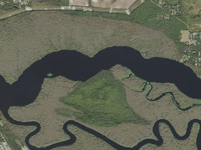
FREE by the agency's own published statement plus binding rule. SJRWMD camping page (https://www.sjrwmd.com/lands/recreation/camping/), downloaded raw this fire and string-matched locally: "Campsites are available to individuals or groups and are free of charge" and "Camping on District lands is governed by Chapter 40C-9.300, Florida Administrative Code." The rule text itself was downloaded this fire from flrules.org (https://www.flrules.org/gateway/ruleNo.asp?id=40C-9.300): 40C-9.300 allows primitive camping on District Lands "only in designated camping sites" and creates no fee. STAY LIMIT: "no greater than seven continuous days or 30 total days per year per District Land" (40C-9.300(5)); the camping page repeats it as "a maximum of 7 consecutive days and annual maximum of 30 days on any property." RESERVATION: required and free. "Campsite reservations may be made up to 90 days in advance and must be made at least 48 hours in advance (before 1 p.m. two days prior to the desired arrival date)." The District does not say on the camping page whether THIS particular site is drive-in or hike-in, so camp_type is left NULL rather than guessed - confirm when you book. TENTS ONLY: "Only primitive tent camping is allowed. RVs, trailers, truck or van campers are prohibited." "Dispersed camping is prohibited" - hence dispersed=0. NOT A PARTNERSHIP PROPERTY: checked against SJRWMD's own partnership list (https://www.sjrwmd.com/lands/recreation/partnership/) and the partner-managed block on the camping page. Caravelle Ranch WMA, Lake Norris CA, Ralph E. Simmons/Tiger Bay/Jennings State Forests and Lake George FOREST are run by FWC, the Lake County Water Authority and the Florida Forest Service and were all excluded from this ingest; Lake George CONSERVATION AREA is a different, District-run property and was kept. SEASONAL/FIRE: no seasonal closure is published for District camping, but the page warns that "land management activities, such as prescribed burns, project construction and timber thinning operations, take precedence over camping" and sites can shut at short notice - check the District's recreation announcements page before you drive. Fires only in designated campfire rings, and "obey local burn bans"; firewood may be collected from the ground, no cutting of standing trees dead or alive. COORDINATE: the District's OWN mapped campsite point, pulled live this fire from services.arcgis.com/s8wtJX9suxFen6TA/.../Management_Area_Campsite/FeatureServer/0 ("Mapped public recreational campsites located on District lands"), outSR=4326. Layer attributes: management area "Murphy Creek Conservation Area", designation "Group - For 7 or more people per tent site", county Putnam. WATER: the campsite layer has no water column, so none is claimed here. The camping page says only that SOME drive-in sites have "a non-potable water pitcher pump." Assume none, carry your own, and do not treat any surface water here as drinkable. NEAREST TOWN: Palatka, about 3.7 mi in a straight line (US Census Bureau 2024 Gazetteer place internal point). STRAIGHT-LINE, NOT DRIVING DISTANCE. Ingest 2026-08-16 10:52:36 (fire 800, FL thin-state fill). RE-VERIFIED 2026-08-18 (night shift, FL backlog review). Re-fetched LIVE this fire: the District's own campsite layer https://services.arcgis.com/s8wtJX9suxFen6TA/arcgis/rest/services/Management_Area_Campsite/FeatureServer/0 (69 features, no transfer limit hit) and the SJRWMD camping page https://www.sjrwmd.com/lands/recreation/camping/ . The row's OBJECTID is still present in the layer and its coordinate still agrees to within 25 m. The camping page still carries the exact sentences this row was built on -- "Campsites are available to individuals or groups and are free of charge", "Only primitive tent camping is allowed", "Dispersed camping is prohibited", "Camping is limited to a maximum of 7 consecutive days and annual maximum of 30 days on any property", and the reference to Chapter 40C-9.300, F.A.C. The property is NOT on the camping page's live partnership list (Caravelle Ranch WMA, Faver-Dykes SP, Herky Huffman/Bull Creek WMA, Lake Norris CA, Princess Place Preserve, Ralph E. Simmons Memorial SF, St. Sebastian River Preserve SP, Triple N Ranch WMA). No coordinate duplicate against any published FL camp -- checked on COORDINATES, not name, against all 43 published FL rows at a 250 m threshold. PROPERTY PAGE CORROBORATES AND ADDS A HARD CONSTRAINT: https://www.sjrwmd.com/lands/recreation/murphy-creek/ (fetched this fire) says "Primitive camping is allowed only at designated sites on the island; no camping on the inland portion" and "Murphy Island contains a boat landing, more than six miles of hiking trails and a primitive campsite." The page describes exactly one campsite and the layer maps exactly one point for this conservation area, so the two agree. The page also says the property "is accessible by water; however, there are no launches" on it -- treat this as boat access. camp_type is left as the ingest set it rather than guessed. DECISION: status pending -> approved.
EV chargers
US DOE Alternative Fuels Data Center station locator, snapshot 2026-09-16. Straight-line miles to the nearest public, open, unrestricted station; restricted and planned units are shown but never counted.
Field check
On the agency's books. The land manager inventoried this site, so its existence is not in question — current conditions are. Nobody from here has camped it recently.
What we don’t know about Murphy Creek Conservation Area group campsite
A land record can put you within a few meters of a spot. It cannot tell you any of this — so check it yourself, and treat anything below as the open question it is.
Road surface & last-mile access
How many rigs actually fit
Cell coverage by carrier
Seasonal & winter access
Current fire restrictions
Whether any water here is drinkable
Shade & wind exposure
Noise and who else shows up
Whether a listed EV charger works today, or the road miles to it
Before you go — Murphy Creek Conservation Area group campsite
Been here? Tell us what changed. This page is built from public records, so the fastest way it gets better is somebody who has actually pulled in. Road washed out, site gone, gate locked, or it is exactly as described — all of it useful. Send a report →