Oswegatchie River Campsite 41 A (Five Ponds Wilderness)
FREE primitive camping in Five Ponds Wilderness, part of New York's Adirondack Forest Preserve, in the western Adirondacks northwest of Stillwater Reservoir and southwest of Cranberry Lake -- St. Lawrence, Herkimer, Lewis and Hamilton Counties (DEC Region 6), reached from Wanakena / Cranberry Lake off NY Route 3 and from Inlet / Stillwater off the south. DEC-designated primitive tent site ('Oswegatchie River Campsite 41 A'). New York provides these designated primitive tent sites at NO CHARGE (the DEC unit page lists the fee as 'Free'); sites are first-come and cannot be reserved. This is a WATER-ACCESS (paddle-in) site -- reach it by canoe or kayak (the Oswegatchie River canoe route and the Cranberry Lake / Dead Creek Flow backwaters), sometimes with a short carry; a few of these sites also have foot access, so confirm the route on the DEC unit page before you go. Camping for more than 3 nights in one spot requires a FREE New York State Forest Ranger permit; a free New York State Forest Ranger permit is required for any stay of more than three nights at one spot, or for a group of ten or more (the DEC page sets no stricter local threshold, so the statewide rule governs). Arrange any permit in advance through the DEC Region 6 Potsdam Office at (315) 265-3090. Camp only at the marked site (look for the yellow 'Camp Here' disc), keep camp 150 feet from water and trails unless the site is otherwise designated, and follow the posted wilderness rules. These are primitive sites -- typically only a fire ring, no hookups and no potable water; pack out all trash and follow Leave No Trace and the DEC fire rules. Both wilderness areas are open year-round, but winter access is on ski/snowshoe -- confirm current conditions, and this site's access, with the DEC unit page (dec.ny.gov/places/five-ponds-and-pepperbox-wildernesses) or the Region 6 Potsdam office before you go; we have not visited.
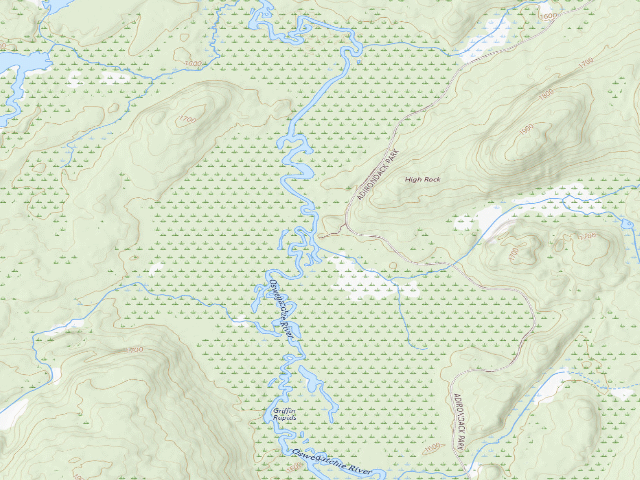
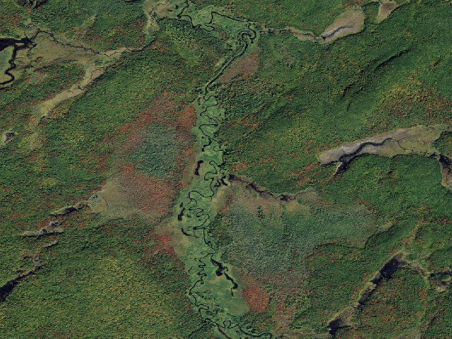
Everything you need — measured from Oswegatchie River Campsite 41 A (Five Ponds Wilderness) · New York State Dept. of Environmental Conservation · NY
- GGrocery3 mi
- @Mail3 mi
- FFuel9 mi
- OOutfitter15 mi
- +Urgent care20 mi
- LLaundry24 mi
- WWater25 mi
- HHardware25 mi
- MMechanic25 mi
- RxPharmacy27 mi
- DDump28 mi
- ShShower28 mi
- EVEV fast charger34 mi
The read: water is a real 25-mi drive, fuel & food sit about 3 mi out, the nearest EV fast charger is a 34-mi run (and back).
Not within 60 mi: Propane. Plan those before you head up.
One dot per need — the nearest of each kind, straight-line from camp. Places from OpenStreetMap (© OpenStreetMap contributors); the EV fast charger from the US DOE station locator. Open in Google Maps ↗
The site — Oswegatchie River Campsite 41 A (Five Ponds Wilderness)
Nearby & resupply — around Oswegatchie River Campsite 41 A (Five Ponds Wilderness) · New York State Dept. of Environmental Conservation · NY (OpenStreetMap)
- Water featureOswegatchie River (river) · nearby
- Nearest townWanakena · ~3.5 mi
- Drinking waternone within 10 mi
- FuelU-B's Mercantile · ~9.3 mi
- Propane / LPGnone within 31 mi
- Dump station~28.2 mi
- GroceriesOtto's Abode · ~3.4 mi
- PharmacyKinney Drugs · ~26.6 mi
- Hospital / clinicClifton Fine Hospital · ~6.5 mi
- HardwareAce Hardware - Old Forge Department Store · ~26.6 mi
EV charging — from Oswegatchie River Campsite 41 A (Five Ponds Wilderness) · New York State Dept. of Environmental Conservation · NY — nearest public DC fast & Level 2 (US DOE station data)
- Nearest public DC fast charger33.9 mi straight-line W — Aldi Carthage TUL 27, West Carthage, NY (at a public site) · RED_E · CCS, NACS (Tesla) · 8 fast ports listed · listed open, last confirmed by AFDC 2026-09-16 · hours: not listed · directions
- Public DC fast stations within reachnone within 25 mi · 16 within 50 · 176 within 100 · 430 within 150
- Nearest listing CHAdeMO39.5 mi — EVolve NY Potsdam, Potsdam
- Nearest public Level 2 (J1772)3.4 mi — Otto's Abode, Wanakena, NY (at a parking lot) · Non-Networked · J1772 · 1 Level 2 port listed · listed open, last confirmed by AFDC 2024-03-14 · hours: 24 hours daily
- Pricing at the fast chargernot listed
- Power (kW)not listed by AFDC — “DC fast” spans roughly 24 to 350 kW, so ask the network.
- Read this honestlyStraight-line miles, like every distance on this site. Roads run longer than this, and you have to get back. We know where a charger is listed. We don’t know if it works today, how fast it is, or the road miles. Check the network before you commit.
Snapshot 2026-09-16 · AFDC record 434178 · US DOE Alternative Fuels Data Center
Nearby restrooms — around Oswegatchie River Campsite 41 A (Five Ponds Wilderness) · New York State Dept. of Environmental Conservation · NY — pit toilets, restrooms & rest areas (government data)
- No mapped restroom within 30 miles — plan to pack it out.
Open Oswegatchie River Campsite 41 A (Five Ponds Wilderness) elsewhere
Other camps near Oswegatchie River Campsite 41 A (Five Ponds Wilderness)
If this one is full, gated or washed out.
- Oswegatchie River Campsite 41 B (Five Ponds Wilderness)~0.0 mi
- Oswegatchie River Campsite 42 (Five Ponds Wilderness)~0.2 mi
- Oswegatchie River Campsite 40 (Five Ponds Wilderness)~0.4 mi
- Oswegatchie River Campsite 43 (Five Ponds Wilderness)~0.4 mi
How we know this — Oswegatchie River Campsite 41 A (Five Ponds Wilderness)
What we don’t know about Oswegatchie River Campsite 41 A (Five Ponds Wilderness)
A land record can put you within a few meters of a spot. It cannot tell you any of this — so check it yourself, and treat anything below as the open question it is.
- Road surface & last-mile access
- How many rigs actually fit
- Cell coverage by carrier
- Current fire restrictions
- Whether any water here is drinkable
- Shade & wind exposure
- Noise and who else shows up
- Whether a listed EV charger works today, or the road miles to it