Agency-listedLDWFFee
Pointe-aux-Chenes WMA camping area -- Hwy 665
Drive-up · Louisiana Dept. of Wildlife & Fisheries · LA · 29.45939, -90.48218
Ask an AI about this campsiteOpens Grok already loaded with this site. It reads the same records this page is built from, and links whatever it tells you.
Ask about this camp →Louisiana Dept. of Wildlife & Fisheries lists this site. Someone from the agency inventoried it, so it is a real camp — not a spot we guessed at. What changes is conditions — roads, gates, closures, fire rules. Check those with the unit before you commit to the drive.
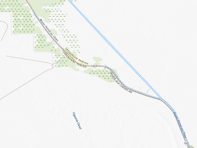
USGS topo — contours & terrain
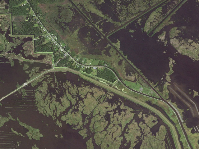
Aerial — USGS / NAIP
Weather outlook — at Pointe-aux-Chenes WMA camping area -- Hwy 665
Loading the latest forecast…
Live NWS area forecast (~2.5 km grid, not elevation-corrected). Camp sits at -2 ft.
Fire & smoke — around Pointe-aux-Chenes WMA camping area -- Hwy 665NIFC · AirNow
Checking active fires & air quality…
Active wildfires from NIFC (within ~50 mi); air quality from AirNow. Always confirm current fire restrictions with the managing office before you go.
Everything you need — measured from Pointe-aux-Chenes WMA camping area -- Hwy 665 · Louisiana Dept. of Wildlife & Fisheries · LA
▲ your camp. Rings are 15, 30 and 60 straight-line miles; bearings are approximate and roads run longer.
Nearest of each
- @Mail5 mi
- FFuel5 mi
- GGrocery5 mi
- HHardware10 mi
- LLaundry10 mi
- +Urgent care10 mi
- MMechanic12 mi
- RxPharmacy15 mi
- DDump35 mi
- ShShower35 mi
- WWater38 mi
- OOutfitter39 mi
- AAir-up43 mi
≤30 mi30–4545+water
The read: water is a real 38-mi drive, fuel & food sit about 5 mi out.
Not within 60 mi: Propane. Plan those before you head up.
One dot per need — the nearest of each kind, straight-line from camp. Places from OpenStreetMap (© OpenStreetMap contributors); the EV fast charger from the US DOE station locator. Open in Google Maps ↗
The site — Pointe-aux-Chenes WMA camping area -- Hwy 665
Access
Drive-up
Land
Louisiana Dept. of Wildlife & Fisheries
Elevation
-2 ft
State
LA
Coordinates
29.45939, -90.48218
Cost
Fee · priced on the land manager's own page (wlf.louisiana.gov, read 2026-09-29)
Nearby & resupply — around Pointe-aux-Chenes WMA camping area -- Hwy 665 · Louisiana Dept. of Wildlife & Fisheries · LA (OpenStreetMap)
- Drinking waternone within 10 mi
- FuelFuel · ~4.7 mi
- Propane / LPGnone within 31 mi
- GroceriesMontegut Mini Mart · ~4.7 mi
- PharmacyWalgreens · ~15.0 mi
- Hospital / clinicHospital · ~10.4 mi
- HardwareRenovations Hardware · ~10.2 mi
Nearby restrooms — around Pointe-aux-Chenes WMA camping area -- Hwy 665 · Louisiana Dept. of Wildlife & Fisheries · LA — pit toilets, restrooms & rest areas (government data)
- No mapped restroom within 30 miles — plan to pack it out.
Coming out here — Pointe-aux-Chenes WMA camping area -- Hwy 665 · Louisiana Dept. of Wildlife & Fisheries · LA
- No surface water within about a mile and a half in our records — which is not proof there is none, only that we found none. Plan to carry washing water as well as drinking water.
- Power: Dave carries his own — batteries or solar. A generator will run your rig and it is also the thing everybody camped near you can hear.
- Getting online: Dave recommends Starlink. He has had it since SpaceX introduced it, used it for four years living on the road, and it delivers as promised — several hundred nights out, and he can count on one hand the places he could not connect. The cable on his unit runs 150 feet, which is usually all it takes to find enough sky. Starlink → Referral link — Starlink pays Dave $100 in cash if you sign up through it, and that money funds this site and the next trip. It costs you nothing and does not change the recommendation.
Open Pointe-aux-Chenes WMA camping area -- Hwy 665 elsewhere
How we know this — Pointe-aux-Chenes WMA camping area -- Hwy 665
Source
public land records
Confidence
Likely — The record is good enough to put a pin on, but thin in places. Treat the details as a starting point, not gospel.
How it was placed
Designated camping area on Pointe-aux-Chenes WMA, Louisiana Department of Wildlife and Fisheries. LDWF's own page (https://www.wlf.louisiana.gov/page/pointeauxchenes, read 2026-09-28) states: "There is a tent-only campground along Hwy 665, north of the headquarters area." TENT ONLY. The 2026-2027 regulations (pamphlet p.65) list a self-clearing permit station at the 'WMA Campground/Pirogue Launch'. About 15 miles southeast of Houma; LDWF notes interior access is 'typically limited to boats', but this campground is on the highway. Symbol sits on Hwy 665 next to the headquarters symbol, matching LDWF's description. LDWF WMA CAMPING RULE (2026-2027 Louisiana Hunting & WMA Regulations, https://www.wlf.louisiana.gov/assets/Resources/Publications/Regulations/26LAHD.pdf pamphlet p.52, re-read 2026-09-28): 'Camping on WMAs, including trailers, houseboats, vessels, recreational vehicles and tents, is allowed only in designated areas and for a period not to exceed 16 ... consecutive days, regardless of whether the camp is attended or unattended. At the end of the 16-day period camps must be removed from the area for at least 48 hours.' (The elided words are the Bodcau WMA exception, which does not apply here.) First-come, first-serve unless otherwise specified. Where no public restroom exists, tent campers 'shall have and shall utilize portable waste disposal units and shall remove all human waste from the WMA upon leaving'; campers in a camper/trailer must use an attached disposal system. Burning of trash prohibited; glass containers prohibited on campgrounds; only hunting dogs allowed in WMA camping areas; firearms may not be kept loaded or discharged in a camping area. PERMITS (https://www.wlf.louisiana.gov/page/wmarefugeconservation-area-licenses-and-permits, re-read 2026-09-28): a free Self-Clearing Permit (check-in/check-out) is required for ALL activities on a WMA; a WMA Access Permit is required of users 18+ -- 'Annual permit: $20 for both residents and nonresidents; 5-day permit: $5' -- included with the Sportsman's Paradise, Senior Hunting/Fishing and Lifetime licences. SEPARATELY, 'Camp in a LDWF-operated campground' requires a WMA Camping Permit, '$7/night for up to five adults who are camping together'. LDWF publishes no list of which camping areas count as 'LDWF-operated', so this row is recorded as free-camping-with-access-permit; verify with the region office before advertising it as free. COORDINATE PROVENANCE -- READ BEFORE PUBLISHING: LDWF publishes no GIS layer of camp points (re-checked 2026-09-28 across its whole ArcGIS org and its Outdoor Explorer app). This point was DIGITISED FROM LDWF'S OWN WMA MAP: the map PDF (https://www.wlf.louisiana.gov/assets/Conservation/WMAs_Refuges_Conservation_Areas/Files/Pointe_aux_Chenes.pdf) was registered to LDWF's own WMA boundary polygon (layer LOE_LDWF_WMAs_09262025_WGS84_WMAS) and the tent symbol's centre was converted to lat/lon. Map scale ~8.79 m/pixel at 200 dpi; 96% of LDWF's boundary polygon falls within 3 px of the map's red WMA line. ACCURACY: the same method on LDWF's Bodcau WMA map, checked against the Corps of Engineers' own GPS points for the same camps, was off by 20-614 m (median ~216 m, n=12) -- treat this pin as 'within a few hundred metres', NOT as a surveyed spot, and confirm on the ground or against the map before publishing a precise location. The symbol was checked by eye; it is not an OpenStreetMap feature (no OSM campsite lies within 2 km). No drinking water is stated for this site by LDWF. Treat all natural water as non-potable. This is an active hunting area. Check LDWF season dates and area closures before you go and wear hunter orange in season. Nearest town: Montegut ~4.6 mi -- STRAIGHT-LINE distance to the nearest OpenStreetMap place=city/town/village (snapshot 2026-08-15), NOT a driving distance. Ingest 2026-09-28. | nightshift-verified 2026-09-29 (fire 2820): RE-CHECKED. https://www.wlf.louisiana.gov/page/pointeauxchenes re-fetched (HTTP 200) and still says "There is a tent-only campground along Hwy 665, north of the headquarters area.". The WMA map PDF was re-fetched and is byte-identical (sha256) to the 2026-09-28 copy; on it the pin sits on a camping symbol (checked by eye against the map legend). 26LAHD.pdf was re-fetched, is byte-identical, and the p.52 camping rule is unchanged. Live LDWF polygon query (LOE_LDWF_WMAs_09262025_WGS84_WMAS): point is INSIDE 'Pointe aux Chenes WMA'. Nearest published/approved camp 78.8 km ('Maurepas Swamp WMA tent camping area 2'); none within 2 km, so not a duplicate. FEE CORRECTED (was fee=0 / free-camping): the 2026-09-28 note left open whether the $7 WMA Camping Permit applies here, because the regulations say 'LDWF-operated campground'. Two other LDWF pages read today settle it the plain way: the fee list says the permit is 'Required to camp on a WMA (where camping is permitted)', and the public-lands page (https://www.wlf.louisiana.gov/page/visiting-ldwfs-public-lands-nonconsumptive) says 'Are You Camping? Purchase a WMA Camping Permit' with no qualifier. With an access permit also required, this is not free camping under the site rule either; recorded as fee=1, tag paid-camping. The 26LAHD entry says 'All nighttime activities prohibited, EXCEPT that hunters may enter ... or as otherwise specified'. LDWF specifies this campground itself (page, plus the 'WMA Campground/Pirogue Launch' permit station), so the rule is not read as a ban here. On the map the symbol sits just WEST-SOUTHWEST of the HQ symbol on Hwy 665, but the page says 'north of the headquarters area'. The pin follows the map; expect it within a few hundred metres. DECISION: APPROVED -- agency page, agency map and agency regulations agree today. Coordinate is still map-digitised: within a few hundred metres, not a surveyed spot. | Fee 2026-09-29: $7 per night WMA Camping Permit per camping party of up to five adults (17 and under exempt), on top of the WMA Access Permit ($20 a year or $5 for five days, included with some LDWF licences). Source: https://www.wlf.louisiana.gov/page/license-and-permit-fee-list (LDWF fee list, footnote to the WMA Camping Permit: 'Required to camp on a WMA (where camping is permitted)'; figure verified on that page).
Field check
On the agency's books. The land manager inventoried this site, so its existence is not in question — current conditions are. Nobody from here has camped it recently.
What we don’t know about Pointe-aux-Chenes WMA camping area -- Hwy 665
A land record can put you within a few meters of a spot. It cannot tell you any of this — so check it yourself, and treat anything below as the open question it is.
- Road surface & last-mile access
- How many rigs actually fit
- Cell coverage by carrier
- Seasonal & winter access
- Current fire restrictions
- Whether any water here is drinkable
- Shade & wind exposure
- Noise and who else shows up
- Whether a listed EV charger works today, or the road miles to it
Before you go — Pointe-aux-Chenes WMA camping area -- Hwy 665
Water on public land →Dumping grey & black →Fire rules & restrictions →Leave no trace →All field notes →