Drive-up · North Dakota Game & Fish · ND · 46.67785, -100.75562
Ask an AI about this campsiteOpens Grok already loaded with this site. It reads the same records this page is built from, and links whatever it tells you.
North Dakota Game & Fish lists this site. Someone from the agency inventoried it, so it is a real camp — not a spot we guessed at. What changes is conditions — roads, gates, closures, fire rules. Check those with the unit before you commit to the drive.
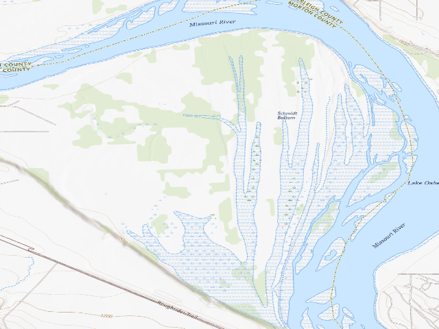
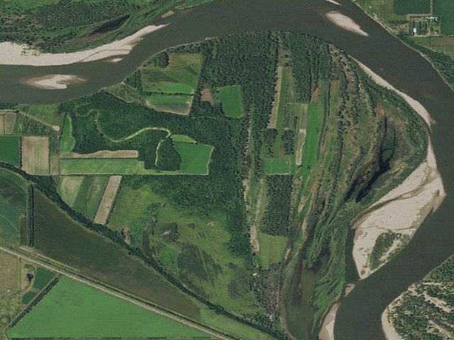
Schmidt Bottoms Wildlife Management Area is 1,318 acres of state wildlife land in Morton County, managed by the North Dakota Game and Fish Department, and you may camp on it free. That is not a rumour off a listing site -- it is how the state rule works. North Dakota Administrative Code 30-04-02-01 opens every WMA to 'public hunting, fishing, and trapping, or other compatible public use', and 30-04-02-11 sets the only real limit: 'camping for longer than ten consecutive days on any wildlife management area is prohibited'. There is no camping fee, and unlike South Dakota and Oklahoma, North Dakota does NOT make you buy a license or a conservation pass just to be on the land. Game and Fish says so itself on its WMA regulations page: 'Most WMAs are ideal for nature study, hiking and primitive camping.' Now the honest part. This is primitive dispersed camping on a wildlife area, not a campground. Assume NO toilets, NO drinking water, NO tables, NO fire rings and no marked sites unless you happen to find them -- bring all your own water. You may gather downed wood for a campfire, but you may not mow or cut vegetation to clear a campsite, you may not leave a trailer or tent set up unless you are actually sleeping in it, and you may not dump holding tanks on the area. Vehicles must stay on the constructed roads, established trails and parking areas a passenger car would normally use -- do not drive out across the grass. Camping is also prohibited on any WMA where it is posted as such at the road entry, so READ THE SIGN at the entrance you use; the posted sign beats anything we can tell you here. These are working wildlife areas, so expect hunters in season and plan your visibility accordingly. The pin is a representative point inside the unit boundary, not a campsite -- you will need to find your own spot off an established access. Confirm current rules with ND Game and Fish at (701) 328-6300 before you go.
Nearby & resupply — around Schmidt Bottoms WMA (Morton County) · North Dakota Game & Fish · ND(OpenStreetMap)
Resupply lookup unavailable — try the map links below.
EV charging — from Schmidt Bottoms WMA (Morton County) · North Dakota Game & Fish · ND— nearest public DC fast & Level 2 (US DOE station data)
Nearest public DC fast charger6.8 mi straight-line N — AIRPORT BIS AIRPORT, Bismarck, ND · ChargePoint Network · CHAdeMO, CCS · 1 fast port listed · listed open, last confirmed by AFDC 2026-09-16 · hours: 24 hours daily · directions
Public DC fast stations within reach9 within 25 mi · 11 within 50 · 18 within 100 · 27 within 150
Nearest public Level 2 (J1772)10.2 mi — Lignite Energy Council, Bismarck, ND (at an office building) · Non-Networked · J1772 · 2 Level 2 ports listed · listed open, last confirmed by AFDC 2025-08-12 · hours: 8am-5pm M-F
Pricing at the fast chargernot listed
Power (kW)not listed by AFDC — “DC fast” spans roughly 24 to 350 kW, so ask the network.
Read this honestlyStraight-line miles, like every distance on this site. Roads run longer than this, and you have to get back. We know where a charger is listed. We don’t know if it works today, how fast it is, or the road miles. Check the network before you commit. Snapshot 2026-09-16 · AFDC record 193286 · US DOE Alternative Fuels Data Center
Nearby restrooms — around Schmidt Bottoms WMA (Morton County) · North Dakota Game & Fish · ND— pit toilets, restrooms & rest areas (government data)
How we know this — Schmidt Bottoms WMA (Morton County)
Fire rules
Gathering of downed wood for campfires is permitted.
Stay limit
10 nights (camping up to 10 consecutive days)
Area rules
Trailers, campers, motor homes, or tents may not be left on any wildlife management area unless used for daily lodging. Camping is prohibited on those wildlife or fish management areas where posted at public road entry points. Mowing of vegetation for campsites is prohibited on wildlife management areas.
Source
North Dakota Game & Fish (wildlife management areas)
Confidence
Researched — The record is detailed and internally consistent, and the coordinates land where the managing agency says this site is.
How it was placed
Free primitive camping authorised by BINDING RULE, not by a listing: NDAC 30-04-02-01 & -11 (ndlegis.gov/information/acdata/pdf/30-04-02.pdf) + gf.nd.gov/wma (WMA Regulations, last updated August 2026). Both sources were downloaded and read in full on 2026-08-16 (this fire), not inherited from an earlier fire's notes. 30-04-02-01 grants open public use with no licence/pass/entrance-fee precondition; 30-04-02-11 (amended eff. 2024-04-01) permits camping up to 10 consecutive days, bans leaving equipment set up when not in use, bans mowing for campsites, and creates NO camping fee -- every dollar figure in the chapter (50/100/250) is a noncriminal-offence penalty, see 30-04-02-19. gf.nd.gov/wma (last updated August 2026) states 'Most WMAs are ideal for nature study, hiking and primitive camping'; its camping-prohibited and Thursday-Monday-only WMA lists were downloaded raw and string-matched locally, never via a search summary. STAY LIMIT 10 consecutive days. SEASONAL: no seasonal closure is published for WMA camping, but access trails are unplowed and gumbo when wet. FIRE: campfires are allowed and downed wood may be gathered, subject to any county burn ban in force -- check before you light one. Boundary/acreage/county from the ND state ArcGIS Wildlife_Management_Areas layer (gis.dmr.nd.gov/dmrpublicservices/rest/services/OilGasPublicMapDataVectorTiles/Wildlife_Management_Areas/FeatureServer/0), re-pulled live this fire: 1318 ac, 1 parcel(s), largest parcel used. Coordinate: representative interior point (centroid), asserted point-in-polygon against the unit boundary, WGS84. NOT a surveyed campsite. WATER: not recorded -- there is no stated potable supply on these units and any surface water present must not be assumed drinkable. NEAREST TOWN: not determined this fire. Ingest 2026-08-16 08:46:47 (fire 790, ND thin-state fill).
--- NIGHT-SHIFT REVIEW 2026-08-18 (reviewer nightshift-verified) ---
Every source below was re-fetched and read IN FULL this fire; nothing inherited.
(1) NDAC ch. 30-04-02, https://www.ndlegis.gov/information/acdata/pdf/30-04-02.pdf -- 30-04-02-01 (all WMAs open for 'public hunting, fishing, and trapping, or other compatible public use', no licence/pass/entrance-fee precondition) and 30-04-02-11 Camping (>10 consecutive days prohibited; trailers/campers/tents may not be left unless used for daily lodging; mowing vegetation for campsites prohibited; CAMPING PROHIBITED WHERE POSTED AT PUBLIC ROAD ENTRY POINTS; $100 noncriminal-offence fee) both verified word-for-word against what this row already recorded -- they match. 30-04-02-19 confirms the 50/100/250 dollar figures are penalties, not camping fees. 30-04-02-08 confirms 'Gathering of downed wood for campfires is permitted.'
(2) https://gf.nd.gov/wma -- 'Wildlife Management Areas - Regulations (Last updated August 2026)'; still carries 'Most WMAs are ideal for nature study, hiking and primitive camping.' Its camping-prohibited list and its Tuesday/Wednesday-closed list were re-transcribed verbatim this fire.
(3) https://gf.nd.gov/wma-listing -- 'WMA Listing'. SOURCE NOT USED BY THE INGEST FIRE. It gives the agency's own per-unit county, acreage and directions, and it carries PER-UNIT camping notes that the regulations page's summary lists do not fully reproduce. 243 unit records parsed.
(4) ND DMR ArcGIS Wildlife_Management_Areas layer, https://gis.dmr.nd.gov/dmrpublicservices/rest/services/OilGasPublicMapDataVectorTiles/Wildlife_Management_Areas/FeatureServer/0 -- re-pulled live (374 parcel polygons, 236 distinct unit names).
UNIT: found in the live GIS layer as 1 parcel polygon(s), largest 1318 ac, parcel sum 1318 ac. AGENCY LISTING: 'Schmidt Bottoms', Morton County, 1318 ac. PER-UNIT CAMPING NOTE in the listing: none -- the listing states no camping restriction for this unit. COORDINATE: point-in-polygon against the live unit boundary = PASS -- the recorded lat/lon is inside the unit. DUPLICATE CHECK (by coordinate, never by name): no published or approved ND camp lies within 1.0 mi of this coordinate, and no published/approved ND camp point falls inside this unit's boundary. Not a duplicate. DECISION: APPROVED. The legal basis, the unit's existence, its boundary, its acreage and its coordinate all check out against the agency's own sources today, and no camping restriction applies that the public field_note does not already state. WATER: unchanged and still not asserted -- no potable supply is published for these units and no natural water here may be assumed drinkable.
EV chargers
US DOE Alternative Fuels Data Center station locator, snapshot 2026-09-16. Straight-line miles to the nearest public, open, unrestricted station; restricted and planned units are shown but never counted.
Field check
On the agency's books. The land manager inventoried this site, so its existence is not in question — current conditions are. Nobody from here has camped it recently.
What we don’t know about Schmidt Bottoms WMA (Morton County)
A land record can put you within a few metres of a spot. It cannot tell you any of this — so check it yourself, and treat anything below as the open question it is.
Road surface & last-mile access
How many rigs actually fit
Cell coverage by carrier
Seasonal & winter access
Current fire restrictions
Whether any water here is drinkable
Shade & wind exposure
Noise and who else shows up
Whether a listed EV charger works today, or the road miles to it
Before you go — Schmidt Bottoms WMA (Morton County)
Been here? Tell us what changed. This page is built from public records, so the fastest way it gets better is somebody who has actually pulled in. Road washed out, site gone, gate locked, or it is exactly as described — all of it useful. Send a report →