Ask an AI about this campsiteOpens Grok already loaded with this site. It reads the same records this page is built from, and links whatever it tells you.
The land manager lists this site. Someone from the agency inventoried it, so it is a real camp — not a spot we guessed at. What changes is conditions — roads, gates, closures, fire rules. Check those with the unit before you commit to the drive.
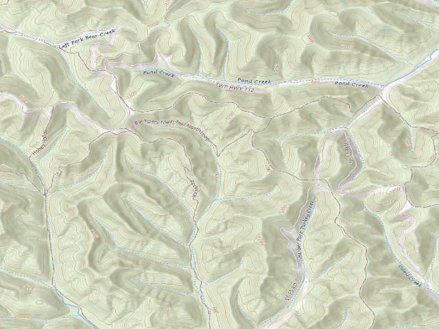
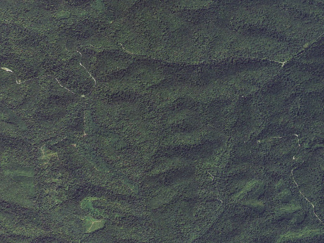
FREE hike-in camping. Camp 1 is the northernmost of the designated backpack campgrounds on the Shawnee State Forest Backpack Trail, in Scioto County west of Portsmouth -- it sits right on the main north loop. ODNR's own Shawnee Backpack Trail map states the rules: 'People may camp only in the designated campground areas shown on the map' and 'A self-registration permit (NO FEE) is required of all hikers' -- you fill it out before you start, at the trailhead parking (available 24 hours) or at forest headquarters on a weekday, drop it in the registration box and carry the stub. No reservations are taken and none are needed; ODNR confirmed in June 2025 that Shawnee stays first-come, first-served. Camping is capped at 14 days in any 30-day period. There is a latrine at each campground and nothing else. WATER: do not count on it -- the only supplies are caches near road crossings, filled from the City of Portsmouth, and ODNR warns they 'may not be serviced in winter'; carry your own and a filter. Shawnee is Ohio's largest state forest at 63,000+ acres, the 'Little Smokies', and it is a public hunting area, so wear blaze orange in season. ODNR specifically warns about venomous snakes here -- both copperheads and the endangered timber rattlesnake -- so watch where you put your hands and feet in rocky ground. The forest is open 6 a.m. to 11 p.m. to everyone but legal hunters and anglers. Do not confuse this with Shawnee STATE PARK's Turkey Creek Campground nearby, which charges. Confirm current rules with the forest office (740) 858-6685 before you go -- we have not visited.
The site — Shawnee State Forest Backpack Trail - Camp 1
Access
Drive-up
Land
public land
Elevation
902 ft
State
OH
Coordinates
38.76765, -83.15383
Cost
Free
Nearby & resupply — around Shawnee State Forest Backpack Trail - Camp 1 · public land · OH(OpenStreetMap)
Water featureBear Lake (water) · nearby
Nearest townFriendship · ~5.8 mi
Drinking waterDrinking water · ~3.0 mi
FuelThompson's Petroleum Services · ~8.4 mi
Propane / LPGnone within 31 mi
Dump station~3.0 mi
GroceriesKroger · ~8.8 mi
PharmacyHallmark Pharmacy · ~16.1 mi
Hospital / clinicKing's Daughters Medical Center Ohio · ~8.8 mi
HardwareVandervort Ace Hardware · ~9.4 mi
EV charging — from Shawnee State Forest Backpack Trail - Camp 1 · public land · OH— nearest public DC fast & Level 2 (US DOE station data)
Nearest public DC fast charger9.3 mi straight-line E — Glockner Chevrolet, Portsmouth, OH · EV Connect · CCS · 1 fast port listed · listed open, last confirmed by AFDC 2026-09-16 · hours: 24 hours daily · directions
Public DC fast stations within reach1 within 25 mi · 15 within 50 · 238 within 100 · 344 within 150
Nearest public Level 2 (J1772)8.8 mi — PORTSMOUTH EVCS STATION1 · ChargePoint Network · J1772 · 2 Level 2 ports listed · listed open, last confirmed by AFDC 2026-09-16 · hours: 24 hours daily
Pricing at the fast chargernot listed
Power (kW)not listed by AFDC — “DC fast” spans roughly 24 to 350 kW, so ask the network.
Read this honestlyStraight-line miles, like every distance on this site. Roads run longer than this, and you have to get back. We know where a charger is listed. We don’t know if it works today, how fast it is, or the road miles. Check the network before you commit. Snapshot 2026-09-16 · AFDC record 302837 · US DOE Alternative Fuels Data Center
Nearby restrooms — around Shawnee State Forest Backpack Trail - Camp 1 · public land · OH— pit toilets, restrooms & rest areas (government data)
How we know this — Shawnee State Forest Backpack Trail - Camp 1
Permit
A self-registration permit (no fee) is required of all hikers.
Area rules
People may camp only in the designated campground areas shown on the map.
Source
public land records
Confidence
Likely — The record is good enough to put a pin on, but thin in places. Treat the details as a starting point, not gospel.
How it was placed
Source: ODNR Division of Forestry, Shawnee State Forest Backpack Trail map (dam.assets.ohio.gov/image/upload/odnr/forestry/Maps/shawnee_backpack.pdf), 'Backpack Trail Rules' 1-3, read 2026-07-29. Pin: ODNR GIS OIT_Services/ODNR_POI/MapServer/0 (statewide, all-division Points of Interest), SUBTYPE='Primitive Camping', outSR=4326 ('Primitive Camping' point). Name: no camp-named side trail exists for this one in ODNR GIS FOR_Services/Forestry_Trails_verify/MapServer/5 ('Forestry_Trails'), true nearest-point distance per segment -- not a bounding-box centre, so the number comes from OSM node 11934930559 'Camp 1' 180 ft away; the pin itself sits 6 ft off ODNR's own 'Backpack Main Trail North Loop', which is what establishes it as a trail camp. Confidence 'med' for the NAME only. FREE STATUS: ODNR's own backpack-trail map requires 'a self-registration permit (no fee)' -- the operator prices the permit in the sentence that requires it -- and Ohio charges no state-forest entry or vehicle permit (no Discover-Pass analogue), so the free-only guardrail on ACCESS cost is met; a free self-issued register is expressly allowed by the mission. CAMPING-ALLOWED guardrail met by the restrictive form of rule 1 ('may camp only in the designated campground areas'). Corroborated by ohiodnr.gov 'Primitive Camping' ('reservations are not required or accepted' at backpack campsites) and by the ODNR news release of 2025-06-06, which keeps Shawnee and Zaleski on first-come, first-served while moving Hocking and Mohican-Memorial to reserved permits. Hunters camps (licensed hunters only) and horse camps (horse required) on these forests were checked and EXCLUDED. NOTE: the GIS `FEE` attribute is NULL on 100% of rows in both layers and was NOT relied on. Ingest 2026-07-29.
--- NIGHTSHIFT REVIEW 2026-08-21 (fire 1220, leftover backlog) --- HOLDS UP. Re-downloaded ODNR Division of Forestry's Shawnee State Forest Backpack Trail map (https://dam.assets.ohio.gov/image/upload/odnr/forestry/Maps/shawnee_backpack.pdf) this fire and re-read the 'Backpack Trail Rules' panel. Verbatim and unchanged: rule 1 'People may camp only in the designated campground areas shown on the map.'; rule 2 'A self-registration permit (no fee) is required of all hikers. The permit, which must be filled out prior to entering the trail, is available on the trail parking area 24-hours a day, and at Shawnee State Forest headquarters (open 8 a.m. to 4:30 p.m. on weekdays). Hikers should place the completed permit in the registration box provided and carry the stub with them on the trail.'; rule 3 'No person is permitted to camp more than 14 days in any 30-day period.' RULE THE ORIGINAL INGEST MISSED -- ADD IT TO THE PAGE: rule 3 continues 'Camps must be moved to a different backpack campground each day.' This is a one-night-per-campground trail. The existing field_note says only '14 days in any 30-day period' and would let a reader plan a two-night stay at one camp, which the operator forbids. Also rule 4: 'Backpack groups are limited to a maximum of 10 people per party at any one backpack campground.' Water caches, latrines and the snake warnings are all still verbatim as recorded. COORDINATE UPGRADE: ODNR's own GIS (OIT_Services/ODNR_POI/MapServer/0, live this fire) returns a 'Primitive Camping' point on LANDS_NAME='ShawneeFR' at exactly this row's coordinate (0 ft). The pin is ODNR's own. NAME: still the weakest link on this one. ODNR's trail layer (FOR_Services/Forestry_Trails_verify/MapServer/5, live this fire) has NO trail named 'Camp 1'; the nearest ODNR trail is 'Backpack Main Trail North Loop' at 6 ft, which establishes this as a backpack-trail camp on the north loop but not its number. The label 'Camp 1' remains OpenStreetMap's (node 11934930559). Keep the name caveat on the page. APPROVED: agency pin, agency rules, agency no-fee statement; only the site number is community-sourced.
EV chargers
US DOE Alternative Fuels Data Center station locator, snapshot 2026-09-16. Straight-line miles to the nearest public, open, unrestricted station; restricted and planned units are shown but never counted.
Field check
On the agency's books. The land manager inventoried this site, so its existence is not in question — current conditions are. Nobody from here has camped it recently.
What we don’t know about Shawnee State Forest Backpack Trail - Camp 1
A land record can put you within a few meters of a spot. It cannot tell you any of this — so check it yourself, and treat anything below as the open question it is.
Road surface & last-mile access
How many rigs actually fit
Cell coverage by carrier
Seasonal & winter access
Current fire restrictions
Whether any water here is drinkable
Shade & wind exposure
Noise and who else shows up
Whether a listed EV charger works today, or the road miles to it
Before you go — Shawnee State Forest Backpack Trail - Camp 1
Been here? Tell us what changed. This page is built from public records, so the fastest way it gets better is somebody who has actually pulled in. Road washed out, site gone, gate locked, or it is exactly as described — all of it useful. Send a report →