Shawnee State Forest Backpack Trail - Camp 5
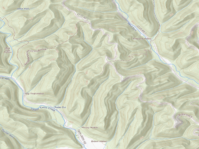
FREE hike-in camping. Camp 5 is the southernmost designated backpack campground on the Shawnee State Forest Backpack Trail, in Scioto County west of Portsmouth, on its own side trail off the main south loop. ODNR's own Shawnee Backpack Trail map states the rules: 'People may camp only in the designated campground areas shown on the map' and 'A self-registration permit (NO FEE) is required of all hikers' -- you fill it out before you start, at the trailhead parking (available 24 hours) or at forest headquarters on a weekday, drop it in the registration box and carry the stub. No reservations are taken and none are needed; ODNR confirmed in June 2025 that Shawnee stays first-come, first-served. Camping is capped at 14 days in any 30-day period. There is a latrine at each campground and nothing else. WATER: do not count on it -- the only supplies are caches near road crossings, filled from the City of Portsmouth, and ODNR warns they 'may not be serviced in winter'; carry your own and a filter. Shawnee is Ohio's largest state forest at 63,000+ acres, the 'Little Smokies', and it is a public hunting area, so wear blaze orange in season. ODNR specifically warns about venomous snakes here -- both copperheads and the endangered timber rattlesnake -- so watch where you put your hands and feet in rocky ground. The forest is open 6 a.m. to 11 p.m. to everyone but legal hunters and anglers. Do not confuse this with Shawnee STATE PARK's Turkey Creek Campground nearby, which charges. Confirm current rules with the forest office (740) 858-6685 before you go -- we have not visited.
Everything you need — measured from Shawnee State Forest Backpack Trail - Camp 5 · public land · OH
- FFuel4 mi
- GGrocery4 mi
- MMechanic4 mi
- @Mail4 mi
- WWater5 mi
- LLaundry5 mi
- DDump5 mi
- HHardware6 mi
- +Urgent care10 mi
- OOutfitter12 mi
- RxPharmacy12 mi
- EVEV fast charger15 mi
- ShShower20 mi
- AAir-up30 mi
- PPropane34 mi
The read: water is basically at camp, fuel & food sit about 4 mi out.
One dot per need — the nearest of each kind, straight-line from camp. Places from OpenStreetMap (© OpenStreetMap contributors); the EV fast charger from the US DOE station locator. Open in Google Maps ↗
The site — Shawnee State Forest Backpack Trail - Camp 5
Nearby & resupply — around Shawnee State Forest Backpack Trail - Camp 5 · public land · OH (OpenStreetMap)
- Nearest townGarrison · ~4.0 mi
- Drinking waterWater · ~4.9 mi
- FuelGarrison Short Stop · ~4.2 mi
- Propane / LPGnone within 31 mi
- Dump station~5.0 mi
- GroceriesGrocery · ~4.2 mi
- PharmacySmith Discount Pharmacy · ~12.4 mi
- Hospital / clinicHospital · ~9.7 mi
- HardwareOhio Builder Surplus · ~5.6 mi
EV charging — from Shawnee State Forest Backpack Trail - Camp 5 · public land · OH — nearest public DC fast & Level 2 (US DOE station data)
- Nearest public DC fast charger15.1 mi straight-line NE — Glockner Chevrolet, Portsmouth, OH · EV Connect · CCS · 1 fast port listed · listed open, last confirmed by AFDC 2026-09-16 · hours: 24 hours daily · directions
- Public DC fast stations within reach1 within 25 mi · 17 within 50 · 214 within 100 · 340 within 150
- Nearest listing NACS (Tesla)26.3 mi — LOVE'S 418 - KY #418 DC1, Grayson
- Nearest listing CHAdeMO43.3 mi — COLONY PARK STATION EAST, Hillsboro
- Nearest public Level 2 (J1772)12.3 mi — PORTSMOUTH EVCS STATION1 · ChargePoint Network · J1772 · 2 Level 2 ports listed · listed open, last confirmed by AFDC 2026-09-16 · hours: 24 hours daily
- Pricing at the fast chargernot listed
- Power (kW)not listed by AFDC — “DC fast” spans roughly 24 to 350 kW, so ask the network.
- Read this honestlyStraight-line miles, like every distance on this site. Roads run longer than this, and you have to get back. We know where a charger is listed. We don’t know if it works today, how fast it is, or the road miles. Check the network before you commit.
Snapshot 2026-09-16 · AFDC record 302837 · US DOE Alternative Fuels Data Center
Nearby restrooms — around Shawnee State Forest Backpack Trail - Camp 5 · public land · OH — pit toilets, restrooms & rest areas (government data)
- Highway rest areaScioto US23 SB · ~22.3 mi NE
- RestroomLewis Lake Fishing Area · ~25.2 mi E · USFS
- Highway rest areaPike SR32 EB · ~26.4 mi N
- Vault / pit toiletHanging Rock Trailhead · ~26.7 mi E · USFS
Open Shawnee State Forest Backpack Trail - Camp 5 elsewhere
Other camps near Shawnee State Forest Backpack Trail - Camp 5
If this one is full, gated or washed out.
- Shawnee State Forest Backpack Trail - Camp (unnumbered ODNR GIS point)~1.6 mi
- Shawnee State Forest Backpack Trail - Camp 4~3.1 mi
- Shawnee State Forest Backpack Trail - Camp 7~5.0 mi
- Shawnee State Forest Backpack Trail - Camp 3~5.3 mi
How we know this — Shawnee State Forest Backpack Trail - Camp 5
What we don’t know about Shawnee State Forest Backpack Trail - Camp 5
A land record can put you within a few meters of a spot. It cannot tell you any of this — so check it yourself, and treat anything below as the open question it is.
- Road surface & last-mile access
- How many rigs actually fit
- Cell coverage by carrier
- Seasonal & winter access
- Current fire restrictions
- Whether any water here is drinkable
- Shade & wind exposure
- Noise and who else shows up
- Whether a listed EV charger works today, or the road miles to it