Agency-listedNPSFree
Swains Lock hiker-biker campsite (C&O Canal towpath mile 16.6)
Hike-in · public land · MD · 39.03110, -77.24439
Ask an AI about this campsiteOpens Grok already loaded with this site. It reads the same records this page is built from, and links whatever it tells you.
Ask about this camp →The land manager lists this site. Someone from the agency inventoried it, so it is a real camp — not a spot we guessed at. What changes is conditions — roads, gates, closures, fire rules. Check those with the unit before you commit to the drive.
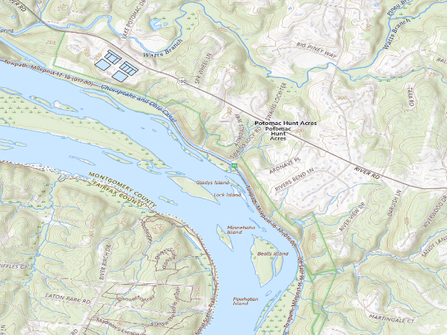
USGS topo — contours & terrain
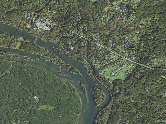
Aerial — USGS / NAIP
Weather outlook — at Swains Lock hiker-biker campsite (C&O Canal towpath mile 16.6)
Loading the latest forecast…
Live NWS area forecast (~2.5 km grid, not elevation-corrected). Camp sits at 163 ft.
Fire & smoke — around Swains Lock hiker-biker campsite (C&O Canal towpath mile 16.6)NIFC · AirNow
Checking active fires & air quality…
Active wildfires from NIFC (within ~50 mi); air quality from AirNow. Always confirm current fire restrictions with the managing office before you go.
Everything you need — measured from Swains Lock hiker-biker campsite (C&O Canal towpath mile 16.6) · public land · MD
Straight-line miles · bearings approx · roads run longer
Nearest of each
- WWater0 mi
- GGrocery2 mi
- @Mail2 mi
- EVEV fast charger2 mi
- FFuel2 mi
- HHardware2 mi
- PPropane3 mi
- RxPharmacy3 mi
- MMechanic3 mi
- +Urgent care5 mi
- DDump6 mi
- AAir-up6 mi
- LLaundry7 mi
- OOutfitter7 mi
- ShShower9 mi
≤30 mi30–4545+water
The read: water is basically at camp, fuel & food sit about 2 mi out.
One dot per need — the nearest of each kind, straight-line from camp. Places from OpenStreetMap (© OpenStreetMap contributors); the EV fast charger from the US DOE station locator. Open in Google Maps ↗
The site — Swains Lock hiker-biker campsite (C&O Canal towpath mile 16.6)
Access
Hike-in
Land
public land
Elevation
163 ft
State
MD
Coordinates
39.03110, -77.24439
Cost
Free
Nearby & resupply — around Swains Lock hiker-biker campsite (C&O Canal towpath mile 16.6) · public land · MD (OpenStreetMap)
- Water featureLock 21: Swains Lock (water) · nearby
- Nearest townPotomac · ~2.1 mi
- Drinking waterDrinking water · ~0.1 mi
- FuelSunoco · ~2.1 mi
- Propane / LPGPropane · ~14.0 mi
- Dump station~6.3 mi · customers only
- GroceriesGiant · ~2.0 mi
- PharmacyCVS Pharmacy · ~3.3 mi
- Hospital / clinicPotomac Dermatology · ~2.0 mi
- HardwareStrosnider's · ~2.2 mi
EV charging — from Swains Lock hiker-biker campsite (C&O Canal towpath mile 16.6) · public land · MD — nearest public DC fast & Level 2 (US DOE station data)
- Nearest public DC fast charger2.0 mi straight-line SE — BOA MDW-215 (Potomac, MD) · Electrify America · CCS · 4 fast ports listed · listed open, last confirmed by AFDC 2026-09-16 · hours: 24 hours daily · directions
- Public DC fast stations within reach194 within 25 mi · 403 within 50 · 640 within 100 · 1044 within 150
- Nearest listing NACS (Tesla)4.7 mi — Cabin John Village - Tesla Supercharger, Potomac
- Nearest listing CHAdeMO5.2 mi — EVsmart - Pepco - Cabin John Ice Rink, Rockville
- Nearest public Level 2 (J1772)3.7 mi — MC FLEET POTOMAC REC CEN, Rockville, MD · ChargePoint Network · J1772 · 2 Level 2 ports listed · listed open, last confirmed by AFDC 2026-09-16 · hours: 24 hours daily
- Pricing at the fast chargernot listed
- Power (kW)not listed by AFDC — “DC fast” spans roughly 24 to 350 kW, so ask the network.
- Read this honestlyStraight-line miles, like every distance on this site. Roads run longer than this, and you have to get back. We know where a charger is listed. We don’t know if it works today, how fast it is, or the road miles. Check the network before you commit.
Snapshot 2026-09-16 · AFDC record 207960 · US DOE Alternative Fuels Data Center
Nearby restrooms — around Swains Lock hiker-biker campsite (C&O Canal towpath mile 16.6) · public land · MD — pit toilets, restrooms & rest areas (government data)
- RestroomSwains Lock Toilet · at this camp · NPS
- RestroomGreat Falls "New" Comfort Station (014.33) · ~2.1 mi S · NPS
- RestroomGreat Falls "Historic" Comfort Station (014.28) · ~2.1 mi S · NPS
- RestroomGreat Falls Tavern (014.30) · ~2.2 mi S · NPS
Open Swains Lock hiker-biker campsite (C&O Canal towpath mile 16.6) elsewhere
Other camps near Swains Lock hiker-biker campsite (C&O Canal towpath mile 16.6)
If this one is full, gated or washed out.
- Horsepen Branch hiker-biker campsite (C&O Canal towpath mile 26.1)~8.8 mi
- Chisel Branch hiker-biker campsite (C&O Canal towpath mile 30.5)~13.0 mi
- Turtle Run hiker-biker campsite (C&O Canal towpath mile 34.4)~16.4 mi
- Marble Quarry hiker-biker campsite (C&O Canal towpath mile 38.2)~16.8 mi
How we know this — Swains Lock hiker-biker campsite (C&O Canal towpath mile 16.6)
Stay limit
1 night (Stays limited to one night per site, per trip)
Source
public land records
Confidence
Researched — The record is detailed and internally consistent, and the coordinates land where the managing agency says this site is.
How it was placed
NPS Chesapeake & Ohio Canal NHP camping pages, read 2026-08-13 (nps.gov/choh/planyourvisit/camping.htm and .../primitive-campsites.htm): hiker-biker campsites are 'No fee; first-come, first-served; no reservations.' 'Stays limited to one night per site, per trip.' Each has 'chemical toilet, picnic table, firepit, and non-potable well water'; the well water is NON-POTABLE and must be filtered, chemically treated or boiled, and is 'turned off from mid-November to mid-April each year.' Sites hold five to ten tents. Hiker/biker access only -- most sites sit 1-5 miles from the nearest parking, so this is not a drive-up site. Coordinate = OSM way/411220571 ('Lock 21 “Swains” Campground'), VERIFIED by projecting it onto the OSM C&O towpath relation 1392951: it lands at towpath mile 16.38 against the NPS-published mile 16.6 (delta -0.22 mi) and sits 164 ft from the towpath centreline. County CONFIRMED as Montgomery County, MD via the FCC Census Block API, matching the county NPS files it under. Nearest town: Potomac ~2.1 mi. 'Nearest town' is straight-line distance to the nearest OSM place=city/town/village and is NOT a driving distance; along the Potomac the nearest named place is often across the river in VA or WV with no nearby bridge. Ingest 2026-08-13.
--- REVIEWED 2026-08-19 (nightshift-verified) ---
SOURCE RE-READ. Both NPS pages this row rests on were re-fetched today and both still say what the row records, verbatim: nps.gov/choh/planyourvisit/camping.htm and nps.gov/choh/planyourvisit/primitive-campsites.htm (page footer: 'Last updated: November 19, 2025'). Still present word for word: 'No fee; first-come, first-served; no reservations.'; 'Stays limited to one night per site, per trip.'; 'All sites have: chemical toilet, picnic table, firepit, and non-potable well water.'; 'Well water at hiker-biker campsites is non-potable. Water is not treated and not for drinking or cooking. If you use this water, you are advised to filter, chemically treat, or boil before use. Water is turned off from mid-November to mid-April each year.'; 'Hiker-Biker campsites can fit a maximum of five to ten tents, depending on the campsite.' The primitive-campsites page's 'List of Hiker-Biker Campsites' still holds exactly 31 entries, and all 31 of our rows matched one each on BOTH name and towpath mile, with nothing left over on either side. This row's entry on the NPS list is under the 'Montgomery County, MD' heading, which matches the county the coordinate actually falls in (below). COORDINATE RE-VERIFIED THREE WAYS, recomputed in this fire rather than taken on trust. (1) TOWPATH PROJECTION: re-projected onto OSM relation 1392951 ('Chesapeake and Ohio Canal Towpath (Maryland)', 151 member ways, all with geometry, stitched end-to-end with no join gap over 50 m, total 180.08 mi). This row lands 164 ft from the towpath centreline, at relation mile 11.97, i.e. -0.10 mi from the NPS-published mile once the constant 4.53 mi is added back -- that constant is the District of Columbia section the Maryland-only relation omits, and it is corroborated independently by 184.5 (the canal's published length) minus 180.08 = 4.42 mi. Across all 31 sites the residual never exceeds 0.44 mi and the distance off centreline never exceeds 195 ft. (2) OSM CAMPSITE: this row sits 0 m from an independently mapped OSM feature way/411220571 ('Lock 21 “Swains” Campground'), tagged camp_site, whose name matches the NPS site name. (3) NPS'S OWN COORDINATES: this row sits 33 m from a point in the NPS Public POIs national dataset (mapservices.nps.gov/arcgis/rest/services/NationalDatasets/NPS_Public_POIs_Geographic/MapServer/0, queried WHERE UNITCODE='CHOH' on 2026-08-19; 524 POIs returned, 34 of POITYPE 'Primitive Campsite') whose POITYPE is 'Primitive Campsite'. All 31 rows matched a DIFFERENT NPS pin one-to-one -- no pin was claimed twice -- and 30 of the 31 matched within 88 m. Six NPS campsite/campground POIs matched no row of ours; the park separately operates reservable fee drive-in campgrounds and a permit-only group site, which are correctly outside this free hiker-biker set, but I did not individually identify those six and am not claiming to have. COUNTY re-confirmed as Montgomery County, MD (state FIPS 24) via the US Census geocoder (geocoding.geo.census.gov, benchmark Public_AR_Current / vintage Current_Current, queried 2026-08-19). DUPLICATE CHECK, matched on COORDINATES and not on name: the nearest already-published-or-approved camp anywhere in the leads DB is rowid 19265 ('Weston WMA', approved) at 56508 m -- not a duplicate; and no pending Maryland lead is within 250 m of any other. CORRECTION MADE THIS FIRE -- WATER. This row carried the generic hiker-biker water string, but the NPS camping page singles this site out: 'Please note that the Swains Lock campsite draws on the same municipal water as the Swains Lockhouse and will remain potable.' The water field is updated to say so, quoting NPS; the old 'non-potable, treat before drinking' text is wrong for THIS site only and remains correct for the other 30. Also site-specific and not previously recorded: NPS says 'With the exception of Swains (Mile 16.6), all campsites are located anywhere from 1 to 5 miles from the nearest parking area,' so Swains is the one hiker-biker site with parking at hand. camp_type is left as 'hike' because NPS still classifies and rules it as a hiker-biker campsite, but a driver can reach this one. NOT VERIFIED: whether the municipal supply runs year-round -- NPS gives a mid-November to mid-April shutoff for the park's WELLS and says nothing either way about this municipal tap. STATUS -> approved. PHRASING: the water field is rendered verbatim into the map blurb, so it was reworded to read as
a sentence there; the substance is unchanged and is still NPS's own words.
EV chargers
US DOE Alternative Fuels Data Center station locator, snapshot 2026-09-16. Straight-line miles to the nearest public, open, unrestricted station; restricted and planned units are shown but never counted.
Field check
On the agency's books. The land manager inventoried this site, so its existence is not in question — current conditions are. Nobody from here has camped it recently.
What we don’t know about Swains Lock hiker-biker campsite (C&O Canal towpath mile 16.6)
A land record can put you within a few meters of a spot. It cannot tell you any of this — so check it yourself, and treat anything below as the open question it is.
- Road surface & last-mile access
- How many rigs actually fit
- Cell coverage by carrier
- Seasonal & winter access
- Current fire restrictions
- Whether any water here is drinkable
- Shade & wind exposure
- Noise and who else shows up
- Whether a listed EV charger works today, or the road miles to it
Before you go — Swains Lock hiker-biker campsite (C&O Canal towpath mile 16.6)
Finding water out here →Fire rules & restrictions →Gear & rig loadout →Off-grid communication →All field notes →
Been here? Tell us what changed. This page is built from public records, so the fastest way it gets better is somebody who has actually pulled in. Road washed out, site gone, gate locked, or it is exactly as described — all of it useful. Send a report →