Temple Canyon Park (Canon City)
Temple Canyon Park is a City of Canon City mountain park about 8 miles southwest of town, listed as free on the city's own campgrounds page. There are just two camping areas, deliberately spread apart, so it is the quieter of the city's two free parks. It sits next to the Temple Canyon trail down to Grape Creek and The Temple rock formation. The city describes dispersed camping, vault toilets, fire rings and some picnic tables, and NO WATER -- bring everything. Open year-round. The city's Park Rules and Regulations limit overnight camping in its Mountain Parks to 72 hours once every two weeks, with extensions available by calling the Park Department at (719) 269-9028. Fires are allowed only in the campfire rings the city provides, and the city can ban open fires outright in high or extreme fire conditions -- a Stage 2 fire ban was in effect when we checked on 2026-07-20, so check the current ban before you plan on a fire. One honest wrinkle: the same city rules PDF has a general line closing City Parks at 11 PM and a general ban on camping without the City Administrator's permission, and the campgrounds page calls this 'dispersed camping' while the rules PDF says camping is limited to designated sites. Those read as in-city-park rules, with the Mountain Parks section being the one that governs here -- but it is ambiguous in the city's own documents, so camp in an obvious established site and do not be surprised if a ranger reads it differently. The access road is unpaved and rough by most accounts; the city does not publish a road condition, so scout it before you commit a big rig. The deal these towns offer is simple: camp free, and they hope you buy fuel, groceries or dinner in town. Be a good guest and it stays free for the next traveler. Town rules change often and we have not visited -- confirm current rules with the city before you go.
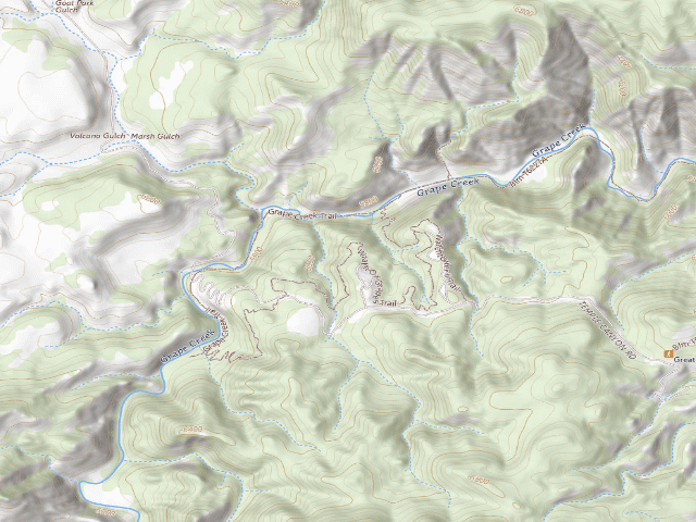
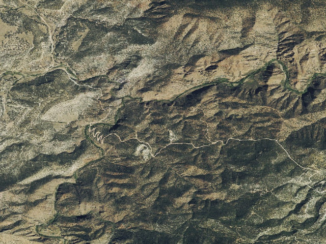
Everything you need — measured from Temple Canyon Park (Canon City) · public land · CO
- FFuel4 mi
- GGrocery4 mi
- WWater5 mi
- EVEV fast charger5 mi
- LLaundry5 mi
- MMechanic6 mi
- HHardware6 mi
- @Mail6 mi
- RxPharmacy6 mi
- +Urgent care6 mi
- ShShower31 mi
- DDump34 mi
- AAir-up37 mi
- OOutfitter38 mi
- PPropane38 mi
The read: water is basically at camp, fuel & food sit about 4 mi out.
One dot per need — the nearest of each kind, straight-line from camp. Places from OpenStreetMap (© OpenStreetMap contributors); the EV fast charger from the US DOE station locator. Open in Google Maps ↗
The site — Temple Canyon Park (Canon City)
Nearby & resupply — around Temple Canyon Park (Canon City) · public land · CO (OpenStreetMap)
- Water featureGrape Creek (stream) · nearby
- Nearest townProspect Heights · ~4.5 mi
- Drinking waterDrinking water · ~4.6 mi
- FuelExxon · ~5.5 mi
- Propane / LPGnone within 31 mi
- GroceriesSafeway · ~5.5 mi
- Hospital / clinicSt. Thomas More Hospital · ~5.7 mi
EV charging — from Temple Canyon Park (Canon City) · public land · CO — nearest public DC fast & Level 2 (US DOE station data)
- Nearest public DC fast charger4.7 mi straight-line NE — HION NETWORK CANON CITY PL2, Cañon City, CO · ChargePoint Network · CHAdeMO, CCS · 1 fast port listed · listed open, last confirmed by AFDC 2026-09-16 · hours: 24 hours daily · directions
- Public DC fast stations within reach7 within 25 mi · 54 within 50 · 246 within 100 · 454 within 150
- Nearest listing NACS (Tesla)36.9 mi — ES1 SALIDA PL1, Salida
- Nearest public Level 2 (J1772)4.1 mi — PUEBLO CC PUEBLO 3, Cañon City, CO · ChargePoint Network · J1772 · 2 Level 2 ports listed · listed open, last confirmed by AFDC 2026-09-16 · hours: 24 hours daily
- Pricing at the fast chargernot listed
- Power (kW)not listed by AFDC — “DC fast” spans roughly 24 to 350 kW, so ask the network.
- Read this honestlyStraight-line miles, like every distance on this site. Roads run longer than this, and you have to get back. We know where a charger is listed. We don’t know if it works today, how fast it is, or the road miles. Check the network before you commit.
Snapshot 2026-09-16 · AFDC record 257138 · US DOE Alternative Fuels Data Center
Nearby restrooms — around Temple Canyon Park (Canon City) · public land · CO — pit toilets, restrooms & rest areas (government data)
- RestroomAhra - Spikebuck Restroom · ~8.7 mi NW · BLM
- RestroomAhra - Five Points Campground Restroom · ~10.0 mi W · BLM
- RestroomAhra - Five Points Restroom (East) · ~10.0 mi W · BLM
- RestroomAhra - Five Points Restroom (West) · ~10.1 mi W · BLM
Open Temple Canyon Park (Canon City) elsewhere
Other camps near Temple Canyon Park (Canon City)
If this one is full, gated or washed out.
- Gold Belt Recreation Management Area~7.2 mi
- Oak Creek~8.2 mi
- Stoney Point~9.9 mi
- Red Canyon Park (Canon City)~12.9 mi
How we know this — Temple Canyon Park (Canon City)
What we don’t know about Temple Canyon Park (Canon City)
A land record can put you within a few meters of a spot. It cannot tell you any of this — so check it yourself, and treat anything below as the open question it is.
- Road surface & last-mile access
- How many rigs actually fit
- Cell coverage by carrier
- Current fire restrictions
- Whether any water here is drinkable
- Shade & wind exposure
- Noise and who else shows up
- Whether a listed EV charger works today, or the road miles to it