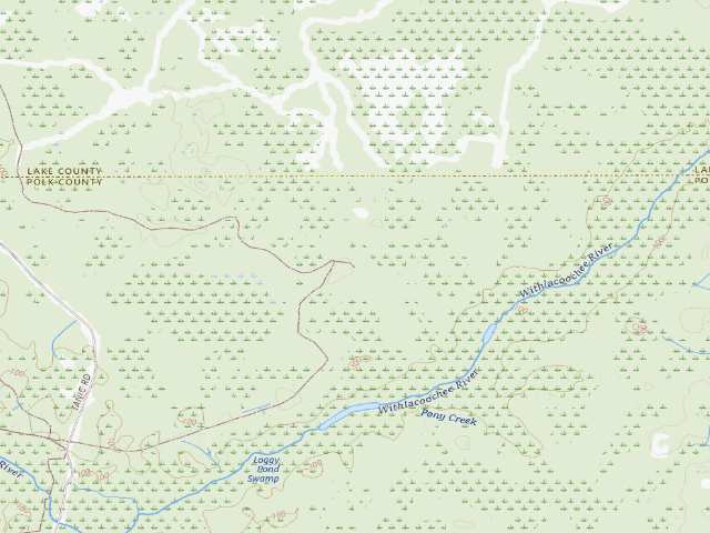
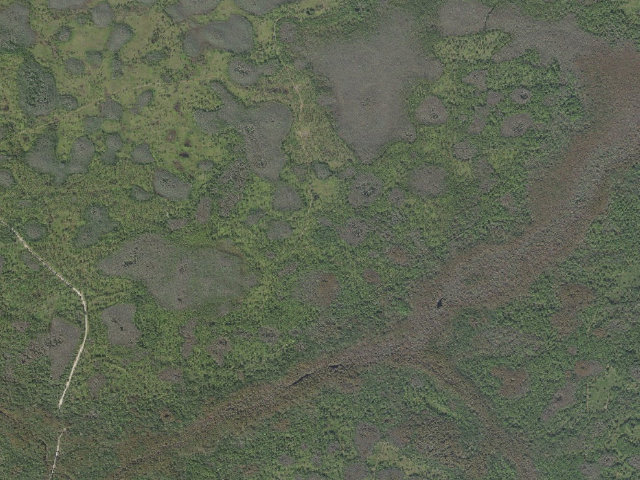
Tillman (Green Swamp Wilderness Preserve - East Tract)
Hike-in · public land · FL · 28.34016, -81.91512
Ask an AI about this campsiteOpens Grok already loaded with this site. It reads the same records this page is built from, and links whatever it tells you.
The land manager lists this site. Someone from the agency inventoried it, so it is a real camp — not a spot we guessed at. What changes is conditions — roads, gates, closures, fire rules. Check those with the unit before you commit to the drive.
Tillman (Green Swamp Wilderness Preserve - East Tract) is a designated campsite on Southwest Florida Water Management District land, and the price is zero. The District's camping page puts it in one sentence: "Camping is allowed in designated campsites only and requires a free reservation." Free, but not casual - you need a valid permit or Special Use Authorization in hand BEFORE you arrive, the reservation has to be made no later than the day before your permit starts, and you may hold only two at a time. Stay is capped at seven consecutive days and 30 days per calendar year; you may arrive no earlier than 3 p.m. and must be gone by 11 a.m. on your last day. This is a backcountry site, which in District language means you reach it on foot or off the water and nothing else. Expect a small cleared patch, generally no amenities and no water source. The honest part: there are no trash receptacles anywhere in these campgrounds, so everything you carry in comes back out with you. Fires only in the fire rings, firewood off the ground, never off a standing tree. Quiet hours are 10 p.m. to 7 a.m. Where the District does provide water it calls it nonpotable - do not drink it untreated. And check the District's closure list first; on the day we pulled this record its camping page was flagging a closed recreation site. The nearest town is Polk City, roughly 12.2 miles away in a straight line - the drive is longer, and on some of these approaches a good deal longer.
The site — Tillman (Green Swamp Wilderness Preserve - East Tract)
Access
Hike-in
Land
public land
Elevation
105 ft
State
FL
Coordinates
28.34016, -81.91512
Cost
Free
Nearby & resupply — around Tillman (Green Swamp Wilderness Preserve - East Tract) · public land · FL(OpenStreetMap)
Nearest townZephyrhills North · ~16.4 mi
Drinking waterWater · ~3.5 mi
FuelFuel · ~11.4 mi
Propane / LPG7-Eleven · ~28.3 mi
Dump station~23.8 mi
GroceriesGrocery · ~11.4 mi
PharmacyCVS Pharmacy · ~14.3 mi
Hospital / clinicFirst Help Urgent Care clinic and family practice · ~12.4 mi
HardwareAce Hardware · ~12.3 mi
EV charging — from Tillman (Green Swamp Wilderness Preserve - East Tract) · public land · FL— nearest public DC fast & Level 2 (US DOE station data)
Nearest public DC fast charger14.4 mi straight-line E — Cagan Crossings Library, Clermont, FL · EV Connect · CHAdeMO, CCS · 2 fast ports listed · listed open, last confirmed by AFDC 2026-09-16 · hours: 24 hours daily · directions
Public DC fast stations within reach44 within 25 mi · 234 within 50 · 432 within 100 · 582 within 150
Nearest public Level 2 (J1772)14.6 mi — INTEGRA LAND COMPANY, Clermont, FL · Blink Network · J1772 · 4 Level 2 ports listed · listed open, last confirmed by AFDC 2026-09-16 · hours: 24 hours daily
Pricing at the fast chargernot listed
Power (kW)not listed by AFDC — “DC fast” spans roughly 24 to 350 kW, so ask the network.
Read this honestlyStraight-line miles, like every distance on this site. Roads run longer than this, and you have to get back. We know where a charger is listed. We don’t know if it works today, how fast it is, or the road miles. Check the network before you commit. Snapshot 2026-09-16 · AFDC record 170864 · US DOE Alternative Fuels Data Center
Nearby restrooms — around Tillman (Green Swamp Wilderness Preserve - East Tract) · public land · FL— pit toilets, restrooms & rest areas (government data)
How we know this — Tillman (Green Swamp Wilderness Preserve - East Tract)
Fire rules
Campfires are only permitted in fire rings.
Stay limit
7 nights (no more than seven consecutive days)
Permit
Camping is allowed in designated campsites only and requires a free reservation. A valid permit of Special Use Authorization is required before arrival. Reservations must be made no later than the day prior to the start of the camping permit. Only 2 camping reservations are allowed per family group at a time.
Area rules
Camping is allowed in designated campsites only. Arrival is at 3 p.m. on the first day of the reservation and departure is by 11 a.m. on the last day. Unauthorized buildings or structures are not permitted. Firewood should be collected from the ground; DO NOT cut any standing trees, dead or alive. To protect the natural experience for all campers, no loud music is allowed at any time. Quiet time is from 10 p.m. to 7 a.m. There are no trash receptacles in the campgrounds. Please ensure that all trash is carried out with you at your departure.
Source
public land records
Confidence
Researched — The record is detailed and internally consistent, and the coordinates land where the managing agency says this site is.
How it was placed
FREE by the agency's own published statement. SWFWMD camping page (https://www.swfwmd.state.fl.us/recreation/camping), downloaded raw this fire and string-matched locally: "Camping is allowed in designated campsites only and requires a free reservation. A valid permit of Special Use Authorization is required before arrival." Reservations "must be made no later than the day prior to the start of the camping permit" and only 2 may be held per family group at a time. STAY LIMIT: "Camping is limited to no more than seven consecutive days and 30 total days per calendar year", per the District's rule-change news release (https://www.swfwmd.state.fl.us/about/newsroom/news/district-announces-changes-camping-rules-effective-october-1), which also sets arrival at 3 p.m. and departure by 11 a.m. and notes the District "may revoke a camping permit" for non-compliance with Chapter 40D-9, F.A.C. SITE TYPE: SWFWMD GIS records this as "Backcountry camping" on "Green Swamp Wilderness Preserve - East Tract". camp_type is derived from the District's own definitions, not guessed: backcountry sites are "accessible only by foot or from a water body" (hike), while at primitive and equestrian sites personal vehicles and horse trailers may be driven in (drive). RESTROOM per the layer: "Portolet". NOT A PARTNER SITE: SWFWMD's layer carries a PARTNERSITE column naming the outside agency that runs a campground; this row's PARTNERSITE is empty. Every row with a partner (Colt Creek State Park, Edward Medard Park, Withlacoochee River Park, Starkey, Myakka State Forest, Two Mile Prairie/Withlacoochee State Forest, Alafia River Corridor, Chassahowitzka RV) was excluded - those charge, or somebody else sets the price. SEASONAL/FIRE: the District posts closures on its recreation pages (its camping page was carrying a "1 recreation site is closed" banner on 2026-08-16) - check before you go. "Campfires are only permitted in fire rings"; firewood from the ground only, "DO NOT cut any standing trees, dead or alive"; quiet hours 10 p.m.-7 a.m.; no trash receptacles, pack it all out. COORDINATE: the District's OWN mapped campsite point, pulled live this fire from services1.arcgis.com/gdr0FcZCwx1BmrQk/.../RecreationGuide/FeatureServer/4 ("Camping Locations"), outSR=4326. NEAREST TOWN: Polk City, about 12.2 mi in a straight line (US Census Bureau 2024 Gazetteer place internal point). STRAIGHT-LINE, NOT DRIVING DISTANCE. Ingest 2026-08-16 10:52:36 (fire 800, FL thin-state fill). RE-VERIFIED 2026-08-18 (night shift, FL backlog review). Re-fetched LIVE this fire: the District's own "Camping Locations" layer https://services1.arcgis.com/gdr0FcZCwx1BmrQk/arcgis/rest/services/RecreationGuide/FeatureServer/4 (59 features, no transfer limit hit) and the SWFWMD camping page https://www.swfwmd.state.fl.us/recreation/camping . The row's OBJECTID is still present and its coordinate still agrees to within 25 m; PARTNERSITE is still empty. The camping page still says "Camping is allowed in designated campsites only and requires a free reservation. A valid permit of Special Use Authorization is required before arrival" and still caps stays at "seven consecutive days". camp_type re-derived from the page's own live definitions -- Backcountry = "accessible only by foot or from a water body" (hike); Primitive = "Only personal vehicles are allowed in the campsites" and Equestrian = "Horse trailers may be driven into equestrian campsites" (drive) -- and it matches what the row already carried. Checked against the District's OWN recreation-site browser https://www.swfwmd.state.fl.us/recreation/sites (all three result pages, 69 sites): this row's property is NOT flagged "(Cooperatively Managed)" and its property page does list Camping under Site Features. Checked against the live closure list https://www.swfwmd.state.fl.us/recreation/closed-recreation-sites : this property is not on it. No coordinate duplicate against any published FL camp -- checked on COORDINATES, not name, against all 43 published FL rows at a 250 m threshold. DECISION: status pending -> approved.
EV chargers
US DOE Alternative Fuels Data Center station locator, snapshot 2026-09-16. Straight-line miles to the nearest public, open, unrestricted station; restricted and planned units are shown but never counted.
Field check
On the agency's books. The land manager inventoried this site, so its existence is not in question — current conditions are. Nobody from here has camped it recently.
What we don’t know about Tillman (Green Swamp Wilderness Preserve - East Tract)
A land record can put you within a few meters of a spot. It cannot tell you any of this — so check it yourself, and treat anything below as the open question it is.
Road surface & last-mile access
How many rigs actually fit
Cell coverage by carrier
Seasonal & winter access
Current fire restrictions
Whether any water here is drinkable
Shade & wind exposure
Noise and who else shows up
Whether a listed EV charger works today, or the road miles to it
Before you go — Tillman (Green Swamp Wilderness Preserve - East Tract)
Been here? Tell us what changed. This page is built from public records, so the fastest way it gets better is somebody who has actually pulled in. Road washed out, site gone, gate locked, or it is exactly as described — all of it useful. Send a report →