Trails End Campsite (Sundown Wild Forest)
FREE primitive camping in Sundown Wild Forest, part of New York's CATSKILL Forest Preserve (DEC Region 3, Ulster County -- the Ashokan High Point / Vernooy Kill Falls country). This is a DEC-designated primitive tent site ('Trails End Campsite'), and New York provides it at NO CHARGE: the DEC Sundown Wild Forest page lists the fee as 'Free' and the unit as open year-round, first-come first-served. ROAD-END (drive-to): this is a Wild Forest, so public motor vehicles are allowed on the designated public road -- you can drive to the end of the road and the site is a few steps in; confirm the road is open and drivable to its end first (about 127 feet from the road-end). Note: a site about 127 feet from the END of Trails End Road (a minor public road) where the Long Path and a snowmobile trail begin -- effectively a park-at-the-road-end site, not a deep hike, but confirm Trails End Road is open and drivable to its end before relying on driving in. The nearest named water (the Vernooy Kill) is over half a mile off, so carry water. This is free Catskill Forest Preserve backcountry -- do NOT confuse it with the Peekamoose Valley 'Lower Field' sites a few miles west along County Route 42, which are on the paid Reserve America system and require a $10 permit (all visitors, including campers) from May 15 to September 15; this site is well outside that permit corridor. SEASON / ACCESS: DEC lists Sundown Wild Forest as open YEAR-ROUND and free, but these are foot-access (or road-end) Catskill backcountry sites; the trailhead roads (Watson Hollow Road, Trails End Road) are minor mountain roads that may not be plowed or maintained in winter and can wash out -- confirm current road, gate and trail status with the New Paltz office (845-256-3076) before you go. RULES: this is a designated, first-come first-served free site -- no reservation and no fee. Look for the yellow 'Camp Here' disc that marks each designated site. Standard Catskill Forest Preserve rules apply: camp only at the designated site, keep 150 feet from water/trails/roads unless the site itself is marked closer, and a free Forest Ranger permit is required only if you stay more than 3 nights or camp with a group of 10 or more (arrange it through the DEC Region 3 New Paltz Office at (845) 256-3076 (Forest Rangers via 911 or DEC dispatch)). DEC prints no other night limit for these sites, so plan around that statewide 3-night default and confirm on site. This is a primitive backcountry site: expect at most a fire ring -- no privy, no hookups, no showers and no potable water, so carry water or treat what you take from a brook. Pack out all trash, follow Leave No Trace and the DEC fire rules, and store food from bears (this is black-bear country). Confirm current rules, road/trail status and this site's status on the DEC page (dec.ny.gov/places/sundown-wild-forest) or with the New Paltz office (845-256-3076) before you go; we have not visited.
Everything you need — measured from Trails End Campsite (Sundown Wild Forest) · New York State Dept. of Environmental Conservation · NY
- @Mail7 mi
- GGrocery8 mi
- MMechanic8 mi
- FFuel8 mi
- RxPharmacy10 mi
- WWater10 mi
- DDump10 mi
- HHardware10 mi
- LLaundry11 mi
- EVEV fast charger11 mi
- ShShower12 mi
- AAir-up14 mi
- +Urgent care14 mi
- OOutfitter16 mi
- PPropane52 mi
The read: water's a short hop out, fuel & food sit about 8 mi out.
One dot per need — the nearest of each kind, straight-line from camp. Places from OpenStreetMap (© OpenStreetMap contributors); the EV fast charger from the US DOE station locator. Open in Google Maps ↗
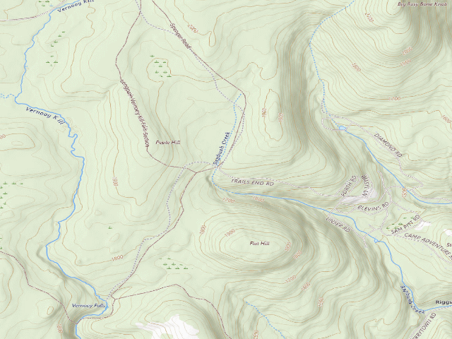
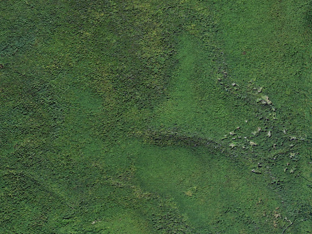
The site — Trails End Campsite (Sundown Wild Forest)
Nearby & resupply — around Trails End Campsite (Sundown Wild Forest) · New York State Dept. of Environmental Conservation · NY (OpenStreetMap)
- Water featureMettacahonts Creek (stream) · nearby
- Nearest townRiggsville · ~1.4 mi
- Drinking waternone within 10 mi
- FuelFuel · ~8.4 mi
- Propane / LPGnone within 31 mi
- Dump station~10.5 mi
- GroceriesGood Friend · ~7.1 mi
- PharmacyNekos Boiceville Pharmacy · ~9.7 mi
- Hospital / clinicEllenville Regional Hospital · ~10.5 mi
- HardwareTrue Value · ~17.8 mi
EV charging — from Trails End Campsite (Sundown Wild Forest) · New York State Dept. of Environmental Conservation · NY — nearest public DC fast & Level 2 (US DOE station data)
- Nearest public DC fast charger11.3 mi straight-line S — HondoGo - Ellenville, NY · EVGATEWAY · CCS · 4 fast ports listed · listed open, last confirmed by AFDC 2026-09-16 · hours: 24 hours daily · directions
- Public DC fast stations within reach27 within 25 mi · 86 within 50 · 873 within 100 · 1499 within 150
- Nearest listing NACS (Tesla)17.6 mi — Kingston, NY - Tesla Supercharger, Kingston
- Nearest listing CHAdeMO19.7 mi — PRESHYUN PKG 1, Kingston
- Nearest public Level 2 (J1772)11.3 mi — Marbletown - 350 Tongore Rd, Kingston, NY · Blink Network · J1772 · 3 Level 2 ports listed · listed open, last confirmed by AFDC 2026-09-16 · hours: 24 hours daily
- Pricing at the fast chargernot listed
- Power (kW)not listed by AFDC — “DC fast” spans roughly 24 to 350 kW, so ask the network.
- Read this honestlyStraight-line miles, like every distance on this site. Roads run longer than this, and you have to get back. We know where a charger is listed. We don’t know if it works today, how fast it is, or the road miles. Check the network before you commit.
Snapshot 2026-09-16 · AFDC record 451459 · US DOE Alternative Fuels Data Center
Nearby restrooms — around Trails End Campsite (Sundown Wild Forest) · New York State Dept. of Environmental Conservation · NY — pit toilets, restrooms & rest areas (government data)
- RestroomFederal restroom · ~18.8 mi SE · FWS
- Highway rest areaUlster Travel Plaza · ~20.6 mi NE
- RestroomPavilion · ~22.3 mi E · NPS
- Highway rest areaParking/Rest Area · ~22.7 mi NE
Open Trails End Campsite (Sundown Wild Forest) elsewhere
Other camps near Trails End Campsite (Sundown Wild Forest)
If this one is full, gated or washed out.
- Vernooy Falls primitive tent site [DEC #228991] (Sundown Wild Forest)~0.9 mi
- Vernooy Falls primitive tent site [DEC #228992] (Sundown Wild Forest)~1.0 mi
- Ashokan High Point Trail Primitive Campsite #2 (Sundown Wild Forest)~3.6 mi
- Ashokan High Point Trail Primitive Campsite #1 (Sundown Wild Forest)~3.8 mi
How we know this — Trails End Campsite (Sundown Wild Forest)
What we don’t know about Trails End Campsite (Sundown Wild Forest)
A land record can put you within a few meters of a spot. It cannot tell you any of this — so check it yourself, and treat anything below as the open question it is.
- Road surface & last-mile access
- How many rigs actually fit
- Cell coverage by carrier
- Current fire restrictions
- Whether any water here is drinkable
- Shade & wind exposure
- Noise and who else shows up
- Whether a listed EV charger works today, or the road miles to it