Tupper Lake Site #7 (Horseshoe Lake Wild Forest)
FREE primitive camping in the 17,123-acre Horseshoe Lake Wild Forest, part of New York's Adirondack Forest Preserve -- Town of Tupper Lake in Franklin County and the Towns of Clifton, Colton and Piercefield in St. Lawrence County (DEC Region 6), between Tupper Lake and the Bog River. DEC-designated primitive tent site ('Tupper Lake Site #7'). New York provides these designated primitive tent sites at NO CHARGE -- the DEC page lists the fee as 'Free' -- and they are first-come, first-served and cannot be reserved. BOAT-IN OR PADDLE-IN LAKESHORE CAMPING ON TUPPER LAKE. This site is a measured 0.00 mi from the Tupper Lake shoreline -- right on the water -- and DEC calls the Tupper Lake sites "remote campsites". The nearest mapped road is 0.6 miles away, so this is not a drive-up site. Get here by water: DEC's published launch is the Bog River Day Use Area off State Route 421, about 1.9 miles away in a straight line, and the page notes it is a trailered launch with parking for 35 cars and trailers. Your actual paddle will be longer than the straight line, and Tupper Lake is big enough that wind can build a real chop, so watch the forecast. Motor boats ARE allowed on Tupper Lake (unlike Horseshoe Lake), so expect some boat traffic. Two lean-tos on this lake, at Black Bay and Eagle Landing, are a fallback if the tent site is taken. There is no privy here: DEC says plainly that "remote campsites on Bridge Brook Pond and Tupper Lake" do not have the pit privies most sites in this unit have, and this is one of those. Bury human waste properly, well away from the water. PERMITS: DEC states the rule for this Wild Forest in its own words -- "Camping for more than 3 nights or with 10 or more people requires a permit from a Forest Ranger" -- and the permit itself is free. Do not confuse this with the stricter 'parties of nine or less' limit printed on the same DEC page: that one governs Lows Lake, a different piece of the Bog River Complex, not this Wild Forest. Arrange any permit in advance through the DEC Region 6 Potsdam Office at 315-265-3090 (Mon-Fri, 8:00 AM to 4:30 PM). Camp only at the designated site, because elsewhere on the Forest Preserve camping is prohibited within 150 feet of any road, trail or water, and DEC also warns that some areas are posted 'Camping Prohibited'. These are primitive sites: typically just a fire ring, no hookups, no showers and no potable water, so treat any water you take from the lake or a pond. Pack out all trash, follow Leave No Trace and the DEC fire rules, and store food away from black bears -- DEC says bears are common here. DO NOT CONFUSE THIS WITH THE CRANBERRY LAKE CAMPGROUND AND DAY USE AREA, which the same DEC page points to for "campers who prefer more amenities" -- that is DEC's developed campground with showers, a beach and a dump station, and it CHARGES. This site charges nothing and has none of that. ONE THING ON DEC'S PAGE THAT DOES *NOT* APPLY HERE, so you do not turn around for nothing: because DEC covers this whole area on one 'Bog River Complex' page, that page says the area is open "Year-round, except for Big Tupper and Piercefield Flow Conservation Easements which is open May 1 - Sep. 30". That seasonal limit, and the rule that camping there is restricted to a single lean-to reachable by water only, belong to the separate 4,864-acre Big Tupper/Piercefield Flow Conservation Easement several miles north of here -- not to this campsite, which is on Horseshoe Lake Wild Forest Forest Preserve and is open year-round. HEADS UP ON CLOSURES: DEC's Adirondack backcountry conditions page listed two campsites in this Wild Forest as closed during 2026 (Campsite 2 on NY 421 for a gravel stockpile, and Campsite 8 on Otterbrook Road for accessibility work); this site is not one of them, but it shows the unit does close individual sites, so check the current conditions page before you drive out. Confirm current rules, road conditions and this site's status on the DEC page (dec.ny.gov/places/bog-river-complex) or with the Potsdam office before you go; we have not visited.
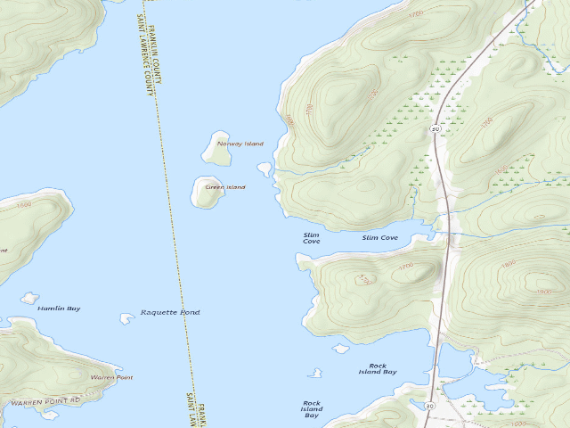
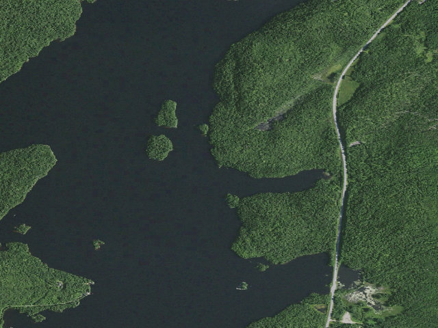
Everything you need — measured from Tupper Lake Site #7 (Horseshoe Lake Wild Forest) · New York State Dept. of Environmental Conservation · NY
- OOutfitter4 mi
- FFuel6 mi
- GGrocery6 mi
- HHardware6 mi
- MMechanic6 mi
- RxPharmacy6 mi
- +Urgent care9 mi
- WWater12 mi
- ShShower12 mi
- DDump13 mi
- @Mail14 mi
- EVEV fast charger23 mi
- LLaundry29 mi
The read: water's a short hop out, fuel & food sit about 6 mi out.
Not within 60 mi: Propane. Plan those before you head up.
One dot per need — the nearest of each kind, straight-line from camp. Places from OpenStreetMap (© OpenStreetMap contributors); the EV fast charger from the US DOE station locator. Open in Google Maps ↗
The site — Tupper Lake Site #7 (Horseshoe Lake Wild Forest)
Nearby & resupply — around Tupper Lake Site #7 (Horseshoe Lake Wild Forest) · New York State Dept. of Environmental Conservation · NY (OpenStreetMap)
- Water featureJenkins Brook (stream) · nearby
- Nearest townMount Arab · ~3.6 mi
- Drinking waternone within 10 mi
- FuelFuel · ~5.8 mi
- Propane / LPGnone within 31 mi
- Dump station~12.9 mi
- GroceriesStewart's Shops · ~5.9 mi
- PharmacyKinney Drugs · ~6.5 mi
- Hospital / clinicCamp Massawepie Health Lodge · ~9.3 mi
- HardwareSturdy Supply & Rental · ~23.3 mi
EV charging — from Tupper Lake Site #7 (Horseshoe Lake Wild Forest) · New York State Dept. of Environmental Conservation · NY — nearest public DC fast & Level 2 (US DOE station data)
- Nearest public DC fast charger23.2 mi straight-line NE — Upstate Auto, Saranac Lake, NY · VIALYNK · J1772, CCS · 2 fast ports listed · listed open, last confirmed by AFDC 2026-09-16 · hours: 24 hours daily · directions
- Public DC fast stations within reach3 within 25 mi · 18 within 50 · 170 within 100 · 393 within 150
- Nearest listing NACS (Tesla)23.4 mi — ChargeSmart EV - Saranac Lake, Saranac Lake
- Nearest listing CHAdeMO41.9 mi — EVolve NY Potsdam, Potsdam
- Nearest public Level 2 (J1772)13.5 mi — Fish Creek Pond Ampitheatre, Saranac Lake, NY (at a campground) · Non-Networked · J1772 · 2 Level 2 ports listed · listed open, last confirmed by AFDC 2024-03-14 · hours: 24 hours daily
- Also listed, not counted aboveNACS-only Level 2 — Shaheen's Adirondack Inn - Tesla Destination, Tupper Lake, 6.4 mi · NACS (Tesla) · hours: 24 hours daily. Open to Teslas only. · AFDC lists it “Free”
- Pricing at the fast chargernot listed
- Power (kW)not listed by AFDC — “DC fast” spans roughly 24 to 350 kW, so ask the network.
- Read this honestlyStraight-line miles, like every distance on this site. Roads run longer than this, and you have to get back. We know where a charger is listed. We don’t know if it works today, how fast it is, or the road miles. Check the network before you commit.
Snapshot 2026-09-16 · AFDC record 351665 · US DOE Alternative Fuels Data Center
Nearby restrooms — around Tupper Lake Site #7 (Horseshoe Lake Wild Forest) · New York State Dept. of Environmental Conservation · NY — pit toilets, restrooms & rest areas (government data)
- No mapped restroom within 30 miles — plan to pack it out.
Open Tupper Lake Site #7 (Horseshoe Lake Wild Forest) elsewhere
Other camps near Tupper Lake Site #7 (Horseshoe Lake Wild Forest)
If this one is full, gated or washed out.
- Tupper Lake Site #6 (Horseshoe Lake Wild Forest)~0.2 mi
- Tupper Lake Site #9 (Horseshoe Lake Wild Forest)~1.3 mi
- Tupper Lake Site #10 (Horseshoe Lake Wild Forest)~1.5 mi
- Tupper Lake Campsite #12 (Horseshoe Lake Wild Forest)~1.6 mi
How we know this — Tupper Lake Site #7 (Horseshoe Lake Wild Forest)
What we don’t know about Tupper Lake Site #7 (Horseshoe Lake Wild Forest)
A land record can put you within a few meters of a spot. It cannot tell you any of this — so check it yourself, and treat anything below as the open question it is.
- Road surface & last-mile access
- How many rigs actually fit
- Cell coverage by carrier
- Current fire restrictions
- Whether any water here is drinkable
- Shade & wind exposure
- Noise and who else shows up
- Whether a listed EV charger works today, or the road miles to it