Willow Flowage Scenic Waters Area - Free First-Come Campsite #19
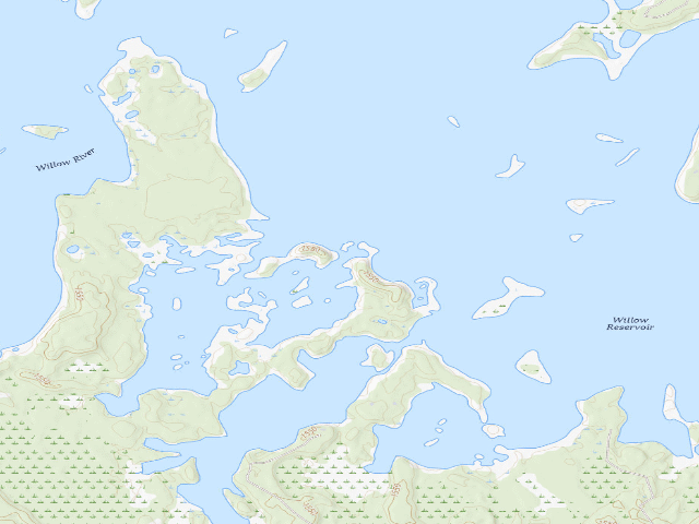
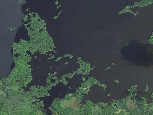
WATER-ACCESS ONLY, FREE, RUSTIC. This is a genuinely FREE campsite, but you can only reach it BY BOAT -- the Wisconsin DNR's own page says "All flowage and river campsites are signed along the water's edge and are accessible via watercraft." There is no drive-up; bring a canoe, kayak or boat and launch from one of the flowage landings. This is DNR campsite #19, one of exactly 12 sites on the Willow Flowage Scenic Waters Area (Oneida County, north-central Wisconsin, near Hazelhurst and Tomahawk) that the DNR keeps first-come, first-served with NO reservation and NO fee. Beginning in 2026 the DNR made 25 of the flowage's 37 sites reservation-and-fee; these 12 stayed free, so confirm on the DNR page that this site is still non-reservable before you rely on it. On the DNR map this site is in the southeast of the flowage off Hilbert Bay near Rock Island. This pin also stands in for 2 other free first-come site(s) the DNR maps within about half a mile of here (DNR site #20, #21); they are separate designated sites but too close to show as distinct pins. RULES (from the DNR page): 10-day camping limit on the flowage; you must occupy the site the first night and may not leave it empty more than one night after; you may NOT leave unattended gear to save a first-come site; camping is allowed in designated, signed sites only (Wis. Admin. Code NR 45.10). RUSTIC: no electric, no hookups, no potable water -- bring your own water and pack out all trash. CAVEAT ON THIS PIN: the coordinate is the DNR's own published campsite GPS fix (degrees + decimal minutes, so roughly 30 m precision); it was confirmed to fall on DNR-managed Willow Flowage Scenic Waters Area land, but we have not visited -- follow the site's shoreline sign and the DNR map on the water. Rules and which sites are free can change; confirm the current rules with the DNR (Willow Flowage manager 715-892-0143) before you go.
Everything you need — measured from Willow Flowage Scenic Waters Area - Free First-Come Campsite #19 · public land · WI
- FFuel6 mi
- GGrocery9 mi
- @Mail10 mi
- WWater14 mi
- +Urgent care15 mi
- EVEV fast charger15 mi
- RxPharmacy15 mi
- MMechanic16 mi
- HHardware16 mi
- OOutfitter17 mi
- LLaundry17 mi
- DDump23 mi
- ShShower24 mi
- AAir-up26 mi
- PPropane52 mi
The read: water's a short hop out, fuel & food sit about 6 mi out.
One dot per need — the nearest of each kind, straight-line from camp. Places from OpenStreetMap (© OpenStreetMap contributors); the EV fast charger from the US DOE station locator. Open in Google Maps ↗
The site — Willow Flowage Scenic Waters Area - Free First-Come Campsite #19
Nearby & resupply — around Willow Flowage Scenic Waters Area - Free First-Come Campsite #19 · public land · WI (OpenStreetMap)
- Water featureTomahawk River (river) · nearby
- Nearest townGoodnow · ~9.7 mi
- Drinking waternone within 10 mi
- FuelFuel · ~5.9 mi
- Propane / LPGPropane · ~30.2 mi
- Dump station~22.9 mi · free · also fills water · customers only
- GroceriesSave More Foods · ~14.5 mi
- PharmacyWalmart Pharmacy · ~14.8 mi
- Hospital / clinicMarshfield Clinic-Minocqua Center · ~15.1 mi
- HardwareAce Hardware · ~22.6 mi
EV charging — from Willow Flowage Scenic Waters Area - Free First-Come Campsite #19 · public land · WI — nearest public DC fast & Level 2 (US DOE station data)
- Nearest public DC fast charger14.6 mi straight-line NE — Minocqua, WI - Tesla Supercharger (at a grocery store) · Tesla · NACS (Tesla) · 8 fast ports listed · listed open, last confirmed by AFDC 2026-06-18 · hours: 24 hours daily. NACS partner enabled. · directions
- Public DC fast stations within reach4 within 25 mi · 9 within 50 · 44 within 100 · 139 within 150
- Nearest listing CCS21.9 mi — CULVERS KEMP 01, Rhinelander
- Nearest listing CHAdeMO37.8 mi — BPC LEVEL 3-1, Merrill
- Nearest public Level 2 (J1772)18.7 mi — Harley Davidson - Kaphaem, Tomahawk, WI (at an office building) · ENVIROSPARK · J1772 · 4 Level 2 ports listed · listed open, last confirmed by AFDC 2025-11-13 · hours: 24 hours daily
- Pricing at the fast chargernot listed
- Power (kW)not listed by AFDC — “DC fast” spans roughly 24 to 350 kW, so ask the network.
- Read this honestlyStraight-line miles, like every distance on this site. Roads run longer than this, and you have to get back. We know where a charger is listed. We don’t know if it works today, how fast it is, or the road miles. Check the network before you commit.
Snapshot 2026-09-16 · AFDC record 237640 · US DOE Alternative Fuels Data Center
Nearby restrooms — around Willow Flowage Scenic Waters Area - Free First-Come Campsite #19 · public land · WI — pit toilets, restrooms & rest areas (government data)
- Vault / pit toiletRound Lake Bl · ~18.1 mi NW · USFS
- Vault / pit toiletRound Lake Logging Dam · ~18.3 mi NW · USFS
- Vault / pit toiletEmily Lake · ~19.2 mi N · USFS
- Vault / pit toiletWabasso Lake Bl · ~19.5 mi N · USFS
Open Willow Flowage Scenic Waters Area - Free First-Come Campsite #19 elsewhere
Other camps near Willow Flowage Scenic Waters Area - Free First-Come Campsite #19
If this one is full, gated or washed out.
- Willow Flowage Scenic Waters Area - Free First-Come Campsite #2~0.5 mi
- Willow Flowage Scenic Waters Area - Free First-Come Campsite #10~2.0 mi
- Willow Flowage Scenic Waters Area - Free First-Come Campsite #11~2.8 mi
- Willow Flowage Scenic Waters Area - Free First-Come Campsite #12~3.2 mi
How we know this — Willow Flowage Scenic Waters Area - Free First-Come Campsite #19
What we don’t know about Willow Flowage Scenic Waters Area - Free First-Come Campsite #19
A land record can put you within a few meters of a spot. It cannot tell you any of this — so check it yourself, and treat anything below as the open question it is.
- Road surface & last-mile access
- How many rigs actually fit
- Cell coverage by carrier
- Seasonal & winter access
- Current fire restrictions
- Whether any water here is drinkable
- Shade & wind exposure
- Noise and who else shows up
- Whether a listed EV charger works today, or the road miles to it