Wood County Wildlife Area – Designated Primitive Camp Site #2
SEASONAL, FREE, PRIMITIVE. This is FREE camping, but ONLY during the property's open camping windows -- the Wisconsin DNR's own page says primitive camping here is free "during the spring turkey seasons and from Sept. 1 through Dec. 31"; it is closed to camping the rest of the year. Within those windows the DNR page states VERBATIM: "Primitive camping is permitted at designated sites, free of charge ... Campers are required to self-register." There is no camping fee and no camping-permit fee, and Wisconsin does NOT require a vehicle admission sticker on a wildlife area (that sticker is only for state parks, forests and recreation areas). Under Wis. Admin. Code NR 45.10 you may camp on a wildlife area ONLY in a designated area, so pitch only at a marked/self-register designated site. This is one of exactly TWO designated primitive camping areas on the 21,000-acre Wood County Wildlife Area (southwestern Wood County, central Wisconsin sand country, about 20 miles north of Necedah and 18 miles west of Wisconsin Rapids). This site (#2) is in the southeast of the property, just south of Amundson Road between South Bluff Road and Ingraham Road. Primitive conditions: no electric, no hookups, bring your own water, pack out all garbage; some sites have a pit toilet. CAVEAT ON THIS PIN: there is no published campsite coordinate for this property and nothing is mapped in OpenStreetMap, so the pin was digitized off the DNR's own property map and is accurate to roughly a tenth of a mile -- it was confirmed to fall on DNR-managed Wood County land, but when you arrive, self-register and follow the DNR property map and the posted signs to the actual designated site. HEADS UP: this is working wildlife land and the open camping season overlaps fall hunting and spring turkey seasons -- wear blaze orange or plan around it. Rules can change or a site can be closed by posting -- confirm the current camping rules, the designated-site locations and any stay limit with the DNR before you go.
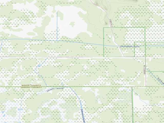
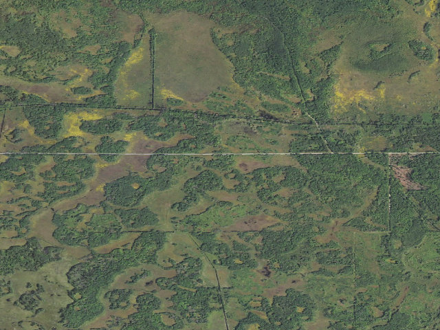
Everything you need — measured from Wood County Wildlife Area – Designated Primitive Camp Site #2 · public land · WI
- GGrocery12 mi
- FFuel13 mi
- WWater14 mi
- ShShower16 mi
- DDump16 mi
- @Mail16 mi
- HHardware17 mi
- +Urgent care18 mi
- EVEV fast charger20 mi
- MMechanic20 mi
- RxPharmacy21 mi
- LLaundry21 mi
- OOutfitter28 mi
- AAir-up37 mi
- PPropane48 mi
The read: water's a short hop out, fuel & food sit about 12 mi out.
One dot per need — the nearest of each kind, straight-line from camp. Places from OpenStreetMap (© OpenStreetMap contributors); the EV fast charger from the US DOE station locator. Open in Google Maps ↗
The site — Wood County Wildlife Area – Designated Primitive Camp Site #2
Nearby & resupply — around Wood County Wildlife Area – Designated Primitive Camp Site #2 · public land · WI (OpenStreetMap)
- Water featurePortion of Meadow Valley Flowage (water) · nearby
- Nearest townMeadow Valley · ~2.8 mi
- Drinking waternone within 10 mi
- FuelWhitetail Crossing · ~12.6 mi
- Propane / LPGnone within 31 mi
- Dump station~15.9 mi
- GroceriesWhitetail Crossing · ~12.5 mi
- PharmacyDaly Drug · ~21.1 mi
- Hospital / clinicAspirus Riverview Hospital · ~21.0 mi
- HardwareAce Hardware · ~21.3 mi
EV charging — from Wood County Wildlife Area – Designated Primitive Camp Site #2 · public land · WI — nearest public DC fast & Level 2 (US DOE station data)
- Nearest public DC fast charger20.4 mi straight-line NE — Wheelers Chevrolet of Wisconsin Rapids · FLO · CHAdeMO, CCS · 1 fast port listed · listed open, last confirmed by AFDC 2026-09-16 · hours: 24 hours daily · directions
- Public DC fast stations within reach4 within 25 mi · 22 within 50 · 111 within 100 · 285 within 150
- Nearest listing NACS (Tesla)21.8 mi — Tomah, WI - Tesla Supercharger, Tomah
- Nearest public Level 2 (J1772)20.8 mi — Rapids Motor Company - Series, Wisconsin Rapids, WI · Blink Network · J1772 · 6 Level 2 ports listed · listed open, last confirmed by AFDC 2026-09-16 · hours: 24 hours daily
- Pricing at the fast chargernot listed
- Power (kW)not listed by AFDC — “DC fast” spans roughly 24 to 350 kW, so ask the network.
- Read this honestlyStraight-line miles, like every distance on this site. Roads run longer than this, and you have to get back. We know where a charger is listed. We don’t know if it works today, how fast it is, or the road miles. Check the network before you commit.
Snapshot 2026-09-16 · AFDC record 259275 · US DOE Alternative Fuels Data Center
Nearby restrooms — around Wood County Wildlife Area – Designated Primitive Camp Site #2 · public land · WI — pit toilets, restrooms & rest areas (government data)
- RestroomFederal restroom · ~2.7 mi S · FWS
- RestroomFederal restroom · ~4.9 mi S · FWS
- RestroomFederal restroom · ~14.0 mi S · FWS
- Highway rest areaRest Area #53 · ~24.4 mi W
Open Wood County Wildlife Area – Designated Primitive Camp Site #2 elsewhere
Other camps near Wood County Wildlife Area – Designated Primitive Camp Site #2
If this one is full, gated or washed out.
- Wood County Wildlife Area – Designated Primitive Camp Site #1~3.8 mi
- Meadow Valley Wildlife Area – Designated Primitive Camp Site (OSM "MVWA 4")~4.9 mi
- Meadow Valley Wildlife Area – Designated Primitive Camp Site (OSM "MVWA 10")~5.7 mi
- Meadow Valley Wildlife Area – Designated Primitive Camp Site (OSM "MVWA 9")~6.0 mi
How we know this — Wood County Wildlife Area – Designated Primitive Camp Site #2
What we don’t know about Wood County Wildlife Area – Designated Primitive Camp Site #2
A land record can put you within a few meters of a spot. It cannot tell you any of this — so check it yourself, and treat anything below as the open question it is.
- Road surface & last-mile access
- How many rigs actually fit
- Cell coverage by carrier
- Current fire restrictions
- Whether any water here is drinkable
- Shade & wind exposure
- Noise and who else shows up
- Whether a listed EV charger works today, or the road miles to it