Black Hills National Forest
Where the camps cluster
The place
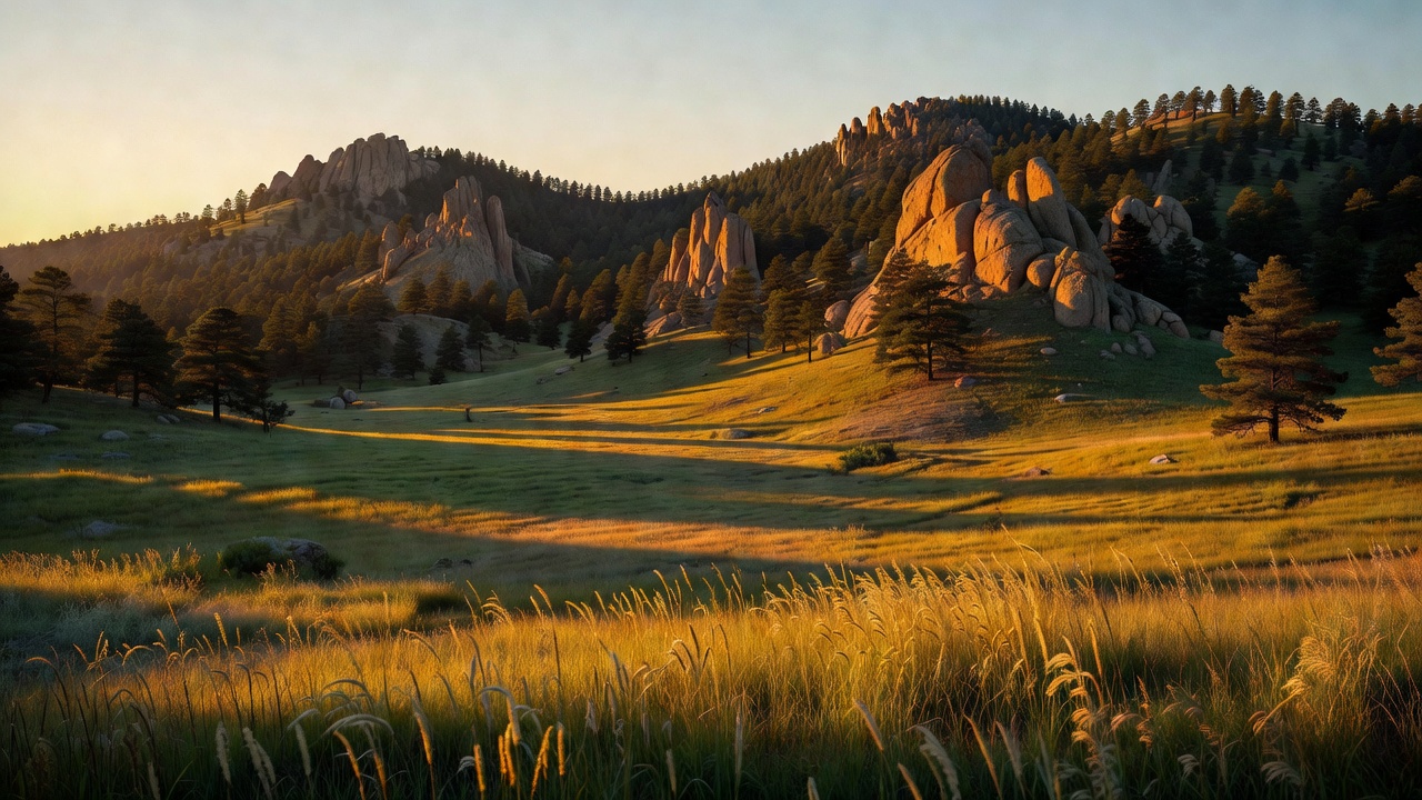
Black Hills National Forest sits in western South Dakota and northeastern Wyoming, and the first thing you notice is that it should not be there. You drive for hours across shortgrass and cattle country, and then a dark dome of timber lifts out of the plains. From a distance the ponderosa look nearly black, which is where the Lakota name Paha Sapa -- 'hills that are black' -- comes from. The Forest Service's own shorthand for the place is 'island in the plains,' and it is the right phrase: the unit runs about 110 miles long by 70 miles wide, and it is biologically an island too. Spearfish Canyon in the northern hills is a documented crossroads where plants from the Rocky Mountains, the eastern woodlands, the northern forests and the Great Plains all turn up in the same drainage.
The rock changes what camping here feels like. The core of the Hills is granite about 1.8 billion years old, pushed up in the Laramide orogeny and ringed by concentric bands of metamorphic and sedimentary rock. In the center that means the Needles -- granite spires and slabs -- and pine duff. Out on the flanks it means limestone: Spearfish Canyon's walls are stacked Deadwood shale, pinkish Englewood limestone and buff Paha Sapa limestone that runs 300 to 600 feet thick, and that same limestone is why the Hills are riddled with caves. Ponderosa pine dominates almost everywhere, with spruce at the higher and cooler elevations, plus aspen, bur oak and birch, and it drops into grassland prairie at the low edges.
It is not a lonely forest. Mount Rushmore is surrounded by it on all sides, Jewel Cave National Monument and Wind Cave National Park sit in the same neighborhood, and Custer State Park's Needles Highway pulls traffic through the granite all summer. That means the Black Hills give you an unusual combination: genuinely wild country with a gas station and a cell signal thirty minutes away, and weekend crowds to match. It also means the map matters more than usual here -- the forest is laced with private inholdings and other ownerships, and a flat, inviting pull-off is not automatically public land.
History
This is stolen land, and that is not a rhetorical flourish -- it is a Supreme Court holding. The 1868 Treaty of Fort Laramie established the Great Sioux Reservation and promised the Black Hills would be protected from American settlement forever. In 1874 George Armstrong Custer's expedition confirmed gold on French Creek, the rush was on, and after the Great Sioux War of 1876 the United States took the Hills anyway. In 1980 the Supreme Court found the taking illegal and ordered compensation of roughly $106 million plus interest. The Lakota refused it and have kept refusing it; they want the land, not the check. The money still sits there. To the Lakota the Hills are sacred ground, 'the heart of everything that is,' and every camp you make here is made inside that unresolved history.
The forest itself was born out of fire and gold. Devastating wildfires in 1893 helped push the government to act, and the Black Hills Forest Reserve was proclaimed on February 22, 1897 -- the same Washington's Birthday on which President Grover Cleveland signed thirteen proclamations setting aside some 21 million acres, an act so unpopular in the West that Congress tried to undo it and Cleveland pocket-vetoed the repeal on his last day in office. The fight produced the Organic Act of 1897, the law that said the reserves existed in part to furnish a continuous supply of timber. It became a national forest in 1907.
Then came Case No. 1. Advertised on August 4, 1899 and awarded to the Homestake Mining Company, it was the first regulated federal timber sale in the United States -- 13 million board feet of sawtimber and 5,100 cords of wood for $14,967.32, priced at a dollar per thousand board feet, with an 8-inch diameter limit and seed trees left standing so the stand would come back. Logging began that December. Homestake needed timbers for its gold mine at Lead and wood to heat its buildings; what the country got was the template for how the government would sell trees for the next century. Before that contract, people simply cut what they wanted. Federal forestry, as a practice, starts on this forest.
Wildlife & plants
The animal list here reads like two different states got shuffled together, which is exactly what an island range does. Elk, mule deer, white-tailed deer, pronghorn, moose, black bears, cougars, coyotes and bighorn sheep all turn up, and more than 200 bird species have been recorded, including bald eagles, osprey, hawks and peregrine falcons. Eleven reservoirs are stocked for fishing.
The odd one out is the mountain goat. Mountain goats are not native to South Dakota -- an isolated population has lived in the Black Hills since the 1920s, when they were introduced, and they took to the granite the way you would expect. South Dakota Game, Fish and Parks describes their core range as running from Highway 385 at Crazy Horse east to Mount Rushmore, and from Highway 244 south to the Needles, roughly 32,000 acres of granite outcrops between 4,000 and 7,242 feet, with animals also turning up in the Battle Creek drainage and Spearfish Canyon. The hunting season is closed. Bridal Veil Falls in Spearfish Canyon is a well-known place to spot them; so is the high granite around Black Elk Peak.
The other thing you will meet is the mountain pine beetle, mostly in the form of standing gray snags. The most recent epidemic ran from 1996 to 2016 and affected roughly 450,000 acres to varying degrees. The beetle is a quarter-inch insect that tunnels under the bark and carries a blue-stain fungus; the tunneling cuts off the tree's food and the fungus blocks its water, and between the two the pine dies. Ponderosa is the main host, and ponderosa covers more than a million acres of forestland in western South Dakota. Populations here cycle on roughly a ten-year rhythm. Practically, that means a lot of dead standing timber -- pick your campsite with an eye upward, because a snag in wind is a real hazard, and dry pine litter is why this forest takes fire so seriously.
Notable features
Black Elk Peak, at 7,242 feet, is the high point of South Dakota and is often called the highest summit east of the Rocky Mountains -- a claim that depends on how you classify the Hills, since they are geologically tied to the Rocky Mountain Front rather than being a separate range. The stone lookout tower on top was built by the Civilian Conservation Corps between 1935 and 1938, was last staffed in 1967, and the tower, dam, pumphouse and stairway went on the National Register of Historic Places in 1983. The mountain was named Harney Peak in 1855 by Lieutenant Gouverneur K. Warren for General William S. Harney, who had massacred Sicangu Lakota that same year; after a campaign led by Basil Brave Heart, the U.S. Board on Geographic Names voted unanimously on August 11, 2016 to rename it for Black Elk, the Oglala Lakota holy man who received his great vision on that peak as a nine-year-old and whose teachings were recorded in John Neihardt's 'Black Elk Speaks' in 1932. Around the summit is the Black Elk Wilderness -- 13,426 acres designated by Congress in 1980, with about eight miles of the Centennial Trail crossing it, and no motorized or mechanized travel, bicycles included.
Spearfish Canyon in the northern hills is the other set-piece: a narrow limestone gorge cut by Spearfish Creek with Spearfish Falls, Roughlock Falls and Bridal Veil Falls along it, followed by a national scenic byway on U.S. 14A that runs on an old railroad grade abandoned after the 1933 floods. The George S. Mickelson Trail runs 108.8 miles from Edgemont to Deadwood on a Chicago, Burlington and Quincy branch line built in 1890-91 -- four tunnels, more than 100 converted railroad bridges, packed crushed limestone underfoot, South Dakota's first rails-to-trails project, opened in segments from 1991 and finished in 1998. Note that the trail corridor is a separate ownership: you cannot dispersed camp in its right-of-way.
The famous neighbors are not forest land, and it is worth knowing the difference. Mount Rushmore National Memorial -- 1,278 acres carved into the northwest margin of the Black Elk Peak granite batholith by Gutzon Borglum and some 400 workers between October 4, 1927 and October 31, 1941 -- is a National Park Service unit ringed on all sides by this forest. Jewel Cave National Monument, proclaimed by Theodore Roosevelt on February 7, 1908 as the first national monument created specifically to protect a cave, had 220.33 miles of mapped passage as of July 2025, making it the fifth-longest known cave in the world; brothers Frank and Albert Michaud found it in 1900 by noticing cold air blowing out of a hole. The Needles Highway -- 14 miles of South Dakota Highway 87, finished in 1922 under Senator Peter Norbeck, with the Iron Creek, Needles Eye and Hood tunnels blasted straight through granite -- runs through Custer State Park, not the national forest, and closes in winter.
Camps are sourced from public U.S. Forest Service recreation data and have not been personally visited. Roads shown are Forest Service passenger-car routes (maintenance level 3–5) and may be seasonal or gated. Always confirm access, fees and fire rules with the ranger district before you go. Found a fee where we show free? Tell us on the contact page.