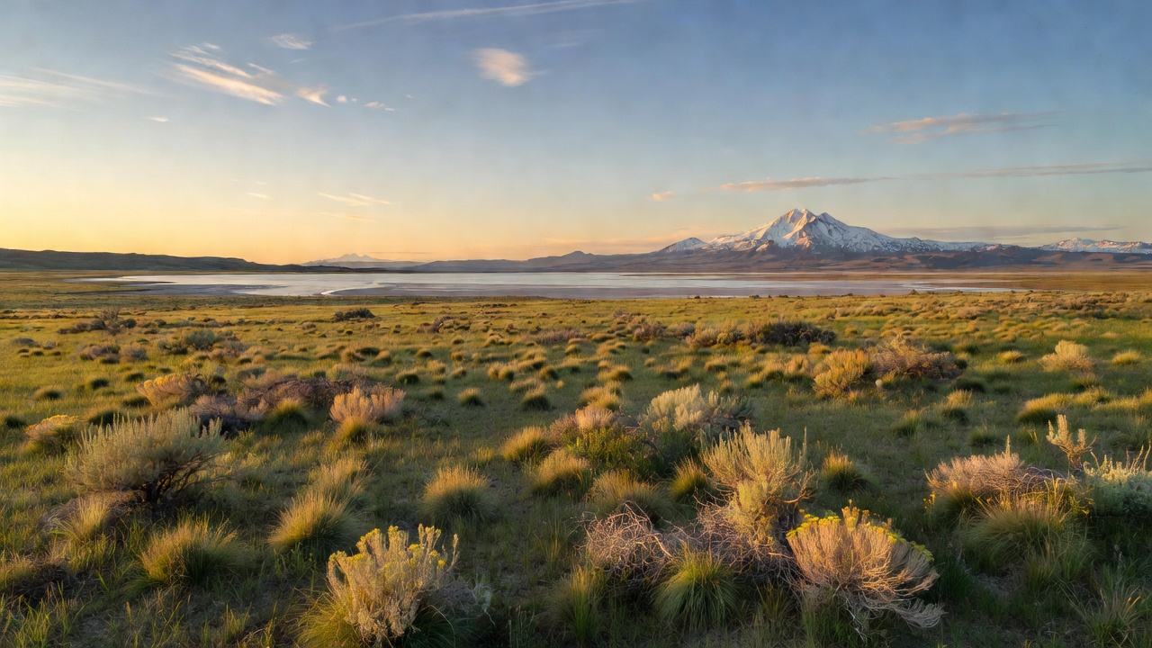
Butte Valley National Grassland
The place
Butte Valley National Grassland sits in northern Siskiyou County, California, in a scenic basin on the east flank of the southern Cascade Range, right where the Cascades give way to the west edge of the Modoc Plateau. U.S. Route 97 runs up the valley between Macdoel and Dorris, and the grassland lies just off it -- the Forest Service's own description is that it is 'easily visited' from the highway, which is a fair way to put it. The landscape is shrub-steppe, not prairie in the Great Plains sense: sagebrush, rabbitbrush, bitterbrush, basin wildrye, intermediate wheatgrass and a long list of other arid grasses and flowers, with western juniper as the only tree, scattered thin across the flat. It is small as national grasslands go -- under twenty thousand acres -- and it is one piece of a much larger valley floor, a featureless plain the USGS measured at more than 130 square miles. Immediately west of the grassland are Meiss Lake and the Butte Valley Wildlife Area, which belong to the California Department of Fish and Wildlife, not the Forest Service. Different landlord, different rules.
This is semiarid country. The USGS calls the Butte Valley climate semiarid with warm, dry summers and cool, humid winters, and the published precipitation figures for the valley floor land somewhere around a foot a year, increasing as you go north and up into the Cascades. There is no shade to speak of and no water on the grassland. The Forest Service is blunt about what is here for visitors: there are no designated recreation sites within Butte Valley National Grassland. What it offers instead is a drive, a pair of binoculars and a lot of sky, and the agency lays out the loop turn by turn -- north from Macdoel 5.1 miles to Meiss Lake Sam's Neck Road, west 4.9 miles through the grassland to Indian Point Road, north 4.6 miles with low rock bluffs on your left, then east 5.2 miles on Richardson Road back to Route 97 a mile south of Dorris. Run it the other way from Dorris if that suits you better. Local ranchers graze cattle out here under Forest Service permit, so expect stock, expect gates, and leave them how you found them.
Plan the camping around the grassland rather than on it. Free dispersed camping is allowed on Klamath National Forest land along roads and trails open to OHVs, with vehicles parked up to 30 feet from the edge of the road surface where that can be done without tearing anything up -- which makes the Motor Vehicle Use Map the document that matters, especially in a valley stitched together from national forest, a state wildlife area and a lot of private irrigated farmland. Across the Pacific Southwest Region the standard dispersed rules apply: self-contained, pack it out, 150 feet back from water, and a stay limit that typically tops out around 14 days. A California Campfire Permit is required for any fire, stove or barbecue anywhere on the forest outside a developed campground, and the Goosenest Ranger District -- the district that administers this grassland -- sits right on Highway 97 in Macdoel if you need to ask somebody. The nearest developed campgrounds are Juanita Lake and Martins Dairy off Ball Mountain Little Shasta Road to the west, and Shafter and Orr Lake to the south off Forest Road 8Q01.
History
Start with the lake, because everything here follows from it. Butte Valley is a large structural depression nearly ringed by young fault scarps, and it drains nowhere -- the USGS describes it as a closed drainage basin, a valley whose water has no river out. During the Pleistocene a lake filled much of that depression. Meiss Lake, west of the grassland, is what is left of it, and the flat you drive across is the old lakebed, filled in with sediment washed down off the surrounding mountains. That is where the grassland's soils come from, and it is also why the ground is so relentlessly level.
The Forest Service's history of the grassland states that for more than 7,000 years Butte Valley has been within the ancestral lands of the Modoc Tribe. Euro-American settlement came in the 1860s, and the draw was exactly what you would expect: flat sandy soils and an old lakebed, ready-made for the plow. Homesteaders drained it, plowed it and grazed it. Farming and ranching worked for a while, and then it stopped working -- productivity fell off and many of the farms failed outright during the drought and Depression of the 1930s, leaving families stranded on land that could no longer carry them. Under the Bankhead-Jones Farm Tenant Act of 1937 the federal government began buying up the submarginal ground, and by 1943 the purchase in Butte Valley was complete. The Soil Conservation Service took over as administrator and went to work stabilizing dirt that had stopped holding together, planting over 4,000 acres of crested wheatgrass and organizing the remaining settlers into grazing associations with locally worked-out conservation practices. During the 1940s, with the valley emptied out and the country at war, the military used the grassland as a practice bombing range.
In 1954 the land was reassigned to the Forest Service -- specifically the Goosenest Ranger District of the Klamath National Forest -- and here is where Butte Valley's story splits from the rest of the national grasslands. Other tracts bought under the same authority were designated National Grasslands. Butte Valley was not. It stayed a 'purchase unit,' which sounds like paperwork and was not: it meant the land could be disposed of, and that in turn meant nobody wanted to make long-term investments in ground that might not stay public. That limbo ran for decades. By the 1980s there were active attempts to get rid of it -- the tract was identified by the federal government for sale, considered as a prison site, and eyed as a possible county landfill. What saved it was an unusually broad local coalition: in 1984 the push for National Grassland designation drew strong support from the local Congressional delegation, the California Cattlemen's Association, California Fish and Game and the local public. The designation came through in 1991, making Butte Valley the nation's 20th National Grassland. The Forest Service's own summary of what that meant is worth quoting, because it is more honest than most agency prose: the designation 'is not a description of the area as much as a statement of policy and effort to restore the area to a multiple of uses and benefits.'
Wildlife & plants
The plant community is high-desert shrub-steppe -- sagebrush, rabbitbrush, bitterbrush, basin wildrye and intermediate wheatgrass, with scattered western juniper standing as the only tree on the place. Some of what you are looking at is a repair job: the crested wheatgrass sown across more than 4,000 acres in the reclamation years was an introduced species, planted because it would hold soil that had quit holding itself.
For big animals, the Forest Service lists mule deer, Roosevelt elk, pronghorn, coyote, marmot, weasel, porcupine, bobcat, snakes and lizards using the grassland, and notes that bighorn sheep released over in nearby Oregon have recently been spotted near it. But the reason people with good optics come to Butte Valley is birds, and specifically raptors. This is a genuinely notable place for them: for over 35 years the valley has been the site of a long-term study of Swainson's hawk, which nests in the western junipers here through spring and summer and then winters as far south as Argentina. Golden eagle, bald eagle, merlin and sandhill crane are all part of the resident cast. Winter brings its own roster -- red-tailed hawk, ferruginous hawk, rough-legged hawk, northern harrier, American kestrel and prairie falcon -- and at dawn and dusk the owls come out: great horned, short-eared and long-eared. Wikipedia's account of the grassland adds the songbirds that go with sage country, including sage thrasher, Brewer's sparrow, horned lark and lark sparrow.
Two honest notes. First, the Forest Service records that burrowing owls were here historically but have not been seen in several years, which is the kind of detail an agency does not have to publish and it is to their credit that they do. Second, the birding is as good as it is partly because of the neighbors: the state's Butte Valley Wildlife Area next door covers roughly 13,400 acres of wetlands, sage flats and farmland including 4,000-acre Meiss Lake, and California Fish and Wildlife calls it a great place for waterfowl, bald eagles and sandhill cranes. Grassland, wetland and cropland stacked side by side in one basin is a lot of habitat in a small radius. Note that the wildlife area is state land with its own access and hunting rules -- it is a Type B hunting area requiring passes -- so do not assume Forest Service rules carry across the fence.
Notable features
The drive is the main event, and it is better than that sounds. From Macdoel, go north 5.1 miles on Route 97 to Meiss Lake Sam's Neck Road, then west 4.9 miles straight through the grassland to Indian Point Road. Turn north and run 4.6 miles with the low rock bluffs on the west side of the road. The sharp turn at Indian Point is the spot to pull over -- the Forest Service calls it a scenic stop and points out the windmill there. Then east 5.2 miles on Richardson Road brings you back to Route 97 a mile south of Dorris. It is a loop of gravel and farm road through open sage with the Cascade Range and Mount Shasta on the skyline, and it is the whole of the developed 'recreation' here.
The geology is the other reason to slow down. The valley floor sits at about 4,200 feet, ringed by young fault scarps, with flat-floored grabens -- Sams Neck and Pleasant Valley among them -- running north off the main depression; Sam's Neck is the road you drive in on. Volcanic vents stand up all around the rim: the USGS's 1960 survey of the region puts Ball Mountain at 7,776 feet and the Mount Hebron vent at 6,147 feet among them, and to the east the long northwest-trending fault block of Mahogany Mountain ridge walls Butte Valley off from the Lower Klamath Lake marshland. In the eastern part of the valley near Inlow Butte and Cedar Point there are small hard-surfaced playas and a patch of dune sand -- fine-to-coarse quartz sand up to about 20 feet thick, blown off the old lake and alluvial deposits and marching northeast away from an abandoned shoreline. There is a lot of Pleistocene lying in plain sight out here for anyone who knows what they are looking at.
For a base, Juanita Lake Campground is the closest developed option: from Route 97 about 3.8 miles south of Macdoel, turn west on Ball Mountain Road, run roughly 4 miles to Forest Road 46N04 and follow it in. It has 23 sites plus a 50-person group camp, a 55-acre lake stocked with trout and holding bass and catfish, and a 1.5-mile paved barrier-free trail circling the water with two fishing jetties. Single sites run $15 a night, doubles $20 and the group camp $50, reservations go through recreation.gov, the stay limit is 14 days, and no motorized boats are allowed. One thing to plan around: the Forest Service's own current-conditions note says to bring drinking water, because the water at the campground is not potable. Martins Dairy is the other campground on that side, with Shafter and Orr Lake to the south off Forest Road 8Q01.
Camps are sourced from public U.S. Forest Service recreation data and have not been personally visited. Roads shown are Forest Service passenger-car routes (maintenance level 3–5) and may be seasonal or gated. Always confirm access, fees and fire rules with the ranger district before you go. Found a fee where we show free? Tell us on the contact page.