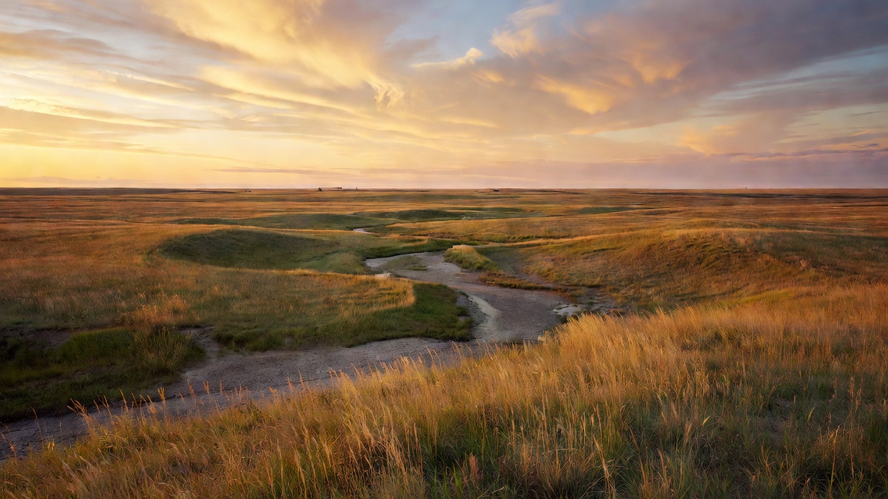
Cedar River National Grassland
The place
Cedar River National Grassland sits in southern North Dakota, in Grant and Sioux counties, and the Forest Service describes the country in one short line: level plains and rolling hills with some small streams. That is mixed-grass prairie, the northern plains kind -- blue grama, needle-and-thread, needleleaf sedge, prairie junegrass, western wheatgrass and western snowberry, shot through with imported crested wheatgrass, Kentucky bluegrass and smooth brome. It is open, it is big-sky, and it is not a forest. The only trees you will find are narrow strips of green ash woodland along the smaller creeks, and those ribbons are worth walking: the Forest Service's own field biologists call green ash woodland the most diverse and productive habitat on this district, full of American plum, chokecherry, buffaloberry, box elder and serviceberry.
The administration takes a sentence to untangle. Cedar River is one of four units in the Dakota Prairie Grasslands, which the Forest Service created in 1998 out of ranger districts that had belonged to the Custer National Forest over in Billings, Montana. The supervisor's office is in Bismarck at 2000 Miriam Circle, 701-989-7300. But nobody in Bismarck is going to tell you which two-track is open. The people who actually run this ground are the Grand River Ranger District at 1005 5th Avenue West in Lemmon, South Dakota, (605) 374-3592, Grand-River.RD@usda.gov, open weekdays 8:00 to 4:30 Mountain time. That one district office administers both Cedar River and the much larger Grand River National Grassland down in South Dakota, and most published material treats the two as a single landscape. Read carefully when you research this place -- a lot of what turns up online is Grand River wearing Cedar River's name.
Here is the planning fact that matters more than any other. In a 2011 Forest Service field publication covering both grasslands, the agency's own biologists put the entire landscape inside the two units' administrative boundary at about 650,000 acres and then said the quiet part out loud: only a quarter of that acreage is National Forest System land. The rest is roughly seventy percent private, about three percent state, about one percent Indian reservation and about one percent Bureau of Reclamation. The federal acres are not a block. They are a checkerboard laid into working ranch country, and the Forest Service's advice is blunt -- unless you have landowner permission to do otherwise, stay on public roadways when you are off public land, and carry the Grasslands Visitor Map so you do not trespass. That map is sold at the Lemmon office; it was ten dollars when the agency published that guidance, so call and ask what it costs now.
Travel rules are simple and strict. Public walking access is allowed on all National Forest System land here. Off-road vehicle travel is prohibited, but every paved, graveled and designated two-track road is open to the public -- and the Lemmon office is the one that can tell you which two-tracks are designated, because the answer is not obvious on the ground. Bring a high-clearance vehicle if you plan to use them, leave every gate exactly as you found it, and expect two-track travel to be shut down outright during periods of extreme fire danger. In winter and early spring, stay on the main roads. There is a current Motor Vehicle Use Map for Cedar River; routes that are not on it are not open to public motor vehicle travel, and that rule has teeth.
One more thing to sort out before you go. The portion of the grassland in Sioux County lies within the Standing Rock Indian Reservation -- Sioux County is the only county in North Dakota that sits entirely inside a reservation -- and tribal land, federal land and private land all meet out here. This guide is not going to invent a rule for you about what that means for access, hunting or camping on any given parcel. Call Lemmon before you go and ask about the specific ground you intend to use.
History
The reason this grassland exists is that somebody plowed it. The Forest Service's own history of the national grasslands starts with the Homestead Act of 1862 and the settlers who tried to replace native prairie sod with crops, and it does not soften the ending: land that should never have been plowed yielded its topsoil to incessant dry winds. In the 1930s those winds built dust clouds that the agency records rising over 20,000 feet across Oklahoma, Texas, Wyoming, Nebraska, Kansas, Colorado and the Dakotas.
Washington's answer was to buy the wreckage back. The National Industrial Recovery Act of 1933 and the Emergency Relief Appropriations Act of 1935 gave the federal government authority to acquire damaged land, restore it, and resettle the families who had been ruined trying to farm it; the long-term authority for holding and managing what it bought came from Title III of the Bankhead-Jones Farm Tenant Act of 1937. The repair work took a generation. Then, in the Forest Service's own words, 'a hundred years after the Homestead Act on June 23, 1960, the National Grasslands were born.' Today there are twenty of them, totaling almost four million acres -- seventeen running from North Dakota down the Great Plains to north-central Texas, three more out in Great Basin country in Oregon, California and Idaho. Cedar River is at the top of that string.
The grassland is also laid across a much older map. The counties tell part of it. Sioux County was created by North Dakota's governor on September 3, 1914 and named for the Lakota, whose historic territory took in this ground; its seat is Fort Yates. Grant County was partitioned off from Morton County by a vote on November 7, 1916, organized that November 28, and named for Ulysses S. Grant, president from 1869 to 1877; its seat is Carson. But the deeper history belongs to Standing Rock, which covers all of Sioux County plus parts of Corson, Dewey and Ziebach counties in South Dakota -- some 3,572 square miles, roughly twice the size of Delaware -- and is home to the Hunkpapa and Sihasapa bands of Lakota along with Ihunktuwona, Pabaksa and Hunkpatina Dakota. The 1868 Fort Laramie Treaty confined the Great Sioux Nation's lands to a territory that still included the Black Hills. Custer's 1874 expedition into those hills found gold, the rush that followed brought on the Great Sioux War of 1876-1877 and the Battle of the Little Bighorn, and on March 2, 1889 -- months before the Dakotas were admitted as states -- an act of Congress partitioned the Great Sioux Reservation into five smaller ones: Standing Rock, Cheyenne River, Lower Brule, Rosebud and Pine Ridge. The breakup was carried through around February 1890, allotting 320-acre parcels to families and pushing assimilation through boarding schools. The reservation is governed today by an elected seventeen-member tribal council.
Put those two histories side by side and you have the honest shape of this place: ground taken from one people by treaty and allotment, homesteaded, farmed past its limit, blown away, bought back by the government at Depression prices, and now grazed and administered as public land -- part of it inside the reservation it was carved out of.
Wildlife & plants
Birds are the reason to come here, and the Forest Service says so. Its birding page for Cedar River describes a grassland home to many bird species, including migratory waterfowl that stop over, and names sharp-tailed grouse, greater prairie chickens, wild turkeys, eagles, falcons and sparrows. Behind that short page sits something much better: a 115-page Forest Service field publication, 'Bird Status and Distribution on the Cedar River and Grand River National Grasslands: 2011,' by Dan Svingen, David Griffiths and Carolyn Griffiths. If you are serious about birding this district, that is the document to find.
What it describes is a landscape of four habitats. Mixed-grass prairie is the most abundant, and its breeding birds are the grassland specialists that birders drive across states for -- sharp-tailed grouse, upland sandpipers, marbled godwits, Sprague's pipits, chestnut-collared longspurs, and Savannah, grasshopper, vesper and Baird's sparrows. Green ash woodland runs as a narrow strip along the smaller creeks and is the richest habitat on the district: red-tailed hawks, mourning doves, northern flickers, least flycatchers, red-eyed and warbling vireos, black-capped chickadees, house wrens, brown thrashers, yellow warblers, black-headed grosbeaks and lazuli buntings in summer. Natural wetlands are scarce, so the hundreds of small reservoirs built to water cattle end up carrying the wetland birds -- dabbling ducks, American coots, killdeer, Wilson's phalaropes, migrant shorebirds and red-winged and yellow-headed blackbirds. Cropland, hayfields and Conservation Reserve Program grass fill in the rest and hold their own species: ring-necked pheasants, gray partridges, horned larks, northern harriers, bobolinks, western meadowlarks, dickcissels and, after harvest, red-tailed and Swainson's hawks working the stubble.
Cedar River gets more scientific attention than a tract this size has any right to. One of the U.S. Geological Survey's Breeding Bird Survey routes runs straight through it -- the Cedar River BBS, with stop #16 out in the Hoopie Allotment in Sioux County. USGS's Northern Prairie Wildlife Research Center ran area-search surveys of the grassland's breeding birds in 2002 and 2003, covering 42 quarter-sections the first year and 39 the second. Four of the sample areas for a multi-state bird-monitoring effort covering the western Dakotas and eastern Montana and Wyoming sit on Cedar River, centered on the East Maier, Maier, North Community and South Community allotments. A ferruginous hawk trapped here was fitted with a GPS transmitter as part of an international study of the species' movements. And the sharp-tailed grouse counts on this grassland are run by the Dakota Prairie Grasslands together with Sitting Bull College, the tribal college on Standing Rock -- which is about as fitting an arrangement as public-land science gets.
Sharp-tailed grouse are the bird to time a trip around. They are a management indicator species for the Dakota Prairie Grasslands, and in early April the males gather on leks to display twice a day, at first light and again in the evening -- a tail-rattling routine of rapid stepping and vibrating tail feathers that clicks, punctuated by fights with beak and claw and a cooing display through inflated purple air sacs. Hens incubate for about 23 to 24 days.
On the ground, the hazard list is short and unglamorous. The Forest Service's field guide for this district says the only poisonous animals here are western -- 'prairie' -- rattlesnakes and black widow spiders, and that you will likely encounter neither. Poison ivy, on the other hand, is abundant. Mosquitoes, deer flies and horse flies can make a summer day miserable, insect repellent and a stiff breeze help, and if you step off the road in spring or early summer you will pick up wood ticks, so stop periodically and brush the hitchhikers off.
Notable features
Start with what is not here, because it defines the visit. Cedar River has no developed campground, no picnic ground, no visitor center and no signed trail system. The Forest Service's recreation-site directory for this grassland comes back empty. Its own 2011 field guide, listing developed facilities across both grasslands in this district, could name exactly one -- a picnic area with a pit toilet -- and that one is on the Grand River grassland down in South Dakota, not here. So Cedar River is a place you go to walk, glass birds, hunt, and sleep in your rig on open prairie. Nothing else is provided.
Dispersed camping is free and allowed outside developed campgrounds, and the Dakota Prairie Grasslands publishes real rules for it. You may stay up to 14 days in any 30-day period, after which you must move to a completely different location. Drive off a designated road only as far as you need to reach a site and no more than 300 feet, and set up 150 to 300 feet off the road. Keep camp at least 100 to 200 feet from lakes and streams. Do not camp in a pasture that is actively being grazed. Use existing fire rings, keep fires small, never leave one unattended, and put it out cold -- drown it, stir it, feel it. Check current fire restrictions before you strike a match; on this district, dry conditions can close the two-track roads entirely. Pack your trash out rather than burying or burning it, do not park or drive on tall dry grass, and know that unattended property left more than 72 hours is treated as abandoned.
There is one prairie-specific hazard worth spelling out, because it is not obvious to a first-time visitor: stay away from well sites. The Forest Service warns campers to keep clear of them entirely, noting they can hold hazardous materials including lethal gases. A wellhead in the middle of a pasture is not a landmark to camp beside.
Expect cattle, because grazing is the point. The agency's field publication for this district calls livestock grazing the most visible land use on it and puts roughly 11,000 head on the National Forest System land inside the two grasslands' boundary in a typical year. The federal parcels here are literally named as allotments -- Hoopie, East Maier, Maier, North Community, South Community -- and a gate you find closed is closed for a reason.
Water is the caveat that most visitors will not think of. The creek this grassland is named for is not a water source. North Dakota's Department of Environmental Quality assesses Cedar Creek reach by reach, and the reach that runs along the Grant-Sioux county line -- the one at this grassland, from the Hay Creek confluence downstream to the Cannonball River -- is rated Not Supporting Recreation because of elevated E. coli. Statewide, the department identifies the creek's major pollutants as phosphorus, nitrogen, sediment from eroding banks and fields, and bacteria mainly from cow manure. Haul your own water. All of it.
For everything else, the nearest towns are across the state line or one county over. The Forest Service lists food, fuel and lodging in Lemmon and Bison, South Dakota, and Hettinger, North Dakota, with medical clinics in Lemmon and Hettinger, and some services in Lodgepole, McIntosh, Shadehill and Watauga, South Dakota. Lemmon is the practical basecamp: it sits on U.S. Highway 12 in Perkins County right against the North Dakota line, had 1,160 people at the 2020 census, holds the ranger district office -- and, if you want one genuinely odd stop on the way through, is home to what it bills as the world's largest petrified wood park, built between 1930 and 1932 out of petrified wood, fossils and stone, including a 300-ton castle with spires and turrets.
Camps are sourced from public U.S. Forest Service recreation data and have not been personally visited. Roads shown are Forest Service passenger-car routes (maintenance level 3–5) and may be seasonal or gated. Always confirm access, fees and fire rules with the ranger district before you go. Found a fee where we show free? Tell us on the contact page.