Cimarron National Grassland
Where the camps cluster
The place
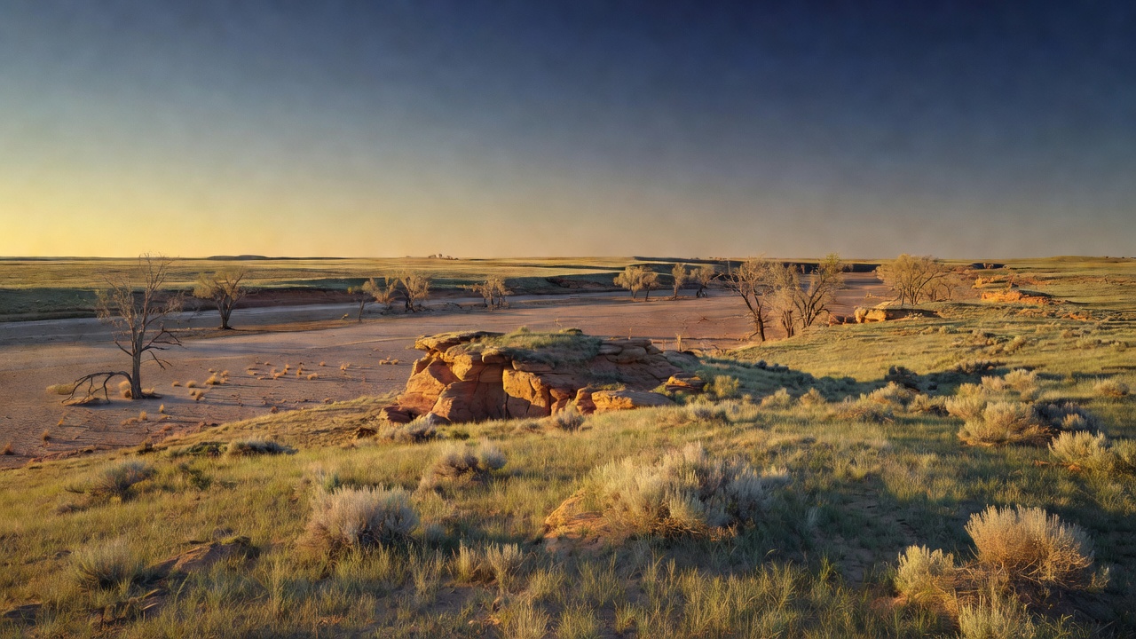
Cimarron National Grassland is shortgrass and sandsage country in Morton and Stevens counties, in the very southwest corner of Kansas -- the Forest Service calls it the state's largest area of public land. The grassland office sits in Elkhart, on Highway 56, and the land starts a couple of miles north of town up K-27. Do not let the word 'grassland' flatten your expectations into a lawn: the Forest Service's own description of the place is rock cliffs, cottonwood groves, grassy fields, yucca and sagebrush, with native grasses and riparian vegetation along the river providing the seasonal variety. Elevations run from about 3,150 to 3,540 feet, and the rock underneath is sandstone, shale, limestone, sand and gravel. Kansas is not flat here so much as it is open.
The Cimarron River bisects the whole grassland, and it is worth being honest about what that means. This is the upper Cimarron, and up here the river's defining habit is disappearing -- the water sinks into the sand of its own bed and the channel goes dry, then comes back. Plan on the river as a landscape feature and a wildlife magnet, not as a water source. Bring your own; the developed sites have potable water and the open country does not.
Two practical things shape a trip here more than anything else. The first is that federal land is interspersed with private land -- this is not one clean block, and the fence you are looking at may well be somebody's ranch. Carry the map and know where the boundary is before you drive off the road. The second is fire. Read the current occupancy and use order for the Cimarron and Comanche National Grasslands before you go, because it is stricter than most and its pieces have different footprints. Two rules apply across all National Forest System land in both grasslands: you cannot camp at any location within the same 20-mile radius for more than 14 days in any continuous 30-day period, and you cannot camp within 100 feet of a lake, stream, pond or river unless you are in a Forest Service developed recreation site or a designated dispersed site. Two more rules are tighter but geographically limited -- inside specific mapped areas of this grassland (the order's exhibits), building, maintaining, attending or using a fire, campfire or STOVE fire is prohibited except in developed recreation sites, and camping in those same areas is limited to developed recreation sites. That stove clause is the one that catches people, so pull the current order and its exhibit maps and find out whether where you intend to camp is inside one of those areas. The climate explains the strictness: the Forest Service describes mild winters, hot dry summers, cool evenings, and usually less than 16 inches of precipitation a year, most of it falling between April and September. This is country that burns.
History
The Santa Fe Trail is why this ground has a name in the record at all. Between 1821 and 1846 the trail was the major trade and travel route between Old Franklin, Missouri and Santa Fe, New Mexico, and in 1822 William Becknell pioneered the Cimarron Cutoff -- the shortcut that saved distance over the mountain route and paid for it in thirst. The cutoff crossed more than 150 miles of dry country, and Middle Spring, which is on this grassland, was one of only three reliable sources of good water on that entire run. Wagon crews camped at the spring and used Point of Rocks, the bluff just above it, as a lookout. Twenty-three miles of the trail lie on the grassland today, the largest section on public land anywhere; limestone posts mark the original route and well-preserved ruts are visible along many segments. The Point of Rocks--Middle Spring Santa Fe Trail Historic District -- the cliff, the spring and four trail segments, 467.5 acres in all -- was added to the National Register of Historic Places on April 10, 2013. This was Comanche country long before it was anyone's trail, and the cutoff was cut straight through it.
The second history is the one that made the grassland. Southwest Kansas was the heart of the Dust Bowl, and Morton County took it about as hard as any county in the country did -- one widely repeated characterization calls it the most devastated county in the nation, which is a superlative worth holding loosely, but nobody disputes the direction of it. Plowed sod, drought and wind stripped the topsoil off and blew it away. Starting in 1938 the federal government began buying the ruined land from bankrupt farmers as land utilization projects, with the explicit goal of restoring the prairie, and the ground was replanted and nursed back to grass. In June 1960 it was formally renamed Cimarron National Grassland. That is the thing to hold in your head while you look at it: the grass you are standing in is deliberate. It was put there. The Forest Service manages it today for wildlife, water conservation, livestock grazing, recreation and minerals production all at once, which is why you will see cattle and gas infrastructure out here alongside the trail ruts. That mixed mandate is what a national grassland is.
Wildlife & plants
The draw here is prairie wildlife in open country where you can actually see it. The grassland holds white-tailed deer, pronghorn, quail, pheasant and prairie dogs, and it is lesser prairie-chicken habitat -- the booming grouse of the southern plains, whose spring courtship display on the leks is the reason serious birders put this corner of Kansas on a calendar. Wikipedia's account of the grassland also reports that elk were reintroduced here in 1981; treat any current herd number you see as unverified. Check with the Elkhart office for current viewing guidance before you go looking for any of it; leks in particular are sensitive, seasonal, and worth not trampling.
The reason so much lives here is the layering of habitat. You have open shortgrass and sandsage prairie across most of the acreage, yucca and sagebrush on the sandy ground, and then a completely different world down in the Cimarron River bottom -- cottonwood groves and riparian vegetation strung along the channel. On a dry plain, a wooded river corridor is an oasis, and the wildlife concentrates in it accordingly. The Forest Service's own recreation pages point at the wooded river stretch as the birdwatching ground, and the agency has published a research bulletin specifically on the birds of this grassland, which tells you something about how much traffic comes through on migration.
Fishing is stocked and modest, and none of it is natural: four human-made ponds at the Cimarron Ponds site, with an accessible pier, plus the Mallard Ponds, stocked by the Kansas Department of Wildlife and Parks. Rainbow trout and channel catfish are the species to expect. Hunting is a major use of this grassland -- deer, pronghorn, quail and pheasant -- and it runs under Kansas state seasons and licensing, so read the state regulations, not just the federal ones.
Notable features
Point of Rocks is the landmark, and it is a short drive and a short walk for what you get. The flat-topped gray outcrop stands about 100 feet above the Cimarron valley at 3,540 feet, roughly 7 miles north of Elkhart, and it is the high point of the grassland. Native people and then trail traffic used it as a lookout for the same reason you will: from up there you can see the whole river valley, and in this country seeing the valley meant seeing the water. There is an overlook with interpretive displays at the top. Middle Spring, just below, is the other half of the story and has a picnic area with drinking water.
For walking the trail itself, the Santa Fe Companion Trail runs 19 miles between the Murphy and Conestoga trailheads and parallels the original route, so you can hike alongside the historic trail without walking on it -- the Santa Fe National Historic Trail is nonmotorized travel only, and there is no water anywhere on it. Fill up at Murphy, Conestoga or Middle Springs before you start. The Turkey Trail is the other main walk: 10.5 miles between the Cottonwood Picnic Area and a point a mile east of County Road 16, through the wooded river country, and it is the best birding and wildlife stretch on the grassland. Note the split personality -- motorized vehicles are allowed from Cottonwood Picnic Area to the Cimarron Recreation Area, and the rest is nonmotorized. There is also the Cimarron River Trail #1842, an OHV route through the sandy riverbed, which is exactly as much fun and exactly as sand-dependent as it sounds.
If you would rather drive it, the self-guided auto tour covers roughly 30 miles of dirt road and hits the grassland's points of interest -- a legitimate way to see this place in an afternoon, and a good idea if the weather has been wet. Camping is simple and cheap. Cimarron Campground has 12 sites under tall cottonwoods, 7 miles north of Elkhart on Highway 27 and then 4 miles east on Forest Road 700, with vault toilets, potable water, picnic tables and a horse corral for pack animals. It is open year-round, costs $7 a night for a single site, is cash or check only, and is strictly first come, first served -- you have to physically show up to claim a site. There is a separate group site available with a rental key. Round it out with the Cottonwood Picnic Area (accessible tables, a steam tractor on display, interpretive signs and a playground) and the Cimarron River Overlook, a small stop with a view down the valley.
Camps are sourced from public U.S. Forest Service recreation data and have not been personally visited. Roads shown are Forest Service passenger-car routes (maintenance level 3–5) and may be seasonal or gated. Always confirm access, fees and fire rules with the ranger district before you go. Found a fee where we show free? Tell us on the contact page.