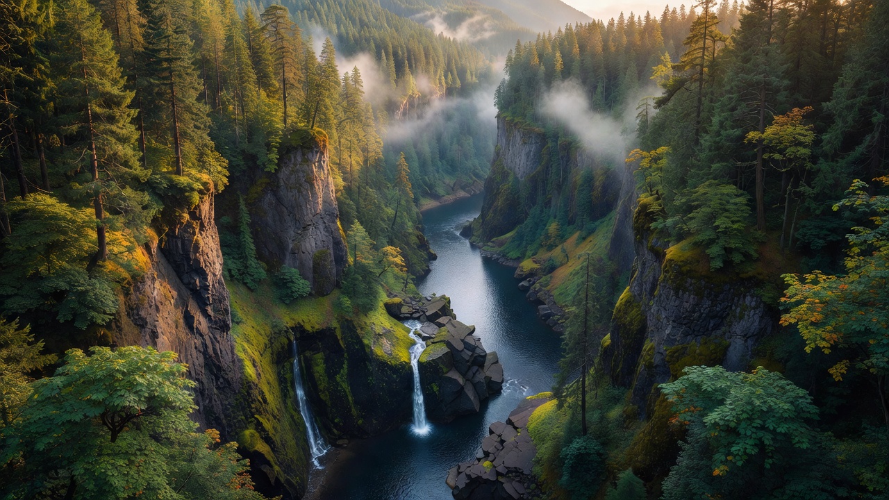
Columbia River Gorge National Scenic Area
Where the camps cluster
The place
The Columbia River Gorge National Scenic Area is not a national forest and it does not behave like one. Congress drew a boundary around 292,500 acres of Oregon and Washington on November 17, 1986, when President Ronald Reagan signed the Columbia River Gorge National Scenic Area Act -- and what fell inside that line was a patchwork of public and private land with more than 75,000 people already living in it, spread across 13 urban areas and six counties in two states. The Forest Service manages the National Forest System land here and shares the rest of the job with a bi-state body, the Columbia River Gorge Commission, along with the six counties, both states' agencies and Four Treaty Tribes, all working from a Management Plan adopted October 15, 1991. The Act has two stated purposes held in tension on purpose: protect and enhance the scenic, cultural, recreational and natural resources of the Gorge, and protect and support the local economy. That is why the land inside is sorted into tiers -- 114,600 acres of Special Management Areas held to the strictest protection, 149,400 acres of General Management Area (which counts 31,500 acres of the Columbia River itself), and 28,500 acres of Urban Area where the towns live and grow.
The canyon is 80 miles long and up to 4,000 feet deep, running past cliffs, spires and ridges, with Nesmith Point the high spot on the rim at 3,848 feet. It is the one place the Columbia gets through the Cascades at sea level, and that single fact drives everything else. Wet Pacific air funnels in from the west and dumps 75 to 100 inches of precipitation a year at the west end; 80 miles east, the grasslands get 10 to 15. Pressure differences on either side of the mountains turn the gap into a wind tunnel that can blow 35 miles an hour, which is why Hood River became a windsurfing and kiteboarding town. Plan for a place with neighbors, in other words. Much of the ground inside the boundary is private, the towns are real towns, and the Forest Service asks for a Northwest Forest Pass at its day-use sites. Come for the waterfalls and the wildflowers and the drive; do not come expecting a big anonymous block of forest to disappear into.
History
People have lived in this canyon for more than 13,000 years, and the center of that world was Celilo Falls at the gorge's east end -- a run of cascades and falls with native settlements and trading villages around them, described as the oldest continuously inhabited community on the North American continent until 1957. The Wishram held the north bank and the Wasco the south, and the Yakama, Warm Springs, Walla Walla, Umatilla and Cayuse all held fishing rights. It was a market as much as a fishery -- historians have called it the Wall Street of the West, with goods arriving from the Great Plains, the Southwest and Alaska. When Lewis and Clark came through in 1805 they wrote it down as 'a great emporium... where all the neighboring nations assemble.' At low water the falls dropped about twenty feet; by volume they ranked sixth in the world. On March 10, 1957, hundreds of people stood and watched the reservoir behind the newly finished Dalles Dam rise and silence them. The falls are still down there, underwater.
The gorge has a habit of rearranging itself. Sometime in the last thousand years -- the dating is genuinely unsettled, with estimates clustering around 1100 CE and more recent work pointing closer to 1450 -- a huge landslide came off Table Mountain and Greenleaf Peak near what is now Cascade Locks and dammed the Columbia outright. The Bonneville Slide spread debris over more than 5.5 square miles and left a natural dam roughly 200 feet high and three and a half miles long; the water backed up behind it drowned a forest for about 35 miles upstream. Eventually the river cut through and washed most of it away, leaving the Cascades Rapids behind. The Klickitat people carried the story as the Bridge of the Gods -- a bridge that the gods' quarrel brought down into the river. The rapids themselves went under water for good when Bonneville Dam filled in 1938.
The modern gorge was built for the view before it was protected for it. Between 1913 and 1922, engineer and landscape architect Samuel C. Lancaster -- with entrepreneur Samuel Hill pushing the project -- laid out roughly 74 miles of the Columbia River Highway, the first planned scenic roadway in the United States. It was listed on the National Register of Historic Places on December 12, 1983, named a National Historic Civil Engineering Landmark by the American Society of Civil Engineers in 1984, and made a National Historic Landmark on May 16, 2000. Pieces of it survive as the Historic Columbia River Highway State Trail: about seven miles between Hood River and Mosier have been open to foot and bike traffic since 2000, and the Oneonta Tunnel was dug back out and reopened on March 21, 2009. The Scenic Area Act that came in 1986 was not universally welcome -- plenty of residents opposed it as government encroachment on land they lived on, which is the honest backstory to the layered zoning the place runs on today.
Wildlife & plants
The gorge's whole ecological story is that rain gradient. The western end is dense temperate rainforest -- Douglas fir, western hemlock and western redcedar, bigleaf maple, moss and epiphytes on everything. The middle, roughly Hood River to The Dalles, is oak-pine woodland: Oregon white oak with ponderosa pine in the wetter pockets and grassland in the drier ones, Oregon grape and rhododendron underneath, cottonwood along the water. The east end is grassland and Columbia Plateau country with sagebrush and bitterbrush. River bottomlands add deciduous forest and marsh. Squeezing that many plant communities into 80 miles is why the wildflowers are the real draw: more than 800 species grow in the gorge, and 15 of them grow nowhere else on earth -- Barrett's penstemon, Columbia desert parsley, Columbia Gorge broad-leaf lupine, Columbia Gorge daisy, Hood River milk vetch and the Dalles mountain buttercup among them. Rowena is one of the classic places to go look.
For animals, the counts run to roughly 44 species of fish and more than 200 species of birds. Peregrine falcons nest on the basalt cliffs and bald eagles work the river, and the threatened northern spotted owl is here too. The river carries Chinook salmon -- averaging about 22 pounds -- along with coho, sockeye, Pacific lamprey, white sturgeon and American shad. On land it is deer, black bear, bobcat and beaver, with Pacific tree frogs and garter snakes in the wet ground. The oddest resident is the Larch Mountain salamander, a lungless salamander of the southern Washington and northern Oregon Cascades whose range runs from the gorge north to just past Snoqualmie Pass -- the gorge is the heart of its small world, though it is not quite confined to it.
Notable features
Multnomah Falls is the one everybody comes for, and it earns it: 620 feet in two drops, an upper fall of 542 feet and a lower of 69, with a nine-foot grade between them. It runs year-round because underground springs on Larch Mountain feed it, not just snowmelt. Simon Benson paid for the footbridge across the lower fall in 1915 and hired Italian stonemasons to build it, 105 feet above the water; A.E. Doyle's fieldstone lodge went up below and was finished in 1925. More than two million people a year come through -- go early, or go in the rain, and you will have a better morning. It is not alone, either: there are more than 90 waterfalls on the Oregon side of the gorge, and the Forest Service points visitors to Wahclella Falls, Wahkeena Creek and Crown Point as well.
On the Washington shore, Beacon Rock stands 848 feet straight up out of the river -- the basalt core of an old volcano, named by Lewis and Clark in 1805 (they wrote it 'Beaten Rock' first). The Army Corps of Engineers once wanted to blast it apart for jetty stone. Henry J. Biddle bought it in 1915 instead and spent three years building a trail up it, finished in April 1918: three-quarters of a mile, more than fifty switchbacks, handrails and bridges pinned to the rock. Downstream at Cascade Locks, the steel Bridge of the Gods -- named for the landslide legend -- opened in 1926, was raised 44 feet in 1938 when Bonneville Dam backed water up behind it, and now runs 1,858 feet across the river. The Pacific Crest Trail crosses the Columbia on it.
Two tributaries carry Wild and Scenic designations inside the boundary, both added the same day the Scenic Area itself was created: roughly 11 miles of the lower Klickitat, from Wheeler Creek down to the Columbia, classed Recreational, and 7.7 miles of the lower White Salmon, classed Scenic. And the gorge still carries its scars. The Eagle Creek Fire started on September 2, 2017 near Cascade Locks, set by a 15-year-old with illegal fireworks, and burned roughly 50,000 acres before it was declared contained on November 30. It stranded 153 hikers overnight on the Eagle Creek trail, and Multnomah Falls Lodge was only saved by crews running water tenders. Reopening the ground took years -- about 3,500 trees cleared and 70 bridges and culverts inspected along Interstate 84, 9,000 hazard trees pulled off a six-mile stretch of the Historic Highway that stayed shut until November 2018. A judge ordered $36 million in restitution in May 2018. Check current trail status before you drive out here; some of this country is still healing.
Camps are sourced from public U.S. Forest Service recreation data and have not been personally visited. Roads shown are Forest Service passenger-car routes (maintenance level 3–5) and may be seasonal or gated. Always confirm access, fees and fire rules with the ranger district before you go. Found a fee where we show free? Tell us on the contact page.