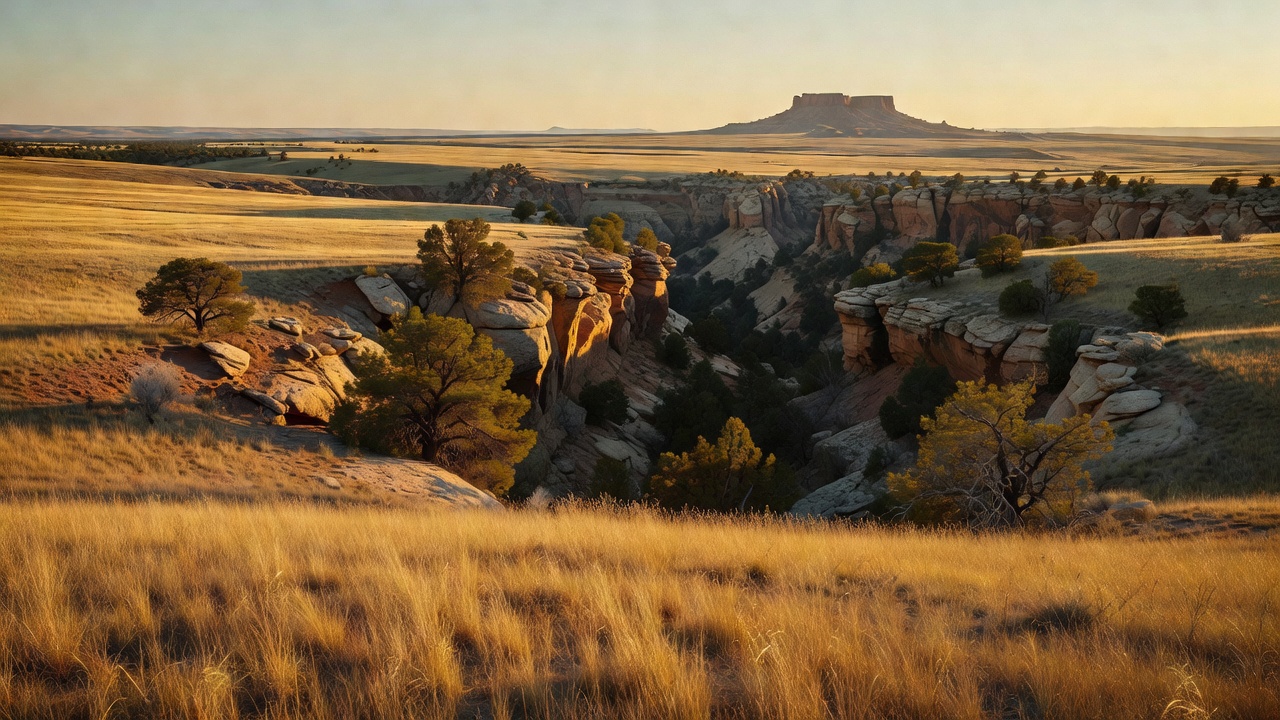
Comanche National Grassland
Where the camps cluster
The place
Comanche National Grassland spreads across Baca, Otero and Las Animas counties in the far southeastern corner of Colorado, and it comes in two pieces that do not touch. The larger Carrizo Unit sits near Springfield in the south; the smaller Timpas Unit lies southwest of La Junta, along the Purgatoire River. Each has its own office -- La Junta for Timpas, Springfield for Carrizo -- and both are administered from Pueblo along with the Pike and San Isabel National Forests and the Cimarron National Grassland in Kansas, a combined outfit the Forest Service describes as covering nearly 3 million acres from western Kansas to Colorado's highest peaks along the Continental Divide. Comanche is the far end of that range in every sense: no peaks, no timber, no crowds.
What you see from the county roads is steppe and shortgrass prairie, and if you stop there you will leave thinking there is nothing here. The grassland's whole character is in the cuts. Streams have trenched sandstone canyons into the plain, and inside them the vegetation changes completely -- pinyon and juniper on the rocky slopes, cottonwoods and willows along the water, western soapberry and netleaf hackberry down in the bottoms, some larger Gambel oak, even a few ponderosa pines on hillsides. Up top it is grass, Chickasaw plum and fragrant mimosa. Elevation runs from about 3,900 feet in the southeastern corner to roughly 6,200 feet on Fallas Mesa, so the relief is real even though the skyline is not.
The river that did most of the work here has the best name on the map and three versions of it. The Spanish called it El Rio de las Animas Perdidas en Purgatorio -- the River of Souls Lost in Purgatory. French trappers shortened that to Purgatoire. English-speaking settlers heard the French and wrote down what it sounded like, which is why the canyon and the canyonlands are called Picketwire to this day. The river runs east-northeast 196 miles out of the Culebra Range to meet the Arkansas near Las Animas, cutting canyons through bedrock on the way across the plains.
Plan around water and heat, because the grassland will not supply either. Vogel Canyon, Picture Canyon and Sierra Vista have no potable water; the Forest Service's standing instruction for the hike to the dinosaur tracks is to plan for extreme heat and carry at least one gallon of water per person. Camping is tighter here than on a national forest, and the rules are written down: under Forest Order 02-12-00-24-06, in effect April 5, 2024 through December 1, 2026, you may not camp at any location within the same 20-mile radius for more than 14 days in any continuous 30-day period, and you may not camp within 100 feet of a lake, stream, pond or river unless you are in a Forest Service developed recreation site or a designated dispersed site. In the areas the order maps out, camping is limited to developed recreation sites and fires are limited to them too. Several of the marquee day-use canyons -- Vogel and Picture among them -- ban overnight camping outright and allow fires only in the existing grates. Check the current order with the La Junta or Springfield office before you plan a night here.
History
People have been leaving marks on these canyon walls for a very long time. The Forest Service dates the rock imagery in Picket Wire Canyonlands to between 375 and 4,500 years old -- deer, elk, human figures and abstract designs -- and points to rock imagery, stone tools, charred bones and rubble from dwellings in Picture Canyon as evidence that people thrived here for thousands of years. In Vogel Canyon the images on the walls were made by American Indians who lived in the canyon 300 to 800 years ago. Some of the art across the grassland may run as old as 8,000 years, and some of it is new enough to show horses, which did not reach the Southwest until the Spanish brought them in the 16th century. The rule at every one of these sites is the same and it is not decorative: do not touch the images. Oils from your hands break down both the drawing and the rock under it, and the sites are protected by federal law.
Then came the wagons. Several routes of the Santa Fe Trail crossed this ground -- the Mountain Route, the Granada-Fort Union Wagon Road and the Aubry Cutoff -- and the Forest Service dates the traffic through here from 1821 to 1880. The Timpas Unit was a water stop: Timpas Creek was the first source of water for Santa Fe Trail travelers after they left the Arkansas River heading southwest, and the Metcalf Ranch stood there from 1869 to 1871 doing duty as a stagecoach station. A spur off the trail between Las Animas and Trinidad ran through Vogel Canyon in the 1870s, developed by the Barlow and Sanderson Mail and Stage Line. You can still see the swales the wagons pressed into the prairie, and the Park Service and Forest Service have put interpretive waysides along them.
Settlement followed the trail. In 1846 Mexican settlers moved into the Purgatoire canyon, and a Catholic community led by Damascio Lopez established the first permanent settlement there; in 1898 Damascio sold 0.11 acres of his land to the Denver Diocese for one dollar, and the community built the Dolores Mission church on it. The mission and its cemetery still stand in the canyon, and the graves say more about the terms of life out here than any plaque does. In 1871 Eugene and Mary Rourke started a cattle and horse ranch on the Purgatoire with 40 acres. Three generations worked it, and by the time it ended in 1971 the Rourke Ranch held over 50,000 acres and was, in the Forest Service's words, one of the most successful ranches in the southwest. It is on the National Register of Historic Places. Elsewhere on the grassland the homesteads of the 1870s and 1880s are just stone walls now -- the Westbrook place in Vogel Canyon among them.
The reason this is federal land at all is the Dust Bowl. The 1930s defeated the farmers here, and the federal government bought the ground out from under its bankrupt owners; Title III of the Bankhead-Jones Farm Tenant Act of 1937 is the authority the national grasslands rest on. Comanche was established as a national grassland in 1960. It is still changing shape: in the early 1990s the U.S. Army transferred roughly 16,000 acres of Purgatoire River Canyon into the grassland, and on November 25, 2013 the Army announced it had cancelled its plan to expand the neighboring Pinon Canyon Maneuver Site -- a proposal that had hung over this corner of Colorado for years.
Wildlife & plants
This is prairie, so the wildlife is the kind you have to sit still for. The Forest Service singles out three species as the ones that make Comanche what it is: the lesser prairie-chicken, the golden eagle and the swift fox. Around them the list runs pronghorn, mule deer, elk, coyotes, badgers, wild turkeys, prairie dogs, hawks, burrowing owls, turtles, collared lizards and the occasional roadrunner. Dawn and dusk in the canyons are when it moves; the permanent springs at the bottom of Vogel Canyon are a good place to be at either one.
The prairie-chicken is the headline and the hardest to see. In Colorado it survives in small fragmented populations in sand sage country -- sandy grassland with mid-grasses, sandsage and yucca -- on the Comanche and on surrounding private land in Baca County. Males gather in spring on communal display grounds called leks and dance for the females, inflating red air sacs and showing yellow combs. Colorado Parks and Wildlife is blunt about the trajectory: populations have declined significantly here, driven by long-term habitat loss and long droughts, with further declines since the early 1990s. The state worked with Kansas on a translocation project starting in 2016 and moved 411 birds onto the Comanche and Cimarron grasslands through 2019.
Its legal status changed recently, and a lot of published material has not caught up. The Fish and Wildlife Service listed two distinct population segments of the lesser prairie-chicken under the Endangered Species Act in 2023, but in 2026, in response to a court order, it removed both the northern and the southern segments from the federal list of threatened and endangered wildlife. In the agency's own words, the regulatory protections under the Endangered Species Act no longer apply to either population, and a new 12-month petition finding process has been opened. Federal, state and private conservation work on the bird continues regardless. Colorado Parks and Wildlife still carries it as a state threatened species, and its pages have not been updated for the federal change -- so if you read a 'federally threatened' line about this bird anywhere, including on a state site, check the date. A lek near Campo has long been described as the only publicly accessible lesser prairie-chicken lek in Colorado, though with the population where it is, do not assume it is open -- ask the Springfield office before you build a trip around it. If you do go, you go before dawn, you stay put, and you do not push the birds.
For birders in general this is one of the great sleepers in Colorado. Three hundred and twenty-eight species have been recorded in Baca County alone, a number that owes a lot to geography -- this is the western edge of the range for a whole set of eastern birds, so species that are ordinary in Kansas turn up here as the last of their kind heading west. The canyon riparian strips concentrate them.
Two other things worth knowing. The water in Carrizo Canyon holds channel catfish, which is not what most people expect from a shortgrass grassland. And beginning around the start of September, male tarantulas leave their burrows and walk the grassland looking for females -- an annual migration that draws people out here on purpose. They are not aggressive and they are not a hazard; they are just crossing the road in numbers, and it is one of the strangest good reasons to visit a national grassland.
Notable features
Picket Wire Canyonlands is the reason most people come, and it is the least convenient thing here on purpose. In a canyon roughly 400 feet deep along the Purgatoire River lies the largest dinosaur tracksite in North America -- a quarter mile of bedrock covered in prints laid down about 150 million years ago, when this valley was the muddy shore of an enormous shallow lake and the surrounding country was tropical, full of tree ferns, pines and sequoia. Apatosaurus and Allosaurus made most of them. The Forest Service's own pages do not agree on the count -- the Picket Wire page says over 1,900 prints in 130 separate trackways, its about-the-area page says over 1,300 visible tracks -- but nobody disputes the scale. Getting there is 11.2 miles round trip on foot, bike or horse from the Withers Canyon Trailhead, with no water and no shade you did not bring. The auto tour is the only authorized motorized access into the canyonlands. Overnight camping is not allowed down there. On the way in you pass the Dolores Mission and Cemetery, and if you keep going past the tracks it is roughly 17 miles round trip to the Rourke Ranch National Historic Site. Do not attempt this in the heat of summer without a real water plan.
Vogel Canyon is the opposite: a short drive from La Junta and the best two hours on the grassland if you only have two hours. It is a scenic tributary of the Purgatoire with permanent springs in the bottom, rock imagery on the walls, the stone-walled ruins of the Depression-era Westbrook homestead, and the tracks of the old Barlow and Sanderson stage spur still visible. Four trails leave the parking area: the Overlook Trail, an easy 1-mile loop that is wheelchair accessible; the Canyon Trail, 1 3/4 miles round trip past ruins, an overlook, a spring and rock imagery; the Prairie Trail, a moderate 3 miles round trip along the historic stage tracks; and the Mesa Trail, a moderate 2 1/4 miles. There are vault toilets, picnic tables -- three of them covered, with grills -- horse trailer parking and hitching rails. No potable water, no shooting, day use only.
On the Carrizo Unit, Picture Canyon is the rock-art destination: gentle sandstone canyons and rolling hills with 13 miles of hiking and horseback trails through them, including the 8-mile Arch Rock Trail #1881, at about 4,300 feet. There is a vault toilet and no potable water, no camping, and fires only in the existing grates. The canyon's oddest feature is Crack Cave, whose walls are covered in rock art -- one group of petroglyphs inside is lit by direct sun for only ten to twelve minutes at sunrise, and only around the spring and autumn equinoxes. Nearby, Carrizo Canyon is a small canyon with the east fork of Carrizo Creek running through it, juniper and cottonwood, rock art, picnic tables, a trail and the catfish. If you would rather drive than walk, the Carrizo Auto Tour is a self-guided 180-mile route through the unit with interpretive kiosks at the stops.
Back on the Timpas Unit, the Santa Fe Trail is the draw. A 3-mile section of the Santa Fe National Historic Trail, marked by stone posts, connects the Timpas Picnic Area to the Sierra Vista Interpretive Site, and it is open to hikers and horseback riders only. At Timpas, 16 miles from La Junta, a half-mile loop nature trail drops to Timpas Creek -- the first water the wagons found after leaving the Arkansas. At Sierra Vista, a short walk up a bluff opens a commanding view of the Rocky Mountains across the prairie, the Spanish Peaks among them, a view the Forest Service notes is very similar to what the early travelers saw; the mountains are roughly 75 miles off. There are no bathrooms and no water at Sierra Vista, and no shooting at either site. The Picket Wire Corrals Interpretive Site, about 33 miles south of La Junta, offers wildlife interpretation and corrals for public equestrian use.
Camps are sourced from public U.S. Forest Service recreation data and have not been personally visited. Roads shown are Forest Service passenger-car routes (maintenance level 3–5) and may be seasonal or gated. Always confirm access, fees and fire rules with the ranger district before you go. Found a fee where we show free? Tell us on the contact page.