Crooked River National Grassland
Where the camps cluster
The place
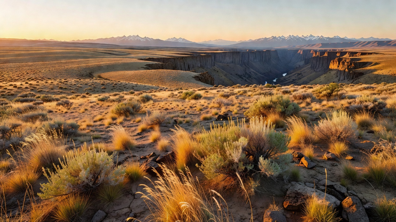
The Crooked River National Grassland lies in Jefferson County, in north-central Oregon, and the Forest Service describes its footprint as a triangle: primarily east of Highway 97, west of Highway 26, and north of Highway 370, with Madras, Prineville and Terrebonne at the corners. This is not a forest and it does not pretend to be one. Highway 97 splits its character in two -- west of the highway the land is a high plateau interrupted by steep canyons, and east of it the ground settles into rolling hills and buttes. The Forest Service gives the elevation range as 2,241 feet at Madras to 5,108 feet on top of Gray Butte -- a town figure and a summit figure rather than a surveyed minimum and maximum, but it tells you the shape of the place. The climate is the whole story: annual precipitation averages 10.5 inches, higher elevations catch 19 inches or more, and the growing season averages 100 days. That is a hard place to make a living and an excellent place to see a long way.
Administratively it is a ranger district of the Ochoco National Forest, run from the Forest Service's offices in Prineville with a grassland office in Madras, and the two units are published together as one place -- 'nearly one million acres of diverse landscapes in Central Oregon, including forests, grasslands, and rocky river canyons,' as the agency puts it. What makes this grassland unusual is not its size but its solitude in the system: it is the only national grassland in the Forest Service's Pacific Northwest Region. National grasslands are overwhelmingly a Great Plains institution, and this one sits in the rain shadow of the Cascades instead. It looks like it.
Plan around three things. First, the boundary is not the land -- the area inside the grassland's boundary takes in considerably more ground than the Forest Service actually administers, so federal, state and private parcels interleave and you need to know which one you are standing on. Second, water. The Forest Service says flatly of Rimrock Springs that the site 'can be brutally hot in summer, so take along drinking fluids,' and potable water is not available at Skull Hollow Campground or at the grassland recreation area generally -- haul your own. Third, seasons. Motorized vehicles, including snowmobiles and electric bicycles, are prohibited in winter range closure areas from December 1 through May 1 to protect wintering mule deer and elk, and in late summer this country runs to fire restrictions and emergency closures often enough that checking the unit's alerts page before you leave is not optional. The standard 14-day stay limit applies on all National Grassland and Forest Service land here.
History
Homesteading began in the 1880s and eventually 700 homesteads were established on this ground. The people who filed on it were not fools; they were working from a federal land policy that assumed a family could prove up a dryland farm on acreage sized for wetter country. On 10.5 inches of rain and a 100-day growing season, it did not work. By the 1930s, in the Forest Service's own summary, 'inadequate rainfall and poor economic conditions had caused the farms to fail,' and the homesteaders walked away. By 1935 federal land banks and private mortgage banks had taken over 35 percent of the homesteads in foreclosures. That is the origin of nearly every national grassland in the country, and it is the origin of this one.
The federal government then bought the land back from the homesteaders who remained, using the authority of the Resettlement Administration and the Bankhead-Jones Farm Tenant Act -- Depression-era programs built specifically to retire land that should never have been plowed and to move the people off it. The purchased ground was first called the Central Oregon Land Utilization Project, a name with no romance in it at all and considerable honesty: this was a project, and the land was being put to a different use. Management was transferred from the Soil Conservation Service to the Forest Service in 1954, and the name was changed to the Crooked River National Grassland in 1960. It has been run since under what the agency calls 'sound and progressive principles of land conservation and multiple use.'
Then came the repair work, and it is worth being honest about how it went. During the 1930s and early 1940s roughly 63,000 acres were seeded -- but not with what had been here. Crews planted crested wheatgrass or bearded wheatgrass, because, in the Forest Service's blunt phrasing, native bluebunch wheatgrass 'proved impossible to restore.' Crested wheatgrass is an Asian import that holds soil and tolerates drought and grazing, and it was the tool available. The result is that a great deal of what looks like prairie here is a deliberate substitution, planted eighty-odd years ago because the original would not come back. Beginning in the 1970s reseeding was phased out and fire was introduced as a management tool instead, and that is still the approach today.
Wildlife & plants
The Forest Service's reconstruction of what grew here before the plow is specific: the grassland is believed to have been originally vegetated with bluebunch wheatgrass and Idaho fescue, with some sagebrush, rabbitbrush, bitterbrush and juniper. Note the word 'some' in front of juniper. What a visitor sees today is a high desert juniper and sagebrush environment, and the shift from scattered trees to widespread woodland is the central ecological fact of central Oregon. A 2011 Forest Service Pacific Northwest paper by Rowland, Suring, Tausch, Greer and Wisdom opens by citing the scale of it: western juniper woodlands in Oregon have expanded four-fold, from 600,000 hectares in 1930 to more than 2.6 million hectares. That figure is background the authors draw from the existing literature, not their own measurement. What they did measure was the John Day Ecological Province of central Oregon, where they sampled 178 sites and found that only 26 percent contained pre-settlement trees older than 140 years, and that fewer than 5 percent of the 2,254 junipers they tallied predated settlement. Densities of post-settlement trees ran from 75 to 211 trees per hectare in non-woodland strata and up to 457 in juniper stands. None of that is a survey of this grassland -- it is a different study area in the same central Oregon juniper country -- but it describes the kind of change this landscape has been through, and it is the backdrop to fire becoming the management tool of choice here.
There is a control plot for all of this, and it is one of the most interesting things on the unit. The Island is an 82-acre mesa isolated by steep cliffs and talus slopes just south of the confluence of the Deschutes and Crooked rivers -- flat on top, with no drainages and no surface water. It is a proposed Research Natural Area, selected to represent two plant associations of the Blue Mountains ecoregion: western juniper/big sagebrush/bluebunch wheatgrass, and western juniper/big sagebrush/antelope bitterbrush/bluebunch wheatgrass. A mesa walled off by cliffs is a mesa that hooves have a hard time reaching, which is precisely what makes it scientifically valuable.
For animals, the grassland is hunted for mule deer, pronghorn, Rocky Mountain elk, cougar and black bear, with game birds including quail, mourning doves, blue grouse and ruffed grouse, plus waterfowl. Mule deer and elk migrate down onto winter range here, which is why the December-to-May motorized closures exist -- the Forest Service's reasoning is that animals forced to flee or stop feeding burn energy reserves they need to survive the winter. The best concentrated wildlife viewing is at Rimrock Springs, where a small dam traps spring-fed water to create what the agency calls 'this wetland oasis in an otherwise parched land'; the species list there runs to pronghorn antelope, nesting waterfowl, song birds, game birds, raptors, aquatic mammals and bats. Along the Crooked River the agency's own description names bald eagles and kingfishers, and the river holds excellent populations of trout and whitefish. Two reptiles deserve a mention: you will likely meet the harmless gopher snake, and the Forest Service tells visitors plainly to stay alert for rattlesnakes.
Notable features
Rimrock Springs Wildlife Management Area is the easiest introduction and the one to take people to. At 3,070 feet, roughly 9 miles southeast of Madras on Highway 26 (or about 18 miles north of Prineville), it offers a 0.5-mile paved, level, ADA-accessible trail out to an uncovered observation deck, plus a not-so-level 0.9-mile dirt loop running south past a second viewing platform. Bring binoculars or a spotting scope, bring water, and go early -- the Forest Service does not sugarcoat the summer heat here.
Gray Butte is the high point of the grassland at 5,108 feet, and the Gray Butte Trail (#852) is the signature walk. It starts in juniper, climbs the side of the butte through sagebrush and spring wildflowers, and delivers what the agency calls 'excellent views of the Crooked River National Grassland and the Cascades.' Expect steep pitches and loose rock. Expect, too, one of the better-worded warnings in the Forest Service's catalog: the soils here are clay and sand that 'form an especially gooey "gumbo" when wet,' so the trail is best avoided after heavy rain. It is popular with hikers, horseback riders and mountain bikers, it ties into trails reaching BLM land and Smith Rock State Park, and it can also be reached from the Cole Loop Trail (#854). None of it is maintained in winter.
Skull Hollow Campground, southeast of Haystack Reservoir, is the practical basecamp -- and it is the reason a lot of people end up on this grassland without meaning to, because the Forest Service lists easy access to Smith Rock State Park among its draws and Smith Rock is a destination climbing area. It has 70 standard campsites, first-come first-served, three vault outhouses, a picnic table and fire ring at each site and a campground host, and it runs March 15 to November 15 weather permitting. Fees at the time of writing were $20 a night for a single site, $40 for a double, $7 per extra vehicle and $7 for day use. There is no potable water. Cyrus Horse Camp, built in 1992 with volunteer help, serves riders.
Haystack Reservoir is the water, and it is working water: from April to October it stores and regulates irrigation delivery for the North Unit Irrigation District, behind an earth-fill dam constructed in 1956-1957. It is named for a butte to the south. Water is present year-round but can ice over in cold winters. There are three camping areas -- the main Campground and Day Use Area, which the Forest Service calls 'the premier campground in the scenic high desert,' plus West Shore and a South Shore group campground with two group sites accommodating up to 75 people each -- and two boat launches, one at the main campground and one on the west side near the dam. Motorized and non-motorized boating are both allowed. Willow thickets line the southeast side, rock cliffs form the north shoreline and can only be reached by boat or on foot, and the view from the water includes Mount Jefferson.
Finally, the rivers. The grassland contains tracts of two National Wild and Scenic Rivers, the Deschutes and the Crooked, and their canyons are the reason this place is not just open country. The Forest Service sums up the Crooked River experience as 'rugged, dramatic canyons, enthusiastic fish, Wild and Scenic tracts, bald eagles and kingfishers, and cool, spring-fed headwaters.' Target shooting is a recognized use on the grassland, concentrated along the 5700 road on the north side of Pine Ridge; the standing rule is no discharging a firearm within 150 yards of a residence, building, campsite, developed site or occupied area.
Camps are sourced from public U.S. Forest Service recreation data and have not been personally visited. Roads shown are Forest Service passenger-car routes (maintenance level 3–5) and may be seasonal or gated. Always confirm access, fees and fire rules with the ranger district before you go. Found a fee where we show free? Tell us on the contact page.