Curlew National Grassland
Where the camps cluster
The place
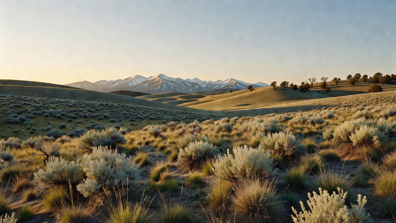
Curlew National Grassland lies in Oneida and Power counties in the far south of Idaho, in the Curlew Valley, a stone's throw from the Utah line. Get the name out of your head first: this is not tallgrass prairie. It is sagebrush steppe -- rolling hills of silver-green sagebrush, open sky, and distant mountains on the horizon -- and the Forest Service's own vegetation analysis found sagebrush covering 95 percent of the place. The Forest Service describes it plainly as rolling sagebrush plains teeming with wildlife. Elevation at the Curlew Campground is about 4,700 feet.
Getting there is easy by western standards and that is part of the appeal. Highway 38 out of Malad City and Highway 37 up from Snowville, Utah meet at Holbrook and run through the grassland, connecting toward American Falls and Interstate 86; the campground sits roughly seven miles north of Snowville and fewer than ten miles south of Holbrook, a few miles off Interstate 84. The Forest Service's own recreation pages point to more than 50 miles of motorized routes here for ATVs and dirt bikes, and the older management plan counted 76 miles of road in and around the unit -- good access for a place this quiet.
Administratively, Curlew is run alongside the Caribou-Targhee National Forest from a common headquarters in Idaho Falls, and the district office you actually want is the Westside Ranger District at 4350 Cliffs Drive in Pocatello. Get the current Motor Vehicle Use Map from them before you ride -- that map is the live legal answer to where you can drive, and travel here has historically carried seasonal teeth on top of it: the grassland's management plan restricted motorized use to designated routes from September 1 through November 30, both to keep soil from washing off and to protect birds during the fall hunts. Assume a seasonal restriction may apply and confirm it with the district. Dispersed camping follows the Caribou-Targhee's published guidance -- 14 days in one spot within a 28-day period, then move at least five road miles; camp at least 100 feet from streams and water sources, at least half a mile from developed campgrounds and trailheads; use existing disturbed areas rather than making new ones. Check current forest orders, which can be tighter. One honest warning that shapes every trip out here: water is limited throughout the area, and what live water exists is largely tapped and diverted for agriculture and livestock. Haul your own.
History
This is a landscape with a receipt. In the early 1900s the Curlew Valley was opened to homesteading and most of the suitable flatland got farmed -- over 35,500 acres of native range broken and put under the plow. Then came the droughts of the 1920s and 1930s. It became clear to many in the valley that the land they owned could not provide them a living, and they sold out to the federal government, much of the ground by then severely eroded. The Forest Service names Title III of the Bankhead-Jones Farm Tenant Act -- the 1937 law that authorized the government to buy up damaged, submarginal farmland and rehabilitate it -- as the authority behind those purchases, which ran through the Depression and finished in 1942, totaling roughly 168,000 acres in and adjacent to Curlew Valley.
What the government did with it next is why the ground looks the way it does. Under the Soil Conservation Service, crews planted bulbous bluegrass, crested wheatgrass and alfalfa to hold the soil down and grow forage for cattle. None of those are native here. In 1954 the Secretary of Agriculture moved responsibility for the Land Utilization Project lands from the Soil Conservation Service to the Forest Service, and the Forest Service received 47,600 acres of the Curlew project -- much of the surrounding acreage went to the Bureau of Land Management or was sold back into private hands, which is why the unit today is a scattered shape rather than a block. The land only became a 'national grassland' in name in 1960, when the Secretary designated some 3.8 million acres of those Land Utilization Project lands as national grasslands; the Forest Service dates the establishment of the National Grasslands to June 23, 1960. Twenty of them exist, totaling almost four million acres.
Since farming stopped in the 1930s, livestock grazing and the vegetation treatments that support it have been the dominant use. Grazing here runs through cooperative associations whose members must own base property in Curlew Valley -- as of the grassland's management plan, the Curlew Valley Cattle and Horse Association ran cattle in five groups rotating through 37 fields on a deferred system, and the smaller Buist Fields Association worked twelve pastures the same way. The Forest Service's own framing of the challenge ahead is refreshingly blunt: balancing newer values like wildlife habitat and riparian recovery against the grazing and vegetation work that has run here for generations.
Wildlife & plants
The Curlew Valley has been identified as an Important Bird Area in Idaho, and birds are the reason to come. The headliner is the Columbian sharp-tailed grouse -- of the 19 species the Caribou National Forest listed as sensitive, it is the only one known to occur on the grassland. The species has collapsed range-wide, and the figures the Forest Service worked from in its planning are stark: the bird occupies less than 10 percent of its former range, and Idaho holds the best remaining populations with roughly 75 percent of the surviving birds, the largest southeastern Idaho concentrations being in Fremont, Bonneville and Oneida counties. Those numbers rest on 1990s research and nobody should quote them as a current census, but the direction of the story has not changed. Idaho Fish and Game spent years trapping birds here and transplanting them to other states. Greater sage-grouse are here too as a management indicator species, in a population the research describes as non-migratory, and the valley is a priority conservation area for them. Alongside those: sage thrasher, Brewer's sparrow, sage sparrow, ferruginous hawk, loggerhead shrike, and -- in the most open, grass-dominated sagebrush -- short-eared owls and long-billed curlews, both documented as breeding here. Pheasant, Hungarian partridge and chukar all run the grassland as well; none are native, all were introduced by the state to build hunting opportunity. At the ponds you can expect Canada geese, ruddy ducks, pintail, mallard and teal loafing, feeding and nesting.
The plant story is honest and a little sad. Basin big sagebrush is the most common sagebrush here and occupies or could occupy about 75 percent of the sagebrush type -- and few large expanses of it are left anywhere in the Intermountain West, precisely because it grows on the deep soils people want to farm. But about three-quarters of this grassland was farmed and seeded at one time; only around 12,000 acres still carry native vegetation, and those survive as fragmented islands on uneven ground and steep slopes that were too awkward to plow. The Forest Service rates the sagebrush as functioning-at-risk, skewed toward old age classes with a thin understory, and notes that establishing exotic perennial grasses cost the native herbaceous diversity that nesting and brood-rearing sage-grouse actually need. The rest is small and interesting: mountain brush on about 3 percent of the unit (chokecherry, serviceberry, currant, mountain snowberry, elderberry, wild rose), fewer than 90 acres of Utah juniper, a couple hundred acres of salt desert shrub northeast of the Curlew Campground, and an estimated five acres of quaking aspen in isolated clones near Salyer and Twin Springs -- living at the very edge of their range in this heat and dryness. Documented noxious weeds include Canada and musk thistle, black henbane and diffuse knapweed.
There is active repair work going on across this corner of Idaho. The Forest Service, Idaho Department of Lands, University of Idaho and a local outfit called S-S Ranch have been using targeted grazing to fight cheatgrass and bulbous bluegrass -- putting cattle out in early spring and fall for roughly 30-day stints, timed to hit the invaders while they are growing but before native perennials come up, with the goal of giving bluebunch wheatgrass, needlegrass and Idaho fescue room to come back. Be precise about where, though: the two named project areas in that partnership are Lead Draw, south of Pocatello, and Spring Hills, east of Malad -- not the grassland itself. On the Curlew, the Forest Service reports pairing targeted grazing with shrub mowing to build fuel breaks. The grassland has also been the focus of a Joint Chiefs' Landscape Restoration Partnership between the Forest Service and the Natural Resources Conservation Service, aimed at watershed function, wetlands and streams, sage-grouse, migrating birds and monarch butterflies. As for fish, keep expectations low: surveys found no salmonids in area streams except stocked rainbow trout in Deep Creek within and above Stone Reservoir, plus small shiners and dace in limited numbers.
Notable features
Curlew Campground on the shore of Stone Reservoir is the center of gravity here and the easiest place to base out of. It sits at about 4,700 feet with paved interior roads, drinking water, vault toilets, picnic shelter, tables, grills, fire rings, horseshoe pits and an on-site host -- plus one large group site that takes up to 200 people, several single sites and a triple-family site. Full services run late May to early September with reservations through Recreation.gov; after the season it stays open first-come, first-served year-round with no water and no toilets. The reservoir itself is owned by the local irrigation district, not the Forest Service, and it holds rainbow trout, largemouth bass, perch and crappie. People fish it, swim it, boat it, and ice fish it in winter.
Twin Springs Campground is the only other developed site on the grassland -- quieter, with moderate use most of the year that spikes during fall hunting season. Sweeten Pond is the sleeper: a small parking area and a pond fenced off from livestock grazing and maintained by the Forest Service specifically so the waterfowl viewing stays good.
But the thing genuinely worth planning a trip around is the dance. Sharp-tailed and sage grouse gather at leks -- traditional strutting grounds, generally in open areas next to sagebrush cover, scattered throughout the grassland -- and put on a display at dawn in March and April. It is not a secret among people who know: in March and April of 1997 alone, over 150 people came out and spent two to four hours apiece watching the birds. Peak strutting is March into April, which makes early spring the best time to be here, right when nobody thinks of southern Idaho as a destination. The rest of the recreation menu is hunting (upland birds, rabbits, waterfowl and deer), riding the designated motorized routes, snowmobiling, dispersed camping and some of the darkest stargazing skies you will find within sight of an interstate.
Camps are sourced from public U.S. Forest Service recreation data and have not been personally visited. Roads shown are Forest Service passenger-car routes (maintenance level 3–5) and may be seasonal or gated. Always confirm access, fees and fire rules with the ranger district before you go. Found a fee where we show free? Tell us on the contact page.