Dakota Prairie Grasslands
Where the camps cluster
The place
The Dakota Prairie Grasslands are not one place. They are four separate national grasslands run from a single supervisor's office in Bismarck: the Little Missouri and the Sheyenne and the Cedar River in North Dakota, and the Grand River over the line in South Dakota. The Forest Service describes the whole unit as rolling hills and prairie ecosystems with 'unique geological features like badlands and buttes,' which is doing a lot of quiet work in one sentence, because the four pieces do not look much alike.
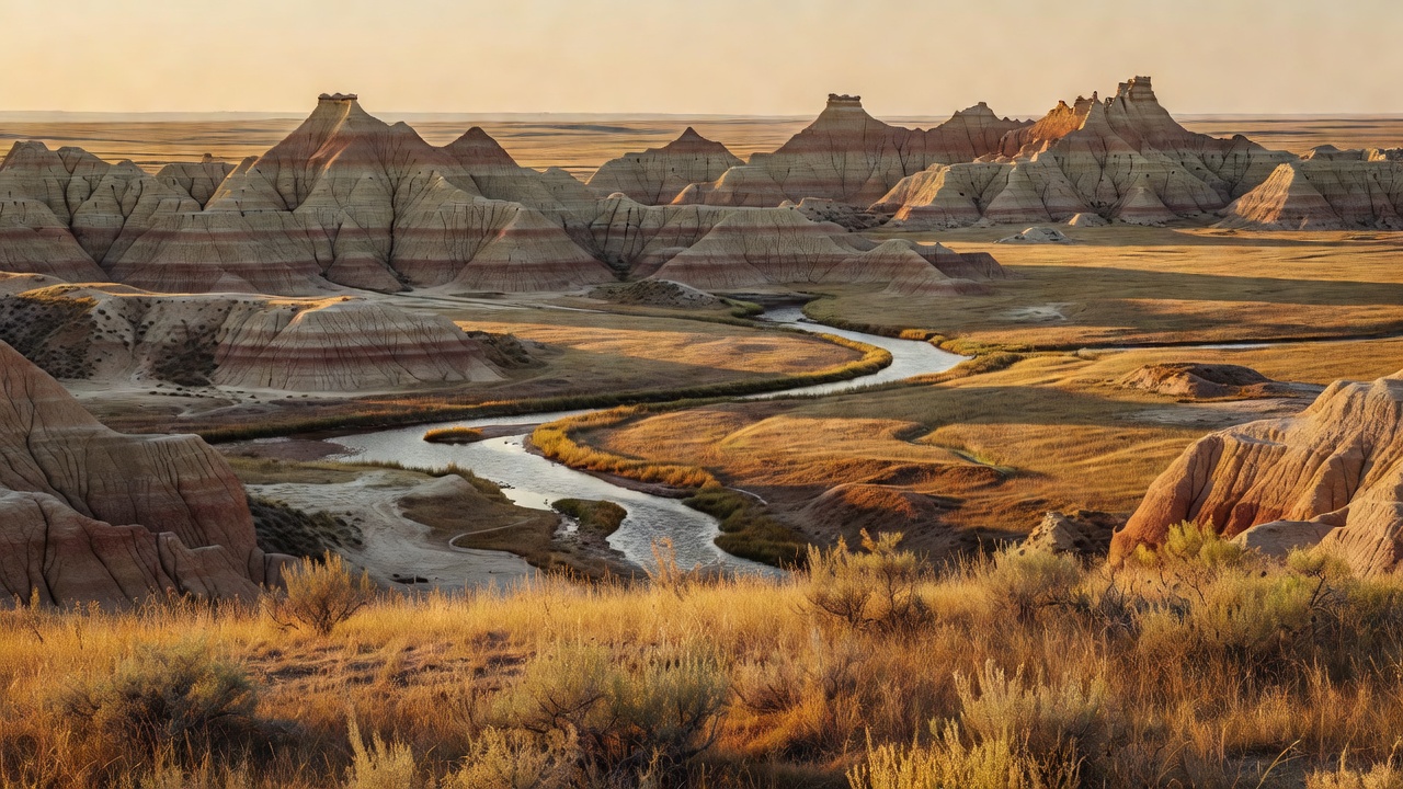
The west end is badlands. The Little Missouri River -- 560 miles of it, rising at Flatiron Butte in Crook County, Wyoming, and running through Montana and South Dakota before it reaches North Dakota and empties into the Missouri at Lake Sakakawea -- has cut the country around it into the eroded, banded, half-collapsed terrain that made this region famous. It is mixed-grass prairie up top, with both tall and short grass, and then the ground simply falls away. The east end is the opposite kind of surprise: the Sheyenne, on sandy soils in the southeast corner of the state, is the only national grassland in the tallgrass prairie region of the United States. Between them, the Cedar River is level plains and rolling hills with dry streambeds and a few small flowing ones, and the Grand River in South Dakota mixes prairie with river bottom, green ash draws, sand dunes and its own badlands.
Two practical things to know before you come. First, this is working range, not wilderness -- the grasslands are a checkerboard of federal and private tracts with cattle grazing under permit across them, so a boundary on a map is a real thing and gates matter. On the Sheyenne alone, roughly 83 cattle ranchers hold grazing on the mixed public-private ground. Second, developed camping is sparse by national-forest standards: the Forest Service counts 13 developed campgrounds across the whole unit, and the Cedar River has none at all -- dispersed camping is the arrangement out there. Field offices are in Dickinson and Watford City for the Little Missouri, Lisbon for the Sheyenne, and Lemmon, South Dakota, for the Grand River and Cedar River.
History
Everything here starts with a bad idea. Settlers took up this country under the Homestead Act in the early 1900s, on the assumption that the northern plains would farm like Ohio. They would not. The 1930s brought drought and the Dust Bowl, the homesteads failed, and the federal government began buying the ruined ground back from the people who had been encouraged to plow it. Congress had created the Soil Conservation Service in 1933; Title III of the Bankhead-Jones Farm Tenant Act of 1937 gave the government the authority to acquire submarginal farmland and put it back into grass.
That is what these grasslands physically are: reassembled failed farms, healed over. The consolidated tracts were formally designated as national grasslands in 1960 -- the Little Missouri on June 23 of that year, the Grand River the same year. Today there are 20 national grasslands nationwide, and these four are among them. For decades the ranger districts here were run as part of the Custer National Forest, headquartered a long way off in Billings, Montana. In 1998 they were split out into the Dakota Prairie Grasslands as a separate unit, in the Forest Service's own words, 'to help focus and better manage the issues and resources of the National Grasslands.' Prairie is not timber, and it took the agency a while to admit that it needed its own outfit.
The older story out here belongs to a 24-year-old New Yorker. Theodore Roosevelt first came to the badlands in September 1883 to hunt bison, liked it enough to put $14,000 into the Maltese Cross Ranch seven miles south of Medora, and then came back for a different reason: on February 14, 1884, his wife and his mother died within hours of each other, and he went west to get away from it. That summer he set up the Elkhorn Ranch about 35 miles north of Medora. The winter of 1886-87 killed most of his cattle and most of everyone else's, and he went home -- but the man who was president from 1901 to 1909, and who did more for public land than anyone before him, was shaped in this specific landscape. Theodore Roosevelt National Park is enclaved inside the Little Missouri National Grassland today, run by the Park Service while the Forest Service runs the grassland around it. And the Cedar River carries a much older claim: its Sioux County portion lies within the Standing Rock Sioux Reservation.
Wildlife & plants
The signature bird is the greater prairie chicken, and the Sheyenne holds the largest population of them in North Dakota. What you come for is the lek -- the 'booming ground,' a patch of very short or bare vegetation where the males gather in spring, inflate the air sacs on the sides of their necks, raise the orange comb-like feathers over their eyes, snap their tails and boom at each other. The display runs from late March through April, males hold the grounds for nearly two months, and dawn is the hour. It is worth understanding that this is a bird that was almost extinct in the 1930s and is still listed as near threatened; the reason there are prairie chickens booming on the Sheyenne is that there is still tallgrass prairie on the Sheyenne.
The rare things here are small and easy to walk past. The western prairie fringed orchid, federally listed as threatened, grows in moist tallgrass prairie and sedge meadows, with its largest concentrations in North Dakota, Minnesota and Manitoba. Its flowers are fragrant at night and pollinated by hawkmoths, which is about as specific a relationship as a plant can have -- and explains why habitat loss hits it so hard. The Dakota skipper, a prairie butterfly, is also on the Sheyenne. On the Grand River, botanists have recorded roughly 476 plant species from 78 families, which is a useful number to carry around the next time somebody calls the prairie empty.
In the badlands country, prairie dogs are the animal that matters most and gets the least respect. They are a keystone species -- their digging turns over soil and drives plant diversity, and their towns feed and shelter a long list of other animals. Inside the enclaved national park, the badlands hold bison, elk, feral horses, bighorn sheep, coyotes and over 186 recorded bird species; the surrounding grassland is the same country with different management, and the coyotes and raptors and deer do not read boundary signs. Green ash draws and river bottom on the Grand River give shelter and water in an otherwise open landscape, which is exactly where wildlife concentrates.
Notable features
The Maah Daah Hey Trail is the headline. It runs 144 miles through the North Dakota badlands, from the Burning Coal Vein Campground near Medora to the CCC campground south of Watford City, and it is the longest continuous singletrack mountain biking trail in America. The name is a Mandan phrase meaning 'an area that has been or will be around for a long time.' It connects the North and South units of Theodore Roosevelt National Park, but bicycles are prohibited inside the park units themselves, so riders take marked alternate routes around them -- a detail that has surprised a lot of people mid-trip. Hikers and horseback riders have the whole thing. Nine fenced campgrounds along the way, reachable by gravel road, have potable water, hitching rails and fire rings.
The Little Missouri National Grassland is the largest national grassland in the country -- big enough that the Forest Service's own literature notes it is about the size of a middling national forest. It spreads across McKenzie, Billings, Slope and Golden Valley counties with Medora as the natural base. In its extreme southeast corner, near Amidon, stands White Butte at 3,508 feet, the highest natural point in North Dakota. Go in with your eyes open: the summit is on private property owned by the Dennis family, who maintain a donation box at the parking area and ask $5 of visitors. The usual route is about a four-mile round trip. It is a courtesy access, not a right, and it stays open because people pay the five dollars.
On the east side, the Sheyenne carries a 31-mile segment of the North Country National Scenic Trail, open to hiking, horseback riding and mountain biking, about 12 miles east of Lisbon -- tallgrass and sandy soil rather than badlands, and a completely different day out. In South Dakota, the Grand River has the Blacktail Trail, a 7-mile loop for hikers, riders and bikes, plus shoreline access on Shadehill Reservoir. Roughly 20,000 acres of the Grand River were reseeded with crested wheatgrass after its farming era, which is why some of that prairie looks more uniform than the native ground beside it.
One honest caveat about the western end: oil and gas exploration, extraction and distribution across the Little Missouri country carry real potential for long-term impacts on soil, water, vegetation and wildlife. Expect industrial traffic, well pads and truck dust on some of these roads. It is a working landscape in more ways than one.
Camps are sourced from public U.S. Forest Service recreation data and have not been personally visited. Roads shown are Forest Service passenger-car routes (maintenance level 3–5) and may be seasonal or gated. Always confirm access, fees and fire rules with the ranger district before you go. Found a fee where we show free? Tell us on the contact page.