Daniel Boone National Forest
Where the camps cluster
The place
The Daniel Boone runs down the eastern edge of Kentucky in a long, skinny, broken-up band -- about 140 miles of Cumberland Plateau, touching something like 21 counties, never very wide. Figure roughly 708,000 acres of actual National Forest System land; the proclamation boundary that contains it runs around 2.1 million acres, and most of what's inside that outer line is private -- farms, hollows, coal country, little towns. That checkerboard is the character of the place. You are rarely more than a few miles from somebody's mailbox, and rarely more than a few miles from a sandstone cliff line with nobody on it. The country itself is vertical in a sneaky way: no big peaks, just a plateau that water has spent a few million years cutting to pieces, leaving cliffs, rockshelters, arches, and hollows so steep and green they feel like a different latitude than the ridge you parked on.
History
This forest started, like a lot of eastern forests, as land nobody wanted anymore. The plateau got logged off hard and burned over, and the federal government bought the worn-out pieces back under the Weeks Act era authority. It was established in 1937 as the CUMBERLAND National Forest, and the Civilian Conservation Corps did much of the early sweat -- roads, fire towers, planting. The name changed in 1966 to honor Daniel Boone, who ranged and hunted this general country in the 1700s (his famous Wilderness Road and Cumberland Gap are south of here, so think of the name as a tribute, not a map of where the man slept). The forest's long trail carries his other name: the Shawnee adopted Boone in 1778 and called him Sheltowee -- Big Turtle. The big story here, though, is the dam that never got built. In 1962 Congress authorized a Corps of Engineers flood-control dam that would have flooded the Red River Gorge. On November 18, 1967, Supreme Court Justice William O. Douglas led a protest hike through the Gorge that put it in the national press; Wendell Berry wrote a book about the place in 1971; the project bogged down in litigation and drifted into inactive status through the 1970s and 80s; and on December 3, 1993 the Red River was designated a National Wild and Scenic River, which closed the door for good. The Gorge you camp in is a place that was argued out of the bottom of a lake.
Wildlife & plants
Black bears are the headline, and they're a comeback story -- with an honest wrinkle. Eastern Kentucky lost its bears, and most of them came back on their own, walking in from the recovering Appalachian country in West Virginia, Virginia, and Tennessee as the woods grew back. Down at the southern end, though, near Big South Fork, the population was also built by a mid-1990s reintroduction of bears from Great Smoky Mountains -- so 'they came back on their own' is true for most of this forest and only part of the story down south. Either way, keep a clean camp and treat them like the neighbors they are. Elk are here too, but be honest about where: Kentucky's restored herd lives mostly out on reclaimed mine land in the coalfields, state-managed, and the forest's southern end (the Stearns / McCreary country) sits inside the elk zone and has had elk released onto it -- so elk are a real possibility down south, not a roadside guarantee forest-wide. Otherwise it's white-tailed deer, turkeys, coyotes, and a whole lot of birds. Two venomous snakes to know: timber rattlesnake and copperhead, both worth respecting and neither worth panicking about. The caves and rockshelters hold bats, including the endangered Indiana bat and gray bat, and they have been hammered by white-nose syndrome -- which is why you'll find some caves gated or closed, and it isn't the Forest Service being unfriendly. The woods are classic mixed mesophytic -- oak, hickory, tulip poplar, maple, beech -- with eastern hemlock and thickets of rhododendron and mountain laurel down in the cool hollows. The hemlocks are in trouble from the hemlock woolly adelgid, a tiny imported insect, so some of those dark green hollows are changing while you watch. One bird you will NOT see: the red-cockaded woodpecker. Kentucky's last ones lived in shortleaf pine on this forest, and a southern pine beetle outbreak around 2000 finished them off here.
Notable features
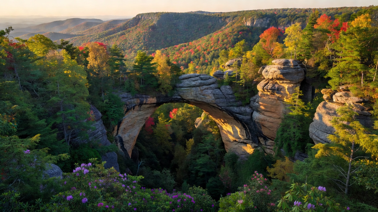
The Red River Gorge Geological Area is the crown jewel -- a maze of sandstone cliffs and side hollows holding more than 100 natural arches, one of the great concentrations of natural arches in the eastern United States (you'll see bigger claims made; the counts depend on what you call an arch). Within it, the Clifty Wilderness is the wild half -- Congress designated it in 1985 at approximately 13,300 acres, though the Forest Service's own inventory puts it at 12,371, which is the kind of gap you get between what a law says and what a map measures. The forest's only other wilderness is Beaver Creek, about 4,800 acres, designated back in 1975. The Red River itself is Kentucky's only federally designated Wild and Scenic River, about 19.4 miles of it, since 1993. The Sheltowee Trace National Recreation Trail, designated in 1979, runs the length of the forest -- generally called 300-plus miles, though the number moves as the route is rerouted and extended. Nada Tunnel is the door: a one-lane, roughly 900-foot former logging railroad tunnel, barely wider than a truck, that you drive through to reach the Gorge. Cave Run Lake up north is a Corps of Engineers reservoir of about 8,270 acres surrounded by forest, with a reputation as one of the South's best muskie waters. Two things worth knowing about who owns what: the Gorge is world-famous sandstone sport climbing, but a lot of the celebrated crags (Muir Valley, the Pendergrass-Murray Recreational Preserve) are PRIVATE conservation land, not Forest Service, and they have their own rules. And the two big postcard names near the forest -- Cumberland Falls and Natural Bridge -- are KENTUCKY STATE RESORT PARKS, not national forest, even though the forest wraps around them.
Camps are sourced from public U.S. Forest Service recreation data and have not been personally visited. Roads shown are Forest Service passenger-car routes (maintenance level 3–5) and may be seasonal or gated. Always confirm access, fees and fire rules with the ranger district before you go. Found a fee where we show free? Tell us on the contact page.