Eldorado National Forest
Where the camps cluster
The place
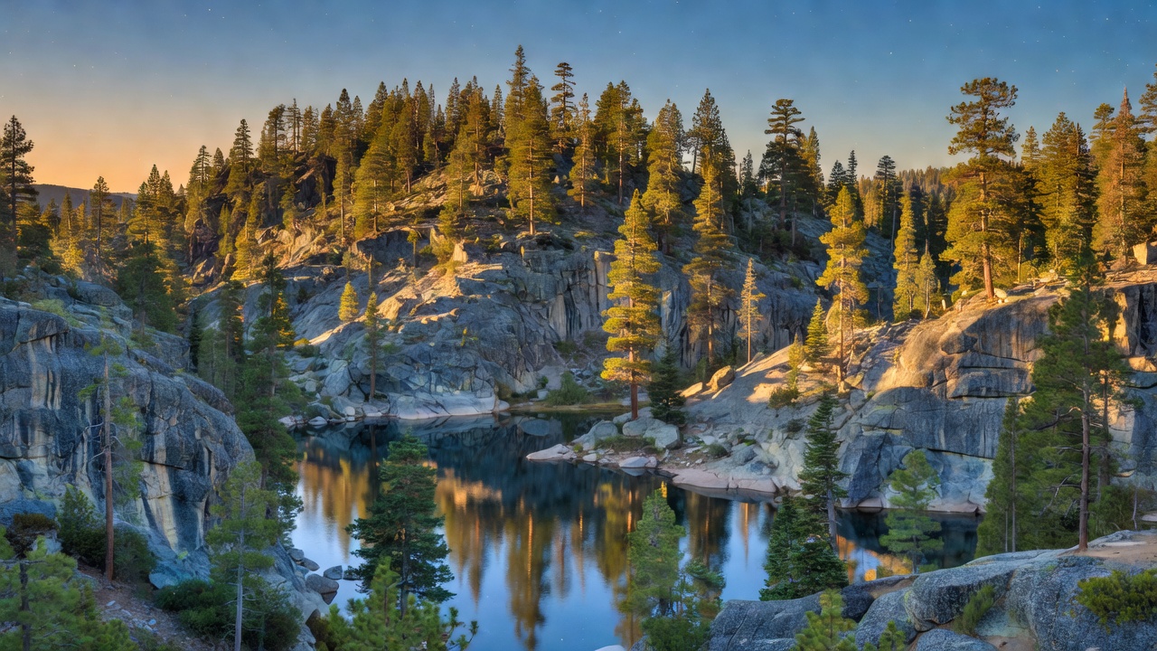
Eldorado National Forest is a west-slope Sierra forest that runs uphill. The Forest Service describes it as stretching from the oak woodlands of the foothills to the crest of the Sierra Nevada at roughly 10,000 feet, and that vertical range is the whole story: at the bottom it's dry foothill oak and pine an hour from the Central Valley, in the middle it's classic mixed-conifer reservoir country, and up top it's bare glaciated granite and subalpine fir. Water is the organizing feature. The forest sits across four drainages -- the American, the Cosumnes and the Mokelumne among them -- and Forest Service figures put it at roughly 611 miles of fishable stream and about 297 lakes and reservoirs. Most of those reservoirs are not natural; this is heavily plumbed hydropower country, and the Crystal Basin northeast of Placerville is essentially a staircase of dammed lakes with campgrounds strung along them.
One thing worth knowing before you plan around a boundary line: the green on the map is bigger than the public land underneath it. Wikipedia's figures put the gross area near 787,000 acres against a net federal area of about 597,000, with roughly 190,000 acres of other ownership mixed in -- the usual Sierra checkerboard of private timber and railroad-era parcels. Combine that with about 2,367 miles of road and 349 miles of trail, and this is a forest where knowing exactly whose dirt you're on actually matters. Check the Motor Vehicle Use Map.
History
The forest itself is a 1910 creation. Per the Forest Service, "the Eldorado came into being on July 28, 1910 when legislation carved it out of the Stanislaus and Tahoe National Forests" -- it was assembled from its neighbors rather than proclaimed whole.
The human history here is much older and runs mostly east-west, because this is one of the places people got over the Sierra. In February 1844 John C. Fremont's expedition forced a winter crossing at what is now Carson Pass (8,574 feet, on today's Highway 88), a grim passage in which the party ate its dogs, horses and mules but reached Sutter's Fort on March 6 with no deaths. The pass carries Kit Carson's name, and California Historical Landmark #315 marks the spot along Highway 88 where he carved it into a tree. Four years later, in 1848, a party of roughly 45 discharged Mormon Battalion members plus one woman worked eastbound over the same country with 17 wagons and some 300 head of stock, blazing what became the Carson Trail -- which then turned into one of the primary emigrant routes into the California gold country, terminating at Placerville. Placerville is still the forest's headquarters town.
The 20th century added the dams. Loon Lake Dam was completed in 1963 as part of the Sacramento Municipal Utility District's Upper American River Project, holding spring snowmelt for summer and fall hydroelectric generation -- the same logic that produced most of the Crystal Basin's lakes. And the recent history is fire. The Caldor Fire started on August 14, 2021 near Little Mountain south of Pollock Pines, burned 221,835 acres, destroyed 1,003 structures, took two-thirds of the community of Grizzly Flats in its first three days, closed Highway 50, and on August 30 became only the second fire known to have burned across the Sierra Nevada crest, pushing evacuation orders onto more than 22,000 people in South Lake Tahoe. Large parts of this forest are burn scar now, and it will look that way for a long time.
Wildlife & plants
The Forest Service's own species notes for the high country here are refreshingly blunt about what you will and won't see. Mule deer are the largest game animal. Black bears are increasingly common and increasingly high -- the FS specifically describes bears being displaced up out of the Tahoe Basin and the lower western slope into the backcountry, which is a polite way of saying store your food properly. Coyote, bobcat, badger and porcupine are all here and all mostly invisible. The agency also lists fisher, pine marten, Sierra Nevada red fox and wolverine as species of interest that are very rare in the area; treat a sighting as a genuinely notable event rather than an expectation.
The small stuff is what you'll actually meet. Yellow-bellied marmots, golden-mantled ground squirrels, Douglas squirrels and pika work the rock and talus up high. Birds run to Steller's jay, Clark's nutcracker, mountain chickadee, blue grouse, mountain bluebird and American dipper, with red-tailed hawk and peregrine falcon overhead and the occasional golden or bald eagle.
Fishing is a real reason people come. The alpine lakes and streams hold rainbow and brook trout, with brown and golden trout less common. Down in the Crystal Basin, Union Valley Reservoir is stocked with rainbows by California Department of Fish and Wildlife roughly every other week from May through September, and also gives up brown trout, kokanee salmon and smallmouth bass. The trees sort themselves by elevation: ponderosa and Jeffrey pine, sugar pine, incense cedar, Douglas fir and white fir lower down, shifting to red fir and lodgepole between about 7,400 and 9,000 feet and thinning out above that. Roughly 122,000 acres of the forest is classed as old growth.
Notable features
Desolation Wilderness is the headliner: 63,960 acres of glacier-scoured granite, subalpine forest and water, shared between this forest and the Lake Tahoe Basin Management Unit, west of Lake Tahoe and north of Highway 50. It holds something like 130 lakes -- Lake Aloha spread across a bare granite basin is the postcard -- and tops out at Pyramid Peak, 9,985 feet, high point of the Crystal Range. Both the Pacific Crest Trail and the Tahoe Rim Trail run through it. It is also, in the Forest Service's own words, one of the most heavily used wilderness areas in the United States, which is why permits are required for day use as well as overnight, with an overnight quota in the summer season. Plan that part before you drive.
Mokelumne Wilderness is the quieter opposite number to the south: 105,165 acres split among the Eldorado, Stanislaus and Toiyabe forests, and volcanic rather than granitic in character. It runs from about 3,900 feet at Salt Springs Reservoir up to 10,380 feet at Round Top, with Elephant Back and Thimble Peak nearby -- landforms built by volcanic activity between roughly 20 and 4 million years ago and then chewed into U-shaped valleys and cirques by ice. The rugged Mokelumne River canyon cuts west out of it.
For drive-up recreation, the Crystal Basin northeast of Placerville is the center of gravity. Union Valley Reservoir at about 4,800 feet is the largest lake in the basin, with several seasonal campgrounds, three boat ramps, and a paved bike trail serving bike-in and boat-in campsites. Ice House Reservoir sits in mixed conifer around 5,000 feet with a boat ramp, day-use area and seasonal campgrounds. Loon Lake, higher and starker, is subalpine red fir and lodgepole with granite bowls and a straight-on view of the Crystal Range.
And then there's the Rubicon. It's a roughly 22-mile route -- part road, part 4x4 trail -- running from the west shore of Lake Tahoe down to Loon Lake, passing through Eldorado National Forest, Tahoe National Forest and the Lake Tahoe Basin Management Unit, with private ground at Rubicon Springs in the middle. The Forest Service rates it difficult to technical and catalogs it as Forest Road 14N34. Obstacles along it -- Little Sluice, Big Sluice, Cadillac Hill, Thousand Dollar Hill -- are known by name to people who have never driven it. It nearly closed in 2001 over water quality; a cleanup and abatement order was in force until it was rescinded in October 2014 after years of work by agencies, the Rubicon Trail Foundation and volunteers. It is not a beginner route and it is not a shortcut.
Camps are sourced from public U.S. Forest Service recreation data and have not been personally visited. Roads shown are Forest Service passenger-car routes (maintenance level 3–5) and may be seasonal or gated. Always confirm access, fees and fire rules with the ranger district before you go. Found a fee where we show free? Tell us on the contact page.