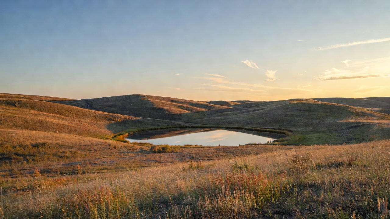
Fort Pierre National Grassland
Where the camps cluster
The place
Fort Pierre National Grassland spreads across Lyman, Stanley and Jones counties in the dead center of South Dakota -- south of Fort Pierre and Pierre, north of Interstate 90, and west of the Lower Brule Indian Reservation. The Forest Service describes the country plainly as a mixture of gently rolling hills and vast prairie flats, and that is exactly what it is: mixed-grass prairie, big sky, and a horizon that does not quit. Do not come looking for trees. The shrubby draws and hillsides are about as vertical as this landscape gets.
Access is unusually easy for a place this empty. The Forest Service puts it this way: the grassland is split nearly in half by US Highway 83, with two thirds on the east side of the highway and one third on the west. From Pierre you simply drive about 24 miles south on US-83; coming the other way, take Exit 212 off Interstate 90 and head north toward Pierre on the same highway. The grassland is open year round and the Forest Service is refreshingly blunt about the cost of admission: no fees or permits are required to access and enjoy the grassland. One honest warning that governs every trip out here, straight from the agency's own description of the place -- the soils are clayey, and vehicles can become stuck when the roads are muddy. That is not a small footnote on a prairie where a thunderstorm can turn a two-track into grease in ten minutes. Watch the sky, and when in doubt park on the highway and walk.
Administratively this unit is run a long way from home. It belongs to the Nebraska National Forests and Grasslands, whose supervisor's office sits at 125 N. Main Street in Chadron, Nebraska (308-432-0300), alongside the Nebraska and Samuel R. McKelvie National Forests and the Buffalo Gap and Oglala National Grasslands. The office you actually want, though, is local and it has its own district ranger: the Fort Pierre Ranger District at 1020 North Deadwood Street, Fort Pierre, SD 57532, 605-224-5517, open 8 to 5 weekdays central time and closed for lunch from noon to one. That is the same number you call to reserve a grouse blind.
Dispersed camping here follows the rules the Nebraska National Forests and Grasslands publishes for the unit: a maximum of 14 nonconsecutive days in any 30-day period, camp 100 feet away from any creek or stream and half a mile from developed recreation sites, and keep motor vehicles within 300 feet of roads shown on the Motor Vehicle Use Map. You may camp farther back than 300 feet; you just cannot drive there. Campfires are allowed, with the obvious caution that on cured prairie grass in a wind you are the one responsible if it gets away. Pack it in, pack it out. Two caveats worth taking seriously: the MVUM itself is the legally live answer to where you can drive, not any web page including this one, and the Forest Service explicitly tells visitors that local restrictions can be tighter than the general rule -- so pick up the current map and ask the Fort Pierre district before you commit to a plan.
History
Nobody set this prairie aside because it was beautiful. It is public land because the farming failed.
The Homestead Act of 1862 opened the Great Plains to settlement in 160-acre parcels -- free but for the filing fees, to anyone who would live on the ground and cultivate it for five years. On the wetter side of the plains that arithmetic worked. Out here, on a quarter section of mixed-grass prairie in a dry year, it did not. Then came the 1930s: drought, dust, and farm families walking away from ground they could not make a living on. The federal government's answer was to buy the wreckage back. The National Industrial Recovery Act of 1933 and the Emergency Relief Appropriations Act of 1935 let it purchase and restore damaged land; in 1934 the Agricultural Adjustment Administration began a submarginal land purchase program with $25 million appropriated from the Federal Emergency Relief Administration, and 8.7 million acres were bought under that authority alone. These purchases were known as Land Utilization Projects, and this grassland is one of them.
In 1937 Congress gave the program a permanent home in Title III of the Bankhead-Jones Farm Tenant Act, which authorized the Secretary of Agriculture 'to develop a program of land conservation and land utilization, including the retirement of lands which are submarginal or not primarily suitable for cultivation in order thereby to correct maladjustments in land use.' That is bureaucratic language for a hard admission: some of this ground should never have been plowed. Congress authorized $50 million for land acquisition and ultimately appropriated $20 million of it. The Soil Conservation Service ran the program from 1938 to 1954, acquiring another 2.6 million acres before Title III purchases stopped for all practical purposes in 1946. Together with earlier buying, the government wound up holding 11.3 million acres in the Land Utilization Program at a total land cost of $47.5 million -- an average of about $4.40 an acre.
What happened next is why the place looks the way it does today. Crews went to work immediately: new roads, buildings, fences, flood and erosion control, grass and trees planted, water storage facilities built, stream channels widened and cleaned. Those improvements cost $102.5 million and created more than 50,000 jobs while the country was climbing out of the Depression. The hundreds of earthen dams scattered across this grassland -- the ones people now fish and watch ducks on -- are the descendants of exactly that work. In 1954 the Secretary of Agriculture moved administration of the Land Utilization Program from the Soil Conservation Service to the Forest Service, and the Forest Service kept going: cooperative land management agreements with grazing associations and conservation districts, more revegetation, wildlife habitat work, and new campsites, picnic areas and reservoirs. The land did not carry the name 'national grassland' until 1960, when the Secretary designated roughly 3.8 million acres of Land Utilization Program land, mostly in the Great Plains, as national grasslands; the Forest Service tells the story as a centennial, the grasslands being born on June 23, 1960, a hundred years after the Homestead Act that started the trouble. Twenty of them exist today, totaling almost four million acres -- seventeen strung east of the Rockies from the North Dakota badlands to north-central Texas, and three out west in Oregon, California and Idaho. This is one of the South Dakota units, and grazing has been the dominant working use of it ever since.
Wildlife & plants
Birds are the reason this grassland has a national reputation. The Forest Service says it is recognized among upland gamebird hunters across the country for its wide-open spaces and robust populations of greater prairie-chickens, sharp-tailed grouse and ring-necked pheasant -- and 'robust' is currently an understatement. Every year from mid-March through mid-May, in the first light of morning, surveyors run designated routes with fixed listening stops and scan the horizon for leks, the traditional breeding grounds where males gather to display. They count displaying males and note whether the birds are prairie-chickens, sharp-tails, or both. In 2025 that count came to 1,221 displaying males -- a 40 percent jump over the previous year, which had itself set a record, and the highest numbers in the fifty-year history of the survey. Dan Svingen, the grassland's district ranger, called it an unprecedented milestone and credited habitat restoration, responsible land management and collaborative conservation. The Forest Service attributes the boom to sustained conservation practices, favorable weather and cooperative partnerships with private landowners, and points to its Cedar Creek Monitoring Unit as showing decades of population growth.
This is not a fluke, and it is unusually well documented -- Fort Pierre has been a prairie grouse research laboratory for half a century, and South Dakota Game, Fish and Parks' prairie grouse management plan walks through the results. A 2003-2005 study here found overall combined nest success of roughly 75 percent, which the state plan flags as one of the highest estimates ever recorded; breeding-season hen survival ran about 82 percent and brood survival about 85 percent, though chick survival was a more sobering 36 percent. Mean nest initiation was April 22. Broods avoided smooth brome and selected forb cover such as sweet clover -- a reminder that what looks like undifferentiated grass to us is not undifferentiated to a grouse. A companion study of the same years put mean home range for hens with broods at about 455 acres for sharp-tailed grouse and 430 acres for prairie-chickens. Going back further, work done here from 1974 to 1978 compared grazing systems and landed on a number managers still use: systems that left at least 900 pounds per acre of forage gave grouse adequate residual cover for nesting and brood rearing, with rest-rotation and winter grazing recommended for this grassland. That is the whole secret, unglamorously stated -- the birds are here because the grass gets left standing.
There is a cautionary tale in the record too. Between 1986 and 1988, prairie-chickens trapped on this grassland and the neighboring Lower Brule Indian Reservation were released in south-central McPherson County to start a new population. It did not take; no prairie-chickens were seen in the release area for the five years after the last release. The birds kept traveling as far as 20 miles in winter looking for croplands to feed in next to grassland good enough to roost in, and most were killed by predators before they could get back. Habitat, not birds, was the limiting ingredient.
Beyond the grouse, the shrubby hillsides hold whitetail and mule deer, and the hundreds of earthen dams provide lush habitat for waterfowl, shorebirds and fish. Black-tailed prairie dogs have colonies here -- one of only a few Forest Service units in the region that do -- and the agency is clear about why they matter: prairie dogs are a keystone species in grassland ecology and the food source for the endangered black-footed ferret. Prairie dog hunting is governed by South Dakota Game, Fish and Parks; check current state rules before you shoot anything. Watch for snakes when you are walking, which the Forest Service mentions without drama and so will we.
The plant show is better than people expect from a place with no scenery. Spring into summer, the central South Dakota prairie comes alive with wildflowers, and as the season progresses the native grasses put on a display every bit as good as the flowers. Along Forest Service Road 227 the agency's own wildflower pages point out purple coneflower (Echinacea angustifolia), western yarrow (Achillea millefolium), pricklypear (Opuntia spp.), spiderwort (Tradescantia spp.), daisy fleabane (Erigeron strigosus) and goldenrods (Solidago spp.).
Notable features
The single best reason to plan a trip here is the dance, and the Forest Service makes it almost absurdly easy. It sets out grouse viewing blinds each spring on the leks, and they are free to the public -- reservations required. Each blind is an unheated plywood box, four feet wide by eight feet long and five feet tall, with small square viewing windows and an open floor. Reservations open February 1 and the blinds are bookable April 1 through May 15; you call 605-224-5517 to claim one, and you get a map when you reserve. The rules are the interesting part: you must arrive an hour before sunrise and stay at least an hour after, because walking up on a lek in the dark or leaving mid-display is how you break up the show for the birds and everyone else. Temporary parking areas a short distance from the blinds are marked with pin flags. The agency's own advice is to find your blind in daylight the day before, dress warmly, bring binoculars or a telephoto lens, and think hard about those clay roads -- four-wheel drive, or park on the highway and walk in. Each year the blinds get moved to a new location, so regulars get a different lek every season.
Richland and Sheriff Dams are the two named significant dispersed recreation areas on the grassland, and the water here is a genuine attraction rather than an afterthought. People of all ages fish the grassland ponds for bluegill, crappie, largemouth bass and perch, and in winter ice fishing is common. With hundreds of earthen dams scattered across the unit, most of the good ones do not have names -- finding your own is part of the deal.
Then there is the hunting, which is the main event for most visitors in the fall. The counties in and around this grassland represent the highest hunter density and the highest prairie grouse harvest in South Dakota. Seasons and bag limits are set by South Dakota Game, Fish and Parks on a multi-year cycle rather than by the Forest Service, so get the current regulations from the state before you load a shell. Worth knowing if you worry about it: research here found only 17 of 209 marked adult prairie grouse were harvested over a three-year study, and in 2020, when statewide harvest was the highest since the early 2000s, the following spring's lek counts on this grassland hit record highs anyway. The birds are limited by grass, not by hunters.
What is not here is worth stating plainly, because it shapes the trip: no developed campground, no visitor center, no fee booth, no shade. This is a dispersed-camping, drive-the-two-tracks, watch-the-weather kind of place, split by a highway and surrounded by private ranchland. Come for the birds at dawn, the fishing at the dams, the hunting in October, and some of the least interrupted horizon in the Dakotas.
Camps are sourced from public U.S. Forest Service recreation data and have not been personally visited. Roads shown are Forest Service passenger-car routes (maintenance level 3–5) and may be seasonal or gated. Always confirm access, fees and fire rules with the ranger district before you go. Found a fee where we show free? Tell us on the contact page.