Grand River National Grassland
The place
Grand River National Grassland lies in northwestern South Dakota, spread across parts of Perkins, Corson and Ziebach counties, and it takes its name from the river: the north and south forks of the Grand come together inside the grassland. A bit over 150,000 acres of federal prairie, it is by far the larger of the two units run out of the Grand River Ranger District office in Lemmon, the other being Cedar River across the line in North Dakota. The Forest Service files both under the Dakota Prairie Grasslands, headquartered in Bismarck, and describes this end of that 1.2-million-acre outfit as savanna -- as opposed to the badlands of the Little Missouri or the rolling plains of the Sheyenne.
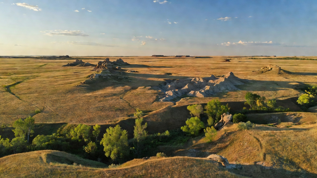
Savanna undersells the variety. The habitat list for this district runs mixed-grass prairie, river bottom, green ash draws, sand dunes along the South Fork, badlands, sandstone outcrops and buttes, and claypan with a few small playas over in Corson County. Roughly 20,000 acres of it is old cropland that was reseeded to crested wheatgrass after the farming era ended, which is why some stretches look flatter and more uniform than the native ground beside them. Lemmon, the base town, sits at 2,566 feet on the South Dakota side of the North Dakota line -- that is the altitude you are working with out here, and the wind is the weather.
Two facts should shape your trip before anything else. The first is that this is grazed country. In the grassland's own published words, it is all open to livestock grazing, so you will have to share it with cattle -- and that includes the roadways. Drive accordingly, leave gates as you found them, and expect a cow around the bend. The second is ownership: parts of the grassland overlap the Standing Rock and Cheyenne River Indian Reservations, and out here federal, tribal and private ground meet without much fanfare on the ground itself. Carry the visitor map and the Motor Vehicle Use Map. Where you are next to private land, stay on public roadways unless you have permission.
Camping is the part people get wrong. There is no developed Forest Service campground on this grassland -- the agency's 13 developed campgrounds are all over on the Sheyenne and the Little Missouri -- and the one developed site here, Blacktail Picnic Area, is explicitly day use only. What you get instead is free dispersed camping on grassland ground: pull up to 300 feet off a designated road to reach a site, stay up to 14 days in any 30-day period and then move somewhere genuinely different, camp 100 to 200 feet back from water, check the alerts page for burn bans before you light anything, and pack your paper out. All other cross-country driving is prohibited. In wet conditions the Forest Service asks you to keep motorized travel on the major improved-surface gravel roads, which is good advice and also self-preservation -- prairie gumbo will strand a capable truck. If you want a hookup, a shower and a boat ramp, that is Shadehill Recreation Area, and it belongs to the state, not the Forest Service. Questions about a specific two-track go to the Lemmon district office at 605-374-3592, weekdays 8:00 to 4:30 Mountain.
History
On a scouting walk in 1823, near where the forks of the Grand River meet, Hugh Glass surprised a mother grizzly with two cubs. A trapper named Hiram Allen who saw the aftermath said the bear had torn the flesh from the lower part of his body and from his lower limbs, and that his neck was so badly opened that an aperture appeared to have been made into the windpipe. Two men were left to stay with him until he died. They did not: John S. Fitzgerald and a man the record calls 'Bridges' -- possibly a young Jim Bridger -- took his rifle, his knife and his kit and left. Glass then crawled. He steered by Thunder Butte, ate berries and roots, reached the Cheyenne River, built a raft and floated the rest, and arrived at Fort Kiowa roughly 200 miles and about six weeks later. A monument to him stands near the site on the southern shore of Shadehill Reservoir. If the story sounds familiar, it is the one behind The Revenant.
That is the frontier story. The Lakota story on this river is longer and is not finished: the Grand flows east from here through the Standing Rock Sioux Reservation on its way to the Missouri, and it was at his camp near this river, downstream on the reservation, that Sitting Bull was killed by Indian agency police. Portions of the grassland itself lie within the Standing Rock and Cheyenne River reservations. It is worth knowing whose ground you are standing on.
The grassland as a legal thing is much younger, and it exists because of a mistake. Homesteaders took this country up in the early 1900s under the assumption that it would farm. The 1930s answered with drought and wind: the Forest Service's own account of the era describes dust clouds rising more than 20,000 feet over parts of Oklahoma, Texas, Wyoming, Nebraska, Kansas, Colorado and the Dakotas. The homesteads failed. Working through Depression-era authorities including the National Industrial Recovery Act of 1933 and the Emergency Relief Appropriations Act of 1935, the federal government bought the ruined farms, consolidated the tracts and set about putting grass back on them. Those restored lands were established as the National Grasslands in 1960 -- the Forest Service's own history dates it to June 23 of that year -- twenty of them, nearly four million acres, Grand River among them. When you walk the reseeded ground here, you are walking on a repair job that took a generation.
One more piece of engineering shaped the map. In 1951 the Bureau of Reclamation closed Shadehill Dam across the Grand River just below the forks, backing up 4,693 surface acres of water up to 62 feet deep. The grassland now shares shoreline with a reservoir that did not exist when this was farm country -- and whose southern shore is as close as anyone can get to where Glass met his bear.
Wildlife & plants
The bird people come here for two species most visitors have never heard of. Grand River holds breeding Sprague's Pipits and Baird's Sparrows -- small, brown, unglamorous grassland specialists that nest in native prairie and essentially nowhere else, which makes an intact mixed-grass unit like this one genuinely important rather than merely scenic. Around them the list broadens fast: pelicans, doves, kingbirds, gulls, terns, warblers and waterfowl use the river bottom and the water, and nearly 300 species have been reported across the Dakota Prairie Grasslands as a whole. Winter brings short-eared owls and lapland longspurs. Spring brings the leks -- communal grouse breeding grounds, where the birds dance at dawn -- and sharp-tailed grouse are the prairie grouse of this country. Bring the binoculars and a checklist; eBird knows this area.
The mammal you will actually see from the trail is the black-tailed prairie dog. Their colonies here are mapped well enough that the district publishes a prairie dog handout showing the towns in Perkins and Corson counties, and a town is worth stopping for on its own terms -- the digging turns the soil, the burrows shelter a long list of other animals, and the whole colony argues with itself all day. Two things to know if you hunt them: prairie dogs are open year-round in South Dakota with a predator/varmint license or any valid state hunting license, and burrowing owls live down in those same burrows and are legally protected. Know the difference before anything comes out of the case.
Otherwise expect the open-country cast. Mule deer and pronghorn work the prairie and the draws; raptors ride the wind, which never really stops; and the wider grasslands hold pronghorn, raccoon and puma among the mammals and sharp-tailed grouse, greater sage-grouse, greater prairie chicken and big migrations of snow geese among the birds. Green ash draws and the river bottom are where the animals concentrate, because that is where the shade and water are -- in a landscape this open, every ribbon of trees is a wildlife corridor. In the water, Shadehill Reservoir carries walleye, smallmouth bass, channel catfish, yellow perch, northern pike and carp; the little pond at Blacktail is stocked with rainbow trout and bass, which is a much shorter walk.
Notable features
Blacktail Trail is the one built destination, and it is a good one: a seven-mile loop out and back to the same trailhead, marked, graveled, with gradual elevation changes and interpretive panels along the way. It is open to hiking, backpacking, horseback riding and mountain biking, year-round, 24 hours, free. It is also strictly non-motorized -- and the Forest Service spells that out to include e-bikes along with motorcycles, ATVs, UTVs and snowmobiles, so leave the pedal-assist at the truck. What you get for the seven miles is broad horizons, prairie and badlands formations, wildflowers in spring and early summer, and reasonable odds on mule deer, pronghorn, raptors and prairie dog towns. There is no water at the trailhead. Carry all of it.
Blacktail Picnic Area sits at the same access point and is the only developed site on the grassland: three picnic tables under covered shelters, fire rings, a vault toilet, interpretive panels, and a stocked fishing pond with a dock that small boats can use. No fee, no potable water, open year-round with limited services outside the Memorial Day to Labor Day window -- and day use only, no overnight camping. To get there, drive 16 miles south of Lemmon on SD-73, turn east on Forest Road 5626 for half a mile, then north on Forest Road 5740 for a mile to the parking area, which is big enough for trailers.
Shadehill Reservoir is the other anchor, and it is a different agency's ground. The Bureau of Reclamation owns the dam; South Dakota Game, Fish and Parks runs the recreation, 12 miles south of Lemmon off the same highway. That is where the developed camping is -- 85 campsites, seven camping cabins and a group lodge that sleeps a dozen, with boat ramps and a shower house that closes for the winter from November 30 to April 30. It is a fee area: electric sites and cabins are priced per night, and every vehicle needs a state park entrance license, daily or annual, resident or not. Budget for it, or camp free out on the grassland and drive in to launch the boat. The Hugh Glass monument is on the reservoir's southern shore.
In town, Lemmon is worth an hour. Founded in 1906 by the cattleman George Ed Lemmon and home to about 1,160 people, it holds the world's largest petrified wood park -- built between 1930 and 1932 under Ole S. Quammen, more than a hundred formations up to twenty feet tall, two museums and a 300-ton castle, all of it assembled out of petrified logs by men who needed work during the Depression. It went up at the same moment the surrounding farms were blowing away. The ranger district office is in the same town, and it is the place to ask which two-tracks are open.
Camps are sourced from public U.S. Forest Service recreation data and have not been personally visited. Roads shown are Forest Service passenger-car routes (maintenance level 3–5) and may be seasonal or gated. Always confirm access, fees and fire rules with the ranger district before you go. Found a fee where we show free? Tell us on the contact page.